Staffordshire Moorlands
| Staffordshire Moorlands District | |
|---|---|
| Non-metropolitan district | |
 Staffordshire Moorlands shown within Staffordshire | |
| Sovereign state | United Kingdom |
| Constituent country | England |
| Region | West Midlands |
| Non-metropolitan county | Staffordshire |
| Status | Non-metropolitan district |
| Admin HQ | Leek |
| Incorporated | 1 April 1974 |
| Government | |
| • Type | Non-metropolitan district council |
| • Body | Staffordshire Moorlands District Council |
| • Leadership | Leader & Cabinet (Conservative / Independent) |
| • MPs |
Karen Bradley William Cash |
| Area | |
| • Total | 222.4 sq mi (575.9 km2) |
| Area rank | 80th (of 326) |
| Population (mid-2014 est.) | |
| • Total | 97,763 |
| • Rank | 243rd (of 326) |
| • Density | 440/sq mi (170/km2) |
| • Ethnicity |
97.6% White 1.0% Asian (2,007 estimate) |
| Time zone | GMT (UTC0) |
| • Summer (DST) | BST (UTC+1) |
| ONS code |
41UH (ONS) E07000198 (GSS) |
| OS grid reference | SJ9821356633 |
| Website |
www |
Staffordshire Moorlands is a local government district in Staffordshire, England. Its council, Staffordshire Moorlands District Council, is based in Leek and is located between the city of Stoke-on-Trent and the Peak District National Park. The 2001 census recorded the population as 94,489.[1]
Principal industries are agriculture, fashion and tourism. The area's three towns are Leek, Cheadle and Biddulph. Visitor attractions include the National Trust property Biddulph Grange, the Churnet Valley Railway, the UK's largest and number one theme park Alton Towers Resort, and the annual Leek Arts Festival. There are also a variety of outdoor pursuits such as rock climbing (The Roaches), sailing (Rudyard Lake) and cycling (Waterhouses).
The district was formed on 1 April 1974, under the Local Government Act 1972, as a merger of the urban districts of Biddulph and Leek, along with Cheadle and Leek Rural Districts.
Energy policy
In May 2006, a report commissioned by British Gas [2] showed that housing in Staffordshire Moorlands produced the 11th highest average carbon emissions in the country at 7,192 kg of carbon dioxide per dwelling.
Geography

The Staffordshire Moorlands district is located within the southern end and foothills of the Pennines. As indicated by the regional name, the upland terrain is mostly moorland with forests and lakes stretching out across rolling hills, crags and valleys.[3] Some of the higher moorland has been largely abandoned for farming. Several Wallabies roamed free for many years in The Roaches, a series of gritstone outcrops within the Peak Park which rises to 505m (1,657 feet).[4] The highest point in both the district and Staffordshire is Cheeks Hill, rising up to 520m (1,710 feet) on Axe Edge Moor.
With the northern part of the district lying inside the Peak District National Park, a large proportion of the Peak District's 'white peak' area is contained within the Staffordshire Moorlands. This includes such places as one half of Dovedale, the Manifold Valley including Thor's Cave, Wetton Mill, Longnor and Butterton. The Staffordshire Moorlands also contains the wooded Churnet Valley, a steep sided valley running between Cheddleton and Rocester also known as "The Rhineland of Staffordshire" or Staffordshire's "Little Switzerland".[5][6]
The Staffordshire Moorlands is also home to the highest village in Britain, Flash. The village stands at 463m (1,518 feet) above sea level. This record was confirmed in 2007 by the Ordnance Survey after Wanlockhead in Scotland also claimed the record. The BBC's The One Show investigated the case in a bid to settle the argument and Flash turned out to be the higher of the two.
The council maintains a number of local nature reserves including Biddulph Valley Way, Brough Park Fields, Cecilly Brook, Hales Hall Pool, Hoften's Cross Meadows, Ladderedge Country Park and Marshes Hill Common.[7]
History
Historically the present day Staffordshire Moorlands District was contained in the Hundred of Totmonslow, except for the parish of Biddulph, which was in Pirehill Hundred. The District makes up the majority of the area of the now obsolete Totmonslow Hundred, with the remaining area of the Hundred now falling in East Staffordshire District. The Hundred was named after a small hamlet of Totmonslow in the parish of Draycott in the Moors, which is within Staffordshire Moorlands District.[8]
Performance
In July 2007 it was announced that Staffordshire Moorlands District Council was the best performing council in Staffordshire and the wider West Midlands region, after achieving 'excellent' status in an independent report by the Audit Commission. This means the council is one of only 33 'excellent' district councils out of 238 nationwide.
Twinnings
Staffordshire Moorlands has "twinning" agreements with:
References
- ↑ "Key Figures for 2001 Census: Key Statistics". National Statistics. Retrieved 2007-05-20.
- ↑ Best Foot Forward Ltd; Craig Simmons; Ignacio Gonzalez (2006-02-20). "Domestic Carbon Dioxide Emissions for Selected Cities" (PDF). Centrica. Retrieved 2007-05-20.
- ↑ Kent, Jeff, Staffordshire's 1,000-Foot Peaks, Witan Books, 2013, ISBN 978-0-9927505-0-3.
- ↑ http://www.beastwatch.co.uk/Staffordshire.htm#WALLABIES
- ↑ "SCENERY AROUND ALTON". BB Doomsday Reloaded. Retrieved 27 April 2016.
- ↑ "Churnet Valley Railway". Churnet Valley Railway. Retrieved 27 April 2016.
- ↑ "Local Nature Reserves". Staffordshire Moorlands Council. Retrieved 29 January 2011.
- ↑ History, Gazetteer and Directory of Staffordshire by William White, pub. Sheffield, 1834
External links
| Unitary authorities | |
|---|---|
| Boroughs or districts | |
| Major settlements | |
| Rivers | |
| Canals | |
| Topics | |
Districts of the West Midlands Region | ||
|---|---|---|
| Herefordshire | 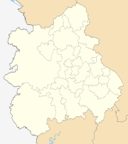 | |
| Shropshire | ||
| Staffordshire | ||
| Warwickshire | ||
| West Midlands | ||
| Worcestershire | ||
Coordinates: 53°6′23.75″N 2°1′36.06″W / 53.1065972°N 2.0266833°W