St. Peter, Wisconsin
| St. Peter, Wisconsin | |
|---|---|
| Census-designated place | |
|
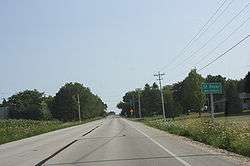
Looking south at the sign for St. Peter | |
| Nickname(s): Gateway to the Holyland | |
 St. Peter, Wisconsin | |
| Coordinates: 43°50′11″N 88°20′29″W / 43.83639°N 88.34139°WCoordinates: 43°50′11″N 88°20′29″W / 43.83639°N 88.34139°W | |
| Country | United States |
| State | Wisconsin |
| County | Fond du Lac |
| Area | |
| • Total | 3.633 sq mi (9.41 km2) |
| • Land | 3.628 sq mi (9.40 km2) |
| • Water | 0.005 sq mi (0.01 km2) |
| Elevation | 1,063 ft (324 m) |
| Population (2010)[1] | |
| • Total | 1,489 |
| • Density | 410/sq mi (160/km2) |
| Time zone | Central (CST) (UTC-6) |
| • Summer (DST) | CDT (UTC-5) |
| ZIP codes | 53049, 54937 |
| Area code(s) | 920 |
| GNIS feature ID | 1573503[2] |
St. Peter, Wisconsin is an unincorporated census-designated place in the Town of Taycheedah in Fond du Lac County, Wisconsin. It is located approximately 2 miles (3.2 km) northeast of Peebles and 1 mile (1.6 km) south of Silica.[3] It was located on Wisconsin Highway 149 before the highway was decommissioned and turned over to county control as County Highway WH. As of the 2010 census, its population is 1,489.[1]
Holyland
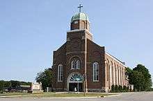
St. Peter Catholic church
Main article: The Holyland (Wisconsin)
St. Peter is in an area of eastern Fond du Lac County, Wisconsin known as "The Holyland", so called because of the large number of communities built around churches, including St. Anna, St. Cloud, Marytown, Mount Calvary, Johnsburg, Calvary, Brothertown and Jericho.[4]
Notes
- 1 2 "American FactFinder". U.S. Census Bureau. Retrieved 20 April 2011.
- ↑ "US Board on Geographic Names". United States Geological Survey. 2007-10-25. Retrieved 2008-01-31.
- ↑ "Location of St. Peter, Wisconsin". Google Maps. Retrieved 26 December 2009.
- ↑ Commemorating the centennial of St. Peter's Parish, St. Peter, Malone, Route One, Fond du Lac County, Wisconsin. 1967. OCLC 57448543
Municipalities and communities of Fond du Lac County, Wisconsin, United States | ||
|---|---|---|
| Cities | 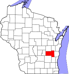 | |
| Villages | ||
| Towns | ||
| CDPs | ||
| Unincorporated communities |
| |
| Ghost towns | ||
| Footnotes | ‡This populated place also has portions in an adjacent county or counties | |
This article is issued from Wikipedia - version of the 12/1/2016. The text is available under the Creative Commons Attribution/Share Alike but additional terms may apply for the media files.