Saint-Elzéar-de-Témiscouata, Quebec
| Saint-Elzéar-de-Témiscouata | |
|---|---|
| Municipality | |
 Location within Témiscouata RCM | |
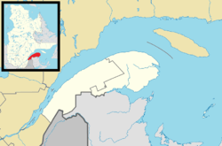 Saint-Elzéar-de-Témiscouata Location in eastern Quebec | |
| Coordinates: 47°35′N 69°06′W / 47.583°N 69.100°WCoordinates: 47°35′N 69°06′W / 47.583°N 69.100°W[1] | |
| Country |
|
| Province |
|
| Region | Bas-Saint-Laurent |
| RCM | Témiscouata |
| Constituted | November 19, 1938 |
| Government[2] | |
| • Mayor | Réjean Deschênes |
| • Federal riding |
Rimouski-Neigette— Témiscouata—Les Basques |
| • Prov. riding | Rivière-du-Loup-Témiscouata |
| Area[2][3] | |
| • Total | 150.70 km2 (58.19 sq mi) |
| • Land | 150.50 km2 (58.11 sq mi) |
| Population (2011)[3] | |
| • Total | 343 |
| • Density | 2.3/km2 (6/sq mi) |
| • Pop 2006-2011 |
|
| • Dwellings | 155 |
| Time zone | EST (UTC−5) |
| • Summer (DST) | EDT (UTC−4) |
| Postal code(s) | G0L 2W0 |
| Area code(s) | 418 and 581 |
| Highways | No major routes |
Saint-Elzéar-de-Témiscouata is a municipality in the Témiscouata Regional County Municipality in the Bas-Saint-Laurent region of Quebec, Canada.[2]
Prior to January 19, 2002, it was known simply as Saint-Elzéar.[4]
See also
References
- ↑ Reference number 369642 of the Commission de toponymie du Québec (French)
- 1 2 3 Geographic code 13085 in the official Répertoire des municipalités (French)
- 1 2 "(Code 2413085) Census Profile". 2011 census. Statistics Canada. 2012.
- ↑ http://www.toponymie.gouv.qc.ca/ct/pdf/modifications_municipalites.pdf
 |
Saint-Honoré-de-Témiscouata | |
Saint-Louis-du-Ha! Ha! | |
| |
||||
| ||||
| | ||||
| Pohénégamook | Rivière-Bleue | Saint-Eusèbe |
| Cities & Towns | |
|---|---|
| Municipalities | |
| Parishes | |
| |
This article is issued from Wikipedia - version of the 12/24/2015. The text is available under the Creative Commons Attribution/Share Alike but additional terms may apply for the media files.