Rozetta Township, Henderson County, Illinois
| Rozetta Township | |
|---|---|
| Township | |
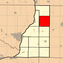 Location in Henderson County | |
 Henderson County's location in Illinois | |
| Coordinates: 40°56′25″N 90°50′33″W / 40.94028°N 90.84250°WCoordinates: 40°56′25″N 90°50′33″W / 40.94028°N 90.84250°W | |
| Country |
|
| State |
|
| County | Henderson |
| Established | November 6, 1906 |
| Area | |
| • Total | 36.43 sq mi (94.4 km2) |
| • Land | 36.42 sq mi (94.3 km2) |
| • Water | 0.01 sq mi (0.03 km2) 0.03% |
| Elevation | 722 ft (220 m) |
| Population (2010) | |
| • Total | 271 |
| • Density | 7.4/sq mi (2.9/km2) |
| Time zone | CST (UTC-6) |
| • Summer (DST) | CDT (UTC-5) |
| ZIP codes | 61418, 61447, 61453, 61462, 61469 |
| GNIS feature ID | 0429680 |
Rozetta Township is one of eleven townships in Henderson County, Illinois, USA. As of the 2010 census, its population was 271 and it contained 121 housing units.[1]
Geography
According to the 2010 census, the township has a total area of 36.43 square miles (94.4 km2), of which 36.42 square miles (94.3 km2) (or 99.97%) is land and 0.01 square miles (0.026 km2) (or 0.03%) is water.[1]
Unincorporated towns
- Reeds at 40°55′02″N 90°49′32″W / 40.917260°N 90.825417°W
- Rozetta at 40°56′30″N 90°51′50″W / 40.941704°N 90.863751°W
(This list is based on USGS data and may include former settlements.)
Cemeteries
The township contains these six cemeteries: Coghill, Cumberland, Reed, Rozetta, Smith Creek and Stockton.
Major highways
Airports and landing strips
- Carner Landing Strip (currently unusable)
School districts
- United Community School District 304
- West Central Community Unit School District 235
Political districts
- Illinois's 17th congressional district
- State House District 94
- State Senate District 47
References
- United States Census Bureau 2008 TIGER/Line Shapefiles
- "Rozetta Township". Geographic Names Information System. United States Geological Survey. Retrieved 2009-09-19.
- United States National Atlas
- 1 2 "Population, Housing Units, Area, and Density: 2010 - County -- County Subdivision and Place -- 2010 Census Summary File 1". United States Census. Retrieved 2013-05-28.
External links
 |
Bald Bluff Township | Sumner Township, Warren County | | |
| Oquawka Township | |
Hale Township, Warren County | ||
| ||||
| | ||||
| Gladstone Township | Biggsville Township | Tompkins Township, Warren County |
Municipalities and communities of Henderson County, Illinois, United States | ||
|---|---|---|
| City | ||
| Villages | ||
| Townships | ||
| Unincorporated communities |
| |
| Footnotes | ‡This populated place also has portions in an adjacent county or counties | |
This article is issued from Wikipedia - version of the 7/16/2016. The text is available under the Creative Commons Attribution/Share Alike but additional terms may apply for the media files.