Round Rock, Texas
| Round Rock, Texas | |
|---|---|
| City | |
| City of Round Rock | |
| Nickname(s): Daffodil Capital of Texas [1] | |
| Motto: "Sports Capital of Texas" | |
 | |
 Round Rock, Texas Location within the state of Texas | |
| Coordinates: 30°30′31″N 97°40′44″W / 30.50861°N 97.67889°WCoordinates: 30°30′31″N 97°40′44″W / 30.50861°N 97.67889°W | |
| Country |
|
| State |
|
| Counties | Williamson |
| Brushy Creek | 1851 |
| Government | |
| • Type | Council-Manager |
| • City Council |
Mayor Alan Martin McGraw Mayor Pro-tem George White Craig Morgan Frank Leffingwell Will Peckham Writ Baese Kris Whitfield |
| • City Manager | Laurie Hadley |
| Area | |
| • Total | 26.3 sq mi (68.0 km2) |
| • Land | 26.1 sq mi (67.7 km2) |
| • Water | 0.1 sq mi (0.3 km2) |
| Elevation | 735 ft (224 m) |
| Population (2016)[2] | |
| • Total | 122,767 (US: 251st) |
| • Density | 3,827.1/sq mi (903.1/km2) |
| Time zone | Central (CST) (UTC-6) |
| • Summer (DST) | CDT (UTC-5) |
| Zip codes | 78664, 78665, 78680—78683 |
| Area code(s) | 512 & 737 |
| FIPS code | 48-63500 |
| GNIS feature ID | 1366966[3] |
| Website | roundrocktexas.gov |
Round Rock is a city in the U.S. state of Texas, located in Williamson County,[4] which is a part of the Greater Austin, Texas metropolitan area. The 2016 census estimate places the population at 122,727.[5]
The city straddles both sides of the Balcones Escarpment,[6] a fault line in which the areas roughly east of IH-35 are flat and characterized by having black, fertile soils of the Blackland Prairie, and the west side of the Escarpment which consists mostly of hilly, karst-like terrain with little topsoil and higher elevations and which is part of the Texas Hill Country. Located about 20 miles (32 km) north of downtown Austin, Round Rock shares a common border with Austin at Texas State Highway 45.
In August 2008, Money magazine named Round Rock as the seventh-best American small city in which to live.[7] Round Rock was the only Texas city to make the Top 10. In a CNN article dated July 1, 2009, Round Rock was listed as the second fastest-growing city in the country, with a population growth of 8.2% in the preceding year.[8]
Round Rock has a strong public education system.[9] According to the 2008 ratings from the Texas Education Agency, the Round Rock Independent School District (RRISD) ranks among the best in the state. Of 42 schools within it, twelve were rated exemplary and eleven are recognized.
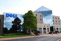
Round Rock is perhaps best known as the international headquarters of Dell, which employs approximately 16,000 people at its Round Rock facilities.[10] The presence of Dell along with other major employers,[11] a strong economic development program, favorable tax rates, and major retailers such as IKEA and a Premium Outlet Mall, and the mixed use La Frontera center, have changed Round Rock from a sleepy bedroom community[12] into its own self-contained "super suburb."[13]
History
Prehistoric Round Rock

Round Rock and Williamson County have been the site of human habitation since at least 9,200 BC. The earliest known inhabitants of the area lived during the late Pleistocene (Ice Age), and are linked to the Clovis culture around 9,200 BC (11,200 years old) based on evidence found at the much-studied "Gault Site," midway between Georgetown and Fort Hood.[14] One of the most important discoveries in recent times is that of the ancient skeletal remains dubbed "The Leanderthal Lady" because of its age and proximity to Leander, Texas.[15] The site is 4 miles (6 km) west of Round Rock and was discovered by accident by Texas Department of Transportation workers while drilling core samples for a new highway. The site has been extensively studied for many years and samples carbon date to this particular Pleistocene period at approximately 10,500 years ago (8,500 BC). Prehistoric and Archaic Period "open occupation" campsites are also found throughout the county along streams and other water sources including Brushy Creek in Round Rock and the San Gabriel River in Georgetown, ten miles (16 km) north.[16] These archeology dig sites show a much greater volume of evidence of Archaic Period inhabitants based on relics and flint tools recovered from burned rock middens. The earliest known "historical" Native American occupants, the Tonkawa, were a flint-working, hunting people who followed the buffalo on foot and periodically set fire to the prairie to aid them in their hunts. During the 18th century they made the transition to a horse culture and used firearms to a limited extent. There also appear to have been small numbers of Kiowa, Yojuane, Tawakoni, and Mayeye Native-Americans living in the county at the time of the earliest Anglo settlements.[17] After they were crowded out by white settlement, the Comanches continued to raid settlements in the county until the 1860s. In the late 19th century, Native Americans were being pushed out of Central Texas.
As the area developed into a rural Anglo community, some of the modern paved roads actually followed the original Native-American pathways. One famous immigration route passed through Round Rock and is called the "Double File Trail" because the path was wide enough for two horsemen to ride side-by-side. It is part of a longer trail from north Texas that crossed the San Gabriel River in Georgetown, Brushy Creek in Round Rock, and the Colorado River in Austin.[18] An elementary school in the Round Rock school district is named for the trail, Double File Trail Elementary School.
19th century history

In 1851, a small community was formed on the banks of Brushy Creek, near a large round and anvil-shaped rock located in the middle of the creek. This round rock marked a convenient low-water crossing for wagons, horses, and cattle. The first postmaster called the community "Brushy," and the creek was called "Brushy Creek". But in 1854, at the suggestion of the postmaster, the small settlement was renamed Round Rock in honor of this now famous rock. After the Civil War, Jesse Chisholm began moving cattle from South Texas through Round Rock on the way to Abilene, Kansas. The route he established, which crossed Brushy Creek at the round rock, became known as the Chisholm Trail.[19] Most of the old buildings, including the old Saint Charles Hotel, have been preserved. This historic area is now called "Old Town."[20]
The Sam Bass era of the 1870s

Downtown Round Rock was the site of an historic gunfight and subsequent capture (and death) of the 19th-century American train robber Sam Bass,[21] by the Texas Ranger Division on July 19, 1878. The Rangers followed Bass and his gang after they robbed the Fort Worth-to-Cleburn train. Bass was tracked to Round Rock and as he attempted to flee, Bass was shot and killed in a gun battle by Ranger George Herold and Ranger sergeant Richard Ware. Near Ware was Soapy Smith, a noted con man, and his cousin Edwin, who witnessed Ware's shot. Soapy exclaimed, "I think you got him."[22] The event is known locally as the "Sam Bass Shootout."[23] This shootout is re-created each year at the July 4 'Frontier Days' Celebration in Old Settlers Park. Bass is buried in Round Rock Cemetery, located northwest of "Old Town" on Sam Bass Road. His original headstone can be found on display at the Round Rock Public Library.[24]
Cotton
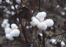
In the first half of the 20th century the county's wealth came from the cotton fields.[25] Cotton, row-crops, grapes, and truck farming were the predominant subsistence east of Interstate 35. West of the Balcones divide ranchers raised cattle, sheep and to a lesser extent goats.[26] Due to Round Rock's favorable geographic location over the rich, fertile "blackland prairie" soils also known locally as the "black waxy"[27] (due to the soil's high clay content), cotton was the largest economic driver at that time. Because of the soil and climate, this eco-region is ideally suited to crop agriculture. Nearby Taylor, Texas, east of Round Rock, was the primary cotton center where the crop was hauled for ginning (its seeds mechanically removed) at the cotton gin, compressed into bales, and shipped by train. Austin was also a cotton center for a time once the railroad arrived there in the 1870s.[28] Cotton production and cattle raising, on a much smaller scale, continues today although primarily east of Round Rock.
Chisholm Trail Crossing Park
To preserve the heritage of the famous crossing, a Chisholm Trail Crossing Park was developed to provide visitors with a simulated scene of Round Rock's historical role in the Chisholm cattle drive. Commemorative plaques in the park tell of the history of Round Rock. The bronze sculptures of four steers and pioneer woman Hattie Cluck and her son, Emmitt, were commissioned by the city through donations from Round Rock residents. The sculptures depict Round Rock's history as a crossing location along the Chisholm Trail.[29] The project plans include 18 to 20 additional bronze statues over time.
Old Settlers Association

Following the end of the American Civil War a group of Confederate veterans held a reunion in Georgetown on August 27, 1904, for the old settlers of Williamson County and their descendants. The invitation promised "good music, plenty to eat, and above all a warm welcome." The event was well-attended, and reunions — now called Old Settlers Association (OSA) reunions — have been held annually ever since. After the initial one, the event was moved to Round Rock and eventually a structure was built (along with three restored log cabins) in the Palm Valley area of Round Rock, in front of Old Settlers Park, just off Highway 79 in east Round Rock. All members of the organization are descendants of Williamson County residents prior to 1904. OSA has approximately 50 active members and 300 members total.[30] The Old Settlers Association today is a social and educational group, with the purpose of facilitating social activities, as well as collecting and preserving important historical information and facts. The facilities are rented for meetings, arts and craft and collectable shows, events, parties, weddings and rehearsal dinners.[31]
The economic impact of Interstate 35
In the 1950s, Taylor was the economic powerhouse in the county due to it being the center of cotton production and shipping and had a large population. So it was expected, then, that the proposed Interstate 35, part of the new Interstate Highway System would pass through Taylor on its way from Dallas to Austin. In fact, the original routing plans drawn by Highway Commissioner DeWitt Greer called for the "interregional" highway to go through Taylor. Some of the citizens and leadership of Taylor lobbied against the Taylor route citing multiple concerns ranging from the loss of farmland, to unwanted right of way (ROW) acquisition — it was proposed to be an astounding 300 feet (90 m) wide, unheard of before this time—the possibility of cutting farmers off from their fields or having their fields be located on opposite sides of the road, traffic noise, and loss of country life. No one even knew what an "Interregional Highway" would look like. Instead they wanted improvements to the farm-to-market roads and a straight route to Austin.[32]
Meanwhile, Round Rock leaders wanted the highway to come their way as they were focused on the potential economic development opportunities it would bring. At that time no one had ever seen such a road as an "Interstate" (unless they had traveled to Germany to see the Autobahn or Connecticut), but then-Mayor Louis Henna lobbied hard at the Highway Commission for the Round Rock route. In June 1956, the fifteen-year debate over the form, funding and route of the Interstate was resolved.[33] Due to the heavy lobbying effort, and not wanting to antagonize Taylor, the route was eventually changed and the highway was built along the edge of the Balcones Fault line running through Round Rock. The precise route was not without opposition, however, as the final route cut off "Old Town" to the west from what had become the more recent "downtown" area east of Interstate 35.[34] The Interstate eventually made Round Rock into a viable and vibrant commercial center. Due to the Interstate and the reduction in the importance of cotton as a primary crop, Taylor is today a minor, modest town with a smaller population, while Round Rock has thrived and rapidly grown into the largest city in the county, attracting companies like Dell Computer and major retail centers.[13] The transformation of Round Rock is detailed in a book by Linda Scarborough (publisher of the Williamson County Sun newspaper) titled Road, River and Ol' Boy Politics: A Texas County's Path from Farm to Supersuburb published by Texas State Historical Press.[35]
Life as a bedroom community
By the 1990s, Round Rock was primarily a bedroom community with the majority of its employed residents working in Austin and then returning home after work to places like Round Rock and Georgetown where housing and land was less expensive. In the 1990s, Round Rock had few major employers and jobs other than local retail and other services, or ranching and farming.[12] But in the late 1990s, that began to change as economic development became a major focus of the city and the Chamber of Commerce. Dell Corporation (later renamed Dell) moved its headquarters to Round Rock which has provided a significant number of jobs with 16,000 employees at its Round Rock headquarters .[36][37](See also the Business and economic development section in this article.)
Geography
Round Rock is located 17 miles (27 km) north of downtown Austin, and 10 miles (16 km) south of Georgetown. Its elevation is 709 ft (216 m).
According to the US Census Bureau, the city has a total area of 26.3 square miles (68.0 km2), of which 26.1 square miles (67.7 km2) are land and 0.1 square mile (0.3 km2) (0.50%) is water.[38]
Climate
The climate in this area is characterized by generally hot, humid summers and mild, cool winters. According to the Köppen Climate Classification system, Round Rock has a humid subtropical climate, abbreviated "Cfa" on climate maps.[39]
Demographics
| Historical population | |||
|---|---|---|---|
| Census | Pop. | %± | |
| 1880 | 628 | — | |
| 1890 | 1,438 | 129.0% | |
| 1900 | 1,138 | −20.9% | |
| 1910 | 1,245 | 9.4% | |
| 1920 | 900 | −27.7% | |
| 1930 | 1,005 | 11.7% | |
| 1940 | 1,173 | 16.7% | |
| 1950 | 1,683 | 43.5% | |
| 1960 | 2,458 | 46.0% | |
| 1970 | 2,811 | 14.4% | |
| 1980 | 12,740 | 353.2% | |
| 1990 | 30,923 | 142.7% | |
| 2000 | 61,136 | 97.7% | |
| 2010 | 99,887 | 63.4% | |
| Est. 2016 | 122,767 | [40] | 22.9% |
| U.S. Decennial Census[41] 2013 Estimate[42] | |||
As of the 2010 census, there were 99,887 people and 37,223 households, residing in the city. There were 37,223 housing units with 20,364 owner-occupied homes costing at a median value of $163,400. The racial makeup of the city was 76.4% White, 9.4% African American, 0.4% Native American, 4.1% Asian, 0% Pacific Islander, 5.7% from other races, and 3% from two or more races. Hispanic or Latino of any race made up 25% of its population. According to a 2009 estimate by the U.S Census Bureau, the median income for a household was $69,892, and the median income for a family was $79,417.
There were 21,076 households out of which 47.5% had children under the age of 18 living with them, 60.5% were married couples living together, 11.0% had a female householder with no husband present, and 24.4% were non-families. 18.1% of all households were made up of individuals and 3.0% had someone living alone who was 65 years of age or older. The average household size was 2.87 and the average family size was 3.29.
In the city, the age distribution of the population shows 31.9% under the age of 18, 8.5% from 18 to 24, 38.8% from 25 to 44, 16.3% from 45 to 64, and 4.5% who were 65 years of age or older. The median age was 30 years. For every 100 females there were 99.1 males. For every 100 women age 18 and over, there were 96.3 men.
Government and politics
City government
The city of Round Rock is managed through a council-manager form of government. The City Council is composed of six city council members and the mayor. The mayor and all council members are elected at large and serve the entire city, not by geographic precincts. The mayor pro tem is appointed annually by council members.[43] City Council positions are not full-time jobs. The council appoints a full-time city manager who manages the daily affairs of the city, and all council meetings are held at 221 E. Main Street, in downtown Round Rock, on the second and fourth Thursday of each month at 7 p.m., unless indicated otherwise. Council meetings are televised.[44]
- The current mayor is Alan McGraw
- Council member Place 1 Craig Morgan
- Council member Place 2 George White
- Council member Place 3 Frank Leffingwell
- Council member Place 4 Will Peckham
- Council member Place 5 Writ Baese
- Council member Place 6 Kris Whitfield
County government
The Commissioners Court[45] is the overall governing and management body of Williamson County, consisting of five members. The county judge presides as chairman over the court, and is elected every four years by all voters in the county. Four commissioners are elected by single-member precincts every four years. While the majority of Round Rock is within Precinct 1, all four precincts include some portions of the city. (See Williamson County, Texas article for more detail.)
State and national representation
- Texas House of Representatives: State Representative District 52: Larry Gonzales (R).
- Texas Senate District 5: Charles Schwertner (R).[46]
- US Congress - Congressman John R. Carter (R), Congressional District 31.[46]
- US Congress - Congressman Michael McCaul (R), Congressional District 10.[46]
Other political subdivisions
Municipal utility districts, commonly referred to as "MUDs", play a significant role in Round Rock. Each is a special-purpose district that provides public utilities such as water, wastewater, storm water, and sometimes roads, parks, solid waste, and other infrastructure and services to the residents of each district. MUDs are typically formed by a residential developer as a means to install utilities and roads to a project when a city is not ready or able to provide them. The developer gets reimbursed over time from the fees levied by the MUD, and at some point the area may be annexed by the city to bring the development into the city's tax base once the basic infrastructure costs are paid off.[47] The MUD is represented by its own board of directors who are voted on by the residents of the district, and it has the authority to condemn land, add additional land area, and levy fees in lieu of property taxes to maintain the utilities and other facilities.
There are currently ten MUDs in Round Rock: Brushy Creek, Fern Bluff, Highlands at Mayfield Ranch, Meadows at Chandler Creek, Paloma Lake, Parkside at Mayfield Ranch, Siena, Teravista, Vista Oaks, and Walsh Ranch. Total population living within these MUDs is 47,648 (2010 city estimate).[48]
Round Rock's largest district is Brushy Creek Municipal Utility District.[49] Brushy Creek MUD was formed as Williamson County Municipal Utility District No. 2 in October 1977 with 725 acres (2.9 km2) of land. An annexation in 1983 increased the District to 2,210 acres (8.9 km2). The district name was changed to Brushy Creek Municipal Utility District on August 1990. The MUD provides a wide range of city-like services including parks and recreation, full utilities, road maintennance and a Home Owner's Association. Services a MUD can offer, however are also limited by law (for example they cannot offer library services).
Another similar but somewhat smaller MUD in Round Rock's is Fern Bluff Municipal Utility District [50] in the Wyoming Springs area of town. Both MUDs play a significant role in local governance and maintenance of basic utilities.
From time to time there have been very contentious elections to the boards and heated debates regarding other MUD issues.[51] Round Rock does not often annex a MUD in order to avoiding having to take on the aging infrastructure replacement and upkeep costs.
Business and economic development


The City of Round Rock has maintained a high quality of life while becoming a major center for economic growth in Central Texas, with industry clusters in clean energy, advanced manufacturing, life sciences and computer/software development.[19]
Round Rock has more than twenty major employers[11] including: Toppan Photomasks, Sears Customer Care, IKEA, Round Rock Premium Outlets, KoMiCo Technology Inc., Texas Guaranteed Student Loan Corp (TGSLC), Cintas, Dresser, Hospira, and TECO-Westinghouse, Cerilliant Corporation, Emerson Process Management, and Dell.[19]
Dell corporate headquarters
Dell is a multinational computer and information technology corporation based in Round Rock, which develops, sells and supports computers and related products and services. The company employs about 11,500 people in the Round Rock facilities[37] and about 96,000 people worldwide.[52] Dell was originally based in Austin after its initial formation in 1984 as PC's Limited by UT college student Michael Dell. With the need for significant space as it expanded, the City of Round Rock in 1996 offered Dell a "Chapter 380" agreement by offering to split sales tax revenue from in-state sales 50/50 between Dell and the City. A "Chapter 380" agreement is named for the chapter in Vernon's Statutes that permits sales tax revenue sharing for economic development purposes. It was the first time such an agreement had been used in Central Texas and among the very first in the state.[53] As of 1999, approximately half of the general fund of the City of Round Rock originates from sales taxes generated from the Dell headquarters.[53] Today the company is one of the largest technology companies in the world, listed as number 38 on the Fortune 500 (2010). Fortune also lists Dell as the #5 most admired company in its industry. As part of its clean energy program, in 2008 Dell switched the power sources of the Round Rock headquarters to more environmentally friendly ones, with 60% of the total power coming from TXU Energy wind farms and 40% coming from the Austin Community Landfill gas-to-energy plant operated by Waste Management, Inc
Commercial and retail
Round Rock's largest commercial and office business center is La Frontera, located at the intersection of Loop 1, SH 45 and IH-35. La Frontera combines multi-tenant offices, company headquarters facilities, 1,000,000 square feet (90,000 m2) of retail,[54] and several apartment complexes and other smaller retail and housing centers. The project also includes Williamson County's largest hotel, the Austin North Marriott, which provides space for large conferences, meetings and banquets - a first for the county and an important component of Round Rock's economic efforts.[55] The center is also home to the Texas Guaranteed Student Loan Corporation (TGSLC),[56] and Emerson Process Management. The retail portion is the second largest outdoor commercial project in the Austin - Round Rock Metro area.[57] La Frontera was developed by Bill Smalling and Don Martin, with Fort Worth financier Ed Bass as financial partner.
In 2006, a retail-only hub opened in Round Rock at the corner of Interstate 35 and Highway 1431 (now renamed "University Boulevard"): The major retailer center includes the Simon Property Group's Premium Outlets Mall, across the street is IKEA[58] as well as numerous other retail stores and restaurants. The project was developed by Simon Property Group, with other portions by Barshop & Oles of Austin.
Health care
Round Rock has a wide array of hospitals and extensive health care services. Many of these facilities serve not only Round Rock, but the greater Williamson county area, as well as North Austin.[59]
- Saint David's Round Rock Medical Center was the first major hospital in Round Rock, opening its doors as Round Rock Hospital in 1984. It is a for-profit hospital with a Level II Trauma center as part of the extensive St. David's system.[60]
- Scott & White Healthcare in Temple opened a satellite hospital in Round Rock in 2007. It is located on University Boulevard. The facility has full hospital services, but also transfers some patients to its primary Temple campus. Scott & White is a non-profit collaborative health care system based in Temple. Scott & White Healthcare - Round Rock serves residents of Williamson and North Travis counties, including the Austin/Round Rock metropolitan area. Facilities include Scott & White Hospital - Round Rock, Scott & White Hospital - Taylor and 15 additional primary care and specialty clinic locations in Burnet, Cedar Park, Georgetown, Hutto, Leander, Pflugerville, Round Rock and Taylor.
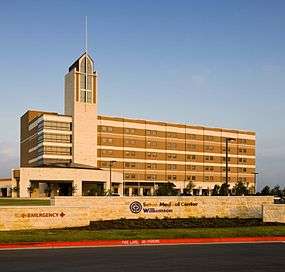
- Seton Medical Center Williamson[61] is the newest hospital in Round Rock, opening in 2009 on University Boulevard. It is adjacent to the Texas State University campus, the new Austin Community College (ACC) campus opened in fall 2010, as well as the Round Rock campus of the Texas A&M Health Science Center. The facility is currently building out its planned expansion space ahead of schedule.[62] Seton Medical Center Williamson is a Level II Trauma center. Seton is a "non-profit" corporation and part of the Daughters of Charity of Saint Vincent de Paul and Ascension Health.
- Another entrant into the health-care field in Round Rock opened in December 2009 is the Texas A&M Health Science Center. The 250,000 square feet (23,000 m2) building is the first of up to seventeen more additional buildings expected to be built in coming years. The facility also houses administrative offices, classrooms and a 33,000 square feet (3,100 m2) Lone Star Circle of Care clinic, where health care students will train.[63]
- In 2010, the latest component of higher education is the School of Nursing at Texas State University, housed within the University's College of Health Professions. Other programs that are offered by the college are health information management, health services research, and physical therapy.[64]
- Lone Star Circle of Care (LSCC) is a grant-funded organization dedicated to serving the health needs of the uninsured and underinsured in Williamson County and nearby areas. They have grown from one clinic in Georgetown in January 2001 to today having eighteen community clinics serving Central Texas. They provided 130,000 patient visits for medically underserved adults and children in 2009. Grants come from the Scott & White Foundation, Seton Foundation, the Michael & Susan Dell Foundation, Georgetown Health Foundation, St. David's Foundation, and many others.[65] In May 2010 the Seton family of hospitals awarded LSCC a $3 million grant for pediatric care.[66] And the new A&M Health Science Center is partnering with the Lone Star Circle of Care for a 32,000 square-foot clinical hub which opened in A&M's existing building in December 2009.[67]
Transportation
Major highways
 Interstate 35
 U.S. Highway 79 (the southern terminus is here)
 State Highway 45
 State Highway 45 Toll Rd
 State Highway 130 Toll Rd
Toll roads

In November 2006, the Central Texas Regional Mobility Authority (CTRMA)[68] opened the first segment of the region's first toll road system. Both State Highway 130 and State Highway 45 toll roads run through portions of Round Rock and provide greatly increased mobility to the city, albeit with strong regional opposition to the high-toll charges to motorists. State Highway 130 runs just south of Austin Bergstrom International Airport at US Highway 183 and connecting to Interstate 35 north of Georgetown, and passes through the easternmost portion of Round Rock. It provides Round Rock residents with quick access to the Austin airport for about $6 each way. The project, when completed, will end at Interstate 10 just east of Seguin, about 30 miles (50 km) east-northeast of San Antonio essentially creating a parallel roadway to Interstate 35.
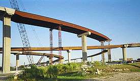
State Highway 45 is part of an eventual loop that runs east from State Highway 183 in Cedar Park to 130 at Pflugerville (east of Round Rock) where it merges with the SH 130 toll road, and then intercects with the southern portion of SH 45 near Buda, south of Austin. SH 45 passes through the entire southern portion of Round Rock. Highway 45 provides much faster access between Round Rock and Austin, alleviating what was previously a major bottleneck at Interstate 35. The project includes a tolled extension to Loop 1 (also known locally as the "Mopac Expressway") and allows direct access from to I-35 to Loop 1 by use of flyover connections rather than ground level intersections. The toll roads also provide access to the Dell headquarters and its considerable number of employees. Together, both toll roads significantly improve mobility in Round Rock in a positive manner.
Round Rock played a major role in the creation of SH 45 through constant pressure on the Texas Department of Transportation to make it a priority project, the purchase of right of way, and other assistance at critical early stages. Robert L. "Bob" Bennett, who was Round Rock City Manager at the time, oversaw the project for the city. Bennett, now retired, served as a founding member of CTRMA board of directors as an appointee of Williamson County in 2003.[69] Former Williamson County Commissioner and former Round Rock City Councilman Mike Heiligenstein is the Executive Director of the CTRMA.[70]
Education
Public education

Round Rock Independent School District, a Texas Education Agency Recognized School District, is located in southern Williamson County and northwest Travis County and includes all the City of Round Rock and portions of the City of Austin and the City of Cedar Park.[9] The area covers 110 square miles (280 km2) encompassing high-tech manufacturing and urban retail centers, suburban neighborhoods, and farm and ranch land. "Roughly 45,000 students attend the district's five high schools, ten middle schools, 32 elementary schools, and two alternative learning centers. During the past five years, the number of students has increased by nearly 15%, and enrollment continues to grow by more than 1,200 students per year."[71]
In August 2010, the district opened its fifth high school (Cedar Ridge High School), a ninth grade center reverted to a middle school and the district's 31st elementary school opened in the Stone Oak subdivision. "The average student-teacher ratio for RRISD is 16. The annual dropout rate for students in grades 7 – 12 is 1.1% and more than 77% of the district's graduating seniors take the SAT and ACT college entrance exams, scoring well above state and national averages."[71] The property tax rates are significantly higher than the national average, and the schools' performance reflects the tax dollars invested.
- Total number of students: 44,781 (as of fall 2010)
- Number of languages spoken: 77
- Average SAT score: 1628 (the state average is 1462 and the national average is 1509)
- Average ACT score: 24.1 (the state average is 20.8 and the national average is 21.0)
- Source:[71]
In the annual report released July 30, 2010 the Round Rock Independent School District received the highest possible rating ("Exemplary") for twenty five of its schools, the highest number so rated in any of the suburban districts in Central Texas. These schools are: Westwood High School. Canyon Vista, Walsh, and Cedar Valley middle schools. Spicewood, Forest North, Caraway, Brushy Creek, Laurel Mountain, Fern Bluff, Canyon Creek, Great Oaks, Teravista, Cactus Ranch, Sommer, Deep Wood, Robertson, Pond Springs, Live Oak, Old Town, Jollyville, Forest Creek, Blackland Prairie, Union Hill and Gattis elementary schools. In 2010 the school district as a whole was rated "academically recognized" a significant step above 2009 when the school district was rated "academically acceptable" by the Texas Education Agency.[72]
Higher education

Round Rock also has a number of higher education opportunities. In 1990, the city, under the leadership of then-City Manager Bob Bennett, planning director Joe Vining, and local citizen Mike Swayze envisioned and oversaw creation of the Texas State University Round Rock Campus (a/k/a Round Rock Higher Education Center - "RRHEC"). The concept was envisioned as a way to lure colleges and universities to jointly provide education, training and degree opportunities on a part-time and full-time bases. The RRC used various empty facilities around town and many of the initial training programs were targeted to help educate students for work at local companies, such as Dell, which had specialized needs. In 2008, an educational campus and the first RRC building—the Avery Building—was opened through the combined efforts of Texas State University, Austin Community College, and Temple College in order to provide a broader range of educational opportunities, specialized training, and varying degree programs including post graduate degrees. The campus is in the heart of the emerging Avery Center development which houses Seton Williamson, the A&M Health Science Center and other medical campuses. By the end of 2009 1,700 students were enrolled in the programs. Texas State University has taken on the lead role in this effort and 100 acres (40 ha) of land for the facility and additional buildings was donated by the Avery family of Round Rock, whose family were early settlers on the land surrounding the RRHEC. Construction on the second Texas State campus building is underway and construction is nearly complete on this additional classroom building.[73] (See also Texas State University Round Rock Campus)
The city is also home to the new Texas A&M Health Science Center Round Rock which opened its doors December 2010.[74] The campus is designed to eventually accommodate as many as 17 additional buildings over time as monies are appropriated each biennium by the Texas Legislature.[63]
In August 2010, Austin Community College's largest campus to date opened adjacent to the Texas State University center.[75][76] ACC is currently constructing five additional buildings with a total of 250,000 square feet (23,000 m2) to accommodate up to 5,000 students in its first phase. All three campuses are adjacent to each other within the burgeoning Avery Farms development.[77]
The newest component of higher education is the School of Nursing at Texas State University, housed within the University's College of Health Professions. Other programs that are offered by the college are health information management, health services research, and physical therapy.[64][78]
Sports

Round Rock is home to the Class AAA Pacific Coast League minor league baseball team Round Rock Express,[79] owned by RSR Sports (Nolan Ryan, Don Sanders, Reid Ryan) and was founded by Reid Ryan, son of Baseball Hall of Famer Nolan Ryan. As of August 2010, Nolan Ryan is also the new owner of the major league Texas Rangers ball club.[80] Home games for the Round Rock Express are played at the Dell Diamond, a facility that is owned by the City of Round Rock and leased long-term to RSR Sports who run and maintain the facility.
Round Rock opened a free public skate park in 2007[81] behind the Clay Madsen Recreation Center on Gattis School Road.[82]
Round Rock is the self-proclaimed "Sports Capital of Texas."[83] The City's Old Settlers Park offers a professionally designed disc golf course, cricket, twenty-field baseball complex, five-field softball complex, and seven soccer facilities in addition to the Rockin' River Family Aquatic Center.[84]
The Round Rock independent school district high schools are known for their accomplishments in sports as well, specifically Stony Point high school for being the state semi-finalists 3 years in a row and the second most winning 5A program in the state of Texas.
Notable people
- Barbette - A world-famous female impersonator (born Vander Clyde December 19, 1898 in Round Rock, later legally changed to Vander Clyde Broadway, and died August 5, 1973, at age 74, in Round Rock).[85] but was known mostly by his/her stage name. Barbette is believed to have been the inspiration for the 1933 German film Viktor und Viktoria, which features a plot about a woman pretending to be a female impersonator whose gimmick of removing her wig at the end of her act is inspired by Barbette's signature gesture.[86] Viktor und Viktoria was remade in 1935 (First a Girl), 1957 also called Viktor und Viktoria; and which in turn inspired a 1982 film Victor Victoria and a Broadway musical starring Julie Andrews (who was nominated for an Oscar for Best Actress) and Blake Edwards, director. Release date: May 6, 1983.[87]

- Michael Dell, an American business magnate and the founder and chief executive officer of Dell (formerly Dell, Inc.) While a pre-med student at the University of Texas at Austin, Dell started an informal business (originally called PC's Limited) by upgrading computers in room 2713 of the Dobie Center residential building. He then applied for a vendor license to bid on contracts for the State of Texas, winning bids by not having the overhead of a computer store.[88][89][90] By 1992, at the age of 27, Dell became the youngest CEO to have his company ranked in Fortune magazine's list of the top 500 corporations.[91] Today he is one of the richest people in the world, with a net worth of an estimated $13.5 billion in 2010.[92] Dell's 1999 book, written in collaboration with Catherine Fredman, Direct from Dell: Strategies That Revolutionized an Industry, is an account of his early life, his company's founding, growth and missteps, as well as lessons learned.[93] While not a resident of Round Rock, Dell's business is based there and has had major impact on the community through the company itself and the Michael & Susan Dell Foundation.
- Larry Gonzales, Republican member of the Texas House of Representatives from Round Rock, first elected in 2010[94]
- Noel Grisham (born Albert Noel Grisham on December 24, 1916, in Hunt County, Texas, and died on June 9, 1999, in Round Rock) helped lay the foundation for Round Rock Independent School District (RRISD) to become the academically successful district it is today.[95][96] Grisham was superintendent of Round Rock ISD for 22 years. As superintendent from 1957 to 1979, Grisham oversaw the consolidation of RRISD and Pond Springs School District—located in the west side of Round Rock—and the construction of more than ten of the district's schools. Following his exit from public education, Grisham served as representative of Texas House of Representatives, District 52 during the 1983 state legislative session, serving on the House Committee on Public Education. Noel Grisham Middle School in Round Rock is named after him.[97] Grisham is buried at the historic Texas State Cemetery in Austin, Texas.[98]

- Louis Henna - visionary business leader, and former mayor. Of all the early mayors, the one who perhaps had the greatest impact on Round Rock at the time, and certainly the greatest flair for business, was Louis M. Henna—an entrepreneur, businessman, civic volunteer, major donor, and politician. He was named one of the first "outstanding citizens" of Round Rock. By 1936, the 21-year-old Henna already operated his own independent garage and filling station in Round Rock. He soon founded the Henna Motor Company and became the youngest person in Chevrolet history to own a car dealership when he negotiated to become a Chevy dealer, a dealership that is still owned and operated by the family today, seven decades later, as Henna Chevrolet.[99] In 1938 he famously erected what was described as "The World's Largest Sign" measuring 47 feet (14 m) by 107 feet (33 m) on the corner of what is now Interstate 35 and Louis Henna Boulevard (now Texas State Highway 45): The sign dwarfed a car he placed in front of the sign to give it scale.[27] Henna was also a generous donor and volunteer in numerous organizations. He and his wife deeded 112 acres of land and five newly constructed buildings, three cottages and an administrator's building for the Texas Children's Baptist Home in Round Rock, which still operates at the same location today. He helped build affordable housing and new suburban subdivisions for GI's returning from World War II.[100] He served on the City Council from 1947 to 1952, and as mayor from 1952 to 1956. During his mayoral tenure he was instrumental in the current routing of Interstate 35 through Round Rock leading to the growth of today.
- Cpl. Robert P. Hernandez is the only Vietnam War casualty from Round Rock. He was awarded the Purple Heart, Vietnam Service Medal, Vietnam Campaign Medal, and the Navy Cross. A Round Rock Independent School District Middle School was named after him in June 2010. His father, a high school janitor, was the founder of the El Amistad Club and resident of Round Rock. The first civic project of El Amistad was to help develop Veterans Memorial Park along Brushy Creek in memory of Hernandez.[101]
- Colleen LaRose - Rose, nicknamed "JihadJane" was identified in 2010 by federal prosecutors as an alleged terrorist intent on recruiting others to her cause. Prosecution is pending.[102][103]

- Donnie Little - former American football quarterback and the first black quarterback to play for The University of Texas[104]
- Garfield McConico - Garfield McConico (1916–2000) literally helped "build" Round Rock. At the end of World War II, a time when the city's population totaled about 1,400, he worked with former Mayor Louis Henna to construct some of the city's first subdivisions from the ground up, building new homes with lumber reused from Army barracks at Fort Hood. McConico also helped create employment opportunities for local soldiers when they came home from serving abroad. McConico's most enduring legacy, however, began in 1969, when he became Round Rock's first African American city councilman. In 1994 he and his wife Petrenella were honored as a "Living Legend" in Round Rock, and in 1994 the new city administrative building (built on the site of McConico boyhood home) was named in their honor.[105]
- Soapy Smith - Jefferson Randolph "Soapy" Smith II (November 2, 1860 – July 8, 1898)[106] was an American confidence man and gangster who had a major hand in organized crime from 1879 to 1898. As a Round Rock youth, he witnessed the shooting of the outlaw Sam Bass. Smith himself was killed in the famed shootout on Juneau Wharf. He is counted among the more famous con men of the Old West.[107][108]
- Chief Rick Stone - Rick Stone, a Round Rock native, is reported to be the most highly decorated policeman in Dallas, Texas history. Stone's awards included the Medal of Valor, Police Commendation Award, Police Commendation Award with Star, Life Saving Award, Certificate of Merit, Distinguished Service Award and multiple lesser medals, unit awards and commendations. He was also a Parade Magazine/International Association Chiefs of Police "Officer of the Year" nominee and twice nominated as the department's "Officer of the Year". Rising to the rank of Division Commander in Dallas, Stone later served as the Chief of Police in Wichita, Kansas and Hollywood, Florida. In May 2003, Officer Stone's contributions to the history of the Dallas Police Department were chosen to be included in a series of bronze plaques, created by New York artist Greg Lefevre, that were installed at the entrance to the newly constructed police headquarters building in downtown Dallas.[109]
- Ryan Goins - MLB Player for the Toronto Blue Jays.
Films and television programs in and about Round Rock

- In "End of an Outlaw", an episode of the CBS television series Trackdown, starring Robert Culp as Texas Ranger Hoby Gilman, which aired on November 27, 1957, the Rangers halt a bank robbery planned by Sam Bass prior to the outlaw's fateful end on his 27th birthday in Round Rock.[111]
- The 1974 horror movie cult classic, The Texas Chain Saw Massacre, was filmed at various Central Texas locations with a majority of shooting occurring at two houses located across the road from each other on an old stretch of County Road 172 later diverted in the middle 1980s on what is historically known as Quick Hill ‒ now the site of the La Frontera commercial development in Round Rock.[110] Contrary to the movie's introduction, the movie is not based on a true story. Tours of local sites are still conducted by avid film buffs.[112] In the early 1980s, the movie's dilapidated two-story house ‒ long-abandoned before the movie's filming and situated across the road from the movie's main Texas Chainsaw House built in 1910 and occupied before and after filming ‒ was torched by local area high school students leaving a charred limestone skeleton of the mostly wooden frame. In 1998, the Texas Chainsaw House was disassembled and moved to Kingsland, Texas, where it was reassembled and fully restored and currently operates as a restaurant at The Antlers Hotel.[113]
- Directed by Joel and Ethan Coen, Blood Simple is a 1984 American neo-noir crime film. It was the directorial debut of the Coen brothers, and the first major film of cinematographer Barry Sonnenfeld. The film's title derives from the Dashiell Hammett novel Red Harvest, in which "blood simple" is a term coined to describe the addled, fearful mindset people are in after a prolonged immersion in violent situations. Blood Simple was re-released theatrically in 2000 and on DVD in 2001 in a "director's cut".
- A majority of the 2002 Disney film, The Rookie, which starred Dennis Quaid and Rachel Griffiths, was shot at and around the minor league-baseball stadium in Round Rock known as Dell Diamond. It is inspired by the true story of Jim Morris who had a brief but famous Major League Baseball career.[114]
- The Simple Life: (TV Season 2, episode 15). The Simple Life is a reality television series that was broadcast from December 2, 2003, to August 5, 2007. The first three seasons aired on Fox, and the final two on E!. The comedic show depicts two wealthy young socialites (Paris Hilton and Nicole Richie) as they struggle to do manual, low-paying jobs such as cleaning rooms, doing farm work, serving meals in fast-food restaurants and working as camp counselors. Season 2, Episode 15 took place during a Round Rock Express baseball game.[115]
- Written and co-produced by Elgin native Jake Helgren, the movie "A Dogwalker's Christmas Tale" (2015) had many scenes shot in and around Round Rock. These included downtown Round Rock around the public library and at Star Coffee Company, the Round Rock Dog Depot, and some sidewalk scenes in Mayfield Ranch subdivision.[116]
Sister cities
See also
References
| Library resources about Round Rock, Texas |
- ↑ Official Capital Designations, Texas State Library and Archives Commission, accessed November 16, 2016
- ↑ "Population Estimates". United States Census Bureau. Retrieved 2014-06-05.
- ↑ "US Board on Geographic Names". United States Geological Survey. 2007-10-25. Retrieved 2008-01-31.
- ↑ "Bureau of Labor Statistics for Austin-Round Rock, Texas Metropolitan Area".
- ↑ "Round Rock city Texas QuickFacts from the US Census Bureau". Retrieved May 1, 2016.
- ↑ Balcones Escarpment from the Handbook of Texas Online. Retrieved May 11, 2010. Texas State Historical Association
- ↑ "Best places to live 2008 – Top 100 City details: Round Rock, Texas". Money Magazine. Money.cnn.com. Retrieved March 19, 2010.
- ↑ Christie, Les (July 1, 2009). "The fastest growing cities in the United States". Money CNN. Retrieved March 19, 2010.
- 1 2 "Round Rock ISD". Community Impact. 1 (6). July 17, 2007. pp. 18–19.
- ↑ Hall, Christine (April 28, 2010). "Cyberstates: Texas second-largest tech employment". Austin Business Journal. Retrieved May 4, 2010.
- 1 2 "Round Rock Chamber of Commerce: Major Employers". Roundrockchamber.org. Retrieved March 19, 2010.
- 1 2 Thompson, Karen R.; Jane H. Digesualado (1985). Historical Round Rock Texas. Austin, Texas: Nortex Press (Eakin Publications). p. 78.
- 1 2 Scarbrough, Linda (2005). Road, River and Good Ol' Boy Politics: A Texas County's Path from Farm to Supersuburb. Austin, Texas: Texas State Historical Association. p. 259. ISBN 978-0-87611-202-1.
- ↑ "Handbook of Texas Online: "Gault Site"". Texas State History Association. Retrieved July 18, 2010.
- ↑ Thompson, Karen R.; Jane H. Digesualado (1985). Historical Round Rock Texas. Austin, Texas: Nortex Press (Eakin Publications). pp. 4, 7.
- ↑ Hester, Thomas R.; Ellen Sue Turner. "Prehistory". Retrieved August 10, 2010.
- ↑ Odintz, Mark. "Williamson County". Retrieved August 10, 2010.
- ↑ Thompson, Karen R.; Jane H. Digesualado (1985). Historical Round Rock Texas. Austin, Texas: Nortex Press (Eakin Publications). pp. 16, 17. OCLC 12119831.
- 1 2 3 "City of Round Rock profile". Roundrocktexas.gov. Retrieved July 23, 2010.
- ↑ "A Brief History of Round Rock". Roundrocktexas.gov. Retrieved March 19, 2010.
- ↑ "Bass, Sam Handbook of Texas entry".
- ↑ Smith, Jeff (2009). Alias Soapy Smith: The Life and Death of a Scoundrel, Klondike Research. pp. 30–32. ISBN 0-9819743-0-9
- ↑ "The Officer Down Memorial Page on A. W. Grimes".
- ↑ "City of Round Rock – Sam Bass". Roundrocktexas.gov. Retrieved March 19, 2010.
- ↑ Scarbrough, Linda (2009). Road, River and Good Ol' Boy Politics: A Texas County's Path from Farm to Supersuburb. Austin, Texas: Texas State Historical Association. p. 22. ISBN 978-0-87611-202-1.
- ↑ Scarbrough, Linda (2009). Road, River and Good Ol' Boy Politics: A Texas County's Path from Farm to Supersuburb. Austin, Texas: Texas State Historical Association. p. 82. ISBN 978-0-87611-202-1.
- 1 2 Scarbrough, Linda (2009). Road, River and Good Ol' Boy Politics: A Texas County's Path from Farm to Supersuburb. Austin, Texas: Texas State Historical Association. ISBN 978-0-87611-202-1.
- ↑ Scarbrough, Linda (2009). Road, River and Good Ol' Boy Politics: A Texas County's Path from Farm to Supersuburb. Austin, Texas: Texas State Historical Association. pp. 250–251. ISBN 978-0-87611-202-1.
- ↑ Torres, Edward (February 23, 2009). "Recalling family connections along Round Rock's old Chisholm Trail". Round Rock Leader.
- ↑ Stansbury, Amy (July 3, 2008). "Round Rock Old Settlers Association". Community Impact Newspaper.
- ↑ Thompson, Karen R.; Jane H. Digesualado. Historical Round Rock Texas. Austin, Texas: Nortex Press (Eakin Publications).
- ↑ Scarbrough, Linda (2009). Road, River and Good Ol' Boy Politics: A Texas County's Path from Farm to Supersuburb. Austin, Texas: Texas State Historical Association. pp. 53–256. ISBN 978-0-87611-202-1.
- ↑ Scarbrough, Linda (2009). Road, River and Good Ol' Boy Politics: A Texas County's Path from Farm to Supersuburb. Austin, Texas: Texas State Historical Association. p. 271. ISBN 978-0-87611-202-1.
- ↑ Scarbrough, Linda (2009). Road, River and Good Ol' Boy Politics: A Texas County's Path from Farm to Supersuburb. Austin, Texas: Texas State Historical Association. p. 257. ISBN 978-0-87611-202-1.
- ↑ Scarbrough, Linda (2009). Road, River and Good Ol' Boy Politics: A Texas County's Path from Farm to Supersuburb. Austin, Texas: Texas State Historical Association. ISBN 978-0-87611-202-1.
- ↑ "Dell Worldwide." Dell. Retrieved on May 4, 2010.
- 1 2 Hall, Christine. "Cyberstates: Texas second-largest tech employment." Austin Business Journal. Wednesday April 28, 2010. Retrieved on May 4, 2010.
- ↑ "Round Rock (city) QuickFacts from the US Census Bureau". Quickfacts.census.gov. Retrieved March 19, 2010.
- ↑ Climate Summary for Round Rock, Texas
- ↑ "Annual Estimates of the Resident Population for Incorporated Places: April 1, 2010 to July 1, 2015". Retrieved July 2, 2016.
- ↑ United States Census Bureau. "Census of Population and Housing". Retrieved June 5, 2014.
- ↑ "Annual Estimates of the Resident Population: April 1, 2010 to July 1, 2013". Retrieved June 5, 2014.
- ↑ City of Round Rock. "About the Round Rock City Council". City of Round Rock website. Retrieved July 23, 2010.
- ↑ City of Round Rock. "About the Round Rock City Council". City of Round Rock website. Retrieved August 3, 2010.
- ↑ "Commissioners Court".
- 1 2 3 "Texas Tribune Directory".
- ↑ Eakens, Kathryn (June 10, 2009). "City to buy regional wastewater system". Round Rock Leader.
- ↑ City of Round Rock email from Joel Jordan, City Planning Department, August 12, 2010
- ↑ bcmud.org
- ↑ fernbluffmud.org
- ↑ Zachry, Lauri (May 4, 2010). "Stempko, McLaughlin vie for MUD position; Newcomers enter as Bradley departs". Round Rock Leader.
- ↑ Staff. "Dell headquarters now carbon-free." New Mexico Business Weekly. Wednesday April 2, 2008. Retrieved on May 4, 2010.
- 1 2 Jacobs, Janet. "Cash flow from Dell lets Round Rock boost budget." Austin American-Statesman. September 9, 1999. A1. Retrieved on May 4, 2010. "Almost half the city's general fund comes from sales tax at Dell's headquarters."
- ↑ "La Frontera Village for sale". Austin Business Journal. 06-10-2010. Retrieved 2010-05-30. Check date values in:
|date=(help) - ↑ austinmarriottnorth.com
- ↑ "Tap into the TG learning center". tgslc.org.
- ↑ Novak, Shonda (30 August 2007). "Deal is milestone for La Frontera". Austin American-Statesman. Austin, Texas. p. D1. Retrieved 2010-05-30
- ↑ "Amid much fanfare, IKEA opens to mass crowd on first day", Austin Business Journal, Austin, Texas, 16 November 2006. Retrieved on 2010-7-7.
- ↑ Zaragoza, Sandra (December 25, 2009). "Expansion in facilities, services marked decade in health care for Round Rock". Austin Business Journal.
- ↑ "About St. David's Round Rock Medical Center" Retrieved August 3, 2010
- ↑ http://www.seton.net/locations/seton_medical_center_williamson/
- ↑ Vose, Robyn (July 21, 2010). "Seton Williamson is feeling fine; Fifth floor adding 32 beds". Round Rock Leader.
- 1 2 "Texas A&M Health Science Center Round Rock opens". Austin Business Journal. December 11, 2009.
|first1=missing|last1=in Authors list (help) - 1 2 "Our Story". rrhec.txstate.edu.
- ↑ "Lone Star Circle of Care" Retrieved August 3, 2010
- ↑ Press Release: "LSCC Partners with the Seton Family of Hospitals to Launch Regional Pediatric Network" May 27, 2010. Retrieved August 3, 2010
- ↑ Press Release: "Lone Star Circle of Care is proud to be a partner of the Texas A&M Health Science Center" Retrieved August 3, 2010
- ↑ Shiffler, D.Ann (September 26, 2003). "On the road again". Austin Business Journal.
- ↑ Alexander, Kate (December 26, 2002). "County appoints three members to toll road board". Austin American-Statesman.
- ↑ Wear, Ben; Laura Heinauer (September 26, 2002). "County official up for key transit job". Austin American-Statesman.
- 1 2 3 "Round Rock ISD: Overview". Round Rock ISD. Archived from the original on August 8, 2013.
- ↑ Tabota, Melissa (July 30, 2010). "Texas Education Agency releases statewide school ratings". Austin American-Statesman.
- ↑ "RRHECord Newsletter". July 2010. Retrieved August 3, 2010.
- ↑ Zachry, Lauri (June 2, 2010). "Area colleges deal with growth, state funding". Round Rock Leader.
- ↑ "Round Rock Campus Campus opens on August 23, 2010, for first day of fall classes." Austin Community College Locations: Round Rock Update. Date retrieved August 3, 2010
- ↑ Zachry, Lauri (September 5, 2008). "ACC presents preliminary plans for Round Rock campus". Round Rock Leader.
- ↑ "Plans revealed for Austin Community College." Austin Business Journal, Austin, Texas, 3 September 2008. Retrieved 2010-7-7.
- ↑ "St. David's Nursing now accepting applications for fall 2010". Texas State University. Retrieved September 9, 2009.
- ↑ "Official Site of Minor League Baseball and the Round Rock Express". Retrieved July 5, 2010.
- ↑ Garrett (Sports Editor), Jon (August 6, 2010). "Ryan victory felt in Round Rock". Round Rock Leader.
- ↑ Bowlin, Sean (June 9, 2007). "Skate park to open July 20". Round Rock Leader.
- ↑ "Round Rock Skate Park". Retrieved August 11, 2007.
- ↑ "Sports Capital of Texas". Sports Capital of Texas. Retrieved March 19, 2010.
- ↑ "Game on! Old Settlers Park" Retrieved August 3, 2010
- ↑ United States passport application for Vander Clyde Broadway, dated March 9, 1923
- ↑ Williams, Albert (1997). "The Hidden Holocaust". The Chicago Reader. Retrieved May 26, 2008.
- ↑ "Victor Victoria". imdb.com. Retrieved August 3, 2010.
- ↑ Dell, Michael; Catherine Fredman (1999). Direct from Dell: Strategies that Revolutionized an Industry. HarperBusiness. pp. 9–10. ISBN 0-88730-914-3.
- ↑ "Michael Dell Remarks University of Texas at Austin" (PDF).
- ↑ Pietz, John (May 2, 2004). "Michael Dell's view from the top". Austin American-Statesman.
- ↑ "Michael Dell". National Press Club Summary. National Public Radio. June 8, 2008. Retrieved 16 April 2010.
- ↑ Michael Dell topic page Forbes.com. Accessed April 2010.
- ↑ Dell, Michael; Catherine Fredman (1999). Direct from Dell: Strategies that Revolutionized an Industry. HarperBusiness. ISBN 0-88730-914-3.
- ↑ "Larry Gonzales Biography" (PDF). lrl.state.tx.us. Retrieved February 19, 2014.
- ↑ "Noel Grisham obituary and cemetery information including grave market photo". findagrave.com. Retrieved May 5, 2014.
- ↑ "Official TAKS Scores, Ratings Released". Cedar Ridge High School PTSA.
- ↑ Eakens, Kathryn (July 2, 2010). "Noel Grisham - Round Rock Legend". Community Impact News.
- ↑ "Noel Grisham buried at Texas State Cemetery in Austin, Texas". findagrave.com. Retrieved May 5, 2014.
- ↑ Thompson, Karen R.; Jane H. Digesualado. Historical Round Rock Texas. Austin, Texas: Nortex Press (Eakin Publications). pp. 4, 7.
- ↑ Thompson, Karen (December 7, 2007). "The Henna family of Round Rock". Community Impact Newspaper.
- ↑ Bryant, Samantha (June 4, 2010). "Round Rock ISD approves elementary, middle school names". Community Impact News.
- ↑ Johnson, Carrie (March 3, 2010). "JihadJane, an American woman, faces terrorism charges.". Washington Post.
- ↑ "Indictment, U.S. v. LaRose" (PDF). U.S. District Court for the Eastern District of Pennsylvania. March 4, 2010. Retrieved March 10, 2010.
- ↑ "Dickinson High School 2013 Homecoming Festivities". Gator Bytes Dickinson Independent School District E-Newsletter. Retrieved October 8, 2013.
- ↑ Heidrick, Rob (February 5, 2010). "Garfield McConico - Living Legend". Community Impact Newspaper.
- ↑ Smith, Jeff (2009). Alias Soapy Smith: The Life and Death of a Scoundrel, Klondike Research. p. 22. ISBN 0-9819743-0-9
- ↑ Robertson, Frank C.; Harris, Beth Kay (1961). Soapy Smith: King of the Frontier Con Men. New York City: Hastings House. ISBN 978-0-8038-6661-4.
- ↑ Jeff Smith. "Alias Soapy Smith: King of the Frontier Con Man". Klondike Publishing.
- ↑ "Decorated former Dallas officer wants chief chance". Dallas Morning News. September 15, 2003.
- 1 2 "Howdy Neighbor, can I borrow your saw?". Austin American-Statesman. July 2, 1999.
- ↑ Billy Hathorn, "Roy Bean, Temple Houston, Bill Longley, Ranald Mackenzie, Buffalo Bill, Jr., and the Texas Rangers: Depictions of West Texans in Series Television, 1955 to 1967", West Texas Historical Review, Vol. 89 (2013), p. 105
- ↑ Texas Chainsaw Tours ltd website. "Texas Chainsaw Massacre Tours". web site. Retrieved July 23, 2010.
- ↑ Pack, MM (October 31, 2003). "The Killing Fields: A culinary history of 'The Texas Chainsaw Massacre' farmhouse". Austin Chronicle.
- ↑ "The Rookie - 2002". Rotten Tomatoes. Retrieved July 23, 2010.
- ↑ List provided by the Texas Film Commission: Katie Kelley, Office Manager - Texas Film Commission, Email, July 23, 2009
- ↑ http://www.imdb.com/title/tt3991066/locations?ref_=ttspec_sa_6
External links
| Wikimedia Commons has media related to Round Rock, Texas. |
- Williamson County Historical Commission page on Round Rock
- City of Round Rock, TX
- Community Center of City of Round Rock, TX
- Round Rock Chamber of Commerce
- Round Rock Weather and Climate Data
Municipalities and communities of Travis County, Texas, United States | ||
|---|---|---|
| Cities |  | |
| Villages | ||
| CDPs | ||
| Other unincorporated communities | ||
| Footnotes | ‡This populated place also has portions in an adjacent county or counties | |
Municipalities and communities of Williamson County, Texas, United States | ||
|---|---|---|
| Cities | 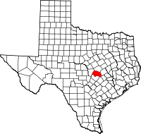 | |
| CDPs | ||
| Unincorporated communities | ||
| Ghost town | ||
| Footnotes | ‡This populated place also has portions in an adjacent county or counties | |
| Central city |  | ||||||
|---|---|---|---|---|---|---|---|
| Satellite cities | |||||||
| Other communities | |||||||
| Counties |
| ||||||
| Parks and preserves |
| ||||||
| Geography | |||||||
| Bodies of water | |||||||
| Transportation | |||||||
