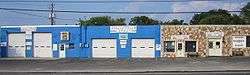
Jollyville, Texas
| Jollyville, Texas | |
|---|---|
| CDP | |
 | |
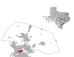
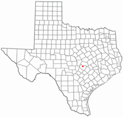 Location of Jollyville, Texas | |
 | |
| Coordinates: 30°27′12″N 97°45′45″W / 30.45333°N 97.76250°WCoordinates: 30°27′12″N 97°45′45″W / 30.45333°N 97.76250°W | |
| Country | United States |
| State | Texas |
| Counties | Williamson, Travis |
| Area | |
| • Total | 5.9 sq mi (15.3 km2) |
| • Land | 5.9 sq mi (15.3 km2) |
| • Water | 0.0 sq mi (0.0 km2) |
| Elevation | 938 ft (286 m) |
| Population (2000) | |
| • Total | 15,813 |
| • Density | 2,681.7/sq mi (1,035.4/km2) |
| Time zone | Central (CST) (UTC-6) |
| • Summer (DST) | CDT (UTC-5) |
| ZIP code | 78729 |
| Area code(s) | 512 |
| FIPS code | 48-37936[1] |
| GNIS feature ID | 1360365[2] |
Jollyville is a census-designated place (CDP) in Travis and Williamson counties in Texas. It is a neighborhood in north Austin. The population was 16,151 at the 2010 census.
History
The area was first settled by Henry Rhodes after obtaining a land grant in 1841 of about 1,000 acres (4 km2) from the Republic of Texas. The name, however, comes from a later settler, John G. (possibly Grey, but no proof for middle name exist) Jolly, who purchased 160 acres (0.65 km2) in 1866. John and his wife, Nancy Isabell (Guill) Jolly, operated a blacksmith shop and store. The Jollys donated land for a school and the cemetery in which they were eventually buried. Jollyville remained lightly settled for decades; only twenty families lived in the area in 1960. Eventually, the growth of nearby Austin led to the development of Jollyville as a suburban community.
Geography
Jollyville is located at 30°27′12″N 97°45′45″W / 30.45333°N 97.76250°W (30°27′12″N 97°45′45″W / 30.453288°N 97.762381°W).[3]
According to the United States Census Bureau, the CDP has a total area of 5.9 sq mi (15 km2), all of it land.
Demographics
| Historical population | |||
|---|---|---|---|
| Census | Pop. | %± | |
| 1990 | 15,206 | — | |
| 2000 | 15,813 | 4.0% | |
| 2010 | 16,151 | 2.1% | |
| source:[4] | |||
As of the census of 2000,[1] there were 15,813 people, 5,897 households, and 4,145 families residing in the CDP. The population density was 2,681.7 people per square mile (1,034.8/km2). There were 5,993 housing units at an average density of 1,016.4/sq mi (392.2/km2). The racial makeup of the area was 79.81% White, 4.69% African American, 0.31% Native American, 8.52% Asian, 0.02% Pacific Islander, 4.36% from other races, and 2.28% from two or more races. 11.43% of the population were Hispanic or Latino of any race.
There were 5,897 households out of which 42.2% had children under the age of 18 living with them, 57.2% were married couples living together, 9.5% had a female householder with no husband present, and 29.7% were non-families. 20.5% of all households were made up of individuals and 1.6% had someone living alone who is 65 years of age or older. The average household size was 2.68 and the average family size was 3.17.
In the CDP the population was spread out with 28.7% under the age of 18, 8.4% from 18 to 24, 41.3% from 25 to 44, 18.7% from 45 to 64, and 3.0% who were 65 years of age or older. The median age is 32 years. For every 100 females there were 99.8 males. For every 100 females age 18 and over, there were 98.7 males.
The median income for a household in the CDP was $66,999, and the median income for a family was $74,851. Males had a median income of $50,048 versus $32,004 for females. The per capita income for the CDP was $28,113. 2.7% of the population and 2.2% of families were living below the poverty line, including 1.7% of those under the age of 18 and 6.2% of those 65 and older.
Climate
The climate in this area is characterized by hot, humid summers and generally mild to cool winters. According to the Köppen Climate Classification system, Jollyville has a humid subtropical climate, abbreviated "Cfa" on climate maps.[5]
References
- 1 2 "American FactFinder". United States Census Bureau. Retrieved 2008-01-31.
- ↑ "US Board on Geographic Names". United States Geological Survey. 2007-10-25. Retrieved 2008-01-31.
- ↑ "US Gazetteer files: 2010, 2000, and 1990". United States Census Bureau. 2011-02-12. Retrieved 2011-04-23.
- ↑ "CENSUS OF POPULATION AND HOUSING (1790-2000)". U.S. Census Bureau. Retrieved 2010-07-17.
- ↑ Climate Summary for Jollyville, Texas
External links
- Williamson County Historical Commission Page on Jollyville
- Jollyville from the Handbook of Texas Online
- Jollyville Elementary School in Round Rock Independent School District, Austin, TX
Municipalities and communities of Travis County, Texas, United States | ||
|---|---|---|
| Cities |  | |
| Villages | ||
| CDPs | ||
| Other unincorporated communities | ||
| Footnotes | ‡This populated place also has portions in an adjacent county or counties | |
Municipalities and communities of Williamson County, Texas, United States | ||
|---|---|---|
| Cities | 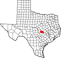 | |
| CDPs | ||
| Unincorporated communities | ||
| Ghost town | ||
| Footnotes | ‡This populated place also has portions in an adjacent county or counties | |
| Central city |  | ||||||
|---|---|---|---|---|---|---|---|
| Satellite cities | |||||||
| Other communities | |||||||
| Counties |
| ||||||
| Parks and preserves |
| ||||||
| Geography | |||||||
| Bodies of water | |||||||
| Transportation | |||||||
