Ropsley and Humby
Ropsley and Humby is a civil parish in the South Kesteven district of Lincolnshire, England. According to the 2001 Census it had a population of 808,[1] increasing to 816 at the 2011 census.[2] The parish consists of the small villages of Ropsley and Great Humby and the larger Little Humby, and the Deserted Medieval Villages of Overton Green[3] and Ogarth.[4]

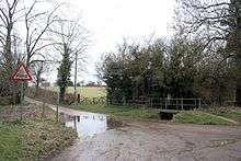

The northern edge of the parish is formed by the A52 Grantham to Boston road, and the eastern edge is largely coincident with the former line of the Roman road King Street between Stainfield and Anacaster. Part of this boundary is the ancient 'long hollow'. The parish is around 100m above sea level on the Lincolnshire limestone hills between Grantham and the Fens. The open country in the north of the parish is known as Ropsley Moor[5]
For the purposes of local democracy, the parish is administered with adjacent Braceby and Sapperton.[6]
References
- ↑ "Neighbourhood statistics". 2001 census. Office for national statistics. Retrieved 20 April 2013.
- ↑ "Civil Parish population 2011". Neighbourhood Statistics. Office foer National Statistics. Retrieved 27 May 2016.
- ↑ Historic England. "Overton Green (892632)". PastScape. Retrieved 7 September 2013.
- ↑ Historic England. "Ogarth (325730)". PastScape. Retrieved 7 September 2013.
- ↑ Grantham: Bottesford & Colsterworth (Map) (A1 ed.). 1:25 000. OS Explorer. Ordnance survey of Great Britain. 3 January 2006. § 247. ISBN 9780319238332.
- ↑ "Ropsley and Humby parish council". Lincolnshire county council. Retrieved 7 September 2013.
The "Ropsley & District Parish Council" covers the electoral area of the village of Ropsley & the hamlets of Braceby, Great Humby, Little Humby & Sapperton. The Ropsley & Humby Ward elects seven councillors & the Braceby & Sapperton Ward one.
- Google (5 September 2013). "Parish Outline" (Map). Google Maps. Google. Retrieved 5 September 2013.
Coordinates: 52°54′N 0°29′W / 52.90°N 0.49°W
External links
 Media related to Ropsley and Humby at Wikimedia Commons
- "all 43 historical records for the parish". Pastscape. English Heritage.
England Portal | |
| Unitary authorities | |
| Boroughs or districts | |
| Major settlements |
|
| Topics | |