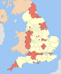
North East Lincolnshire
| Borough of North East Lincolnshire | |
|---|---|
| unitary authority area and Borough | |
 North East Lincolnshire | |
| Coordinates: 53°33′N 0°06′W / 53.55°N 0.10°WCoordinates: 53°33′N 0°06′W / 53.55°N 0.10°W | |
| Sovereign state | United Kingdom |
| Constituent country | England |
| Region | Yorkshire and the Humber |
| Ceremonial county | Lincolnshire |
| Founded | 1996 |
| Admin. HQ | Grimsby |
| Government | |
| • Type | North East Lincolnshire Council |
| • Leadership: | Leader & Cabinet |
| • Executive: | Labour |
| • MPs: |
Martin Vickers (C) Melanie Onn (L) |
| • Chief Executive | Rob Walsh |
| • Leader | Ray Oxby (Labour) |
| Area | |
| • Total | 74.1 sq mi (191.9 km2) |
| Area rank | 171st |
| Population (mid-2014 est.) | |
| • Total | 159,804 |
| • Rank | Ranked 116th |
| • Density | 2,200/sq mi (830/km2) |
| Time zone | Greenwich Mean Time (UTC+0) |
| • Summer (DST) | British Summer Time (UTC+1) |
| ONS code |
00FC (ONS) E06000012 (GSS) |
| Ethnicity |
97.4% White 1.1 Asian[1] |
| Website |
www |
North East Lincolnshire is a unitary authority area in the Yorkshire and the Humber region of England, bordering the unitary authority of North Lincolnshire and the non-metropolitan county of Lincolnshire. The population of the Unitary Authority at the 2011 Census was 159,616.[2] These three administrative units make up the ceremonial county of Lincolnshire.
History
North East Lincolnshire was created from the boroughs of Cleethorpes and Great Grimsby on 1 April 1996 on the abolition of Humberside.
Historically, it was part of the Kingdom of Lindsey.
North East Lincolnshire had its first "North East Lincolnshire Day" on 3 June 2016.
Geography
The north part of the authority has a flat landscape.
Recent council results
_-_geograph.org.uk_-_295856.jpg)
| Local Elections 2012 : North East Lincolnshire | ||||||||
|---|---|---|---|---|---|---|---|---|
| Labour | Conservative | UKIP | Liberal Democrats | Others | Green | Turnout | ||
| 11,661 +4,522 |
6,439 −5,310 |
4,916 +4,916 |
3,634 −5,310 |
388 −2,604 |
158 +158 |
27,196 27.53% | ||
| Local Elections 2012: Seats | ||||||||
|---|---|---|---|---|---|---|---|---|
| Labour | Conservative | Liberal Democrats | UKIP | Others | Green | |||
| 25 +6 |
12 −2 |
4 −5 |
1 +1 |
0 |
0 | |||
Towns and villages
- Ashby cum Fenby
- Aylesby
- Barnoldby le Beck
- Beelsby
- Bradley
- Brigsley
- Cleethorpes
- East Ravendale
- Great Coates
- Grimsby
- Habrough
- Hatcliffe
- Healing
- Humberston
- Immingham
- Irby upon Humber
- Laceby
- Little Coates
- New Waltham
- Old Clee
- Scartho
- Stallingborough
- Waltham
- Weelsby
- Wold Newton
Places of interest
- Waltham Windmill
- Cleethorpes Coast Light Railway
- Pleasure Island
- Blundell Park (home of Grimsby Town Football Club)
- The Greenwich Meridian passes through the county.
Governance
North East Lincolnshire is a unitary authority that has operated a cabinet-style council since 2003. There are 42 councillors. They elect the cabinet in May each year. Each cabinet member is responsible for making decisions within their portfolio area.[3] The governance of North East Lincolnshire Council has come under scrutiny from the audit commission on two occasions[4] leading to special public interest reports for its failings. During this time (between 2003 and 2011) it was run politically as a coalition between the Conservatives and Liberal Democrats. In June 2011 it became a minority Labour controlled Council.[5]
North East Lincolnshire council was also the council subject to the Kelly report for Ian Huntley involvement and the Soham murders.
Media
The radio station for the area is called Compass FM, and takes its logo from the logo of North East Lincolnshire, being based south of Grimsby railway station. BBC Radio Humberside have a small studio to the east of Grimsby town centre. Grimsby Institute have the innovative Seven (former Channel 7) television, based in Immingham at the Immage Studios. Propeller TV was also part of Grimsby Institute. The Grimsby Telegraph is a daily newspaper.
Economy
The North East Lincolnshire towns of Grimsby, Immingham and Cleethorpes, form the economic area known as Greater Grimsby. The main sectors of the Greater Grimsby economy are food and drink; ports and logistics; renewable energy and chemicals and process industries.
This is a table of trend of regional gross value added of North and North East Lincolnshire at current basic prices published (pp. 240–253) by the Office for National Statistics with figures in millions of British pounds sterling.
| Year | Regional Gross Value Added[6] | Agriculture[7] | Industry[8] | Services[9] |
|---|---|---|---|---|
| 1995 | 3,512 | 82 | 1,701 | 1,729 |
| 2000 | 3,861 | 60 | 1,805 | 1,997 |
| 2003 | 4,569 | 62 | 1,896 | 2,611 |
The area has one power station, the South Humber Bank Power Station, which is owned and operated by Centrica sited at Stallingborough.
Similar to North Lincolnshire, the area has its fire and police run by Humberside Fire and Rescue Service and Humberside Police.
Transport

There are four main roads that link to the unitary authority - the A180 (from the M180) which was built in 1984, and the A46 from Lincoln. The A46 terminates in Cleethorpes, previously terminating at the Laceby roundabout, and follows the former route of the A18 through Grimsby and Cleethorpes. The A18 which runs from Doncaster to Laceby past the Humberside Airport. And the A16 from southern Lincolnshire through Louth, Entering the town at toll bar roundabout Waltham
There are good connections by railway from Doncaster and Sheffield, which start at Manchester Airport - the TransPennine Express.
It is transport by sea that the area has national significance. The two ports of Immingham and Grimsby, when combined, have the largest tonnage of freight of any UK port. Immingham has many DFDS freight routes (DFDS Seaways since 2010, the former DFDS Tor Line) to Europe.
Education
The local LEA has comprehensive schools, becoming comprehensive in the early 1970s when part of the County Borough of Grimsby, and the Lindsey Education Committee, based in Lincoln. However, due to the proximity of West and East Lindsey which have grammar schools, some children capable of passing the eleven-plus are bussed over the border to places like Caistor, a short journey along the A46. Previous to this Cleethorpes had girls' and boys' grammar schools, and Grimsby had the girls' and boys' (which joined in the late 1960s) Wintringham grammar schools.
The local secondary schools have improved in recent years, but Grimsby still has some of the worst GCSE results in the country. There is a clear cut dichotomy of education up to 16, with schools on the edge of Grimsby and Cleethorpes performing with respectable results, leaving the centre of these towns with struggling schools that have faced closure. Most schools have converted to Academy status, with some also lucky enough to move into brand new spacious buildings. It is more the case that affluent parents would refuse to send their children to schools in central Grimsby, hence the schools on the outer edge do much better.
The Franklin College has a good reputation at A level, and regularly produces the best A level results for state schools in the former area of Humberside (north and south). It was formed by the (Conservative-controlled) Humberside Education Committee, based in Beverly. Sixth formers travelled from East and West Lindsey to attend this college, such was its reputation.
The main FE college in Grimsby is the Grimsby Institute. This offers a wide range of vocational courses and has links with the fishing industry. It offers higher education courses, and has done for many years - HNDs, for vocational subjects. It has the long-term ambition to become a university. The University of Humberside used to have its food science campus at the college, but removed this when it became the University of Lincoln.
References
- ↑ Office for National Statistics
- ↑ "Unitary Authority population 2011". Neighbourhood Statistics. Office for National Statistics. Retrieved 20 April 2016.
- ↑ "Information About the Cabinet". North East Lincolnshire Council. Retrieved 10 May 2010.
- ↑ "Council 'ignored' Icelandic risk". BBC News. 26 March 2009.
- ↑ Governance
- ↑ Components may not sum to totals due to rounding
- ↑ includes hunting and forestry
- ↑ includes energy and construction
- ↑ includes financial intermediation services indirectly measured

External links
- Invest North East Lincolnshire - official site promoting the area to inward investors
Video clips

England Portal | |
| Unitary authorities | |
| Boroughs or districts | |
| Major settlements |
|
| Topics | |