Rodgers Flat, California
| Rodgers Flat | |
|---|---|
| Unincorporated community | |
 Rodgers Flat  Rodgers Flat Location in California | |
| Coordinates: 39°57′35″N 121°16′44″W / 39.95972°N 121.27889°WCoordinates: 39°57′35″N 121°16′44″W / 39.95972°N 121.27889°W | |
| Country |
|
| State |
|
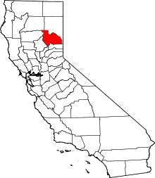
| County | Plumas County |
| Elevation[1] | 2,096 ft (639 m) |
Rodgers Flat (formerly, Camp Rodgers)[2] is an unincorporated community in Plumas County, California.[1] It lies at an elevation of 2096 feet (639 m).[1] Rodgers Flat is located on the Western Pacific Railroad, 3.5 miles (5.6 km) northeast of Storrie.[2]
The Camp Rodgers post office operated from 1916 to 1936.[2]
References
This article is issued from Wikipedia - version of the 7/5/2016. The text is available under the Creative Commons Attribution/Share Alike but additional terms may apply for the media files.