Bells Bar, California
| Bells Bar | |
|---|---|
| Former settlement | |
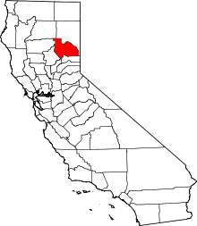
 Bells Bar Location in California | |
| Coordinates: 39°51′57″N 120°45′07″W / 39.86583°N 120.75194°WCoordinates: 39°51′57″N 120°45′07″W / 39.86583°N 120.75194°W | |
| Country |
|
| State |
|
| County | Plumas County |
| Elevation[1] | 4,068 ft (1,240 m) |
Bells Bar (also, Bell Bar)[2] is a former settlement in Plumas County, California.[1] It lay at an elevation of 4068 feet (1240 m).[1] Bells Bar is located on the Middle Fork of the Feather River, 11.5 miles (18.5 km) east-southeast of Quincy.[2]
References
This article is issued from Wikipedia - version of the 7/22/2011. The text is available under the Creative Commons Attribution/Share Alike but additional terms may apply for the media files.