Pine Hill, Alabama
| Pine Hill, Alabama | |
|---|---|
| Town | |
 Location in Wilcox County and the state of Alabama | |
| Coordinates: 31°59′11″N 87°35′32″W / 31.98639°N 87.59222°W | |
| Country | United States |
| State | Alabama |
| County | Wilcox |
| Area | |
| • Total | 3.9 sq mi (10 km2) |
| • Land | 3.9 sq mi (10 km2) |
| • Water | 0 sq mi (0 km2) |
| Elevation | 112 ft (34 m) |
| Population (2010) | |
| • Total | 975 |
| • Density | 247.7/sq mi (96.6/km2) |
| Time zone | Central (CST) (UTC-6) |
| • Summer (DST) | CDT (UTC-5) |
| ZIP code | 36769 |
| Area code(s) | 334 |
| FIPS code | 01-60240 |
| GNIS feature ID | 0155204 |
Pine Hill is a town in Wilcox County, Alabama, United States. It incorporated in 1895.[1] As of the 2010 census, the population of the town was 975, up from 966 in 2000.
Geography
Pine Hill is located at 31°59′11″N 87°35′32″W / 31.98639°N 87.59222°W (31.986332, -87.592131).[2]
According to the U.S. Census Bureau, the town has a total area of 3.9 square miles (10 km2), all land.
Demographics
| Historical population | |||
|---|---|---|---|
| Census | Pop. | %± | |
| 1910 | 470 | — | |
| 1920 | 375 | −20.2% | |
| 1930 | 433 | 15.5% | |
| 1940 | 418 | −3.5% | |
| 1950 | 408 | −2.4% | |
| 1960 | 367 | −10.0% | |
| 1970 | 697 | 89.9% | |
| 1980 | 510 | −26.8% | |
| 1990 | 481 | −5.7% | |
| 2000 | 966 | 100.8% | |
| 2010 | 975 | 0.9% | |
| Est. 2015 | 919 | [3] | −5.7% |
| U.S. Decennial Census[4] 2013 Estimate[5] | |||
As of the census[6] of 2000, there were 966 people, 391 households, and 272 families residing in the town. The population density was 249.2 people per square mile (96.1/km²). There were 443 housing units at an average density of 114.3 per square mile (44.1/km²). The racial makeup of the town was 49.90% Black or African American, 48.96% White, 0.72% Native American, 0.10% Asian, and 0.31% from two or more races. 0.10% of the population were Hispanic or Latino of any race.
There were 391 households out of which 36.6% had children under the age of 18 living with them, 41.4% were married couples living together, 25.8% had a female householder with no husband present, and 30.2% were non-families. 27.9% of all households were made up of individuals and 11.8% had someone living alone who was 65 years of age or older. The average household size was 2.47 and the average family size was 3.01.
In the town the population was spread out with 30.8% under the age of 18, 9.0% from 18 to 24, 24.1% from 25 to 44, 22.7% from 45 to 64, and 13.4% who were 65 years of age or older. The median age was 34 years. For every 100 females there were 87.9 males. For every 100 females age 18 and over, there were 78.6 males.
The median income for a household in the town was $23,375, and the median income for a family was $32,813. Males had a median income of $32,368 versus $17,396 for females. The per capita income for the town was $15,845. About 28.3% of families and 30.9% of the population were below the poverty line, including 49.5% of those under age 18 and 21.0% of those age 65 or over.
References
- ↑ http://www.encyclopediaofalabama.org/article/h-3448
- ↑ "US Gazetteer files: 2010, 2000, and 1990". United States Census Bureau. 2011-02-12. Retrieved 2011-04-23.
- ↑ "Annual Estimates of the Resident Population for Incorporated Places: April 1, 2010 to July 1, 2015". Retrieved July 2, 2016.
- ↑ "U.S. Decennial Census". Census.gov. Archived from the original on May 11, 2015. Retrieved June 6, 2013.
- ↑ "Annual Estimates of the Resident Population: April 1, 2010 to July 1, 2013". Retrieved June 3, 2014.
- ↑ "American FactFinder". United States Census Bureau. Retrieved 2008-01-31.
Coordinates: 31°59′11″N 87°35′32″W / 31.986332°N 87.592131°W
Municipalities and communities of Wilcox County, Alabama, United States | ||
|---|---|---|
| City | 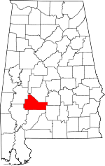 | |
| Towns | ||
| CDPs | ||
| Unincorporated communities | ||
| Ghost town | ||