Pine Apple, Alabama
| Pine Apple, Alabama | |
|---|---|
| Town | |
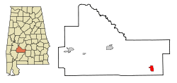 Location in Wilcox County and the state of Alabama | |
| Coordinates: 31°52′4″N 86°59′15″W / 31.86778°N 86.98750°W | |
| Country | United States |
| State | Alabama |
| County | Wilcox |
| Area | |
| • Total | 3.1 sq mi (8 km2) |
| • Land | 3.1 sq mi (8 km2) |
| • Water | 0 sq mi (0 km2) |
| Elevation | 302 ft (92 m) |
| Population (2010) | |
| • Total | 132 |
| • Density | 46.8/sq mi (18.1/km2) |
| Time zone | Central (CST) (UTC-6) |
| • Summer (DST) | CDT (UTC-5) |
| ZIP code | 36768 |
| Area code(s) | 251 |
| FIPS code | 01-59880 |
| GNIS feature ID | 0152909 |
Pine Apple is a town in Wilcox County, Alabama, United States. It incorporated in 1872.[1] At the 2010 census the population was 132, down from 145 in 2000. It has two places on the National Register of Historic Places, the Hawthorne House and the Pine Apple Historic District.[2]
History
Pine Apple was originally called Friendship, and under the latter name was laid out in 1825.[3] The present name was given in 1852 on account of there being pine and apple groves near the town site.[3]
In 1904, residents of Pine Apple set a black prisoner on fire in the city's jail. The fire spread to burn down the jail, and further to scorch about ninety percent of the town. [4]
Geography
Pine Apple is located at 31°52′4″N 86°59′15″W / 31.86778°N 86.98750°W (31.867882, -86.987624).[5]
According to the U.S. Census Bureau, the town has a total area of 3.1 square miles (8.0 km2), all land.
Demographics
| Historical population | |||
|---|---|---|---|
| Census | Pop. | %± | |
| 1880 | 358 | — | |
| 1890 | 520 | 45.3% | |
| 1900 | 623 | 19.8% | |
| 1910 | 627 | 0.6% | |
| 1920 | 464 | −26.0% | |
| 1930 | 438 | −5.6% | |
| 1940 | 455 | 3.9% | |
| 1950 | 445 | −2.2% | |
| 1960 | 355 | −20.2% | |
| 1970 | 347 | −2.3% | |
| 1980 | 298 | −14.1% | |
| 1990 | 365 | 22.5% | |
| 2000 | 145 | −60.3% | |
| 2010 | 132 | −9.0% | |
| Est. 2015 | 126 | [6] | −4.5% |
| U.S. Decennial Census[7] 2013 Estimate[8] | |||
As of the census[9] of 2000, there were 145 people, 65 households, and 44 families residing in the town. The population density was 46.8 people per square mile (18.1/km²). There were 101 housing units at an average density of 32.6 per square mile (12.6/km²). The racial makeup of the town was 62.76% White, 36.55% Black or African American, and 0.69% from two or more races.
There were 65 households out of which 20.0% had children under the age of 18 living with them, 55.4% were married couples living together, 10.8% had a female householder with no husband present, and 32.3% were non-families. 32.3% of all households were made up of individuals and 18.5% had someone living alone who was 65 years of age or older. The average household size was 2.23 and the average family size was 2.82.
In the town the population was spread out with 22.8% under the age of 18, 4.1% from 18 to 24, 22.8% from 25 to 44, 22.8% from 45 to 64, and 27.6% who were 65 years of age or older. The median age was 45 years. For every 100 females there were 81.3 males. For every 100 females age 18 and over, there were 80.6 males.
The median income for a household in the town was $35,625, and the median income for a family was $44,583. Males had a median income of $29,583 versus $30,833 for females. The per capita income for the town was $16,876. There were 7.7% of families and 15.8% of the population living below the poverty line, including 35.9% of under eighteens and 14.3% of those over 64.
Notable people
- Fred Cone - a former running back in the NFL for the Green Bay Packers and Dallas Cowboys.
- Kenneth R. Giddens - Broadcaster and Voice of America executive.
- Philemon T. Herbert, former U.S. Representative from California
References
- ↑ http://www.encyclopediaofalabama.org/article/h-3031
- ↑ National Park Service (2008-04-15). "National Register Information System". National Register of Historic Places. National Park Service.
- 1 2 "Pine Apple, Alabama Announced Front Poarch [sic] Tour". Thomasville News. Mar 8, 2006. p. 3. Retrieved 29 May 2015.
- ↑ "A Lynching Boomerang". Chicago Tribune. 1904-01-16. Retrieved 2015-06-10.
- ↑ "US Gazetteer files: 2010, 2000, and 1990". United States Census Bureau. 2011-02-12. Retrieved 2011-04-23.
- ↑ "Annual Estimates of the Resident Population for Incorporated Places: April 1, 2010 to July 1, 2015". Retrieved July 2, 2016.
- ↑ "U.S. Decennial Census". Census.gov. Archived from the original on May 11, 2015. Retrieved June 6, 2013.
- ↑ "Annual Estimates of the Resident Population: April 1, 2010 to July 1, 2013". Retrieved June 3, 2014.
- ↑ "American FactFinder". United States Census Bureau. Retrieved 2008-01-31.
Coordinates: 31°52′04″N 86°59′15″W / 31.867882°N 86.987624°W
Municipalities and communities of Wilcox County, Alabama, United States | ||
|---|---|---|
| City | 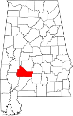 | |
| Towns | ||
| CDPs | ||
| Unincorporated communities | ||
| Ghost town | ||