Perry Township, Lawrence County, Indiana
| Perry Township | |
|---|---|
| Township | |
|
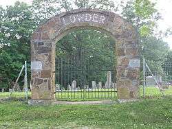
Gate at the Lowder Cemetery, northwest of Springville | |
 Location in Lawrence County | |
| Coordinates: 38°56′58″N 86°38′12″W / 38.94944°N 86.63667°WCoordinates: 38°56′58″N 86°38′12″W / 38.94944°N 86.63667°W | |
| Country |
|
| State |
|
| County | Lawrence |
| Government | |
| • Type | Indiana township |
| Area | |
| • Total | 35.68 sq mi (92.4 km2) |
| • Land | 35.64 sq mi (92.3 km2) |
| • Water | 0.04 sq mi (0.1 km2) 0.11% |
| Elevation | 659 ft (201 m) |
| Population (2010) | |
| • Total | 2,259 |
| • Density | 63.4/sq mi (24.5/km2) |
| ZIP code | 47462 |
| GNIS feature ID | 0453720 |
Perry Township is one of nine townships in Lawrence County, Indiana, United States. As of the 2010 census, its population was 2,259 and it contained 943 housing units.[1]
History
Perry Township was established in 1822.[2] It was named for Matthew C. Perry.[3]
Geography
According to the 2010 census, the township has a total area of 35.68 square miles (92.4 km2), of which 35.64 square miles (92.3 km2) (or 99.89%) is land and 0.04 square miles (0.10 km2) (or 0.11%) is water.[1]
Unincorporated towns
- Popcorn at 38°58′33″N 86°39′25″W / 38.975881°N 86.656944°W
- Red Hill at 38°56′00″N 86°35′52″W / 38.933382°N 86.597775°W
- Springville at 38°56′10″N 86°37′10″W / 38.93616°N 86.619442°W
(This list is based on USGS data and may include former settlements.)
Cemeteries
The township contains these four cemeteries: Byers, Christian, Graves and Lowder.
Major highways
School districts
- North Lawrence Community Schools
Political districts
- Indiana's 4th congressional district
- State House District 65
- State Senate District 44
References
- "Perry Township, Lawrence County, Indiana". Geographic Names Information System. United States Geological Survey. Retrieved 2009-10-08.
- United States Census Bureau 2008 TIGER/Line Shapefiles
- IndianaMap
- 1 2 "Population, Housing Units, Area, and Density: 2010 - County -- County Subdivision and Place -- 2010 Census Summary File 1". United States Census. Retrieved 2013-05-10.
- ↑ History of Lawrence and Monroe Counties, Indiana: Their People, Industries, and Institutions. B.F. Bowen. 1914. p. 53.
- ↑ History of Lawrence, Orange, and Washington Counties, Indiana: From the Earliest Time to the Present. Higginson Book Company. 1884. p. 46.
External links
- Indiana Township Association
- United Township Association of Indiana
- City-Data.com page for Perry Township

Municipalities and communities of Lawrence County, Indiana, United States | ||
|---|---|---|
| Cities | ||
| Town | ||
| Townships | ||
| CDPs | ||
| Other unincorporated communities |
| |
| Extinct town | ||
This article is issued from Wikipedia - version of the 10/19/2016. The text is available under the Creative Commons Attribution/Share Alike but additional terms may apply for the media files.