Bono, Lawrence County, Indiana
| Bono | |
|---|---|
| Unincorporated community | |
|
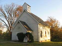
Bono United Methodist Church, built in 1880 | |
 Bono  Bono | |
| Coordinates: 38°43′53″N 86°19′16″W / 38.73139°N 86.32111°WCoordinates: 38°43′53″N 86°19′16″W / 38.73139°N 86.32111°W | |
| Country | United States |
| State | Indiana |
| County | Lawrence |
| Township | Bono |
| Elevation | 673 ft (205 m) |
| ZIP code | 47446 |
| FIPS code | 18-06418[1] |
| GNIS feature ID | 431325[2] |
Bono is an unincorporated community in Bono Township, Lawrence County, Indiana.
History
Bono was laid out about 1816, making it the oldest settlement in Lawrence County.[3]
Geography
Bono is located at 38°43′53″N 86°19′16″W / 38.73139°N 86.32111°W.
References
- ↑ "American FactFinder". United States Census Bureau. Archived from the original on 2013-09-11. Retrieved 2008-01-31.
- ↑ "Bono, Lawrence County, Indiana". Geographic Names Information System. United States Geological Survey. Retrieved 2009-10-10.
- ↑ History of Lawrence and Monroe Counties, Indiana: Their People, Industries, and Institutions. B.F. Bowen. 1914. p. 47.
This article is issued from Wikipedia - version of the 11/5/2016. The text is available under the Creative Commons Attribution/Share Alike but additional terms may apply for the media files.