Ogori/Magongo
| Ogori/Magongo | |
|---|---|
| LGA | |
 Ogori/Magongo Location in Nigeria | |
| Coordinates: 7°29′N 6°13′E / 7.483°N 6.217°ECoordinates: 7°29′N 6°13′E / 7.483°N 6.217°E | |
| Country |
|
| State | Kogi State |
| Area | |
| • Total | 79 km2 (31 sq mi) |
| Population (2006 census) | |
| • Total | 39,622 |
| Time zone | WAT (UTC+1) |
| 3-digit postal code prefix | 263 |
| ISO 3166 code | NG.KO.OM |
Ogori-Magongo is a Local Government Area in Kogi State, Nigeria. Its headquarters are in the village of Akpafa. It was created from the Okene Local Government Area for the Ogori and Magongo ethnic groups.
It has an area of 79 km² and a population of 39,622 at the 2006 census.
The postal code of the area is 263.[1]
The population of the area is much less than Okene. There are two main towns in the LGA, Magongo and Ogori which form the name of the area. People of the area are renowned for their scholarship and industry. Important festivals include the nationally acclaimed example of which is [Owiya[Ovia Osese]] festival held annually a two weeks after Easter, They value their traditional culture and also believe God and adopts Christianity as the major religion with few Muslims around.
References
- ↑ "Post Offices- with map of LGA". NIPOST. Archived from the original on November 26, 2012. Retrieved 2009-10-20.
State capital: Lokoja | ||
| LGAs | 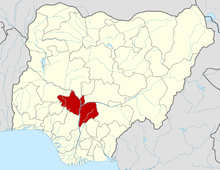 | |