Adavi, Nigeria
| Adavi | |
|---|---|
| LGA | |
 Adavi Location in Nigeria | |
| Coordinates: 7°40′N 6°27′E / 7.667°N 6.450°ECoordinates: 7°40′N 6°27′E / 7.667°N 6.450°E | |
| Country |
|
| State | Kogi State |
| Headquarters | Ogaminana |
| Area | |
| • Total | 718 km2 (277 sq mi) |
| Population (2006 census) | |
| • Total | 202,194 |
| Time zone | WAT (UTC+1) |
| 3-digit postal code prefix | 264 |
| ISO 3166 code | NG.KO.AD |
Adavi is a Local Government Area in Kogi State, Nigeria, adjoining Edo State in the south and the state capital Lokoja in the north. Its headquarters are in the town of Ogaminana near the A123 highway in the southwest of the area at7°36′05″N 6°12′01″E / 7.60139°N 6.20028°E.
It has an area of 718 km² and a population of 202,194 at the 2006 census.
The postal code of the area is 264.[1]
References
- ↑ "Post Offices- with map of LGA". NIPOST. Archived from the original on 7 October 2009. Retrieved 2009-10-20.
State capital: Lokoja | ||
| LGAs | 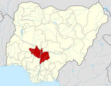 | |
This article is issued from Wikipedia - version of the 10/4/2016. The text is available under the Creative Commons Attribution/Share Alike but additional terms may apply for the media files.