Dekina
| Dekina Ajobi | |
|---|---|
| LGA and town | |
| Motto: Unity is strength | |
 Dekina Location in Nigeria | |
| Coordinates: 7°35′N 7°12′E / 7.583°N 7.200°ECoordinates: 7°35′N 7°12′E / 7.583°N 7.200°E | |
| Country | Nigeria |
| State | Kogi State |
| Area | |
| • Total | 2,461 km2 (950 sq mi) |
| Population (2006 census) | |
| • Total | 260,312 |
| Time zone | WAT (UTC+1) |
| 3-digit postal code prefix | 272 |
| ISO 3166 code | NG.KO.DE |
Dekina is a local government area in Kogi State, Nigeria. Its headquarters are in the town of Dekina on the A233 highway in the north of the area at7°41′41″N 7°01′20″E / 7.69472°N 7.02222°E.
The northeasterly line of equal latitude and longitude passes through the southeast of the LGA.
It has an area of 2,461 km2 (950 sq mi) and a population of 260,312 at the 2006 census.
The postal code of the area is 272.[1]
References
- ↑ "Post Offices- with map of LGA". NIPOST. Retrieved 2009-10-20.
State capital: Lokoja | ||
| LGAs | 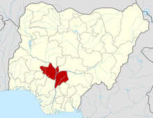 | |
This article is issued from Wikipedia - version of the 5/16/2012. The text is available under the Creative Commons Attribution/Share Alike but additional terms may apply for the media files.