Mineral Ridge, Ohio
| Mineral Ridge, Ohio | |
|---|---|
| Census-designated place | |
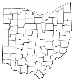 Location of Mineral Ridge, Ohio | |
| Coordinates: 41°8′31″N 80°46′1″W / 41.14194°N 80.76694°WCoordinates: 41°8′31″N 80°46′1″W / 41.14194°N 80.76694°W | |
| Country | United States |
| State | Ohio |
| Counties | Trumbull, Mahoning |
| Area | |
| • Total | 3.28 sq mi (8.49 km2) |
| • Land | 3.26 sq mi (8.45 km2) |
| • Water | 0.02 sq mi (0.04 km2) |
| Elevation[1] | 1,004 ft (306 m) |
| Population (2010) | |
| • Total | 3,789 |
| • Density | 1,193/sq mi (460.6/km2) |
| Time zone | Eastern (EST) (UTC-5) |
| • Summer (DST) | EDT (UTC-4) |
| ZIP code | 44440 |
| Area code(s) | 330 |
| FIPS code | 39-50778[2] |
| GNIS feature ID | 1065031[1] |
Mineral Ridge is a census-designated place (CDP) in Mahoning and Trumbull counties in the U.S. state of Ohio. The population was 3,892 at the 2010 census.[3] It is part of the Youngstown-Warren-Boardman, OH-PA Metropolitan Statistical Area.
Mineral Ridge was named for valuable coal deposits near the original town site.[4]
Geography
Mineral Ridge is located at 41°8′31″N 80°46′1″W / 41.14194°N 80.76694°W (41.141888, -80.767075).[5]
According to the United States Census Bureau, the CDP has a total area of 3.28 square miles (8.49 km2), of which 3.26 square miles (8.45 km2) is land and 0.015 square miles (0.04 km2), or 0.51%, is water.[3]
Demographics
As of the census[2] of 2000, there were 3,900 people, 1,377 households, and 995 families residing in the CDP. The population density was 1,183.5 people per square mile (456.3/km²). There were 1,439 housing units at an average density of 436.7/sq mi (168.4/km²). The racial makeup of the CDP was 96.31% White, 2.08% African American, 0.10% Native American, 0.10% Asian, 0.03% Pacific Islander, 0.62% from other races, and 0.77% from two or more races. Hispanic or Latino of any race were 1.51% of the population.
There were 1,377 households out of which 36.0% had children under the age of 18 living with them, 56.8% were married couples living together, 12.5% had a female householder with no husband present, and 27.7% were non-families. 24.1% of all households were made up of individuals and 7.0% had someone living alone who was 65 years of age or older. The average household size was 2.61 and the average family size was 3.12.
In the CDP the population was spread out with 24.5% under the age of 18, 7.9% from 18 to 24, 28.4% from 25 to 44, 25.0% from 45 to 64, and 14.2% who were 65 years of age or older. The median age was 38 years. For every 100 females there were 92.7 males. For every 100 females age 18 and over, there were 88.0 males.
The median income for a household in the CDP was $45,689, and the median income for a family was $51,538. Males had a median income of $41,556 versus $25,833 for females. The per capita income for the CDP was $19,111. About 6.7% of families and 9.2% of the population were below the poverty line, including 14.2% of those under age 18 and 3.5% of those age 65 or over.
References
- 1 2 "US Board on Geographic Names". United States Geological Survey. 2007-10-25. Retrieved 2008-01-31.
- 1 2 "American FactFinder". United States Census Bureau. Retrieved 2008-01-31.
- 1 2 "Geographic Identifiers: 2010 Demographic Profile Data (G001): Mineral Ridge CDP, Ohio". U.S. Census Bureau, American Factfinder. Retrieved March 28, 2013.
- ↑ Overman, William Daniel (1958). Ohio Town Names. Akron, OH: Atlantic Press. p. 89.
- ↑ "US Gazetteer files: 2010, 2000, and 1990". United States Census Bureau. 2011-02-12. Retrieved 2011-04-23.
Municipalities and communities of Mahoning County, Ohio, United States | ||
|---|---|---|
| Cities | 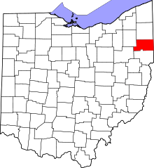 | |
| Villages | ||
| Townships | ||
| CDPs | ||
| Unincorporated communities |
| |
| Footnotes | ‡This populated place also has portions in an adjacent county or counties | |
Municipalities and communities of Trumbull County, Ohio, United States | ||
|---|---|---|
| Cities |  | |
| Villages | ||
| Townships | ||
| CDPs |
| |
| Unincorporated communities | ||
| Footnotes | ‡This populated place also has portions in an adjacent county or counties | |