New Middletown, Ohio
| New Middletown, Ohio | |
|---|---|
| Village | |
|
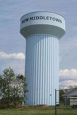
New Middletown Water Tower | |
 Location of New Middletown, Ohio | |
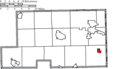 Location of New Middletown in Mahoning County | |
| Coordinates: 40°57′56″N 80°33′30″W / 40.96556°N 80.55833°WCoordinates: 40°57′56″N 80°33′30″W / 40.96556°N 80.55833°W | |
| Country | United States |
| State | Ohio |
| County | Mahoning |
| Township | Springfield |
| Area[1] | |
| • Total | 0.87 sq mi (2.25 km2) |
| • Land | 0.87 sq mi (2.25 km2) |
| • Water | 0 sq mi (0 km2) |
| Elevation[2] | 1,253 ft (382 m) |
| Population (2010)[3] | |
| • Total | 1,621 |
| • Estimate (2012[4]) | 1,600 |
| • Density | 1,863.2/sq mi (719.4/km2) |
| Time zone | Eastern (EST) (UTC-5) |
| • Summer (DST) | EDT (UTC-4) |
| ZIP code | 44442 |
| Area code(s) | 330 |
| FIPS code | 39-55118[5] |
| GNIS feature ID | 1084862[2] |
New Middletown is a village in Mahoning County, Ohio, United States. The population was 1,621 at the 2010 census. New Middletown is served by a branch of the Public Library of Youngstown and Mahoning County. It is part of the Youngstown-Warren-Boardman, OH-PA Metropolitan Statistical Area.
History
New Middletown was laid out in 1825.[6] The village most likely was named after Middletown, Pennsylvania, the former home of a share of the first settlers.[7]
Geography
New Middletown is located at 40°57′56″N 80°33′30″W / 40.96556°N 80.55833°W (40.965443, -80.558307).[8]
According to the United States Census Bureau, the village has a total area of 0.87 square miles (2.25 km2), all land.[1]
Demographics
| Historical population | |||
|---|---|---|---|
| Census | Pop. | %± | |
| 1870 | 147 | — | |
| 1880 | 190 | 29.3% | |
| 1920 | 168 | — | |
| 1930 | 205 | 22.0% | |
| 1940 | 227 | 10.7% | |
| 1950 | 264 | 16.3% | |
| 1960 | 500 | 89.4% | |
| 1970 | 1,664 | 232.8% | |
| 1980 | 2,195 | 31.9% | |
| 1990 | 1,912 | −12.9% | |
| 2000 | 1,682 | −12.0% | |
| 2010 | 1,621 | −3.6% | |
| Est. 2015 | 1,576 | [9] | −2.8% |
2010 census
As of the census[3] of 2010, there were 1,621 people, 707 households, and 492 families residing in the village. The population density was 1,863.2 inhabitants per square mile (719.4/km2). There were 741 housing units at an average density of 851.7 per square mile (328.8/km2). The racial makeup of the village was 98.8% White, 0.1% African American, 0.1% Asian, 0.4% from other races, and 0.6% from two or more races. Hispanic or Latino of any race were 1.7% of the population.
There were 707 households of which 26.9% had children under the age of 18 living with them, 51.1% were married couples living together, 14.0% had a female householder with no husband present, 4.5% had a male householder with no wife present, and 30.4% were non-families. 28.0% of all households were made up of individuals and 16% had someone living alone who was 65 years of age or older. The average household size was 2.29 and the average family size was 2.77.
The median age in the village was 47 years. 19.6% of residents were under the age of 18; 7.2% were between the ages of 18 and 24; 20.3% were from 25 to 44; 31.9% were from 45 to 64; and 21.3% were 65 years of age or older. The gender makeup of the village was 45.0% male and 55.0% female.
2000 census
As of the census[5] of 2000, there were 1,682 people, 690 households, and 503 families residing in the village. The population density was 1,932.0 people per square mile (746.5/km²). There were 727 housing units at an average density of 835.1 per square mile (322.6/km²). The racial makeup of the village was 99.29% White, 0.06% African American, 0.12% Native American, and 0.54% from two or more races. Hispanic or Latino of any race were 0.77% of the population.
There were 690 households out of which 28.7% had children under the age of 18 living with them, 58.3% were married couples living together, 12.2% had a female householder with no husband present, and 27.1% were non-families. 25.1% of all households were made up of individuals and 12.0% had someone living alone who was 65 years of age or older. The average household size was 2.44 and the average family size was 2.92.
In the village the population was spread out with 22.2% under the age of 18, 7.7% from 18 to 24, 25.7% from 25 to 44, 27.6% from 45 to 64, and 16.8% who were 65 years of age or older. The median age was 41 years. For every 100 females there were 84.4 males. For every 100 females age 18 and over, there were 83.6 males.
The median income for a household in the village was $35,139, and the median income for a family was $42,500. Males had a median income of $37,125 versus $21,563 for females. The per capita income for the village was $19,741. About 6.5% of families and 7.7% of the population were below the poverty line, including 10.2% of those under age 18 and 12.1% of those age 65 or over.
References
- 1 2 "US Gazetteer files 2010". United States Census Bureau. Retrieved 2013-01-06.
- 1 2 "US Board on Geographic Names". United States Geological Survey. 2007-10-25. Retrieved 2008-01-31.
- 1 2 "American FactFinder". United States Census Bureau. Retrieved 2013-01-06.
- ↑ "Population Estimates". United States Census Bureau. Retrieved 2013-06-17.
- 1 2 "American FactFinder". United States Census Bureau. Retrieved 2008-01-31.
- ↑ Mack, Horace (1879). History of Columbiana County, Ohio: With Illustrations and Biographical Sketches of Some of Its Prominent Men and Pioneers. Unigraphic. p. 360.
- ↑ Overman, William Daniel (1958). Ohio Town Names. Akron, OH: Atlantic Press. p. 98.
- ↑ "US Gazetteer files: 2010, 2000, and 1990". United States Census Bureau. 2011-02-12. Retrieved 2011-04-23.
- ↑ "Annual Estimates of the Resident Population for Incorporated Places: April 1, 2010 to July 1, 2015". Retrieved July 2, 2016.
- ↑ "Census of Population and Housing". Census.gov. Retrieved June 4, 2015.
External links
Municipalities and communities of Mahoning County, Ohio, United States | ||
|---|---|---|
| Cities | 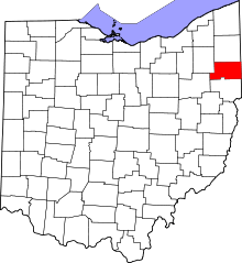 | |
| Villages | ||
| Townships | ||
| CDPs | ||
| Unincorporated communities |
| |
| Footnotes | ‡This populated place also has portions in an adjacent county or counties | |