Micanopy Historic District
|
Micanopy Historic District | |
|
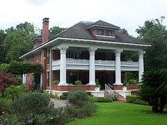
Herlong Mansion in the Micanopy Historic District | |
  | |
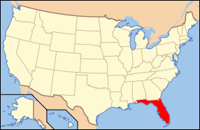
| Location | Micanopy, Florida |
|---|---|
| Coordinates | 29°30′21″N 82°16′58″W / 29.50583°N 82.28278°WCoordinates: 29°30′21″N 82°16′58″W / 29.50583°N 82.28278°W |
| Area | 470 acres (1.9 km2) |
| Built | 1776 |
| NRHP Reference # | 83003512[1] |
| Added to NRHP | January 28, 1983 |
The Micanopy Historic District is a U.S. historic district (designated as such on January 28, 1983) located in Micanopy, Florida. It encompasses approximately 470 acres (1.9 km2), bounded by roughly Cholokka Boulevard from US 441 to Ocala Street then Smith Street West to Okehumkee Street. It contains 35 historic buildings.
Gallery
Churches
 Presbyterian Church, now Episcopal Church of the Mediator.
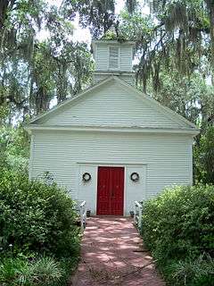
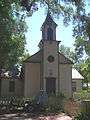 Old Baptist Church, now a private house.
Houses
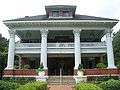 Herlong House, now a bed and breakfast
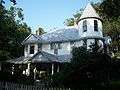 Simonton House
See also
| Wikimedia Commons has media related to National Register of Historic Places in Micanopy, Florida. |
References
- ↑ National Park Service (2010-07-09). "National Register Information System". National Register of Historic Places. National Park Service.
External links
- Florida's Office of Cultural and Historical Programs - Alachua County
- Historic Markers in Alachua County

This article is issued from Wikipedia - version of the 11/25/2016. The text is available under the Creative Commons Attribution/Share Alike but additional terms may apply for the media files.