Mexico, Pampanga
| Mexico | ||
|---|---|---|
| Municipality | ||
|
Town hall | ||
| ||
 Map of Pampanga showing the location of Mexico | ||
.svg.png) Mexico Location within the Philippines | ||
| Coordinates: 15°04′N 120°43′E / 15.067°N 120.717°ECoordinates: 15°04′N 120°43′E / 15.067°N 120.717°E | ||
| Country | Philippines | |
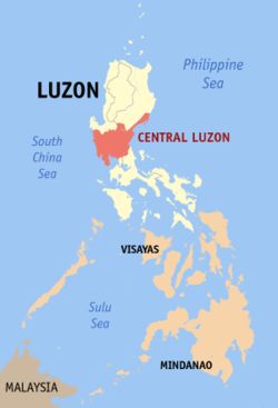
| Region | Central Luzon (Region III) | |
| Province | Pampanga | |
| District | 3rd District | |
| Founded | April 24, 1581 | |
| Barangays | 43 | |
| Government[1] | ||
| • Mayor | Teddy Tumang (elect) | |
| Area[2] | ||
| • Total | 117.41 km2 (45.33 sq mi) | |
| Population (2010)[3] | ||
| • Total | 146,851 | |
| • Density | 1,300/km2 (3,200/sq mi) | |
| Demonym(s) | Mexican | |
| Time zone | PST (UTC+8) | |
| ZIP code | 2021 | |
| Dialing code | 45 | |
| Income class | 1st class | |
| Website |
mexicopampanga | |


Mexico[4] is a first class municipality in the province of Pampanga, Philippines. According to the 2010 census, it had a population of 146,851 people.[3]
The town was renamed after Mexico, a country in North America after being confused with its native name "Masiku" which is often taken as "Elbowed" (elbowing river: macasicung ilug). Some theories attribute the name to "Siku"; an Old Kapampangan term for Chico or Sapodilla which grew richly in the town. It has residential, commercial and recreational developments such as SM Pampanga and Beverly Place. It is a first class municipality which has various educational institutions including Our Lady of Guadalupe School and Play Matters Therapy Center in Lagund).

Barangays
Mexico is administratively subdivided into 43 barangays.[2]
- Acli
- Anao
- Balas
- Buenavista
- Camuning
- Cawayan
- Concepcion
- Culubasa
- Divisoria
- Dolores (Piring)
- Eden
- Gandus
- Lagundi
- Laput
- Laug
- Masamat
- Masangsang (Sto. Cristo)
- Nueva Victoria
- Pandacaqui
- Pangatlan
- Panipuan
- Parian (Poblacion)
- Sabanilla
- San Antonio
- San Carlos
- San Jose Malino
- San Jose Matulid
- San Juan
- San Lorenzo
- San Miguel
- San Nicolas
- San Pablo
- San Patricio
- San Rafael
- San Roque
- San Vicente
- Santa Cruz
- Santa Maria,(sitio tramo)
- Santo Cristo
- Santo Domingo
- Santo Rosario
- Sapang Maisac
- Suclaban
- Tangle
- Victhor Lulu Square
Demographics
| Population census of Mexico | ||
|---|---|---|
| Year | Pop. | ±% p.a. |
| 1990 | 69,441 | — |
| 1995 | 91,696 | +5.35% |
| 2000 | 109,481 | +3.87% |
| 2007 | 141,298 | +3.58% |
| 2010 | 146,851 | +1.41% |
| 2015 | 184,937 | +4.49% |
| Source: National Statistics Office[3][5] | ||
History
In the 16th century, the site was a crossing point between the Áitâ Mag-Anchî and Áinu (Abûrlin) nations at the upper reaches of the Ábakan River and the international port cities of Bétis and Lúbao to the south. Upland products such as deerskins and beeswax became important commodities to the 16th-century Japanese who made candles out of beeswax and samurai armours out of deerskins. Plying their goods down the Ábakan River, these upland traders would have had no choice but to slow down and dock at the place “where the river bends” (nung nú ya másíku ing ílug) or “where the river has an elbow” (nung nú ya makisíku ing ílug) before continuing their trip downstream. From there, the river is matúlid (straight) all the way to its mouth at Uáuâ. Enterprising merchants from Lusòng Guo (Luzón: c. 13th century – 1572) and perhaps even from Japan and China formed a trading base at this natural checkpoint known as Makisíku or Másíku. Japanese sources credited the introduction of candles into the Japanese homes to renowned Hakata merchants Shimai Shoushitsu and Kamiya Soutan both of whom were known to have had trading bases in Lusòng Guo.
After the Fall of Lusòng Guo in 1571, Makisíku or Másíku became an important center for the Spanish colonizers. They renamed it Nueva México and made it the capital of the newly formed Province of Pampanga. Gaspar de San Agustin wrote that being the capital, Mexico was one of the most “beautiful and charming” centers in the province. A lavish church made of stone and tiles, the Parish of Santa Monica, was built in 1581 with Masangsang and Matúlid serving as its visitas.
In 1585, Dr. Luciano P.R. Santiago wrote that a Kapampángan nobleman by the name of Don Miguel Mañago was awarded a royal encomienda of about one hundred cabalitas of land in Nueva México for his service to the Spanish King. Another Maniago from México who distinguished himself in the service the Spanish King was Master-of-Camp Don Francisco Maniago. But he distinguished himself more in the service of a much nobler cause as leader of the Kapampángan Independence Revolt of 1660. In 1700, another Maniago form Mexico placed himself in history as the first graduate of the University of Santo Tomas with a native surname. He was Bachiller Don Juán Mañago, who was ordained priest by Archbishop Camacho in 1705.
The Spanish colonial authorities stripped México of its political importance after the Kapampangan Independence Revolt of 1660 by moving the provincial capital further downstream to Bacolor. But it retained its strategic economic importance especially among the Lúsung Chinese and their mestizo descendants. México was still a regular drop off point of forest products from the upper reaches of the Ábakan River. It was also a favored destination by merchants from as far north as Pangasinan. By the 18th century, the Lúsung Chinese and their mestizo descendants living in México, Guagua and Malabon had formed and maintained business and social alliances with each other. Cascos and sampans maintained the flow of goods along the Malabon-Guagua-México chain. Like the Chinese section of Manila, the commercial center of México became known as the Parian. By the 19th century, the Chinese mestizo families not only dominated México’s economic scene, they also began to replace the native principalia in the local political arena.
Novel ideas and radical movements also flowed along Malabon-Guagua-México chain. In 1892, the gobernadorcillo of México, Don Ruperto Laxamana was mentioned as one of the founders of Masonic triangles in Pampanga. In 1897, the first cells of the Katipunan in Pampanga was formed in Guagua and then in México. In 1898, General Maximino Hizon, a product of the Malabon-Guagua-México Chinese mestizo family alliance, rallied Kapampángans to fight the Spaniards under Emilio Aguinaldo’s revolutionary banner and ordered the execution of the Parish priests of México and San Fernando. When the Americans replaced the Spaniards as the new colonists, General Maximino Hizon soon rose up to become supreme commander of all the Philippine Forces in Pampanga. He was captured by the Americans in 1901 and exiled to Guam after refusing to pledge his allegiance to the United States. He died in exile on September 1, 1901.[6]:505
Revolutionary sentiments remained alive in México even after the victory of the Americans. The Manila Times reported that in August 4, 1901, two principales from the town of México were buried alive for collaborating with the Americans. In 1903, the Universal Democratic Filipino Republic, a paramilitary independence movement composed of Kapampángan elite, was organized in México.
Parish churches and Spanish-era chapels


- Santa Monica Parish Church and Belfry was built by Fr. Jose dela Cruz in 1665, but was destroyed during an earthquake in 1880. What remains is just the Belfry Tower of the former Augustinian-run church. Near the 17th century Belltower of Mexico, one can also find the St. Benedict’s Institution de Mexico, an Augustinian convent that was constructed in time with the Sta. Monica Parish Church in 1665. Although Augustinian records such as the Estado of 1612 indicates that Mexico has one convent and two priests during that time.
- Good Shepherd Parish Church, Pandacaqui Ressetlement
- Our Lord's Annunciation Parish Church, San Vicente
- San Jose Parish Church, San Jose Malino
- San Miguel de Archangel Parish Church, Anao
- Santo Domingo de Guzman Parish Church
- San Jose Matulid chapel is believed to be the oldest chapel in Pampanga.[7][8][9]
- Sabanilla chapel. The Our Lady of the Most Holy Rosary chapel, commonly referred to as the Sabanilla chapel (bisitas ning Sabanilla), is a stone chapel located between the fork roads of the barangay leading to rice fields. Like the San Jose Matulid chapel, no available documents tell of the exact date and history of the chapel. Notable features of the structure are the saint’s niche flanked by decorative columns and carved stone blinds located on rectangular windows of the façade.

Religious and cultural traditions
- Good Friday rites: The faithful remember the passion and death of Jesus by the pondering om the Seven Last Words of Christ and the "Tanggal" (a re-enactment of how Jesus’ body was taken down from the cross). After the "Prusisyung Pasu at Pamangutcut" (Procession of the Scenes and Burial of Christ), the traditional "burul" (literally means: wake) where the Santo Entierro seems to be in a wake follows. In here, people visit and pray before the image, after which, in the midnight of Good Friday, there is a procession of the Virgen de Soleded (Our Lady of Solitude). This is a ‘silent procession’ meditating and joining with the Virgin’s sorrow and grief. Usually, single men and women join the procession believing that they will be blessed in their opted state of ‘single blessedness' in life.
- Easter Sunday celebration: The faithful celebrate Easter. During the day, the Filipino tradition of "Salubong/Encuentro" is done, after which the "Pacbung Judas" or the burning of Judas' effigy follows.
- April 24: This is regarded as the Mexico Day, following the date of the establishment of the town and parish in April 24, 1581. (Also the Feast of the Conversion of Saint Augustine). During the day, the parish organizes the Augustinian Festival as a tribute to the Augustinian forefathers of the town. A procession of different Augustinian saints and blesseds is held. Among the images joining the procession are Saint Monica, Saint Augustine, Saint Nicholas of Tolentino, Saint Rita of Cascia, Saint Thomas of Villanova, Saint John of Sahagun, San William the Hermit, Saint Magdalene of Nagasaki, Saint Ezequiel Moreno and Our Lady of Consolation and Cord.
- May 4: Mexico's town fiesta is celebrated in honor of its patron saint, Saint Monica (Mother of Saint Augustine).
- September 4: The people of Mexico celebrate the feast of Virgen dela Consolacion y Correa (Our Lady of Consolation and Cord; Patroness of the Augustinian Order) during which they receive blessed cinctures imitating the gesture of the Virgin Mary giving her own cincture to Saint Monica during her grief and sorrow at her son's misgivings.
- September 10: The Sanikulas Festival is celebrated in honor of Saint Nicolas de Tolentino. Bread/cookies (a local delicacy in the town with arrowroot as their main ingredient) are eaten. The tradition is inspired by the story of San Nicolas when he was ill for some time and his advancement to old age started to manifest. He was about to die when his superiors asked him to eat a little meat (for he was a vegetarian) to be nourished, after all he is needed by his community and the souls in purgatory, which he had been praying for. Although he wanted to follow the advice of his superiors he also acknowledged the power and value of fasting towards God’s merciful love. He then sought the help of the Virgin Mary through a prayer. Moved by his parayers, she appeared with the baby Jesus in her arms. She handed Nicolas a small piece of bread and asked him to dip it in the water contained in a chalice being held by the baby Jesus. Following her advice, he immediately recovered from his illness, and had more strength than he had ever had before. From then on, Nicolas would bless little pieces of bread, which he would hand out among the people for them to be healed.
- December 15–24: Christmas is welcomed by the annual "Lubenas Pascu". During this celebration, they parade colorful lanterns and decorated carozzas. According to Tantingco, Lubenas came from the word novena, which means nine days, referring to the nine-day simbang gabi. But while the rest of the country was content with attending dawn masses for nine consecutive days, Kapampangans went a step farther by holding a procession on the eve of every simbang gabi with a procession after dinner, which means they slept late, and then woke up before dawn for the simbang gabi (or simbang bengi in Kapampangan).
References
- ↑ "Municipalities". Quezon City, Philippines: Department of the Interior and Local Government. Retrieved 12 December 2012.
- 1 2 "Province: Pampanga". PSGC Interactive. Makati City, Philippines: National Statistical Coordination Board. Retrieved 12 December 2012.
- 1 2 3 "Total Population by Province, City, Municipality and Barangay: as of May 1, 2010" (PDF). 2010 Census of Population and Housing. National Statistics Office. Retrieved 12 December 2012.
- ↑ Pronounced as in English.
- ↑ "Province of Pampanga". Municipality Population Data. LWUA Research Division. Retrieved 17 September 2013.
- ↑ Foreman, J., 1906, The Philippine Islands, A Political, Geographical, Ethnographical, Social and Commercial History of the Philippine Archipelago, New York: Charles Scribner's Sons
- ↑ "Attractions: San Jose Matulid Chapel". www.mexicopampanga.gov.ph. Retrieved 14 November 2014.
- ↑ "The Rivers That Shaped San Fernando and Angeles" (PDF). www.hau.edu.ph. Holy Angel University - Center for Kapampangan Studies. Retrieved 14 November 2014.
- ↑ "Tara Na sa Mexico, Pampanga". www.vigattintourism.com. Retrieved 14 November 2014.
- Michael Raymon Tayag-Manaloto Pangilinan, Siuálâ ding Meángûbié.
- Gaspar de San Agustin, Conquistas de las Islas Filipinas; 1565–1615, 1st Bilingual Edition, Intramuros: 1998.
- Luciano P.R. Santiago, Laying the Foundations: Kapamangan Pioneers in the Philippine Church, 1592-2001, Angeles City: 2002.
- Mariano A. Henson, Pampanga and Its Towns (AD 1300-1965), Angeles: 1965.
- John Alan Larkin, The Pampangans: Colonial Society in a Philippine Province, Berkely, 1972.
- The Luther Parker Collection, Datos historicos de este municipio de Mexico, Provincia de la Pampanga, Islas Filipinas, translated from Spanish by Antonio Prima.
- The Historical Data Papers, Mexico, Bureau of Public Schools, 1953.
- Teresita Gimenez Maceda, Mga Tinig Mula sa Ibaba: Kasaysayan ng Partido Komunista ng Pilipinas at Partido Sosialista ng Pilipinas sa Awit, 1930–1955, QC, 1996.
- Yoshikawa Eiji, Taikóki (The History of the Life of Toyotomi Hideyoshi), Tokyo, 1967.
- Robby Tantingco, Lubenas is Pampanga’s precious cultural gem. Indung Kapampangan. December 13, 2006.
Books
- Gaspar de San Agustin, Conquistas de las Islas Filipinas 1565-1615, Translated by Luis Antonio Mañeru, 1st bilingual ed [Spanish and English], published by Pedro Galende, OSA: Intramuros, Manila, 1998
External links
| Wikimedia Commons has media related to Mexico, Pampanga. |
- History of Mexico, Pampanga
- Philippine Standard Geographic Code
- Philippine Census Information
- Local Governance Performance Management System
 |
Mabalacat Angeles City |
Magalang | Arayat | |
| San Fernando | |
Santa Ana | ||
| ||||
| | ||||
| San Simon | San Luis |