Paniqui, Tarlac
| Paniqui | ||
|---|---|---|
| Municipality | ||
 | ||
| ||
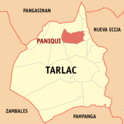 Map of Tarlac showing the location of Paniqui | ||
.svg.png) Paniqui Location within the Philippines | ||
| Coordinates: 15°40′N 120°35′E / 15.667°N 120.583°ECoordinates: 15°40′N 120°35′E / 15.667°N 120.583°E | ||
| Country | Philippines | |
| Region | Central Luzon (Region III) | |
| Province | Tarlac | |
| District | 1st District | |
| Founded | 1712 (First known as Manggang Marikit, a sitio of Pangasinan, in 1571 and as Pampaniki in 1686) | |
| Barangays | 35 | |
| Government[1] | ||
| • Mayor | Max Roxas | |
| Area[2] | ||
| • Total | 105.16 km2 (40.60 sq mi) | |
| Population (2010)[3] | ||
| • Total | 87,730 | |
| • Density | 830/km2 (2,200/sq mi) | |
| Time zone | PST (UTC+8) | |
| ZIP code | 2307 | |
| Dialing code | 45 | |
| Income class | 1st class | |
| Website |
www | |

Paniqui (Ilocano: Ili ti Paniqui; Pangasinan: Baley na Paniqui; Kapampangan: Balen ning Paniqui; Tagalog: Bayan ng Paniqui) is a first class urban municipality in the province of Tarlac, Philippines. According to the 2010 census, it has a population of 87,730 people.[3]
Geographically, Paniqui is situated between the towns of Gerona in the south and Moncada in the north.
Paniqui is a Hispanized term derived from the Ilocano word "pampaniki" which means "bat",[4] since the town has a feature of caves that house a population of bats. It is the birthplace of former President Corazon C. Aquino.
The town was originally part of the province of Pangasinan.
The language predominantly spoken by locals is Ilocano, but Tagalog (as with most towns and cities in Luzon), Pangasinan and Kapampangan are also used frequently; however, where the older generation will use Ilocano to converse with each other, Tagalog is also being used more and more by the younger generation along with their mother languages. This is perhaps due to the influence of education, migration (especially to find work), television and mobile communications, which is extending the reach of previously localized peer groups.
History
The birth of Paniqui could be traced way back in 1712 when the provincial government of Pangasinan sent a group of men south of Bayambang, Pangasinan for the expansion of the Christian Faith. The pioneering group was led by two brothers, Raymundo and Manuel Paragas of Dagupan and established the Local Government in a Sitio called "manggang marikit" (mango of an unmarried woman) now apart of Guimba, Nueva Ecija. Surprisingly, in this sitio, sere a great number of mammals called by Ilocanos "pampaniki" and it was from this term that the name Paniqui was derived.
An uprising led by Caragay during the early part of 1720 forced the Local Government in "manggang marikit" to abandon the place and to evacuate for lowland called Acocolao, a place two kilometers west of the present Poblacion. It was a historical sitio where the first Moro in the Philippines, Sultan Ali Mudin was baptized in 1750 and embraced Christianity.
Paniqui was a sprawling town that covered a wide area that time. Some of the barrios that formerly comprised Paniqui were "San Roque" now Cuyapo; "Barong" now Gerona; "San Jose De Camiling" now Camiling; "Bani" now Ramos; "San Ramon" now Moncada; and Anao.
The period between 1750 and 1896 were painful years of Spanish tyranny and oppression. Because of the insurrectos and sometimes bandits conveniently sprouted among the people that made sporadic attacks upon the Conquistadores. These attacks on the Spaniards, who came on the islands bringing the Sword and the Cross, were marred by cholera and smallpox epidemics punctuated by floods and typhoons.
However, a group of Paniqui patriots, welded together by a common consciousness of oneness, unselfish devotion for freedom and spurred by Spanish ruthless tyranny, organized a legitimate segment of the Katipunan on January 12, 1896 which is far cry from the bandits that used to harass the Spaniards.
These dauntless men made daring exploits, unrecorded in the history of the Katipunan, the most prominent of which was the ambuscade of Spanish soldiers along the road going to Anao and killing a great number of them. These incidents made a prelude to the end of the Spanish occupation in Paniqui.
The advent of American occupation saw a happy transition from the almost aristocratic and enigmatic characteristic of Spanish conquistadores to the democratic way of life under American tutelage.
In Paniqui, the Japanese were confronted with an enemy which is mighty in its fury and relentless in its vengeance. The members of the Guerilla force under Col. Maristela and aiding local troops of the Philippine Commonwealth Army military units was dedicated their unflinching loyalty to the cherished ideals of their motherland...the Philippines by establishing a security cordon of the people under the very nose of the Japanese. The Guerilla outfit preserved the landmarks of Paniqui like the sugar central, municipal building, public school buildings and practically all the unpretentious private homes. One of the bloodiest chapters of this guerilla outfit was recorded on May 8, 1945, when the Guerilla forces were annihilated two platoons of Japanese Soldiers at Sta. Ines where 52 sons of Nippon were killed. The arrival are came back of the local Filipino soldiers under the Philippine Commonwealth Army and Philippine Constabulary units turns to helping guerrillas are become the liberated the town during the war.
Today, the people of Paniqui, welded by the same persuasion that held them together during the most trying moments in history, are working again, hand in hand to make their native town, the progressive, respected, and thriving community that is.
Barangays
Paniqui is politically subdivided into 35 barangays.[2]
- Abogado
- Acocolao
- Aduas
- Apulid
- Balaoang
- Barang
- Brillante
- Burgos
- Cabayaoasan
- Canan
- Cariño, Paniqui, Tarlac
- Cayanga
- Colibangbang
- Coral
- Dapdap
- Estacion
- Mabilang
- Manaois
- Matalapitap
- Nagmisaan
- Nancamarinan
- Nipaco
- Patalan
- Poblacion Norte
- Poblacion Sur
- Rang-ayan
- Salomague
- Samput
- San Carlos
- San Isidro
- San Juan de Milla
- Santa Ines
- Sinigpit
- Tablang
- Ventenilla
Demographics
| Population Census of Paniqui | ||
|---|---|---|
| Year | Pop. | ±% p.a. |
| 1990 | 64,949 | — |
| 1995 | 70,979 | +1.68% |
| 2000 | 78,883 | +2.29% |
| 2007 | 83,311 | +0.76% |
| 2010 | 87,730 | +1.90% |
| Source: National Statistics Office[3][5] | ||

References
- ↑ "Official City/Municipal 2013 Election Results". Intramuros, Manila, Philippines: Commission on Elections (COMELEC). 1 July 2013. Retrieved 12 September 2013.
- 1 2 "Province: Tarlac". PSGC Interactive. Makati City, Philippines: National Statistical Coordination Board. Retrieved 28 November 2012.
- 1 2 3 "Total Population by Province, City, Municipality and Barangay: as of May 1, 2010" (PDF). 2010 Census of Population and Housing. National Statistics Office. Retrieved 28 November 2012.
- ↑ "History of Paniqui". Municipal government of Paniqui. Retrieved 15 December 2015.
- ↑ "Province of Tarlac". Municipality Population Data. LWUA Research Division. Retrieved 11 September 2013.
External links
| Wikimedia Commons has media related to Paniqui, Tarlac. |
 |
Moncada | Anao | | |
| Camiling | |
Ramos | ||
| ||||
| | ||||
| Santa Ignacia | Gerona |
Tarlac City (capital) | |
| Municipalities | |
| Component city | |
| Barangays | |