Lithuania–Poland border
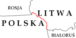
The current Lithuania–Poland border has existed since the re-establishment of the independence of Lithuania on March 11, 1991. Until then the identical border was between Poland and Lithuanian SSR of the Soviet Union. The length of the border is 103 or 104 kilometres (64 or 65 mi).[1][2] It runs from the Lithuania–Poland–Russia tripoint southeast to the Belarus–Lithuania–Poland tripoint.
It is the only land border that the EU- and NATO-member Baltic states share with a country that is not a member of the Russian-aligned Commonwealth of Independent States.[3]
To the military planners of NATO, the border area is known as the Suwalki gap (named after nearby town of Suwałki), because it represents a tough-to-defend flat narrow piece of land, a gap, that is between Belarus and Russia's Kaliningrad enclave and that connects the NATO-member Baltic States to Poland and the rest of NATO.[4]
History
 Map of Poland from the early 11th century shows Polish and Lithuanian lands separated by Old Prussian and Kievan Rus' territories
.png) Map of Poland in the first half of the 13th century, shows a border between Duchy of Masovia and Lithuania
Map of Poland in the first half of the 13th century, shows a border between Duchy of Masovia and Lithuania.png) Map of Poland and Lithuania around 1275–1300, with visible Polish–Lithuanian border
Map of Poland and Lithuania around 1275–1300, with visible Polish–Lithuanian border Map of Poland and Lithuania around 1333–1370, with visible Polish–Lithuanian border
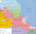 Map of Poland and Lithuania around 1370–1382, with visible Polish–Lithuanian border
 Map of Poland and Lithuania around 1386–1434, with visible Polish–Lithuanian border
 Map of Poland and Lithuania around 1466, with visible Polish–Lithuanian border
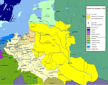 Map of Poland and Lithuania around 1526, with visible Polish–Lithuanian border
 Map of Polish-Lithuania Commonwealth after its formation in 1569, with visible Polish–Lithuanian border. Ukrainian territories were transferred under the administrative control of the Crown of Poland.
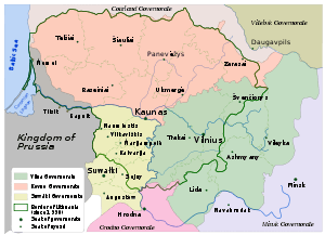 Map of Lithuania around 1867–1914, with visible Polish–Russian border (Lithuania did not exist at that time)
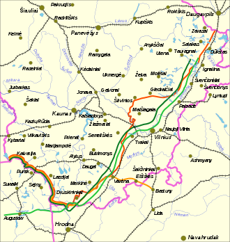 Polish–Lithuanian border around 1918–1939
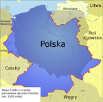
The current Lithuania–Poland border has existed since the re-establishment of the independence of Lithuania on March 11, 1991.[5] Until then the identical border was between Poland and Lithuanian SSR of the Soviet Union. That border was established in the aftermath of World War II. Until then the identical border was between Poland and Lithuanian SSR of the Soviet Union.[6][7] A different border existed between the Second Polish Republic and Lithuania in the period of 1918–1939. Following the Polish–Lithuanian border conflict, from 1922 onward it was stable, and had a length of 521 km.[8][9] During the partitions of Poland era, there were borders between the Congress Poland (Augustów Voivodeship) and the Lithuanian lands of the Russian Empire (Kovno Governorate and Vilna Governorate). From the Union of Lublin (1569) to the partitions, there was no Polish-Lithuanian border, as both countries were a part of a single federated entity, the Polish-Lithuanian Commonwealth.[10] In the medieval times, Kingdom of Poland and Grand Duchy of Lithuania shared yet another border.[11]
Lithuania and Poland joined the Schengen Area in 2007. This meant that all passport checks were removed along the border in December 2007.
Former border crossings

In the period 1991–2007, there were three road and one rail border crossing between Poland and Lithuania.[12]
On May 1, 2004, when both Poland and Lithuania joined the European Union, this border became an internal border of the European Union.[13] On 21 December 2007, Poland and Lithuania accessed to the Schengen Agreement.[14] After this, crossing the border became easier, as EU internal borders are open to all traffic with little need for control. There are still, however, occasional customs and police controls against smuggling of restricted goods, which however affect only about 1% of travelers.[15][16][17]
Road
Rail
References
- ↑ "Warunki Naturalne I Ochrona Środowiska" [Environment and Environmental Protection]. Mały Rocznik Statystyczny Polski 2013 [Concise Statistical Yearbook of Poland 2013] (in Polish and English). Główny Urząd Statystyczny. 2013. p. 26. ISSN 1640-3630.
- ↑ (Polish) Informacje o Polsce – informacje ogólne (archive.org). Page gives Polish PWN Encyklopedia as reference.
- ↑ Vladimir Shlapentokh (1 January 2001). The Legacy of History in Russia and the New States of Eurasia. M.E. Sharpe. p. 100. ISBN 978-0-7656-1398-1.
- ↑ Bearak, Max (June 20, 2016). "This tiny stretch of countryside is all that separates Baltic states from Russian envelopment". The Washington Post. Retrieved 2016-06-20.
- ↑ George Sanford (6 December 2012). Poland: The Conquest of History. Routledge. p. 99. ISBN 978-1-136-65096-3.
- ↑ Peter Andreas; Timothy Snyder (1 January 2000). The Wall Around the West: State Borders and Immigration Controls in North America and Europe. Rowman & Littlefield. p. 187. ISBN 978-0-7425-0178-2.
- ↑ Yaël Ronen (19 May 2011). Transition from Illegal Regimes under International Law. Cambridge University Press. p. 138. ISBN 978-1-139-49617-9.
- ↑ Polska w cyfrach [in:] E. Romer Atlas Polski współczesnej, 1928.
- ↑ Michael Brecher (1997). A Study of Crisis. University of Michigan Press. pp. 252–255. ISBN 0-472-10806-9.
- ↑ Halina Lerski (19 January 1996). Historical Dictionary of Poland, 966–1945. ABC-CLIO. p. 308. ISBN 978-0-313-03456-5.
- ↑ Stephen R. Burant and Voytek Zubek, Eastern Europe's Old Memories and New Realities: Resurrecting the Polish-lithuanian Union, East European Politics and Societies 1993; 7; 370, online
- ↑ Kancelaria Sejmu RP. "Internetowy System Aktów Prawnych". sejm.gov.pl.
- ↑ Stephen Kabera Karanja (January 2008). Transparency and Proportionality in the Schengen Information System and Border Control Co-Operation. Martinus Nijhoff Publishers. p. 39. ISBN 90-04-16223-2.
- ↑ "Europe's border-free zone expands". BBC News. 27 December 2007. Retrieved 11 April 2015.
- ↑ "Nowe polsko-litewskie drogi po wejściu do Schengen". DELFI. 28 July 2012.
- ↑ "Wspólne patrole na polsko-litewskiej granicy :: społeczeństwo". Kresy.pl.
- ↑ "Przemyt papierosów przy polsko – litewskiej granicy [ZDJĘCIA]". bialystok.
External links
| Wikimedia Commons has media related to Poland-Lithuania border. |
- Lithuania–Poland cross-border cooperation programme, a EU programme
- Suwalki Gap on GlobalSecurity.org