| [3] |
Name on the Register[4] |
Image |
Date listed[5] |
Location |
City or town |
Description |
|---|
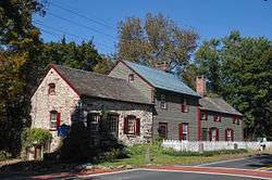
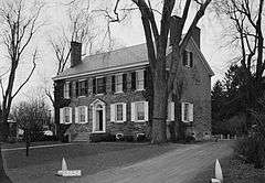
| 1 |
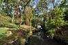
Abbott Farm Archeological Site |
|
000000001976-12-08-0000December 8, 1976
(#76001158) |
John A. Roebling Park, other nearby public and private lands
40°11′10″N 74°43′37″W / 40.186°N 74.727°W / 40.186; -74.727 (Abbott Farm Archeological Site) |
Hamilton and Bordentown Townships, Bordentown[6] |
Paleoindian settlement, 500 BC-500 AD.[7] Extends into Burlington County.
|
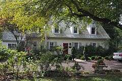
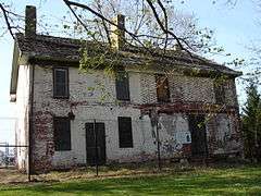
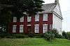
| 2 |
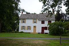
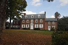
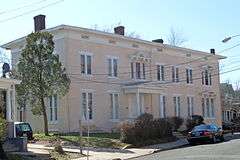
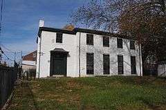
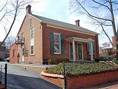
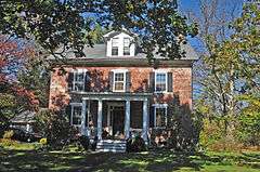
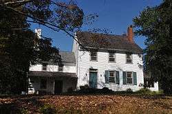
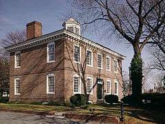
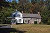
John Abbott II House |
|
000000001976-06-18-0000June 18, 1976
(#76001159) |
2200 Kuser Rd.
40°12′14″N 74°40′51″W / 40.203889°N 74.680833°W / 40.203889; -74.680833 (John Abbott II House) |
Hamilton Township |
Used to hide state treasury during American Revolution[8]
|
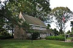
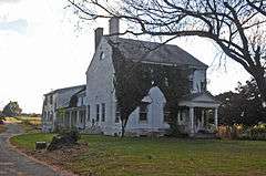
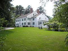
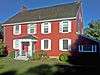
| 3 |
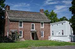
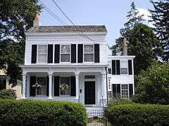
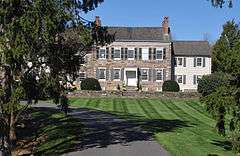
Abbott-Decou House |
|
000000001976-07-01-0000July 1, 1976
(#76001160) |
58 Soloff Dr.
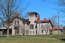
40°11′08″N 74°43′11″W / 40.185556°N 74.719722°W / 40.185556; -74.719722 (Abbott-Decou House) |
Hamilton Township |
Fine example of 18th century Quaker Georgian architecture.[9]
|
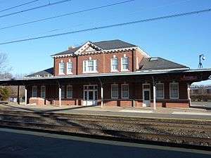
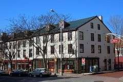
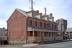
| 4 |
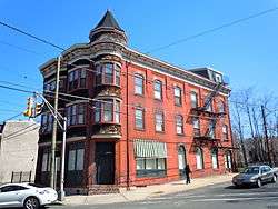
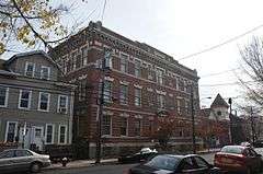
Adams and Sickles Building |
|
000000001980-01-31-0000January 31, 1980
(#80002498) |
1 W. End Ave.
40°13′36″N 74°46′45″W / 40.226667°N 74.779167°W / 40.226667; -74.779167 (Adams and Sickles Building) |
Trenton |
Focal point for West End neighborhood, remembered for soda fountain and corner druggist.[10]
|
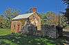
| 5 |
American Cigar Company Building |
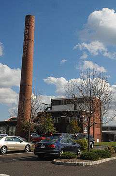
|
000000002011-12-30-0000December 30, 2011
(#11000965) |
176 Division St.
40°12′45″N 74°44′41″W / 40.212498°N 74.744743°W / 40.212498; -74.744743 (American Cigar Company Building) |
Trenton |
Built in 1903 as part of Trenton's vibrant cigar industry
|
| 6 |
Anderson-Capner House |
|
000000001973-04-03-0000April 3, 1973
(#73001107) |
700 Trumbull Ave.
40°14′52″N 74°44′06″W / 40.247755°N 74.734912°W / 40.247755; -74.734912 (Anderson-Capner House) |
Lawrence |
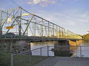
Pre-revolutionary farmhouse built 1764[11]
|
| 7 |
Archeological Site No. 1-18th Century Vessel (28ME196) |
Upload image |
000000001986-08-14-0000August 14, 1986
(#86001508) |
Address Restricted
|
Trenton |
|
| 8 |
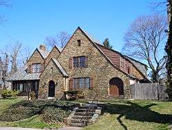
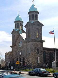
Baker-Brearley House |
|
000000001979-08-31-0000August 31, 1979
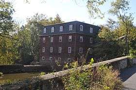
(#79001499) |
East of Lawrenceville on Meadow Rd
40°17′33″N 74°42′03″W / 40.292504°N 74.700792°W / 40.292504; -74.700792 (Baker-Brearley House) |
Lawrenceville |
Georgian house built 1761[12]
|
| 9 |
Bear Tavern Road--Jacob's Creek Crossing Rural Historic District |
|
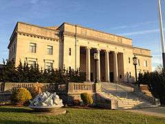
000000002011-11-30-0000November 30, 2011
(#11000872) |
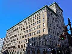
Bear Tavern Rd. & Jacobs Creek Rd.
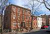
40°17′21″N 74°50′29″W / 40.289151°N 74.841399°W / 40.289151; -74.841399 (Bear Tavern Road--Jacob's Creek Crossing Rural Historic District) |
Hopewell Township, Ewing Township |
Colonial rural landscape, route of Continental Army in 1776[13]
|
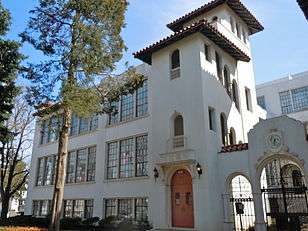
| 10 |
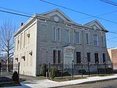
Bellevue Avenue Colored School |
|
000000001997-01-02-0000January 2, 1997
(#96001547) |
81 Bellevue Ave.
40°13′32″N 74°46′17″W / 40.225556°N 74.771389°W / 40.225556; -74.771389 (Bellevue Avenue Colored School) |
Trenton |
|
| 11 |
Berkeley Square Historic District |
|
000000001980-11-20-0000November 20, 1980
(#80002499) |
Roughly bounded by W. State St., Parkside, Riverside, and Overbrook Aves.
40°13′49″N 74°47′23″W / 40.230278°N 74.789722°W / 40.230278; -74.789722 (Berkeley Square Historic District) |
Trenton |
|
| 12 |
Bow Hill |
|
000000001973-01-25-0000January 25, 1973
(#73001111) |
477 Jeremiah Ave. off Lalor St.
40°11′32″N 74°44′39″W / 40.192222°N 74.744167°W / 40.192222; -74.744167 (Bow Hill) |
Hamilton Township |
|
| 13 |
Charles Brearley House |
|
000000001995-04-14-0000April 14, 1995
(#95000407) |
73 N. Clinton Ave.
40°13′23″N 74°45′18″W / 40.223056°N 74.755°W / 40.223056; -74.755 (Charles Brearley House) |
Trenton |
|
| 14 |
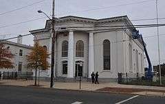
Broad Street National Bank |
|
000000002008-01-17-0000January 17, 2008
(#07001404) |
143 E. State St.
40°13′12″N 74°45′43″W / 40.219907°N 74.762068°W / 40.219907; -74.762068 (Broad Street National Bank) |
Trenton |
|
| 15 |
Camden and Amboy Railroad Right of Way Site |
|
000000002016-06-16-0000June 16, 2016
(#16000252) |
N. side of Rogers Ave. about 100 yds. W. of Mercer St.
40°16′09″N 74°31′31″W / 40.269291°N 74.525172°W / 40.269291; -74.525172 (Camden and Amboy Railroad Right of Way Site) |
Hightstown |
|
| 16 |
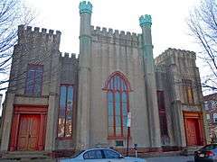
Henry Clay and Bock & Co. Ltd. Cigar Factory |
|
000000001979-06-12-0000June 12, 1979
(#79001500) |
507 Grand St.
40°12′11″N 74°44′45″W / 40.203056°N 74.745833°W / 40.203056; -74.745833 (Henry Clay and Bock & Co. Ltd. Cigar Factory) |
Trenton |
Most architecturally distinctive industrial building in Trenton[14]
|
| 17 |
Grover Cleveland Home |
|
000000001966-10-15-0000October 15, 1966
(#66000463) |
15 Hodge Rd.
40°21′05″N 74°40′04″W / 40.351389°N 74.667778°W / 40.351389; -74.667778 (Grover Cleveland Home) |
Princeton |
|
| 18 |
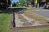
Crosswicks Creek Site III |
|
000000001990-11-26-0000November 26, 1990
(#87001795) |
Address Restricted
|
Bordentown |
|
| 19 |
Delaware and Raritan Canal |
|
000000001973-05-11-0000May 11, 1973
(#73001105) |
Follows the Delaware River to Trenton, then E to New Brunswick
40°19′55″N 74°39′09″W / 40.331930°N 74.652628°W / 40.331930; -74.652628 (Delaware and Raritan Canal) |
Princeton |
|
| 20 |
Gen. Philemon Dickinson House |
|
000000001974-05-17-0000May 17, 1974
(#74001172) |
46 Colonial Ave.
40°13′36″N 74°47′01″W / 40.226667°N 74.783611°W / 40.226667; -74.783611 (Gen. Philemon Dickinson House) |
Trenton |
|
| 21 |
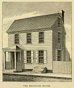
Douglass House |
|
000000001970-12-18-0000December 18, 1970
(#70000387) |
Corner of Front and Montgomery Sts.
40°13′08″N 74°45′42″W / 40.218913°N 74.761726°W / 40.218913; -74.761726 (Douglass House) |
Trenton |
George Washington's headquarters prior to the Battle of Princeton[15]
|
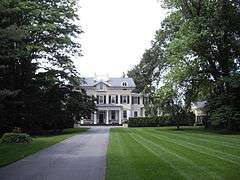
| 22 |
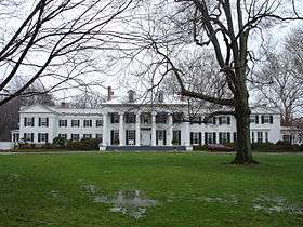
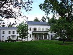
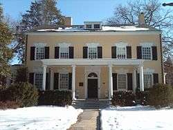
Drumthwacket |
|
000000001975-06-10-0000June 10, 1975
(#75001142) |
344 Stockton Rd.
40°20′22″N 74°40′29″W / 40.339444°N 74.674722°W / 40.339444; -74.674722 (Drumthwacket) |
Princeton |
Official residence of the governor of New Jersey[16]
|
| 23 |
East Trenton Public Library |
|
000000002008-03-05-0000March 5, 2008
(#08000134) |
701 N. Clinton St.
40°14′00″N 74°44′30″W / 40.233255°N 74.741769°W / 40.233255; -74.741769 (East Trenton Public Library) |
Trenton |
|
| 24 |
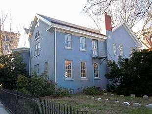
Albert Einstein House |
|
000000001976-01-07-0000January 7, 1976
(#76002297) |
112 Mercer St.
40°20′40″N 74°39′59″W / 40.344444°N 74.666389°W / 40.344444; -74.666389 (Albert Einstein House) |
Princeton |
|
| 25 |
First Presbyterian Church |
|
000000002005-09-09-0000September 9, 2005
(#05000967) |
120 East State St.
40°13′14″N 74°45′48″W / 40.220446°N 74.763312°W / 40.220446; -74.763312 (First Presbyterian Church) |
Trenton |
|
| 26 |
First Presbyterian Church of Pennington |
|
000000002011-08-24-0000August 24, 2011
(#11000591) |
13 S. Main St.
40°19′39″N 74°47′25″W / 40.3275°N 74.790278°W / 40.3275; -74.790278 (First Presbyterian Church of Pennington) |
Pennington |
|
| 27 |
Golden Swan-True American |
|
000000002008-04-30-0000April 30, 2008
(#08000361) |
101-107 S. Warren St.
40°13′09″N 74°45′58″W / 40.2192°N 74.766011°W / 40.2192; -74.766011 (Golden Swan-True American) |
Trenton |
|
| 28 |
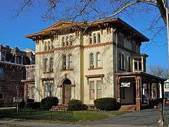
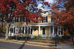
William Green House |
|
000000001973-12-04-0000December 4, 1973
(#73001106) |
Metzger Drive
40°15′53″N 74°46′40″W / 40.264722°N 74.777778°W / 40.264722; -74.777778 (William Green House) |
Ewing Township |
Historic farmhouse, dating to 1717. On Preservation New Jersey's list of 10 most endangered historic sites[17]
|
| 29 |
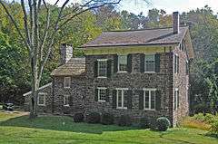
Green-Reading House |
|
000000001998-03-12-0000March 12, 1998
(#98000237) |
107 Wilburtha Rd.
40°15′38″N 74°49′32″W / 40.260427°N 74.825467°W / 40.260427; -74.825467 (Green-Reading House) |
Ewing Township |
Federal style farmhouse from ca. 1797[18]
|
| 30 |
Harbourton Historic District |
|
000000001974-12-31-0000December 31, 1974
(#74001167) |
Jct. of Harbourton/Rocktown Rd. and Harbourton/Mt. Airy Rd.
40°21′08″N 74°51′12″W / 40.352222°N 74.853333°W / 40.352222; -74.853333 (Harbourton Historic District) |
Harbourton |
|
| 31 |
John D. Hart House |
|
000000001972-10-18-0000October 18, 1972
(#72000800) |
Curlis Ave.
40°19′18″N 74°46′59″W / 40.321667°N 74.783056°W / 40.321667; -74.783056 (John D. Hart House) |
Pennington |
Built ca. 1800, fine example of a clapboard house[19]
|
| 32 |
Hart-Hoch House |
|
000000001973-03-14-0000March 14, 1973
(#73001109) |
Southwest of Pennington on CR 546 and Scotch Rd.
40°18′34″N 74°48′43″W / 40.309444°N 74.811944°W / 40.309444; -74.811944 (Hart-Hoch House) |
Hopewell Township |
Federal style home, ca. 1800[20]
|
| 33 |
Joseph Henry House |
|
000000001966-10-15-0000October 15, 1966
(#66000464) |
Princeton University campus
40°20′58″N 74°39′32″W / 40.349444°N 74.658889°W / 40.349444; -74.658889 (Joseph Henry House) |
Princeton |
|
| 34 |
Donald Grant Herring Estate |
|
000000001992-01-17-0000January 17, 1992
(#91001927) |
52, 72 and 75 Arreton Rd., Princeton
40°22′56″N 74°39′57″W / 40.382222°N 74.665833°W / 40.382222; -74.665833 (Donald Grant Herring Estate) |
Princeton |
|
| 35 |
Higbee Street School |
|
000000001995-04-14-0000April 14, 1995
(#95000409) |
20 Bellevue Ave.
40°14′04″N 74°45′57″W / 40.234444°N 74.765833°W / 40.234444; -74.765833 (Higbee Street School) |
Trenton |
|
| 36 |
Highfields |
|
000000001994-09-23-0000September 23, 1994
(#94001096) |
End of Lindbergh Rd., East Amwell Township
40°25′26″N 74°46′04″W / 40.423889°N 74.767778°W / 40.423889; -74.767778 (Highfields) |
Hopewell Township |
Home of Charles and Anne Lindbergh. Site of the Lindbergh kidnapping.[21] Extends into Hunterdon County
|
| 37 |
Hog Island Cranes |
|
000000001980-06-17-0000June 17, 1980
(#80002500) |
Trenton Marine Terminal
40°11′27″N 74°45′22″W / 40.190833°N 74.756111°W / 40.190833; -74.756111 (Hog Island Cranes) |
Trenton |
|
| 38 |
Hopewell Station |
|
000000001984-06-22-0000June 22, 1984
(#84002728) |
Railroad Pl.
40°23′29″N 74°45′48″W / 40.391389°N 74.763333°W / 40.391389; -74.763333 (Hopewell Station) |
Hopewell |
part of the Operating Passenger Railroad Stations Thematic Resource (TR)
|
| 39 |
House at 379 West State Street |
|
000000001980-01-23-0000January 23, 1980
(#80002501) |
379 W. State St.
40°13′29″N 74°46′41″W / 40.224722°N 74.778056°W / 40.224722; -74.778056 (House at 379 West State Street) |
Trenton |
Queen Anne revival house[22]
|
| 40 |
Hunt Farmstead |
|
000000001988-10-28-0000October 28, 1988
(#87002555) |
197 Blackwell Rd.
40°19′18″N 74°45′39″W / 40.321778°N 74.760718°W / 40.321778; -74.760718 (Hunt Farmstead) |
Hopewell Township |
|
| 41 |
In and Out Social Club |
|
000000001987-03-26-0000March 26, 1987
(#87000513) |
714-716 S. Clinton Ave.
40°12′34″N 74°45′06″W / 40.209444°N 74.751667°W / 40.209444; -74.751667 (In and Out Social Club) |
Trenton |
Built in 1893 for "social, intellectual, and recreative purposes."[23]
|
| 42 |
Jugtown Historic District |
|
000000001987-01-22-0000January 22, 1987
(#86003670) |
Nassau and Harrison Sts., Harrison St. N, and Evelyn Pl.
40°21′14″N 74°38′49″W / 40.353889°N 74.646944°W / 40.353889; -74.646944 (Jugtown Historic District) |
Princeton |
|
| 43 |
King's Highway Historic District |
|
000000002000-12-21-0000December 21, 2000
(#00001493) |
NJ 27, US 206
40°20′54″N 74°39′52″W / 40.348261°N 74.664502°W / 40.348261; -74.664502 (King's Highway Historic District) |
Lawrenceville, Princeton |
|
| 44 |
Kingston Mill Historic District |
|
000000001986-04-10-0000April 10, 1986
(#86000707) |
Roughly bounded by Herrontown, River, Princeton-Kingston Rds., and lots west of Princeton
40°22′25″N 74°37′14″W / 40.373577°N 74.620630°W / 40.373577; -74.620630 (Kingston Mill Historic District) |
Princeton |
|
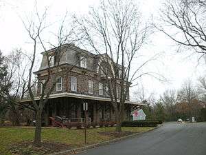
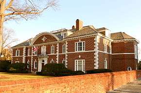
| 45 |
Rudolph V. Kuser Estate |
|
000000001979-08-24-0000August 24, 1979
(#79001501) |
315 W. State St.
40°13′23″N 74°46′36″W / 40.223056°N 74.776667°W / 40.223056; -74.776667 (Rudolph V. Kuser Estate) |
Trenton |
|
| 46 |
Lake Carnegie Historic District |
|
000000001990-06-28-0000June 28, 1990
(#90001000) |
Roughly bounded by Lake Carnegie shoreline from Conrail bridge at west end to dam west of Kingston at east end
40°20′51″N 74°38′12″W / 40.3475°N 74.636667°W / 40.3475; -74.636667 (Lake Carnegie Historic District) |
Princeton |
|
| 47 |
Lawrence Township Historic District |
|
000000001972-09-14-0000September 14, 1972
(#72000799) |
Lawrenceville and vicinity N, including both sides of U.S. 206
40°18′01″N 74°43′12″W / 40.300278°N 74.72°W / 40.300278; -74.72 (Lawrence Township Historic District) |
Lawrenceville |
|
| 48 |
Lawrenceville School |
|
000000001986-02-24-0000February 24, 1986
(#86000158) |
Main St.
40°17′45″N 74°43′49″W / 40.295833°N 74.730278°W / 40.295833; -74.730278 (Lawrenceville School) |
Lawrenceville |
|
| 49 |
Ichabod Leigh House |
|
000000001975-03-04-0000March 4, 1975
(#75001139) |
Pennington-Rocky Hill Rd.
40°22′21″N 74°43′55″W / 40.3725°N 74.731944°W / 40.3725; -74.731944 (Ichabod Leigh House) |
Hopewell |
|
| 50 |
Thomas Maddock's Sons Company |
|
000000002008-03-14-0000March 14, 2008
(#08000178) |
American Metro Boulevard
40°15′27″N 74°42′17″W / 40.257383°N 74.704672°W / 40.257383; -74.704672 (Thomas Maddock's Sons Company) |
Hamilton Township |
Sanitary pottery manufacturing plant built 1924-25[24]
|
| 51 |
Mansion House |
|
000000001973-02-06-0000February 6, 1973
(#73001112) |
Cadwalader Park
40°14′12″N 74°47′22″W / 40.236667°N 74.789444°W / 40.236667; -74.789444 (Mansion House) |
Trenton |
|
| 52 |
Maybury Hill |
|
000000001971-11-11-0000November 11, 1971
(#71000502) |
346 Snowden Lane
40°22′02″N 74°38′34″W / 40.367222°N 74.642778°W / 40.367222; -74.642778 (Maybury Hill) |
Princeton |
|
| 53 |
Mercer Street Friends Center |
|
000000001971-08-12-0000August 12, 1971
(#71000505) |
151 Mercer St.
40°13′02″N 74°45′40″W / 40.217222°N 74.761111°W / 40.217222; -74.761111 (Mercer Street Friends Center) |
Trenton |
|
| 54 |
Mill Hill Historic District |
|
000000001977-12-12-0000December 12, 1977
(#77000880) |
Roughly bounded by Clay, Jackson, Front, Market, Broad, and Greenwood Sts.
40°13′01″N 74°45′40″W / 40.216944°N 74.761111°W / 40.216944; -74.761111 (Mill Hill Historic District) |
Trenton |
|
| 55 |
Morven |
|
000000001971-01-25-0000January 25, 1971
(#71000503) |
55 Stockton St.
40°20′51″N 74°40′01″W / 40.3475°N 74.666944°W / 40.3475; -74.666944 (Morven) |
Princeton |
|
| 56 |
Mott School and Second Street School |
|
000000001986-04-15-0000April 15, 1986
(#86000809) |
Centre and 643-645 Second Sts.
40°12′07″N 74°45′24″W / 40.201944°N 74.756667°W / 40.201944; -74.756667 (Mott School and Second Street School) |
Trenton |
|
| 57 |
Mount Rose Distillery |
|
000000001996-12-12-0000December 12, 1996
(#96001471) |
Address Restricted
40°22′03″N 74°44′49″W / 40.3674138888889°N 74.7470833333333°W / 40.3674138888889; -74.7470833333333 (Mount Rose Distillery) |
Hopewell |
|
| 58 |
Mountain Avenue Historic District |
|
000000001995-02-02-0000February 2, 1995
(#94001604) |
73-143 Mountain Ave.
40°21′25″N 74°40′25″W / 40.356944°N 74.673611°W / 40.356944; -74.673611 (Mountain Avenue Historic District) |
Princeton |
|
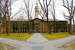
| 59 |
Nassau Hall, Princeton University |
|
000000001966-10-15-0000October 15, 1966
(#66000465) |
Princeton University campus
40°20′55″N 74°39′34″W / 40.348611°N 74.659444°W / 40.348611; -74.659444 (Nassau Hall, Princeton University) |
Princeton |
|
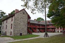
| 60 |
Old Barracks |
|
000000001971-01-25-0000January 25, 1971
(#71000506) |
S. Willow St.
40°13′10″N 74°46′07″W / 40.219444°N 74.768611°W / 40.219444; -74.768611 (Old Barracks) |
Trenton |
|
| 61 |
Old Eagle Tavern |
|
000000001972-11-03-0000November 3, 1972
(#72000801) |
431, 433 S. Broad St.
40°12′47″N 74°45′34″W / 40.213056°N 74.759444°W / 40.213056; -74.759444 (Old Eagle Tavern) |
Trenton |
|
| 62 |
Old Ryan Farm |
|
000000001971-09-10-0000September 10, 1971
(#71000507) |
Federal City Rd.
40°16′47″N 74°46′15″W / 40.279833°N 74.770889°W / 40.279833; -74.770889 (Old Ryan Farm) |
Trenton |
|
| 63 |
Isaac Pearson House |
|
000000002006-02-01-0000February 1, 2006
(#05001568) |
Hobson Ave. at Emiline Ave.
40°11′16″N 74°42′44″W / 40.187778°N 74.712222°W / 40.187778; -74.712222 (Isaac Pearson House) |
Hamilton Township |
|
| 64 |
Pennington Railroad Station |
|
000000001974-12-31-0000December 31, 1974
(#74001170) |
Corner of Franklin and Green Ave.
40°19′58″N 74°47′41″W / 40.332778°N 74.794722°W / 40.332778; -74.794722 (Pennington Railroad Station) |
Pennington |
|
| 65 |
Penns Neck Baptist Church |
|
000000001989-12-28-0000December 28, 1989
(#89002160) |
US 1 at Princeton-Hightstown Rd.
40°19′55″N 74°38′15″W / 40.331944°N 74.6375°W / 40.331944; -74.6375 (Penns Neck Baptist Church) |
Penns Neck |
|
| 66 |
Pennsylvania Railroad Bridge |
|
000000001979-06-06-0000June 6, 1979
(#79001502) |
Spans Delaware River
40°12′24″N 74°46′09″W / 40.206667°N 74.769167°W / 40.206667; -74.769167 (Pennsylvania Railroad Bridge) |
Trenton |
|
| 67 |
Philadelphia and Reading Railroad Freight Station |
|
000000001979-05-14-0000May 14, 1979
(#79001503) |
260 N. Willow St.
40°13′34″N 74°46′03″W / 40.226111°N 74.7675°W / 40.226111; -74.7675 (Philadelphia and Reading Railroad Freight Station) |
Trenton |
|
| 68 |
Joseph Phillips Farm |
|
000000001977-05-02-0000May 2, 1977
(#77000879) |
North of Titusville on Hunter Road
40°20′23″N 74°53′56″W / 40.339722°N 74.898889°W / 40.339722; -74.898889 (Joseph Phillips Farm) |
Hopewell Township |
Started by Joseph Phillips in 1732, now the Howell Living History Farm, which operates and preserves it as it was in 1900[25]
|
| 69 |
Pleasant Valley Historic District |
|
000000001991-06-14-0000June 14, 1991
(#91000676) |
Centered on jct. of Pleasant Valley Rd. with Woodens Ln. and Hunter Rd., Hopewell and West Amwell Twps.
40°20′18″N 74°53′44″W / 40.338333°N 74.895556°W / 40.338333; -74.895556 (Pleasant Valley Historic District) |
Lambertville |
|
| 70 |
President's House (aka Maclean House) |
|
000000001971-07-17-0000July 17, 1971
(#71000504) |
Nassau St.
40°20′56″N 74°39′36″W / 40.348889°N 74.66°W / 40.348889; -74.66 (President's House (aka Maclean House)) |
Princeton |
|
| 71 |
Princeton Battlefield |
|
000000001966-10-15-0000October 15, 1966
(#66000466) |
Princeton Battlefield State Park
• Boundary increase (listed 000000001989-10-10-0000October 10, 1989, refnum 89000761): Roughly Quaker Rd. from Stockton Rd. to Stony Brook
40°19′45″N 74°40′36″W / 40.329167°N 74.676667°W / 40.329167; -74.676667 (Princeton Battlefield) |
Princeton |
|
| 72 |
Princeton Historic District |
|
000000001975-06-27-0000June 27, 1975
(#75001143) |
Irregular pattern between Lytle St. and Haslet Ave. from Lovers Lane to Olden Sts.
40°20′48″N 74°39′51″W / 40.346667°N 74.664167°W / 40.346667; -74.664167 (Princeton Historic District) |
Princeton |
|
| 73 |
Princeton Ice Company |
|
000000002007-08-28-0000August 28, 2007
(#07000874) |
57 Mountain Ave.
40°21′26″N 74°40′17″W / 40.357278°N 74.671331°W / 40.357278; -74.671331 (Princeton Ice Company) |
Princeton |
|
| 74 |
Prospect |
|
000000001985-02-04-0000February 4, 1985
(#85002434) |
Princeton University campus
40°20′49″N 74°39′24″W / 40.346944°N 74.656667°W / 40.346944; -74.656667 (Prospect) |
Princeton |
|
| 75 |
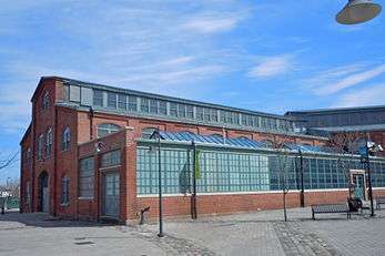
Roebling Machine Shop |
|
000000001997-09-04-0000September 4, 1997
(#97000932) |
675 S. Clinton Ave.
40°12′35″N 74°45′11″W / 40.209722°N 74.753056°W / 40.209722; -74.753056 (Roebling Machine Shop) |
Trenton |
Oldest surviving building in the Roebling complex, built innovative wire rope making machines[26]
|
| 76 |
John A. Roebling's Sons Company, Trenton N.J., Block 3 |
|
000000002012-08-22-0000August 22, 2012
(#12000528) |
Bounded by Hamilton Ave., Clark, Elmer, & E. Canal Sts.
40°12′46″N 74°45′19″W / 40.21267°N 74.755184°W / 40.21267; -74.755184 (John A. Roebling's Sons Company, Trenton N.J., Block 3) |
Trenton |
Northern portion of Roebling complex, built wire for North Sea Mine Barrage, Golden Gate Bridge, among other structures
|
| 77 |
John Rogers House |
|
000000001978-01-31-0000January 31, 1978
(#78001770) |
South of Princeton on S. Post Rd.
40°15′45″N 74°38′52″W / 40.26241389°N 74.64787222°W / 40.26241389; -74.64787222 (John Rogers House) |
West Windsor |
|
| 78 |
Sacred Heart Church |
|
000000002002-05-02-0000May 2, 2002
(#02000434) |
343 S. Broad St.
40°12′59″N 74°45′40″W / 40.216389°N 74.761111°W / 40.216389; -74.761111 (Sacred Heart Church) |
Trenton |
|
| 79 |
Samuel Sloan House |
|
000000001974-03-28-0000March 28, 1974
(#74001168) |
238 S. Main St.
40°15′58″N 74°31′32″W / 40.266111°N 74.525556°W / 40.266111; -74.525556 (Samuel Sloan House) |
Hightstown |
|
| 80 |
Smith-Ribsam House |
|
000000001988-06-09-0000June 9, 1988
(#88000722) |
45 Pine Knoll Dr.
40°16′27″N 74°43′28″W / 40.274167°N 74.724444°W / 40.274167; -74.724444 (Smith-Ribsam House) |
Eldridge Park |
|
| 81 |
Somerset Roller Mills |
|
000000001974-11-19-0000November 19, 1974
(#74001171) |
NJ 29
40°16′45″N 74°51′13″W / 40.279167°N 74.853611°W / 40.279167; -74.853611 (Somerset Roller Mills) |
Titusville |
|
| 82 |
St. Michael's Episcopal Church |
|
000000001982-04-29-0000April 29, 1982
(#82003280) |
140 N. Warren St.
40°13′20″N 74°45′55″W / 40.222222°N 74.765278°W / 40.222222; -74.765278 (St. Michael's Episcopal Church) |
Trenton |
|
| 83 |
State House District |
|
000000001976-08-27-0000August 27, 1976
(#76001161) |
Roughly bounded by Capitol Plaza, Willow, State and Lafayette Sts.
• Boundary increase (listed 000000001992-04-02-0000April 2, 1992, refnum 92000295): W. State St. south side, west of New Jersey State House
40°13′14″N 74°46′15″W / 40.220556°N 74.770833°W / 40.220556; -74.770833 (State House District) |
Trenton |
|
| 84 |
Israel Stevens House |
|
000000002005-03-15-0000March 15, 2005
(#05000176) |
2167 Brunswick Ave.
40°15′19″N 74°44′00″W / 40.255278°N 74.733333°W / 40.255278; -74.733333 (Israel Stevens House) |
Lawrence |
|
| 85 |
Stockton Street Historic District |
|
000000002005-11-25-0000November 25, 2005
(#05001331) |
126-136 Stockton St., 219-237 Rogers Ave.
40°16′15″N 74°31′42″W / 40.2709°N 74.5284°W / 40.2709; -74.5284 (Stockton Street Historic District) |
Hightstown |
|
| 86 |
Stokely-Van Camp Industrial Complex |
|
000000001983-03-11-0000March 11, 1983
(#83001603) |
Lalor Street at Stokely Ave.
40°11′59″N 74°45′16″W / 40.199722°N 74.754444°W / 40.199722; -74.754444 (Stokely-Van Camp Industrial Complex) |
Trenton |
|
| 87 |
Joseph Stout House |
|
000000001974-10-29-0000October 29, 1974
(#74001169) |
Province Line Rd.
40°24′34″N 74°44′44″W / 40.409444°N 74.745556°W / 40.409444; -74.745556 (Joseph Stout House) |
Hopewell |
|
| 88 |
Titusville Historic District |
|
000000001983-03-17-0000March 17, 1983
(#83001604) |
River Dr.
40°18′22″N 74°52′44″W / 40.306111°N 74.878889°W / 40.306111; -74.878889 (Titusville Historic District) |
Titusville |
|
| 89 |
William Trent House |
|
000000001970-04-15-0000April 15, 1970
(#70000388) |
539 S. Warren St.
40°12′46″N 74°45′58″W / 40.212778°N 74.766111°W / 40.212778; -74.766111 (William Trent House) |
Trenton |
|
| 90 |
Trenton and Mercer County War Memorial-Soldiers' and Sailors' Memorial Building |
|
000000001986-12-11-0000December 11, 1986
(#86003480) |
W. Lafayette St.
40°13′06″N 74°46′06″W / 40.218333°N 74.768333°W / 40.218333; -74.768333 (Trenton and Mercer County War Memorial-Soldiers' and Sailors' Memorial Building) |
Trenton |
|
| 91 |
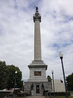
Trenton Battle Monument |
|
000000001977-05-06-0000May 6, 1977
(#77000881) |
Warren and Broad Streets
40°13′33″N 74°45′53″W / 40.225833°N 74.764722°W / 40.225833; -74.764722 (Trenton Battle Monument) |
Trenton |
Commemorates the Battle of Trenton
|
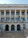
| 92 |
Trenton City Hall |
|
000000001978-01-30-0000January 30, 1978
(#78001771) |
309 State St.
40°13′12″N 74°45′34″W / 40.22°N 74.759444°W / 40.22; -74.759444 (Trenton City Hall) |
Trenton |
|
| 93 |
Trenton City/Calhoun Street Bridge |
|
000000001975-11-20-0000November 20, 1975
(#75001621) |
Spans Delaware River between Morrisville, PA and Trenton, NJ
40°13′11″N 74°46′42″W / 40.219722°N 74.778333°W / 40.219722; -74.778333 (Trenton City/Calhoun Street Bridge) |
Trenton |
|
| 94 |
Trenton Ferry Historic District |
|
000000002013-06-26-0000June 26, 2013
(#13000355) |
Roughly bounded by South Broad and Federal Streets, the Delaware River and the Amtrak Northeast Corridor
40°12′35″N 74°45′34″W / 40.2098°N 74.7595°W / 40.2098; -74.7595 (Trenton Ferry Historic District) |
Trenton |
Working class urban mixed-use neighborhood of row houses, duplexes, churches, and commercial buildings[27]
|
| 95 |
Trenton Friends Meeting House |
|
000000002008-04-30-0000April 30, 2008
(#08000362) |
142 E. Hanover St.
40°13′16″N 74°45′46″W / 40.221181°N 74.762644°W / 40.221181; -74.762644 (Trenton Friends Meeting House) |
Trenton |
|
| 96 |
Trenton Jewish Community Center Bath House and Day Camp |
|
000000001984-02-23-0000February 23, 1984
(#84002730) |
999 Lower Ferry Rd.
40°15′33″N 74°47′58″W / 40.259167°N 74.799444°W / 40.259167; -74.799444 (Trenton Jewish Community Center Bath House and Day Camp) |
Ewing Township |
|
| 97 |
Tusculum |
|
000000001978-01-05-0000January 5, 1978
(#78003171) |
North of Princeton on Cherry Hill Rd.
40°21′58″N 74°40′17″W / 40.366111°N 74.671389°W / 40.366111; -74.671389 (Tusculum) |
Princeton |
|
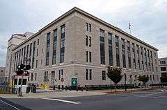
| 98 |
U.S. Post Office and Courthouse |
|
000000002012-05-24-0000May 24, 2012
(#12000309) |
402 E. State St.
40°13′16″N 74°45′26″W / 40.221132°N 74.757314°W / 40.221132; -74.757314 (U.S. Post Office and Courthouse) |
Trenton |
|
| 99 |
University Cottage Club |
|
000000001999-11-19-0000November 19, 1999
(#99001315) |
51 Prospect Ave.
40°20′53″N 74°39′07″W / 40.348056°N 74.651944°W / 40.348056; -74.651944 (University Cottage Club) |
Princeton |
|
| 100 |
Col. John Van Cleve Homestead |
|
000000001983-02-16-0000February 16, 1983
(#83001605) |
Northwest of Pennington on Poor Farm Rd.
40°21′11″N 74°49′27″W / 40.353056°N 74.824167°W / 40.353056; -74.824167 (Col. John Van Cleve Homestead) |
Hopewell Township |
|
| 101 |
Jeremiah Vandyke House |
|
000000001978-03-29-0000March 29, 1978
(#78001769) |
Featherbed Lane
40°24′34″N 74°46′51″W / 40.409444°N 74.780833°W / 40.409444; -74.780833 (Jeremiah Vandyke House) |
Hopewell |
|
| 102 |
Washington Crossing State Park |
|
000000001966-10-15-0000October 15, 1966
(#66000650) |
Titusville, New Jersey, on the Delaware River
40°17′57″N 74°52′07″W / 40.299167°N 74.868611°W / 40.299167; -74.868611 (Washington Crossing State Park) |
Titusville |
|
| 103 |
Washington Road Elm Allée |
|
000000001999-01-14-0000January 14, 1999
(#98001571) |
Washington Rd., bet. the Penns Neck Circle and The D&R Canal
40°20′08″N 74°38′37″W / 40.335556°N 74.643611°W / 40.335556; -74.643611 (Washington Road Elm Allée) |
West Windsor |
|
| 104 |
Isaac Watson House |
|
000000001974-01-21-0000January 21, 1974
(#74001173) |
151 Westcott St.
40°11′25″N 74°43′39″W / 40.190278°N 74.7275°W / 40.190278; -74.7275 (Isaac Watson House) |
Hamilton Township |
|
| 105 |
John Welling House |
|
000000001973-03-14-0000March 14, 1973
(#73001110) |
Curlis Ave. at Birch St.
40°19′17″N 74°46′58″W / 40.321389°N 74.782778°W / 40.321389; -74.782778 (John Welling House) |
Pennington |
Rare example of a Dutch clapboard and shingle house[28]
|
| 106 |
West Trenton Station |
|
000000001984-06-22-0000June 22, 1984
(#84004031) |
Sullivan Way
40°15′27″N 74°48′57″W / 40.2575°N 74.815833°W / 40.2575; -74.815833 (West Trenton Station) |
West Trenton |
part of the Operating Passenger Railroad Stations TR
|
| 107 |
John White House |
|
000000001973-01-29-0000January 29, 1973
(#73001108) |
1 mile (1.6 km) north of Lawrenceville on Cold Soil Rd.
40°18′52″N 74°43′42″W / 40.314444°N 74.728333°W / 40.314444; -74.728333 (John White House) |
Lawrenceville |
|
| 108 |
Windsor Historic District |
|
000000001992-04-10-0000April 10, 1992
(#88001710) |
Roughly bounded by properties along Main St. and Church St.
40°14′27″N 74°35′06″W / 40.240833°N 74.585°W / 40.240833; -74.585 (Windsor Historic District) |
Robbinsville |
|
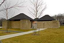
| 109 |
Witherspoon Street School for Colored Children |
|
000000002005-03-09-0000March 9, 2005
(#05000125) |
35 Quarry St.
40°21′19″N 74°39′46″W / 40.355278°N 74.662778°W / 40.355278; -74.662778 (Witherspoon Street School for Colored Children) |
Princeton |
|
| 110 |
Jeremiah Woolsey House |
|
000000001975-01-27-0000January 27, 1975
(#75001140) |
Southwest of Pennington on Washington Crossing Rd.
40°18′32″N 74°49′36″W / 40.308889°N 74.826667°W / 40.308889; -74.826667 (Jeremiah Woolsey House) |
Hopewell Township |
Dutch Colonial house built 1765. Jeremiah Woolsey served as a commissioner to recruit men to serve in the Continental Army during the American Revolution.[29] |


.JPG)


.JPG)
.jpg)

.jpg)


.jpg)