List of Category A listed buildings in Argyll and Bute

This is a list of Category A listed buildings in Argyll and Bute, Scotland.
In Scotland, the term listed building refers to a building or other structure officially designated as being of "special architectural or historic interest".[1] Category A structures are those considered to be "buildings of national or international importance, either architectural or historic, or fine little-altered examples of some particular period, style or building type."[2] Listing was begun by a provision in the Town and Country Planning (Scotland) Act 1947, and the current legislative basis for listing is the Planning (Listed Buildings and Conservation Areas) (Scotland) Act 1997.[3] The authority for listing rests with Historic Scotland, an executive agency of the Scottish Government, which inherited this role from the Scottish Development Department in 1991. Once listed, severe restrictions are imposed on the modifications allowed to a building's structure or its fittings. Listed building consent must be obtained from local authorities prior to any alteration to such a structure.[3] There are approximately 47,400 listed buildings in Scotland, of which around 8% (some 3,800) are Category A.[4] The council area of Argyll and Bute covers 6,909 square kilometres (2,668 sq mi), and has a population of around 90,500. There are 2,031 listed buildings in the area, of which 150 are Category A.[5]
Listed buildings


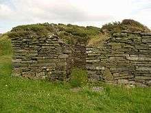


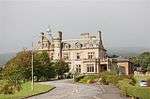
_-_geograph.org.uk_-_2648.jpg)


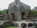
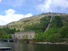
.jpg)


Notes
- ↑ Sometimes known as OSGB36, the grid reference (where provided) is based on the British national grid reference system used by the Ordnance Survey.
• "Guide to National Grid". Ordnance Survey. Retrieved 2007-12-12.
• "Get-a-map". Ordnance Survey. Retrieved 2007-12-17. - ↑ The "HB Number" is a unique number assigned to each listed building by Historic Scotland.
References
- ↑ Guide to the Protection of Scotland’s Listed Buildings (PDF). Historic Scotland. 2009. p. 4. ISBN 978-1-84917-013-0. Retrieved 2010-05-05.
- ↑ "What is Listing?". Historic Scotland. Retrieved 2010-05-05.
- 1 2 Scottish Historic Environment Policy (PDF). Historic Scotland. October 2008. pp. 24–25. ISBN 978-1-84917-002-4. Retrieved 2010-05-05.
- ↑ Guide to the Protection of Scotland’s Listed Buildings, p. 17.
- ↑ "Listed Buildings" (PDF). Argyll and Bute Council. Retrieved 2020-09-07. Check date values in:
|access-date=(help) - ↑ "St. Conan's Church, Listed Building Report". Historic Scotland. Retrieved 2010-05-18.
- ↑ "Old Breacacha Castle, Listed Building Report". Historic Scotland. Retrieved 2010-05-18.
- ↑ "Breacacha Castle, Listed Building Report". Historic Scotland. Retrieved 2011-12-04.
- ↑ "Lochnell House , Listed Building Report". Historic Scotland. Retrieved 2010-05-18.
- ↑ "Lochnell Observatory, Listed Building Report". Historic Scotland. Retrieved 2010-05-18.
- ↑ "Barcaldine Castle, Listed Building Report". Historic Scotland. Retrieved 2010-05-18.
- ↑ "Barbreck House, Listed Building Report". Historic Scotland. Retrieved 2010-05-18.
- ↑ "St Munn's Parish Church , Listed Building Report". Historic Scotland. Retrieved 2010-05-18.
- ↑ "Dunselma, Listed Building Report". Historic Scotland. Retrieved 2010-05-18.
- ↑ "Oronsay Priory, Listed Building Report". Historic Scotland. Retrieved 2010-05-18.
- ↑ "Oronsay Great Cross, Listed Building Report". Historic Scotland. Retrieved 2010-05-18.
- ↑ "Golden Gates, Benmore Botanic Garden, Listed Building Report". Historic Scotland. Retrieved 2010-05-18.
- ↑ "St Peter's College, Listed Building Report". Historic Scotland. Retrieved 2010-05-18.
- ↑ "Old Kilmun House, Listed Building Report". Historic Scotland. Retrieved 2010-05-18.
- ↑ "Auchindrain Township, Listed Building Report". Historic Scotland. Retrieved 2010-05-18.
- ↑ "Carnassarie Castle, Listed Building Report". Historic Scotland. Retrieved 2010-05-18.
- ↑ "Maam Steading, Listed Building Report". Historic Scotland. Retrieved 2010-05-18.
- ↑ "Cherrypark, Listed Building Report". Historic Scotland. Retrieved 2010-05-18.
- ↑ "Carloon, Doocot, Listed Building Report". Historic Scotland. Retrieved 2010-05-18.
- ↑ "Watch Tower, Listed Building Report". Historic Scotland. Retrieved 2010-05-18.
- ↑ "Garden Bridge, Listed Building Report". Historic Scotland. Retrieved 2010-05-18.
- ↑ "Aray Bridge, Listed Building Report". Historic Scotland. Retrieved 2010-05-18.
- ↑ "Garron Lodge, Listed Building Report". Historic Scotland. Retrieved 2010-05-18.
- ↑ "Garron Screen Wall, Listed Building Report". Historic Scotland. Retrieved 2010-05-18.
- ↑ "Garron Bridge, Listed Building Report". Historic Scotland. Retrieved 2010-05-18.
- ↑ "Dubh Loch Bridge, Listed Building Report". Historic Scotland. Retrieved 2010-05-18.
- ↑ "Inveraray Castle, Listed Building Report". Historic Scotland. Retrieved 2010-05-18.
- ↑ "St. Columba's Monastery, Listed Building Report". Historic Scotland. Retrieved 2010-05-18.
- ↑ "Dunderave Castle, Listed Building Report". Historic Scotland. Retrieved 2010-05-18.
- ↑ "Dunans Bridge, Listed Building Report". Historic Scotland. Retrieved 2010-05-18.
- ↑ "Sun-Dial At Ormidale House, Listed Building Report". Historic Scotland. Retrieved 2010-05-18.
- ↑ "Carrick Castle, Listed Building Report". Historic Scotland. Retrieved 2010-05-18.
- ↑ "Kilmorich Kirk, Listed Building Report". Historic Scotland. Retrieved 2010-05-18.
- ↑ "Clachan Bridge, Listed Building Report". Historic Scotland. Retrieved 2010-05-18.
- ↑ "Ardchonnel Castle, Listed Building Report". Historic Scotland. Retrieved 2010-05-18.
- ↑ "Rhinns Of Islay Lighthouse, Listed Building Report". Historic Scotland. Retrieved 2010-05-18.
- ↑ "Dunstaffnage Castle, Listed Building Report". Historic Scotland. Retrieved 2010-05-18.
- ↑ "Dunstaffnage Chapel, Listed Building Report". Historic Scotland. Retrieved 2010-05-18.
- ↑ "Dunollie Castle, Listed Building Report". Historic Scotland. Retrieved 2010-05-18.
- ↑ "Gylen Castle, Listed Building Report". Historic Scotland. Retrieved 2010-05-18.
- ↑ "Killean Chapel (St John's) Killean Burial Ground., Listed Building Report". Historic Scotland. Retrieved 2010-05-18.
- ↑ "Killean House, Listed Building Report". Historic Scotland. Retrieved 2010-05-18.
- ↑ "Killean And Kilchenzie Kirk A'chleit, Listed Building Report". Historic Scotland. Retrieved 2010-05-18.
- ↑ "Mount Stuart House, Listed Building Report". Historic Scotland. Retrieved 2010-05-18.
- ↑ "Mount Stuart, Mausoleum And Graveyard, Listed Building Report". Historic Scotland. Retrieved 2010-05-18.
- ↑ "Mount Stuart, Kerrylamont Farm Dairy, Listed Building Report". Historic Scotland. Retrieved 2010-05-18.
- ↑ "St Blane's Church Including Graveyard, Cauldron And Boundary Wall, Listed Building Report". Historic Scotland. Retrieved 2010-05-18.
- ↑ "Islay House, Listed Building Report". Historic Scotland. Retrieved 2010-05-18.
- ↑ "Islay Woollen Mill And Bridge, Listed Building Report". Historic Scotland. Retrieved 2010-05-18.
- ↑ "Lorne Furnace And Ancillary Buildings, Bonawe, Listed Building Report". Historic Scotland. Retrieved 2010-05-18.
- ↑ "Kilarrow Parish Church, Main Street, Listed Building Report". Historic Scotland. Retrieved 2010-05-18.
- ↑ "Glenorchy Kirk Clachan An Diseart, Listed Building Report". Historic Scotland. Retrieved 2010-05-18.
- ↑ "Kilchurn Castle , Listed Building Report". Historic Scotland. Retrieved 2010-05-18.
- ↑ "St. Kenneth's Chapel Inchkenneth, Listed Building Report". Historic Scotland. Retrieved 2010-05-18.
- ↑ "Iona Abbey, Listed Building Report". Historic Scotland. Retrieved 2010-05-18.
- ↑ "St. Oran's Chapel Reilig Odhrain, Listed Building Report". Historic Scotland. Retrieved 2010-05-18.
- ↑ "Maclean's Cross, Listed Building Report". Historic Scotland. Retrieved 2010-05-18.
- ↑ "Iona Nunnery, Listed Building Report". Historic Scotland. Retrieved 2010-05-18.
- ↑ "Dhu Heartach Lighthouse, Listed Building Report". Historic Scotland. Retrieved 2010-05-18.
- ↑ "Castle Stalker, Listed Building Report". Historic Scotland. Retrieved 2010-05-18.
- ↑ "Lismore Lighthouse Eilean Musdile, Listed Building Report". Historic Scotland. Retrieved 2010-05-18.
- ↑ "Airds House, Listed Building Report". Historic Scotland. Retrieved 2010-05-18.
- ↑ "Islandadd Bridge, Listed Building Report". Historic Scotland. Retrieved 2010-05-18.
- ↑ "Ardkinglas House, Listed Building Report". Historic Scotland. Retrieved 2010-05-18.
- ↑ "Rossdhu House With Walled Garden, Listed Building Report". Historic Scotland. Retrieved 2010-05-18.
- ↑ "Hynish, Harbour And Lighthouse Establishment, Including Signal Tower, Housing, Sheds/Stores, Dam And Walled Enclosures, Listed Building Report". Historic Scotland. Retrieved 2010-05-18.
- ↑ "Skerryvore Lighthouse, Listed Building Report". Historic Scotland. Retrieved 2010-05-18.
- ↑ "3 Kilmoluaig, Listed Building Report". Historic Scotland. Retrieved 2010-05-18.
- ↑ "13 Kilmoluaig, Listed Building Report". Historic Scotland. Retrieved 2010-05-18.
- ↑ "Torosay Castle Statues In Statue Walk, Listed Building Report". Historic Scotland. Retrieved 2010-05-18.
- ↑ "Moy Castle, Lochbuie, Listed Building Report". Historic Scotland. Retrieved 2010-05-18.
- ↑ "Macquarrie Mausoleum Gruline Policies, Listed Building Report". Historic Scotland. Retrieved 2010-05-18.
- ↑ "Duart Castle, Listed Building Report". Historic Scotland. Retrieved 2010-05-18.
- ↑ "Torosay Castle, Listed Building Report". Historic Scotland. Retrieved 2010-05-18.
- ↑ "Wester Kames Tower Including Boundary Fence, Listed Building Report". Historic Scotland. Retrieved 2010-05-18.
- ↑ "Stewart Hall Including Conservatory, Well, Boundary Wall And Gatepiers, Listed Building Report". Historic Scotland. Retrieved 2010-05-18.
- ↑ "Old Castle Lachlan, By Loch Fyne Strathlachlan Estate, Listed Building Report". Historic Scotland. Retrieved 2010-05-18.
- ↑ "Cour House Saddell, Listed Building Report". Historic Scotland. Retrieved 2010-05-18.
- ↑ "Castle Sween, East Shore Of Loch Sween, Listed Building Report". Historic Scotland. Retrieved 2010-05-18.
- ↑ "Saddell Castle, Listed Building Report". Historic Scotland. Retrieved 2010-05-18.
- ↑ "Skipness Castle, Listed Building Report". Historic Scotland. Retrieved 2010-05-18.
- ↑ "St. Brendan's Chapel (Kilbrannan) Skipness Estate, Listed Building Report". Historic Scotland. Retrieved 2010-05-18.
- ↑ "Rhu Village, Rhu Road Lower, Ardencaple Hotel With Former Stables, Cottage Outbuildings And Boundary Wall, Listed Building Report". Historic Scotland. Retrieved 2010-05-18.
- ↑ "Rossdhu Estate, South Lodge And Gate With Railings, Listed Building Report". Historic Scotland. Retrieved 2010-05-18.
- ↑ "Mull Of Kintyre Lighthouse, Listed Building Report". Historic Scotland. Retrieved 2010-05-18.
- ↑ "Old Quay Head, Campbeltown Cross, Listed Building Report". Historic Scotland. Retrieved 2010-05-18.
- ↑ "High Askomil, Bellgrove, With Stable, Laundry, Outbuildings, Boundary Walls, Gates, And Gatepiers, Listed Building Report". Historic Scotland. Retrieved 2010-05-18.
- ↑ "High Askomil, Rothmar, With Garage, Terrace, Boundary And Retaining Walls, Gates And Gatepiers, Listed Building Report". Historic Scotland. Retrieved 2010-05-18.
- ↑ "St John Street And Hall Street, Public Library And Museum, With Librarian's House, Garden, Railings, Gates, And Gatepiers, Listed Building Report". Historic Scotland. Retrieved 2010-05-18.
- ↑ "St. John's Church Of Scotland. Hanover Street And Argyll Street, Listed Building Report". Historic Scotland. Retrieved 2010-05-18.
- ↑ "150 Clyde Street East, Rockland And Sundial, Listed Building Report". Historic Scotland. Retrieved 2010-05-18.
- ↑ "8 Colquhoun Street Upper, The Hill House With Outbuildings, Boundary Walls And Gates, Listed Building Report". Historic Scotland. Retrieved 2010-05-18.
- ↑ "15 Colquhoun Street Upper, The White House With Garage And Boundary Wall, Listed Building Report". Historic Scotland. Retrieved 2010-05-18.
- ↑ "17 Colquhoun Street Upper, Drumadoon (Formerly Morar Lodge) With Gatepiers And Boundary Wall And Garden Pavilion, Listed Building Report". Historic Scotland. Retrieved 2010-05-18.
- ↑ "Dhuhill Drive West, Greycourt, Listed Building Report". Historic Scotland. Retrieved 2010-05-18.
- ↑ "Douglas Drive, Red Towers With Boundary Wall, Gatepiers, Gates And Wellhead, Listed Building Report". Historic Scotland. Retrieved 2010-05-18.
- ↑ "4 Munro Drive West, Brantwoode With Boundary Wall, Gatepiers, Garage And Garden Gate, Listed Building Report". Historic Scotland. Retrieved 2010-05-18.
- ↑ "Rhu Road Lower, Cairndhu House, Listed Building Report". Historic Scotland. Retrieved 2010-05-18.
- ↑ "Rhu Road Lower, Dalmore House, Listed Building Report". Historic Scotland. Retrieved 2010-05-18.
- ↑ "Rossdhu Drive West, Longcroft, Listed Building Report". Historic Scotland. Retrieved 2010-05-18.
- ↑ "38-40 Sinclair Street, Former Helensburgh And Gareloch Conservative Club, Listed Building Report". Historic Scotland. Retrieved 2010-05-18.
- ↑ "Sinclair Street, Hermitage Park, War Memorial And Walled Garden With Ornamental Gates, Listed Building Report". Historic Scotland. Retrieved 2010-05-18.
- ↑ "William Street, St Michael And All Angels' Episcopal Church And Church Hall, Listed Building Report". Historic Scotland. Retrieved 2010-05-18.
- ↑ "Glenaray And Inveraray Parish Church And Church Hall, Church Square, Listed Building Report". Historic Scotland. Retrieved 2010-05-18.
- ↑ "Morrison's Land, N. Main St. W. And Close At Rear., Listed Building Report". Historic Scotland. Retrieved 2010-05-18.
- ↑ "George Hotel, N. Main Street E., Listed Building Report". Historic Scotland. Retrieved 2010-05-18.
- ↑ "Relief Land, 86 Main St. East, Listed Building Report". Historic Scotland. Retrieved 2010-05-18.
- ↑ "Mackenzie's Land, South Main Street West, Listed Building Report". Historic Scotland. Retrieved 2010-05-18.
- ↑ "Black's Land; S. Main St. West, Listed Building Report". Historic Scotland. Retrieved 2010-05-18.
- ↑ "Arkland, S. Main St. West, Listed Building Report". Historic Scotland. Retrieved 2010-05-18.
- ↑ "Post Office, Grocers Shop And House East Front Street, Listed Building Report". Historic Scotland. Retrieved 2010-05-18.
- ↑ "House (Buntain's) East Front Street., Listed Building Report". Historic Scotland. Retrieved 2010-05-18.
- ↑ "House (Miss Maclacklands) Formerly Temperance Hotel E. Front St. And N. Main St. W., Listed Building Report". Historic Scotland. Retrieved 2010-05-18.
- ↑ "Chamberlain's House, West Front Street And N. Main St. W., Listed Building Report". Historic Scotland. Retrieved 2010-05-18.
- ↑ "Town House, W. Front St., Listed Building Report". Historic Scotland. Retrieved 2010-05-18.
- ↑ "'Ivy House' W. Front St., Listed Building Report". Historic Scotland. Retrieved 2010-05-18.
- ↑ "The Avenue Screen Wall, W. Front St., Listed Building Report". Historic Scotland. Retrieved 2010-05-18.
- ↑ "West Front Street And Dalmally Road, The Great Inn, Listed Building Report". Historic Scotland. Retrieved 2010-05-18.
- ↑ "Dalmally Road Screen Wall, W. Front St, Listed Building Report". Historic Scotland. Retrieved 2010-05-18.
- ↑ "The Duke's Tower, (Belfry) Beside All Saints Church, Listed Building Report". Historic Scotland. Retrieved 2010-05-18.
- ↑ "Inveraray Court House, Crown Point., Listed Building Report". Historic Scotland. Retrieved 2010-05-18.
- ↑ "Prison Wall, Crown Point., Listed Building Report". Historic Scotland. Retrieved 2010-05-18.
- ↑ "Factory Land, Listed Building Report". Historic Scotland. Retrieved 2010-05-18.
- ↑ "Ferry Land, Listed Building Report". Historic Scotland. Retrieved 2010-05-18.
- ↑ "'Fern Point' ('Ardrainich'), Listed Building Report". Historic Scotland. Retrieved 2010-05-18.
- ↑ "Inverary Mercat Cross, Listed Building Report". Historic Scotland. Retrieved 2010-05-18.
- ↑ "Corran Esplanade, Cathedral Church Of St Columba, With Boundary Walls (Roman Catholic), Listed Building Report". Historic Scotland. Retrieved 2010-05-18.
- ↑ "High Kirk Of Rothesay, Bute Mausoleum, Listed Building Report". Historic Scotland. Retrieved 2010-05-18.
- ↑ "Columshill Street, St Andrew's Roman Catholic Church, Including Priest's House, Boundary Wall And Piers, Listed Building Report". Historic Scotland. Retrieved 2010-05-18.
- ↑ "Argyle Street, Rothesay Pavilion Including House At Rear And Boundary Wall, Listed Building Report". Historic Scotland. Retrieved 2010-05-18.
- ↑ "Victoria Street, The Winter Gardens, Listed Building Report". Historic Scotland. Retrieved 2010-05-18.
- ↑ "55, 57 And 59 High Street Bute Estate Office Including Outbuilding, Listed Building Report". Historic Scotland. Retrieved 2010-05-18.
- ↑ "Ardencraig Road, Tor House, Including Boundary Wall, Gatepiers And Gates, Listed Building Report". Historic Scotland. Retrieved 2010-05-18.
- ↑ "Gareloch House With Retaining And Boundary Walls And Gatepiers, Listed Building Report". Historic Scotland. Retrieved 2010-05-18.
- ↑ "Rosneath Castle Estate, Bathwell (Near Parkhead), Listed Building Report". Historic Scotland. Retrieved 2010-05-18.
- ↑ "Rosneath Castle Estate, Rosneath Home Farm, Listed Building Report". Historic Scotland. Retrieved 2010-05-18.
- ↑ "Rosneath Point, Ferry Inn, Listed Building Report". Historic Scotland. Retrieved 2010-05-18.
- ↑ "Rosneath Village, St Modan's Parish Church, Listed Building Report". Historic Scotland. Retrieved 2010-05-18.
- ↑ "Cardross, Darleith Road, Saint Mahew's Chapel, Listed Building Report". Historic Scotland. Retrieved 2010-05-18.
- ↑ "Kilkerran Road, Redholme, With Outbuilding, Boundary Walls, Gates And Gatepiers, Listed Building Report". Historic Scotland. Retrieved 2010-05-18.
- ↑ "Sloy Power Station Including Dam, Valve House, Feeder Pipes, Gates, Gatepiers And Boundary Wall, Listed Building Report". Historic Scotland. Retrieved 2010-05-18.
- ↑ "Killean, The Dolls' Houses, Listed Building Report". Historic Scotland. Retrieved 2010-05-18.
- ↑ "Shore Road, Glen Eden With Coach House, Gatepiers, Boundary Wall And Mile Sign, Listed Building Report". Historic Scotland. Retrieved 2010-05-18.
- ↑ "Shore Road, Knockderry Castle With Boundary Walls, Gatepiers And Railings, Listed Building Report". Historic Scotland. Retrieved 2010-05-18.
- ↑ "South Ailey Road, Craig Ailey With Boundary Wall, Gates And Gatepiers, Listed Building Report". Historic Scotland. Retrieved 2010-05-18.
- ↑ "Auchendennan House With Conservatory, Terrace Wall, Fountain, Statury, Listed Building Report". Historic Scotland. Retrieved 2010-05-18.
- ↑ "Darleith Dovecot, Listed Building Report". Historic Scotland. Retrieved 2010-05-18.
- ↑ "Rothesay Castle And Chapel, Listed Building Report". Historic Scotland. Retrieved 2010-05-18.
- ↑ "Ascog, Balmory Road, Balmory House (Former Laidlaw Memorial Home) Including Boundary Walls And Gatepiers, Listed Building Report". Historic Scotland. Retrieved 2010-05-18.
- ↑ "Furnace Village, Former Charcoal Store, Listed Building Report". Historic Scotland. Retrieved 2010-05-18.
External links
![]() Media related to Category A listed buildings in Argyll and Bute at Wikimedia Commons
Media related to Category A listed buildings in Argyll and Bute at Wikimedia Commons