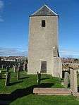
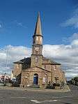
List of Category A listed buildings in Aberdeenshire

Aberdeenshire shown within Scotland

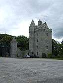
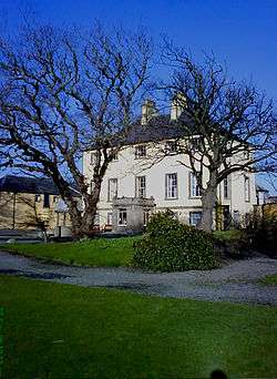
This is a list of Category A listed buildings in Aberdeenshire, north-east Scotland.

In Scotland, the term listed building refers to a building or other structure officially designated as being of "special architectural or historic interest".[1] Category A structures are those considered to be "buildings of national or international importance, either architectural or historic, or fine little-altered examples of some particular period, style or building type."[2] Listing was begun by a provision in the Town and Country Planning (Scotland) Act 1947, and the current legislative basis for listing is the Planning (Listed Buildings and Conservation Areas) (Scotland) Act 1997.[3] The authority for listing rests with Historic Scotland, an executive agency of the Scottish Government, which inherited this role from the Scottish Development Department in 1991. Once listed, severe restrictions are imposed on the modifications allowed to a building's structure or its fittings. Listed building consent must be obtained from local authorities prior to any alteration to such a structure.[3] There are approximately 47,400 listed buildings in Scotland, of which around 8% (some 3,800) are Category A.[4]

The council area of Aberdeenshire covers 6,313 square kilometres (2,437 sq mi), and has a population of around 245,800. There are 195 Category A listed buildings in the area.

Listed buildings

Name Location Date Listed Grid Ref. [note 1] Geo-coordinates Notes HB Number [note 2] Image
Arbuthnott House, North Bridge over Arbuthnott Burn Arbuthnott NO7950475146 56°52′02″N 2°20′16″W / 56.867266°N 2.337811°W / 56.867266; -2.337811 (Arbuthnott House, North Bridge over Arbuthnott Burn) [5] 31

Upload another image

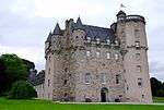
Braemar Castle Braemar NO1560492374 57°00′53″N 3°23′29″W / 57.014753°N 3.391476°W / 57.014753; -3.391476 (Braemar Castle) [6] 36

Upload another image
See more images

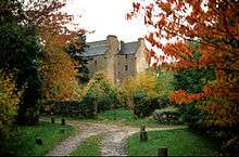
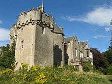
Tilquhillie Castle Banchory NO7217694143 57°02′15″N 2°27′36″W / 57.037533°N 2.460104°W / 57.037533; -2.460104 (Tilquhillie Castle) [7] 38

Upload another image
See more images

Park Bridge over River Dee Drumoak NO7965398179 57°04′27″N 2°20′14″W / 57.074181°N 2.337232°W / 57.074181; -2.337232 (Park Bridge over River Dee) [8] 45

Upload another image

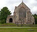
Old Parish Church of Auchindoir Auchindoir, Lumsden NJ4776624559 57°18′31″N 2°52′07″W / 57.308604°N 2.86867°W / 57.308604; -2.86867 (Old Parish Church of Auchindoir) [9] 2732

Upload another image
See more images

Craig Castle Auchindoir, Lumsden NJ4706824826 57°18′39″N 2°52′49″W / 57.310922°N 2.880312°W / 57.310922; -2.880312 (Craig Castle) [10] 2736
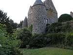
Druminnor Castle Rhynie NJ5131526403 57°19′32″N 2°48′36″W / 57.32556°N 2.810132°W / 57.32556; -2.810132 (Druminnor Castle) [11] 2743
Aberdour House New Aberdour NJ9098163935 57°39′55″N 2°09′10″W / 57.665208°N 2.152832°W / 57.665208; -2.152832 (Aberdour House) [12] 2768
Orrok (or Orrock) House Balmedie 16 April 1971 NJ9640119560 57°16′00″N 2°03′41″W / 57.266685°N 2.061312°W / 57.266685; -2.061312 (Orrok (or Orrock) House) [13] 2778

Upload another image

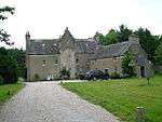
Mounie Castle, original block Daviot NJ7666828671 57°20′53″N 2°23′22″W / 57.347939°N 2.38934°W / 57.347939; -2.38934 (Mounie Castle, original block) [14] 2793

Upload another image
See more images

Benholm Castle Benholm, Gourdon NO8040570430 56°49′30″N 2°19′22″W / 56.82494°N 2.322667°W / 56.82494; -2.322667 (Benholm Castle) [15] 2807
Benholm Parish Church Kirktown of Benholm, Gourdon NO8043869251 56°48′52″N 2°19′19″W / 56.81435°N 2.322035°W / 56.81435; -2.322035 (Benholm Parish Church) [16] 2813

Upload another image

Bourtie Parish Church Bourtie, Oldmeldrum 16 April 1971 NJ8045524860 57°18′50″N 2°19′34″W / 57.313885°N 2.326112°W / 57.313885; -2.326112 (Bourtie Parish Church) [17] 2815

Upload another image
See more images

Bourtie House Bourtie, Oldmeldrum 16 April 1971 NJ7854424047 57°18′23″N 2°21′28″W / 57.306496°N 2.357764°W / 57.306496; -2.357764 (Bourtie House) [18] 2819

Upload another image
See more images

Barra Castle Bourtie, Oldmeldrum 16 April 1971 NJ7922325756 57°19′19″N 2°20′48″W / 57.321879°N 2.346639°W / 57.321879; -2.346639 (Barra Castle) [19] 2821

Upload another image
See more images

Pitcaple Castle Pitcaple, Garioch NJ7273026084 57°19′28″N 2°27′16″W / 57.324482°N 2.454486°W / 57.324482; -2.454486 (Pitcaple Castle) [20] 2830
Chapel of Garioch, Churchyard Gateway (Pittodrie's Yate) Garioch NJ7159124141 57°18′25″N 2°28′23″W / 57.306959°N 2.473175°W / 57.306959; -2.473175 (Chapel of Garioch, Churchyard Gateway (Pittodrie's Yate)) [21] 2846
Arbuthnott Parish Kirk Arbuthnott NO8015574645 56°51′46″N 2°19′38″W / 56.862794°N 2.327093°W / 56.862794; -2.327093 (Arbuthnott Parish Kirk) [22] 2876

Upload another image

Allardyce Castle Inverbervie NO8173673947 56°51′24″N 2°18′04″W / 56.856589°N 2.301114°W / 56.856589; -2.301114 (Allardyce Castle) [23] 2878

Upload another image

Allardyce Castle - Gate Piers Inverbervie NO8172973932 56°51′23″N 2°18′04″W / 56.856454°N 2.301228°W / 56.856454; -2.301228 (Allardyce Castle - Gate Piers) [24] 2879
Arbuthnott House Arbuthnott NO7949875071 56°52′00″N 2°20′16″W / 56.866592°N 2.337903°W / 56.866592; -2.337903 (Arbuthnott House) [25] 2880

Upload another image

Bridge of Alvah Over River Deveron, Banff NJ6802061067 57°38′18″N 2°32′14″W / 57.638397°N 2.537292°W / 57.638397; -2.537292 (Bridge of Alvah) [26] 2883

Upload another image

Fishing Temple, Duff House Banff NJ6906562848 57°39′16″N 2°31′12″W / 57.654467°N 2.520019°W / 57.654467; -2.520019 (Fishing Temple, Duff House) [27] 2885

Upload another image

Dunlugas House Turriff NJ6956055491 57°35′18″N 2°30′39″W / 57.588421°N 2.510796°W / 57.588421; -2.510796 (Dunlugas House) [28] 2888

Upload another image

Dunnottar Castle - Keep Stonehaven NO8804783857 56°56′45″N 2°11′53″W / 56.94582°N 2.198098°W / 56.94582; -2.198098 (Dunnottar Castle - Keep) [29] 2898

Upload another image
See more images

Dunnottar Castle - Entrance Gateway and Guardrooms Stonehaven NO8803883883 56°56′46″N 2°11′54″W / 56.946054°N 2.198247°W / 56.946054; -2.198247 (Dunnottar Castle - Entrance Gateway and Guardrooms) [30] 2919

Upload another image
See more images

Dunnottar Castle - Benholm's Lodgings Stonehaven NO8802883884 56°56′46″N 2°11′54″W / 56.946062°N 2.198412°W / 56.946062; -2.198412 (Dunnottar Castle - Benholm's Lodgings) [31] 2920

Upload another image
See more images

Castle Fraser Kemnay NJ7227612557 57°12′11″N 2°27′38″W / 57.202948°N 2.460506°W / 57.202948; -2.460506 (Castle Fraser) [32] 2924

Upload another image
See more images

Castle Fraser, stable block Kemnay NJ7202912446 57°12′07″N 2°27′52″W / 57.201935°N 2.464581°W / 57.201935; -2.464581 (Castle Fraser, stable block) [33] 2925

Upload another image
See more images

Castle Fraser, sundial Kemnay NJ7233212581 57°12′11″N 2°27′34″W / 57.203167°N 2.459582°W / 57.203167; -2.459582 (Castle Fraser, sundial) [34] 2927
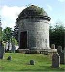
Fraser Mausoleum, Old Churchyard of Cluny Sauchen NJ6848112571 57°12′10″N 2°31′24″W / 57.202827°N 2.523317°W / 57.202827; -2.523317 (Fraser Mausoleum, Old Churchyard of Cluny) [35] 2947

Upload another image

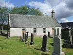
Old Churchyard of Cluny Sauchen NJ6847212563 57°12′10″N 2°31′24″W / 57.202755°N 2.523465°W / 57.202755; -2.523465 (Old Churchyard of Cluny) [36] 2948

Upload another image

Cluny Castle Sauchen NJ6890012743 57°12′16″N 2°30′59″W / 57.204401°N 2.516404°W / 57.204401; -2.516404 (Cluny Castle) [37] 2949

Upload another image
See more images

Tillycairn Castle Sauchen NJ6648311426 57°11′33″N 2°33′22″W / 57.1924°N 2.55623°W / 57.1924; -2.55623 (Tillycairn Castle) [38] 2959
Culsalmond Old Parish Church Kirkton of Culsalmond, Huntly NJ6500732941 57°23′08″N 2°35′01″W / 57.385544°N 2.583704°W / 57.385544; -2.583704 (Culsalmond Old Parish Church) [39] 2960

Upload another image

Crathie Suspension Bridge over River Dee Crathie NO2659994252 57°02′01″N 3°12′40″W / 57.033501°N 3.211007°W / 57.033501; -3.211007 (Crathie Suspension Bridge over River Dee) [40] 2988

Upload another image

Crathie Girder Bridge over River Dee Crathie NO2621094923 57°02′22″N 3°13′03″W / 57.039465°N 3.217611°W / 57.039465; -3.217611 (Crathie Girder Bridge over River Dee) [41] 2989

Upload another image

Abergeldie Castle Deeside NO2870995281 57°02′35″N 3°10′36″W / 57.043074°N 3.176542°W / 57.043074; -3.176542 (Abergeldie Castle) [42] 3005

Upload another image
See more images

Old Invercauld Bridge (Bridge of Dee) Braemar NO1862990942 57°00′09″N 3°20′28″W / 57.002436°N 3.341213°W / 57.002436; -3.341213 (Old Invercauld Bridge (Bridge of Dee)) [43] 3010

Upload another image

Auchanachie Castle Ruthven NJ4985746917 57°30′35″N 2°50′19″W / 57.509651°N 2.838544°W / 57.509651; -2.838544 (Auchanachie Castle) [44] 3016
Parish Church of Crimond Crimond 16 April 1971 NK0538956766 57°36′03″N 1°54′41″W / 57.600876°N 1.911493°W / 57.600876; -1.911493 (Parish Church of Crimond) [45] 3028

Upload another image
See more images

Haddo House, Mains of Haddo Tarves NK0775057166 57°24′11″N 2°13′16″W / 57.403°N 2.221°W / 57.403; -2.221 (Haddo House, Mains of Haddo) [46] 3034

Upload another image
See more images

Finzean Sawmill and Turning Mill Finzean NO5911991586 57°00′49″N 2°40′29″W / 57.013589°N 2.674822°W / 57.013589; -2.674822 (Finzean Sawmill and Turning Mill) [47] 3046

Upload another image

Inchdrewer Castle Banff NJ6559860714 57°38′06″N 2°34′40″W / 57.635048°N 2.577805°W / 57.635048; -2.577805 (Inchdrewer Castle) [48] 3049

Upload another image
See more images

Potarch Bridge over River Dee Potarch, Kincardine O'Neil NO6075997312 57°03′55″N 2°38′55″W / 57.065166°N 2.648714°W / 57.065166; -2.648714 (Potarch Bridge over River Dee) [49] 3095

Upload another image
See more images

Finzean Bucket Mill Finzean NO5776091208 57°00′36″N 2°41′50″W / 57.010071°N 2.697136°W / 57.010071; -2.697136 (Finzean Bucket Mill) [50] 3100

Upload another image

Park House Drumoak NO7800497548 57°04′06″N 2°21′52″W / 57.068436°N 2.364375°W / 57.068436; -2.364375 (Park House) [51] 3103

Upload another image

Drum Castle Drumoak NJ7962000494 57°05′42″N 2°20′17″W / 57.094975°N 2.337966°W / 57.094975; -2.337966 (Drum Castle) [52] 3113

Upload another image

Rhu-Na-Haven Aboyne, Rhu-Na-Haven Road NO5141597740 57°04′05″N 2°48′10″W / 57.068118°N 2.802864°W / 57.068118; -2.802864 (Rhu-Na-Haven) [53] 3126

Upload another image

Dunecht House Dunecht NJ7508307846 57°09′39″N 2°24′49″W / 57.160792°N 2.413574°W / 57.160792; -2.413574 (Dunecht House) [54] 3133

Upload another image
See more images

Echt Parish Church Echt NJ7391105667 57°08′28″N 2°25′58″W / 57.141153°N 2.432721°W / 57.141153; -2.432721 (Echt Parish Church) [55] 3152

Upload another image

Raemoir Hotel Annex - The Ha'hoose Banchory NO6950699526 57°05′09″N 2°30′17″W / 57.085718°N 2.504754°W / 57.085718; -2.504754 (Raemoir Hotel Annex - The Ha'hoose) [56] 3247

Upload another image

Crathes Castle Banchory NO7341396801 57°03′41″N 2°26′24″W / 57.061483°N 2.440004°W / 57.061483; -2.440004 (Crathes Castle) [57] 3262

Upload another image
See more images

Balfluig Castle Alford NJ5864015044 57°13′27″N 2°41′12″W / 57.224256°N 2.686598°W / 57.224256; -2.686598 (Balfluig Castle) [58] 3278

Upload another image
See more images

St Margaret's Episcopal Church Braemar, Castleton Terrace NO1523091377 57°00′21″N 3°23′50″W / 57.005731°N 3.397297°W / 57.005731; -3.397297 (St Margaret's Episcopal Church) [59] 6266

Upload another image

South Colleonard Banff NJ6663562668 57°39′10″N 2°33′39″W / 57.652676°N 2.56071°W / 57.652676; -2.56071 (South Colleonard) [60] 6662

Upload another image

Gairnshiel Bridge over River Gairn Gairnshiel Lodge, Ballater NJ2948800862 57°05′36″N 3°09′55″W / 57.093319°N 3.165277°W / 57.093319; -3.165277 (Gairnshiel Bridge over River Gairn) [61] 6747

Upload another image

Kincardine O'Neil Auld Kirk Kincardine O'Neil, North Deeside Road NO5920799642 57°05′09″N 2°40′29″W / 57.08596°N 2.674685°W / 57.08596; -2.674685 (Kincardine O'Neil Auld Kirk) [62] 6751

Upload another image

Castle of Fiddes Fiddes, Stonehaven NO8242781286 56°55′21″N 2°17′25″W / 56.922544°N 2.290294°W / 56.922544; -2.290294 (Castle of Fiddes) [63] 6753
Balbegno Castle Fettercairn NO6393872989 56°50′49″N 2°35′34″W / 56.846938°N 2.592816°W / 56.846938; -2.592816 (Balbegno Castle) [64] 6754
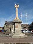
Market Cross of Fettercairn Fettercairn, The Square NO6505273544 56°51′07″N 2°34′29″W / 56.852009°N 2.574631°W / 56.852009; -2.574631 (Market Cross of Fettercairn) [65] 6755

Upload another image

Findlater Castle, Dovecote Sandend NJ5399366742 57°41′17″N 2°46′24″W / 57.68815°N 2.773293°W / 57.68815; -2.773293 (Findlater Castle, Dovecote) [66] 6759

Upload another image

Glassaugh Windmill Sandend NJ5601665713 57°40′45″N 2°44′21″W / 57.679111°N 2.739178°W / 57.679111; -2.739178 (Glassaugh Windmill) [67] 6761

Upload another image

Bridge of Keig over River Don Keig NJ6179218681 57°15′26″N 2°38′06″W / 57.257199°N 2.634964°W / 57.257199; -2.634964 (Bridge of Keig over River Don) [68] 9057
Aquhorthies House Aquhorthies, Inverurie NJ7289220014 57°16′12″N 2°27′04″W / 57.269968°N 2.451128°W / 57.269968; -2.451128 (Aquhorthies House) [69] 9073
Huntly Castle Huntly NJ5319640749 57°27′17″N 2°46′54″W / 57.45461°N 2.781637°W / 57.45461; -2.781637 (Huntly Castle) [70] 9080

Upload another image
See more images

Auchmacoy Dovecot Ellon 16 April 1971 NJ9897331419 57°22′24″N 2°01′07″W / 57.373225°N 2.018724°W / 57.373225; -2.018724 (Auchmacoy Dovecot) [71] 9089

Upload another image
See more images

Kildrummy Parish Church Kildrummy NJ4722717579 57°14′45″N 2°52′34″W / 57.245849°N 2.876125°W / 57.245849; -2.876125 (Kildrummy Parish Church) [72] 9093

Upload another image

Kildrummy Castle Kildrummy NJ4548516390 57°14′06″N 2°54′17″W / 57.234965°N 2.904726°W / 57.234965; -2.904726 (Kildrummy Castle) [73] 9098

Upload another image
See more images

Nether Ardgrain, Farmhouse Ellon 16 April 1971 NJ9529533957 57°23′46″N 2°04′48″W / 57.395999°N 2.079931°W / 57.395999; -2.079931 (Nether Ardgrain, Farmhouse) [74] 9106

Upload another image

Old Parish Church Kirkton of Glenbuchat, Strathdon NJ3756515132 57°13′22″N 3°02′08″W / 57.222653°N 3.035587°W / 57.222653; -3.035587 (Old Parish Church) [75] 9126

Upload another image

Glenbuchat Castle Glenbuchat, Strathdon NJ3971614879 57°13′14″N 3°00′00″W / 57.22067°N 2.999911°W / 57.22067; -2.999911 (Glenbuchat Castle) [76] 9129

Upload another image
See more images

Keith Hall Inverurie NJ7879721193 57°16′51″N 2°21′12″W / 57.280872°N 2.353319°W / 57.280872; -2.353319 (Keith Hall) [77] 9136
Balbithan House Kintore NJ8121418877 57°15′37″N 2°18′47″W / 57.260174°N 2.313055°W / 57.260174; -2.313055 (Balbithan House) [78] 9140
Beldorney Castle River Deveron, west of Huntly NJ4225936980 57°25′10″N 2°57′47″W / 57.419498°N 2.962985°W / 57.419498; -2.962985 (Beldorney Castle) [79] 9164

Upload another image

Foveran Parish Church Turing Slab Foveran NJ9849424141 57°18′28″N 2°01′36″W / 57.307847°N 2.026641°W / 57.307847; -2.026641 (Foveran Parish Church Turing Slab) [80] 9166
Leith Hall Kennethmont, Rhynie NJ5408629789 57°21′23″N 2°45′53″W / 57.35626°N 2.764752°W / 57.35626; -2.764752 (Leith Hall) [81] 9183

Upload another image

Kemnay House Kemnay NJ7336715369 57°13′42″N 2°26′34″W / 57.228272°N 2.442751°W / 57.228272; -2.442751 (Kemnay House) [82] 9212

Upload another image

Mains of Hallhead Hallhead NJ5248309096 57°10′13″N 2°47′15″W / 57.170231°N 2.787415°W / 57.170231; -2.787415 (Mains of Hallhead) [83] 9218

Upload another image

Craigievar Castle Alford NJ5667809486 57°10′27″N 2°43′05″W / 57.174151°N 2.718118°W / 57.174151; -2.718118 (Craigievar Castle) [84] 9229

Upload another image
See more images

Cairness House Fraserburgh 16 April 1971 NK0383160917 57°38′17″N 1°56′15″W / 57.638177°N 1.937497°W / 57.638177; -1.937497 (Cairness House) [85] 9263

Upload another image

Cairness House, Lodges and Gates Fraserburgh 16 April 1971 NK0407561039 57°38′21″N 1°56′00″W / 57.639271°N 1.933408°W / 57.639271; -1.933408 (Cairness House, Lodges and Gates) [86] 9264

Upload another image
See more images

Crimonmogate House Crimond 16 April 1971 NK0399258699 57°37′06″N 1°56′05″W / 57.618253°N 1.934836°W / 57.618253; -1.934836 (Crimonmogate House) [87] 9270

Upload another image
See more images

Muchalls Castle Muchalls NO8918191838 57°01′03″N 2°10′47″W / 57.017543°N 2.179804°W / 57.017543; -2.179804 (Muchalls Castle) [88] 9352

Upload another image

Fetteresso Castle, Doocot Stonehaven NO8438685391 56°57′34″N 2°15′30″W / 56.95949°N 2.258369°W / 56.95949; -2.258369 (Fetteresso Castle, Doocot) [89] 9371

Upload another image

Craigston Castle Turriff NJ7622155021 57°35′05″N 2°23′58″W / 57.5846°N 2.399342°W / 57.5846; -2.399342 (Craigston Castle) [90] 9392

Upload another image
See more images

Old Parish Church of Longside Longside 16 April 1971 NJ0374447226 57°30′18″N 3°36′29″W / 57.504966°N 3.608031°W / 57.504966; -3.608031 (Old Parish Church of Longside) [91] 9410

Upload another image

Churchyard Gateway, Longside Parish Church Longside, Inn Brae 16 April 1971 NJ0373647258 57°30′19″N 3°36′29″W / 57.505251°N 3.608177°W / 57.505251; -3.608177 (Churchyard Gateway, Longside Parish Church) [92] 9412

Upload another image

Frendraught House Glen Dronach, Aberchirder NJ6208841887 57°27′56″N 2°38′01″W / 57.465663°N 2.633641°W / 57.465663; -2.633641 (Frendraught House) [93] 9449

Upload another image

Balbegno Castle Garden And Terrace Walls And Gatepiers Fettercairn NO6394372954 56°50′48″N 2°35′34″W / 56.846624°N 2.592729°W / 56.846624; -2.592729 (Balbegno Castle Garden And Terrace Walls And Gatepiers) [94] 9495
Balbegno Castle, Dovecot Fettercairn NO6402072990 56°50′49″N 2°35′29″W / 56.846953°N 2.591472°W / 56.846953; -2.591472 (Balbegno Castle, Dovecot) [95] 9497

Upload another image

Fasque House Fettercairn NO6483075525 56°52′11″N 2°34′43″W / 56.869787°N 2.578545°W / 56.869787; -2.578545 (Fasque House) [96] 9503

Upload another image
See more images

Fyvie Castle Fyvie NJ7639039306 57°26′36″N 2°23′42″W / 57.443453°N 2.394986°W / 57.443453; -2.394986 (Fyvie Castle) [97] 9615

Upload another image

St Palladius Episcopal Church Drumtochty, Auchenblae NO7074379874 56°54′33″N 2°28′55″W / 56.909266°N 2.482056°W / 56.909266; -2.482056 (St Palladius Episcopal Church) [98] 9634

Upload another image

Phesdo House Fettercairn NO6758675634 56°52′15″N 2°32′00″W / 56.870968°N 2.533352°W / 56.870968; -2.533352 (Phesdo House) [99] 9646
Drumtochty Castle Drumtochty, Auchenblae NO6998480047 56°54′39″N 2°29′40″W / 56.910772°N 2.49454°W / 56.910772; -2.49454 (Drumtochty Castle) [100] 9664

Upload another image

Troup Home Farm, Kiln Barn and Cart Shed Gardenstown NJ8321165686 57°40′51″N 2°16′59″W / 57.680711°N 2.283187°W / 57.680711; -2.283187 (Troup Home Farm, Kiln Barn and Cart Shed) [101] 10585
Birkenbog House Fordyce NJ5366365117 57°40′25″N 2°46′43″W / 57.673521°N 2.778514°W / 57.673521; -2.778514 (Birkenbog House) [102] 10586

Upload another image

Fordyce Castle Fordyce NJ5557963797 57°39′43″N 2°44′46″W / 57.661859°N 2.746151°W / 57.661859; -2.746151 (Fordyce Castle) [103] 10623

Upload another image
See more images

Glassaugh House Dovecot Fordyce NJ5590264787 57°40′15″N 2°44′27″W / 57.670783°N 2.74092°W / 57.670783; -2.74092 (Glassaugh House Dovecot) [104] 10650
Glassaugh House Fordyce NJ5582964773 57°40′14″N 2°44′32″W / 57.67065°N 2.742141°W / 57.67065; -2.742141 (Glassaugh House) [105] 10694
Old Parish Church of St Talorgan Fordyce NJ5557463858 57°39′45″N 2°44′46″W / 57.662407°N 2.746246°W / 57.662407; -2.746246 (Old Parish Church of St Talorgan) [106] 12603

Upload another image

Forglen House Turriff NJ6988751856 57°33′21″N 2°30′18″W / 57.555793°N 2.504875°W / 57.555793; -2.504875 (Forglen House) [107] 13603

Upload another image

Bridge of Dye over Water of Dye South of Strachan NO6510786079 56°57′53″N 2°34′32″W / 56.964614°N 2.575459°W / 56.964614; -2.575459 (Bridge of Dye over Water of Dye) [108] 13878

Upload another image

Terpersie Castle Alford NJ5464420230 57°16′14″N 2°45′13″W / 57.270458°N 2.75372°W / 57.270458; -2.75372 (Terpersie Castle) [109] 13879

Upload another image

Pitsligo Castle Rosehearty 16 April 1971 NJ9373266942 57°41′32″N 2°06′24″W / 57.692265°N 2.106801°W / 57.692265; -2.106801 (Pitsligo Castle) [110] 13884

Upload another image

Marykirk Bridge over River North Esk [note 3] Marykirk NO6859765008 56°46′32″N 2°30′56″W / 56.775583°N 2.515455°W / 56.775583; -2.515455 (Marykirk Bridge over River North Esk [note 3]) [111] 13891
Upper North Water Bridge over River North Esk Marykirk[note 3] NO6527166139 56°47′08″N 2°34′12″W / 56.785506°N 2.570029°W / 56.785506; -2.570029 (Upper North Water Bridge over River North Esk) [112] 13892

Upload another image
See more images

Mounthooley Dovecot Mounthooley, Rosehearty 16 April 1971 NJ9247065945 57°41′00″N 2°07′41″W / 57.68329°N 2.127938°W / 57.68329; -2.127938 (Mounthooley Dovecot) [113] 15909

Upload another image

Hill Kirk (Pitsligo Parish Church of Scotland) Peathill, Rosehearty 16 April 1971 NJ9343866285 57°41′11″N 2°06′42″W / 57.686359°N 2.111715°W / 57.686359; -2.111715 (Hill Kirk (Pitsligo Parish Church of Scotland)) [114] 15911

Upload another image

Old Church of Scotland, Peathill Peathill, Rosehearty 16 April 1971 NJ9339266241 57°41′09″N 2°06′45″W / 57.685963°N 2.112485°W / 57.685963; -2.112485 (Old Church of Scotland, Peathill) [115] 15912

Upload another image

Mains of Pittendrum House Sandhaven 16 April 1971 NJ9644567007 57°41′34″N 2°03′41″W / 57.692879°N 2.061295°W / 57.692879; -2.061295 (Mains of Pittendrum House) [116] 15914

Upload another image

Pittulie Castle Sandhaven 16 April 1971 NJ9451967027 57°41′35″N 2°05′37″W / 57.693039°N 2.093602°W / 57.693039; -2.093602 (Pittulie Castle) [117] 15915

Upload another image

Udny Castle Pitmedden 16 April 1971 NJ8822026789 57°19′53″N 2°11′50″W / 57.331481°N 2.197298°W / 57.331481; -2.197298 (Udny Castle) [118] 15922

Upload another image
See more images

Pitmedden Great Garden Pitmedden 16 April 1971 NJ8854728039 57°20′34″N 2°11′31″W / 57.342718°N 2.191926°W / 57.342718; -2.191926 (Pitmedden Great Garden) [119] 15925

Upload another image
See more images

Glenkindie House Glenbuchat, Strathdon NJ4226914452 57°13′02″N 2°57′27″W / 57.217164°N 2.957542°W / 57.217164; -2.957542 (Glenkindie House) [120] 15945
House of Monymusk Monymusk NJ6888615461 57°13′44″N 2°31′01″W / 57.228814°N 2.516977°W / 57.228814; -2.516977 (House of Monymusk) [121] 15967

Upload another image

Tolquhon Castle Pitmedden 16 April 1971 NJ8726628627 57°20′53″N 2°12′48″W / 57.347966°N 2.213239°W / 57.347966; -2.213239 (Tolquhon Castle) [122] 15980

Upload another image
See more images

Monymusk Parish Church Monymusk NJ6848615248 57°13′37″N 2°31′25″W / 57.226874°N 2.523574°W / 57.226874; -2.523574 (Monymusk Parish Church) [123] 15987

Upload another image

Market Cross Old Rayne NJ6746728308 57°20′39″N 2°32′32″W / 57.344112°N 2.542173°W / 57.344112; -2.542173 (Market Cross) [124] 16019
Straloch House Newmachar NJ8607021057 57°16′48″N 2°13′58″W / 57.279931°N 2.232682°W / 57.279931; -2.232682 (Straloch House) [125] 16125
Harthill Castle Oyne NJ6865925175 57°18′58″N 2°31′19″W / 57.316055°N 2.52197°W / 57.316055; -2.52197 (Harthill Castle) [126] 16132

Upload another image
See more images

Westhall House Oyne NJ6734326652 57°19′45″N 2°32′38″W / 57.329229°N 2.544013°W / 57.329229; -2.544013 (Westhall House) [127] 16134

Upload another image

Cairnbulg Castle Cairnbulg NK0168663964 57°39′56″N 1°58′24″W / 57.665558°N 1.973403°W / 57.665558; -1.973403 (Cairnbulg Castle) [128] 16143

Upload another image
See more images

House of Memsie Memsie 16 April 1971 NJ9730461247 57°38′28″N 2°02′49″W / 57.641147°N 2.046819°W / 57.641147; -2.046819 (House of Memsie) [129] 16146

Upload another image
See more images

Skellater House Strathdon NJ3146510767 57°10′57″N 3°08′07″W / 57.182577°N 3.13538°W / 57.182577; -3.13538 (Skellater House) [130] 16173
Corgarff Castle Corgarff NJ2545208669 57°09′46″N 3°14′03″W / 57.162796°N 3.234196°W / 57.162796; -3.234196 (Corgarff Castle) [131] 16178

Upload another image
See more images

Montgarrie Meal Mill Montgarrie, Alford NJ5747117722 57°14′54″N 2°42′23″W / 57.248203°N 2.706416°W / 57.248203; -2.706416 (Montgarrie Meal Mill) [132] 16207
Meldrum House, outer gate and stable and coachhouse block Oldmeldrum 16 April 1971 NJ8121729095 57°21′07″N 2°18′50″W / 57.351959°N 2.313786°W / 57.351959; -2.313786 (Meldrum House, outer gate and stable and coachhouse block) [133] 16225

Upload another image
See more images

Lickleyhead Castle Auchleven NJ6272423663 57°18′07″N 2°37′13″W / 57.302026°N 2.620269°W / 57.302026; -2.620269 (Lickleyhead Castle) [134] 16234

Upload another image

Midmar Castle Westhill NJ7045205247 57°08′14″N 2°29′23″W / 57.13717°N 2.489824°W / 57.13717; -2.489824 (Midmar Castle) [135] 16262

Upload another image
See more images

Midmar Castle, sundial Westhill NJ7044105240 57°08′14″N 2°29′24″W / 57.137106°N 2.490005°W / 57.137106; -2.490005 (Midmar Castle, sundial) [136] 16263
Midmar Castle, walled garden Westhill NJ7049605246 57°08′14″N 2°29′21″W / 57.137164°N 2.489097°W / 57.137164; -2.489097 (Midmar Castle, walled garden) [137] 16264
Linton House Sauchen NJ7050310012 57°10′48″N 2°29′22″W / 57.179976°N 2.489547°W / 57.179976; -2.489547 (Linton House) [138] 16274
Balmanno House Marykirk NO6913766508 56°47′21″N 2°30′24″W / 56.789094°N 2.506801°W / 56.789094; -2.506801 (Balmanno House) [139] 16278
Inglismaldie Castle, Dovecot Marykirk NO6422866573 56°47′22″N 2°35′14″W / 56.789325°N 2.587159°W / 56.789325; -2.587159 (Inglismaldie Castle, Dovecot) [140] 16289

Upload another image

Forebank House Marykirk NO7009564722 56°46′23″N 2°29′27″W / 56.773113°N 2.490911°W / 56.773113; -2.490911 (Forebank House) [141] 16328

Upload another image

Lower North Water Bridge over River North Esk Marykirk[note 3] NO7245862178 56°45′01″N 2°27′07″W / 56.750405°N 2.451975°W / 56.750405; -2.451975 (Lower North Water Bridge over River North Esk) [142] 16330

Upload another image
See more images

Buchan Ness Lighthouse Boddam 16 April 1971 NK1362442263 57°28′14″N 1°46′28″W / 57.470433°N 1.774514°W / 57.470433; -1.774514 (Buchan Ness Lighthouse) [143] 16367

Upload another image
See more images

Towie Barclay Castle Turriff NJ7443443936 57°29′06″N 2°25′41″W / 57.484935°N 2.428058°W / 57.484935; -2.428058 (Towie Barclay Castle) [144] 16405

Upload another image
See more images

Delgatie Castle Turriff NJ7544550532 57°32′39″N 2°24′43″W / 57.544238°N 2.411864°W / 57.544238; -2.411864 (Delgatie Castle) [145] 16421

Upload another image
See more images

Hatton Castle Turriff NJ7571346976 57°30′44″N 2°24′25″W / 57.512311°N 2.407031°W / 57.512311; -2.407031 (Hatton Castle) [146] 16431

Upload another image

Episcopal Church of St. John the Evangelist New Pitsligo, High Street 16 April 1971 NJ8829655913 57°35′35″N 2°11′51″W / 57.59309°N 2.197443°W / 57.59309; -2.197443 (Episcopal Church of St. John the Evangelist) [147] 16440

Upload another image
See more images

Haddo House Tarves NJ8685334753 57°24′11″N 2°13′14″W / 57.402981°N 2.220432°W / 57.402981; -2.220432 (Haddo House) [148] 16470

Upload another image
See more images

Tower lodges and gates and Loch of Skene boathouse, Dunecht House Dunecht NJ7854308046 57°09′46″N 2°21′23″W / 57.162764°N 2.356391°W / 57.162764; -2.356391 (Tower lodges and gates and Loch of Skene boathouse, Dunecht House) [149] 16505

Upload another image

Garlogie Village Hall, Turbine and Engine House Garlogie NJ7822505494 57°08′23″N 2°21′41″W / 57.139825°N 2.361425°W / 57.139825; -2.361425 (Garlogie Village Hall, Turbine and Engine House) [150] 16506

Upload another image

Skene House Skene NJ7678409702 57°10′39″N 2°23′08″W / 57.177553°N 2.385627°W / 57.177553; -2.385627 (Skene House) [151] 16530
Strichen Town House Strichen, High Street 16 April 1971 NJ9466855163 57°35′11″N 2°05′27″W / 57.586475°N 2.090836°W / 57.586475; -2.090836 (Strichen Town House) [152] 16551

Upload another image
See more images

Blairs College New Chapel Maryculter NJ8833400914 57°05′57″N 2°11′39″W / 57.099053°N 2.194179°W / 57.099053; -2.194179 (Blairs College New Chapel) [153] 19227

Upload another image

Park House Cornhill NJ5890357142 57°36′09″N 2°41′22″W / 57.602403°N 2.689313°W / 57.602403; -2.689313 (Park House) [154] 19597

Upload another image

Crombie Castle Marnoch, Aberchirder NJ5910252250 57°33′31″N 2°41′07″W / 57.558482°N 2.685157°W / 57.558482; -2.685157 (Crombie Castle) [155] 19602

Upload another image
See more images

Kinnairdy Castle Marnoch, Aberchirder NJ6089249812 57°32′12″N 2°39′17″W / 57.536743°N 2.654851°W / 57.536743; -2.654851 (Kinnairdy Castle) [156] 19606

Upload another image

Marnoch Graveyard Marnoch, Aberchirder NJ5949149928 57°32′16″N 2°40′42″W / 57.537662°N 2.678268°W / 57.537662; -2.678268 (Marnoch Graveyard) [157] 19610

Upload another image

Tolquhon Monument, Tarves Churchyard Tarves 16 April 1971 NJ8690631179 57°22′15″N 2°13′10″W / 57.370879°N 2.219358°W / 57.370879; -2.219358 (Tolquhon Monument, Tarves Churchyard) [158] 19770

Upload another image

Glen O'Dee Hospital Banchory NO6847696718 57°03′38″N 2°31′17″W / 57.060425°N 2.521393°W / 57.060425; -2.521393 (Glen O'Dee Hospital) [159] 21871

Upload another image

Banff Town and Country Club Banff, Boyndie Street NJ6883264023 57°39′54″N 2°31′27″W / 57.665005°N 2.524075°W / 57.665005; -2.524075 (Banff Town and Country Club) [160] 21885
Bridge of Banff over River Deveron Banff NJ6947363779 57°39′46″N 2°30′48″W / 57.662857°N 2.513301°W / 57.662857; -2.513301 (Bridge of Banff over River Deveron) [161] 21893

Upload another image

Banff Town Hall Banff, Castle Street NJ6883864205 57°40′00″N 2°31′26″W / 57.66664°N 2.523998°W / 57.66664; -2.523998 (Banff Town Hall) [162] 21941

Upload another image

Banff Castle Banff, Castle Street NJ6893664201 57°40′00″N 2°31′20″W / 57.666611°N 2.522355°W / 57.666611; -2.522355 (Banff Castle) [163] 21957

Upload another image
See more images

Duff House Banff NJ6906363317 57°39′31″N 2°31′12″W / 57.658679°N 2.520113°W / 57.658679; -2.520113 (Duff House) [164] 21985

Upload another image
See more images

Duff House, Mausoleum Banff NJ6804362826 57°39′15″N 2°32′14″W / 57.654198°N 2.53714°W / 57.654198; -2.53714 (Duff House, Mausoleum) [165] 21988

Upload another image

Old St Mary's Burial Ground Banff, Church Street NJ6904864056 57°39′55″N 2°31′14″W / 57.665316°N 2.520459°W / 57.665316; -2.520459 (Old St Mary's Burial Ground) [166] 22003

Upload another image

1 High Shore Banff NJ6901164008 57°39′54″N 2°31′16″W / 57.664882°N 2.521073°W / 57.664882; -2.521073 (1 High Shore) [167] 22004

Upload another image

Banff Primary School (former Banff Academy) Banff, Institution Terrace NJ6881463761 57°39′46″N 2°31′28″W / 57.66265°N 2.524343°W / 57.66265; -2.524343 (Banff Primary School (former Banff Academy)) [168] 22035
8-16 (even nos) Low Street, (former Fife Arms) Banff NJ6899663834 57°39′48″N 2°31′17″W / 57.663318°N 2.521302°W / 57.663318; -2.521302 (8-16 (even nos) Low Street, (former Fife Arms)) [169] 22056

Upload another image

Tolbooth Steeple Banff, Low Street NJ6898963949 57°39′52″N 2°31′17″W / 57.664351°N 2.521434°W / 57.664351; -2.521434 (Tolbooth Steeple) [170] 22062

Upload another image

Town House Banff, Low Street NJ6898863963 57°39′52″N 2°31′17″W / 57.664477°N 2.521453°W / 57.664477; -2.521453 (Town House) [171] 22063

Upload another image

Quayside, Banff Harbour Banff NJ6888364581 57°40′12″N 2°31′24″W / 57.67002°N 2.523293°W / 57.67002; -2.523293 (Quayside, Banff Harbour) [172] 22077

Upload another image

St Catherine's Banff, St Catherine Street NJ6884264326 57°40′04″N 2°31′26″W / 57.667727°N 2.523947°W / 57.667727; -2.523947 (St Catherine's) [173] 22098
Ingleneuk House Banff, Water Path NJ6898864055 57°39′55″N 2°31′17″W / 57.665303°N 2.521465°W / 57.665303; -2.521465 (Ingleneuk House) [174] 22111
Ellon Castle (Old) Sundial at Central Avenue of Garden Ellon NJ9600030669 57°21′59″N 2°04′05″W / 57.366471°N 2.068146°W / 57.366471; -2.068146 (Ellon Castle (Old) Sundial at Central Avenue of Garden) [175] 31108

Upload another image

Old Bridge of Ellon Ellon 16 April 1971 NJ9569930333 57°21′48″N 2°04′23″W / 57.36345°N 2.073144°W / 57.36345; -2.073144 (Old Bridge of Ellon) [176] 31110

Upload another image
See more images

St. Mary on the Rock Episcopal Church Ellon 16 April 1971 NJ9578930139 57°21′42″N 2°04′18″W / 57.361708°N 2.071644°W / 57.361708; -2.071644 (St. Mary on the Rock Episcopal Church) [177] 31111

Upload another image

Market Cross Saltoun Square Fraserburgh 16 April 1971 NJ9979167095 57°41′37″N 2°00′19″W / 57.693684°N 2.00517°W / 57.693684; -2.00517 (Market Cross Saltoun Square) [178] 31867

Upload another image
See more images

Custom House (formerly occupied by Bank of Scotland) Fraserburgh, Broad Street 16 April 1971 NJ9979166932 57°41′32″N 2°00′19″W / 57.69222°N 2.00517°W / 57.69222; -2.00517 (Custom House (formerly occupied by Bank of Scotland)) [179] 31873

Upload another image
See more images

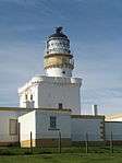
Kinnaird's Head Castle Lighthouse Fraserburgh 16 April 1971 NJ9986467528 57°41′51″N 2°00′14″W / 57.697574°N 2.003946°W / 57.697574; -2.003946 (Kinnaird's Head Castle Lighthouse) [180] 31888

Upload another image
See more images

Wine Tower Fraserburgh 16 April 1971 NJ9993767510 57°41′51″N 2°00′10″W / 57.697412°N 2.002721°W / 57.697412; -2.002721 (Wine Tower) [181] 31889

Upload another image
See more images

Gordon's Schools (original building only) Huntly, Castle Road NJ5308940302 57°27′02″N 2°47′00″W / 57.450584°N 2.783334°W / 57.450584; -2.783334 (Gordon's Schools (original building only)) [182] 34943

Upload another image

St. Margaret's R.C. Church Huntly, Westpark Street and Chapel Street NJ5283840172 57°26′58″N 2°47′15″W / 57.449391°N 2.787491°W / 57.449391; -2.787491 (St. Margaret's R.C. Church) [183] 34945

Upload another image

Scott's Hospital Huntly, Gladstone Road NJ5322039670 57°26′42″N 2°46′52″W / 57.444921°N 2.781031°W / 57.444921; -2.781031 (Scott's Hospital) [184] 34962

Upload another image

Old Bervie Bridge over Bervie Water Inverbervie NO8315172909 56°50′50″N 2°16′40″W / 56.847318°N 2.277842°W / 56.847318; -2.277842 (Old Bervie Bridge over Bervie Water) [185] 35070

Upload another image

Kintore Town House Kintore, The Square NJ7923816317 57°14′14″N 2°20′44″W / 57.237093°N 2.345594°W / 57.237093; -2.345594 (Kintore Town House) [186] 36312

Upload another image

Old St. Peter's Church Peterhead, South Road 16 April 1971 NK1264746055 57°30′16″N 1°47′26″W / 57.504522°N 1.790607°W / 57.504522; -1.790607 (Old St. Peter's Church) [187] 39668

Upload another image

Peterhead Old Parish Church Peterhead, Erroll Street 16 April 1971 NK1312046103 57°30′18″N 1°46′58″W / 57.50494°N 1.782712°W / 57.50494; -1.782712 (Peterhead Old Parish Church) [188] 39671

Upload another image

23, 25 and 27 North High Street Portsoy NJ5887266218 57°41′02″N 2°41′29″W / 57.683917°N 2.69138°W / 57.683917; -2.69138 (23, 25 and 27 North High Street) [189] 40262

Upload another image

16, 18, 20 North High Street 'Old Star Inn' Portsoy NJ5888366217 57°41′02″N 2°41′28″W / 57.683909°N 2.691195°W / 57.683909; -2.691195 (16, 18, 20 North High Street 'Old Star Inn') [190] 40268
10 Shorehead Portsoy NJ5884866309 57°41′05″N 2°41′30″W / 57.684733°N 2.691798°W / 57.684733; -2.691798 (10 Shorehead) [191] 40292
Corf Warehouse (Portsoy Marble) Portsoy, Shorehead NJ5885566331 57°41′06″N 2°41′30″W / 57.684931°N 2.691684°W / 57.684931; -2.691684 (Corf Warehouse (Portsoy Marble)) [192] 40293

Upload another image

Old Harbour Portsoy, Shorehead NJ5889466347 57°41′06″N 2°41′28″W / 57.685078°N 2.691033°W / 57.685078; -2.691033 (Old Harbour) [193] 40296

Upload another image

St James the Great Episcopal Church Stonehaven, Arbuthnott Street NO8733285710 56°57′45″N 2°12′36″W / 56.962447°N 2.209944°W / 56.962447; -2.209944 (St James the Great Episcopal Church) [194] 41552

Upload another image

Rivendell, former textile yard including sea wall Stonehaven, Keith Place NO8772185557 56°57′40″N 2°12′13″W / 56.961083°N 2.20354°W / 56.961083; -2.20354 (Rivendell, former textile yard including sea wall) [195] 41638
Old Tolbooth of Stonehaven Stonehaven, Old Pier NO8780485521 56°57′39″N 2°12′08″W / 56.960762°N 2.202173°W / 56.960762; -2.202173 (Old Tolbooth of Stonehaven) [196] 41655

Upload another image

Old Parish Church of St. Congan Turriff NJ7223149831 57°32′16″N 2°27′56″W / 57.537755°N 2.465474°W / 57.537755; -2.465474 (Old Parish Church of St. Congan) [197] 42163

Upload another image

St Thomas's Episcopal Church Aboyne, Ballater Road NO5201698556 57°04′32″N 2°47′35″W / 57.07551°N 2.79311°W / 57.07551; -2.79311 (St Thomas's Episcopal Church) [198] 47053

Upload another image

Auchtavan, Cottage Auchtavan, Royal Deeside NO2060095600 57°02′41″N 3°18′37″W / 57.044612°N 3.310246°W / 57.044612; -3.310246 (Auchtavan, Cottage) [199] 50074

Upload another image

Notes

  1. Sometimes known as OSGB36, the grid reference (where provided) is based on the British national grid reference system used by the Ordnance Survey.
    "Guide to National Grid". Ordnance Survey. Retrieved 2007-12-12.
    "Get-a-map". Ordnance Survey. Retrieved 2007-12-17.
  2. The "HB Number" is a unique number assigned to each listed building by Historic Scotland.
  3. 1 2 3 4 Also in Angus, as it crosses River North Esk, which is the council boundary

References

  1. Guide to the Protection of Scotland’s Listed Buildings (PDF). Historic Scotland. 2009. p. 4. ISBN 978-1-84917-013-0. Retrieved 2010-05-05.
  2. "What is Listing?". Historic Scotland. Retrieved 2010-05-05.
  3. 1 2 Scottish Historic Environment Policy (PDF). Historic Scotland. October 2008. pp. 24–25. ISBN 978-1-84917-002-4. Retrieved 2010-05-05.
  4. Guide to the Protection of Scotland’s Listed Buildings, p. 17.
  5. "Arbuthnott House, North Bridge Over Arbuthnott Burn: Listed Building Report". Historic Scotland.
  6. "Braemar Castle: Listed Building Report". Historic Scotland.
  7. "Tilquhillie Castle: Listed Building Report". Historic Scotland.
  8. "Park Bridge Over River Dee: Listed Building Report". Historic Scotland.
  9. "Old Parish Church Of Auchindoir: Listed Building Report". Historic Scotland.
  10. "Craig Castle: Listed Building Report". Historic Scotland.
  11. "Druminnor Castle: Listed Building Report". Historic Scotland.
  12. "Aberdour House: Listed Building Report". Historic Scotland.
  13. "Orrok (Or Orrock) House: Listed Building Report". Historic Scotland.
  14. "Mounie Castle, Original Block.: Listed Building Report". Historic Scotland.
  15. "Benholm Castle: Listed Building Report". Historic Scotland.
  16. "Kirktown Of Benholm, Former Parish Church Including Graveyard, Boundary Walls, Gatepiers And Gates: Listed Building Report". Historic Scotland.
  17. "Bourtie Parish Church: Listed Building Report". Historic Scotland.
  18. "Bourtie House: Listed Building Report". Historic Scotland.
  19. "Barra Castle: Listed Building Report". Historic Scotland.
  20. "Pitcaple Castle: Listed Building Report". Historic Scotland.
  21. "Chapel Of Garioch, Churchyard Gateway. (Pittodrie's Yate): Listed Building Report". Historic Scotland.
  22. "Arbuthnott Parish Kirk: Listed Building Report". Historic Scotland.
  23. "Allardyce Castle: Listed Building Report". Historic Scotland.
  24. "Allardyce Castle - Gate Piers: Listed Building Report". Historic Scotland.
  25. "Arbuthnott House: Listed Building Report". Historic Scotland.
  26. "Bridge Of Alvah: Listed Building Report". Historic Scotland.
  27. "Duff House, Fishing Temple: Listed Building Report". Historic Scotland.
  28. "Dunlugas House: Listed Building Report". Historic Scotland.
  29. "Dunnottar Castle - Keep: Listed Building Report". Historic Scotland.
  30. "Dunnottar Castle - Entrance Gateway And Guardrooms: Listed Building Report". Historic Scotland.
  31. "Dunnottar Castle - Benholms Lodgings: Listed Building Report". Historic Scotland.
  32. "Castle Fraser: Listed Building Report". Historic Scotland.
  33. "Castle Fraser, Stableblock (Now Present Mansionhouse And Estate Office): Listed Building Report". Historic Scotland.
  34. "Castle Fraser Sundial: Listed Building Report". Historic Scotland.
  35. "Fraser Mausoleum Old Churchyard Of Cluny: Listed Building Report". Historic Scotland.
  36. "Old Churchyard Of Cluny: Listed Building Report". Historic Scotland.
  37. "Cluny Castle: Listed Building Report". Historic Scotland.
  38. "Tillycairn Castle: Listed Building Report". Historic Scotland.
  39. "Culsalmond Old Parish Church Culsalmond Burial Ground: Listed Building Report". Historic Scotland.
  40. "Crathie Suspension Bridge Over River Dee: Listed Building Report". Historic Scotland.
  41. "Crathie Girder Bridge Over River Dee: Listed Building Report". Historic Scotland.
  42. "Abergeldie Castle: Listed Building Report". Historic Scotland.
  43. "Old Invercauld Bridge (Bridge Of Dee): Listed Building Report". Historic Scotland.
  44. "Auchanachie Castle: Listed Building Report". Historic Scotland.
  45. "Parish Church Of Crimond Including Enclosing Walls Railings And Gates: Listed Building Report". Historic Scotland.
  46. "Haddo House Mains Of Haddo: Listed Building Report". Historic Scotland.
  47. "Finzean, Sawmill And Turning Mill, Including Lade, Weir, Sluice Gate, Generator House, Kiln, Stack, Smiddy, Former Bus Garage, Mill Cottage, Ancillary Structures And Bridge Over Water Feugh: Listed Building Report". Historic Scotland.
  48. "Inchdrewer Castle: Listed Building Report". Historic Scotland.
  49. "Potarch Bridge, Over River Dee: Listed Building Report". Historic Scotland.
  50. "Finzean, Bucket Mill, Including Sawmill, Lade, Weir, Sluice Gate, Kiln, Stable And Cart House (Shop), And Cottage: Listed Building Report". Historic Scotland.
  51. "Park House: Listed Building Report". Historic Scotland.
  52. "Drum Castle: Listed Building Report". Historic Scotland.
  53. "Aboyne, Rhu-Na-Haven Road, Rhu-Na-Haven, And Garden Ornaments, Including Statuary, Urns, Paving, Walls And Rustic Timber Ancillary Structure: Listed Building Report". Historic Scotland.
  54. "Dunecht House: Listed Building Report". Historic Scotland.
  55. "Echt Parish Church: Listed Building Report". Historic Scotland.
  56. "Raemoir Hotel Annex - The Ha'hoose: Listed Building Report". Historic Scotland.
  57. "Crathes Castle: Listed Building Report". Historic Scotland.
  58. "Balfluig Castle: Listed Building Report". Historic Scotland.
  59. "Braemar Village Castleton Terrace St Margaret's Episcopal Church: Listed Building Report". Historic Scotland.
  60. "South Colleonard With Urns, Gates And Gatepiers: Listed Building Report". Historic Scotland.
  61. "Gairnshiel Bridge Over River Gairn: Listed Building Report". Historic Scotland.
  62. "Kincardine O'neil Auld Kirk: Listed Building Report". Historic Scotland.
  63. "Castle Of Fiddes: Listed Building Report". Historic Scotland.
  64. "Balbegno Castle: Listed Building Report". Historic Scotland.
  65. "Fettercairn, Market Cross Of Fettercairn: Listed Building Report". Historic Scotland.
  66. "Findlater Castle, Dovecote: Listed Building Report". Historic Scotland.
  67. "Glassaugh Windmill: Listed Building Report". Historic Scotland.
  68. "Bridge Of Keig Over River Don: Listed Building Report". Historic Scotland.
  69. "Aquahorthies House: Listed Building Report". Historic Scotland.
  70. "Huntly Castle: Listed Building Report". Historic Scotland.
  71. "Auchmacoy Dovecot: Listed Building Report". Historic Scotland.
  72. "Kildrummy Parish Church: Listed Building Report". Historic Scotland.
  73. "Kildrummy Castle: Listed Building Report". Historic Scotland.
  74. "Nether Ardgrain, Farmhouse: Listed Building Report". Historic Scotland.
  75. "Old Parish Church: Listed Building Report". Historic Scotland.
  76. "Glenbuchat Castle: Listed Building Report". Historic Scotland.
  77. "Keith Hall: Listed Building Report". Historic Scotland.
  78. "Balbithan House: Listed Building Report". Historic Scotland.
  79. "Beldorney Castle: Listed Building Report". Historic Scotland.
  80. "Foveran Parish Church Turing Slab: Listed Building Report". Historic Scotland.
  81. "Leith Hall.: Listed Building Report". Historic Scotland.
  82. "Kemnay House: Listed Building Report". Historic Scotland.
  83. "Hallhead, Mains Of Hallhead.: Listed Building Report". Historic Scotland.
  84. "Craigievar Castle: Listed Building Report". Historic Scotland.
  85. "Cairness House: Listed Building Report". Historic Scotland.
  86. "Cairness House Lodges And Gates: Listed Building Report". Historic Scotland.
  87. "Crimonmogate House: Listed Building Report". Historic Scotland.
  88. "Muchalls Castle: Listed Building Report". Historic Scotland.
  89. "Fetteresso Castle - Doocot: Listed Building Report". Historic Scotland.
  90. "Craigston Castle: Listed Building Report". Historic Scotland.
  91. "Old Parish Church Of Longside: Listed Building Report". Historic Scotland.
  92. "Churchyard Gateway, Longside Parish Church: Listed Building Report". Historic Scotland.
  93. "Frendraught House: Listed Building Report". Historic Scotland.
  94. "Balbegno Castle Garden And Terrace Walls And Gatepiers: Listed Building Report". Historic Scotland.
  95. "Balbegno Castle, Dovecot: Listed Building Report". Historic Scotland.
  96. "Fasque House: Listed Building Report". Historic Scotland.
  97. "Fyvie Castle: Listed Building Report". Historic Scotland.
  98. "St Palladius Episcopal Church, Drumtochty: Listed Building Report". Historic Scotland.
  99. "Phesdo House: Listed Building Report". Historic Scotland.
  100. "Drumtochty Castle: Listed Building Report". Historic Scotland.
  101. "Troup Home Farm, Kiln Barn And Cart Shed: Listed Building Report". Historic Scotland.
  102. "Birkenbog House, Rear Walled Garden And Flanking Range: Listed Building Report". Historic Scotland.
  103. "Fordyce Village, Fordyce Castle: Listed Building Report". Historic Scotland.
  104. "Glassaugh House Dovecot: Listed Building Report". Historic Scotland.
  105. "Glassaugh House: Listed Building Report". Historic Scotland.
  106. "Fordyce Village, Old Parish Church Of St Talorgan And Walled Burial Ground: Listed Building Report". Historic Scotland.
  107. "Forglen House: Listed Building Report". Historic Scotland.
  108. "Bridge Of Dye Over Water Of Dye: Listed Building Report". Historic Scotland.
  109. "Terpersie Castle: Listed Building Report". Historic Scotland.
  110. "Pitsligo Castle: Listed Building Report". Historic Scotland.
  111. "Marykirk Bridge Over River North Esk: Listed Building Report". Historic Scotland.
  112. "Upper North Water Bridge: Listed Building Report". Historic Scotland.
  113. "Mounthooley Dovecot: Listed Building Report". Historic Scotland.
  114. "Peathill, Hill Kirk (Pitsligo Parish Church Of Scotland): Listed Building Report". Historic Scotland.
  115. "Peathill, Old Church Of Scotland: Listed Building Report". Historic Scotland.
  116. "Pittendrum, Mains Of Pittendrum House: Listed Building Report". Historic Scotland.
  117. "Pittulie Castle: Listed Building Report". Historic Scotland.
  118. "Udny Castle: Listed Building Report". Historic Scotland.
  119. "Pitmedden Great Garden: Listed Building Report". Historic Scotland.
  120. "Glenkindie House: Listed Building Report". Historic Scotland.
  121. "House Of Monymusk: Listed Building Report". Historic Scotland.
  122. "Tolquhon Castle: Listed Building Report". Historic Scotland.
  123. "Monymusk Parish Church (Augustinian Priory Church Of The Blessed Mary Of Monymusk): Listed Building Report". Historic Scotland.
  124. "Market Cross, Old Rayne: Listed Building Report". Historic Scotland.
  125. "Straloch House: Listed Building Report". Historic Scotland.
  126. "Harthill Castle: Listed Building Report". Historic Scotland.
  127. "Westhall House: Listed Building Report". Historic Scotland.
  128. "Cairnbulg Castle: Listed Building Report". Historic Scotland.
  129. "House Of Memsie: Listed Building Report". Historic Scotland.
  130. "Skellater House: Listed Building Report". Historic Scotland.
  131. "Corgarff Castle: Listed Building Report". Historic Scotland.
  132. "Montgarrie Meal Mill: Listed Building Report". Historic Scotland.
  133. "Meldrum House Outer Gate And Stable And Coachhouse Block: Listed Building Report". Historic Scotland.
  134. "Lickleyhead Castle: Listed Building Report". Historic Scotland.
  135. "Midmar Castle: Listed Building Report". Historic Scotland.
  136. "Midmar Castle, Sundial: Listed Building Report". Historic Scotland.
  137. "Midmar Castle, Walled Garden: Listed Building Report". Historic Scotland.
  138. "Linton House: Listed Building Report". Historic Scotland.
  139. "Balmanno House, Including Outbuildings Garden Walls And Coachhouse: Listed Building Report". Historic Scotland.
  140. "Inglismaldie Castle, Dovecot: Listed Building Report". Historic Scotland.
  141. "Forebank House Including Steading Outbuildings, Garden Walls Railings And Gates: Listed Building Report". Historic Scotland.
  142. "Lower North Water Bridge Over North Esk, Including Approaches: Listed Building Report". Historic Scotland.
  143. "Buchanness Lighthouse: Listed Building Report". Historic Scotland.
  144. "Towie Barclay Castle: Listed Building Report". Historic Scotland.
  145. "Delgatie Castle: Listed Building Report". Historic Scotland.
  146. "Hatton Castle: Listed Building Report". Historic Scotland.
  147. "Episcopal Church Of St. John The Evangelist, High Street Including Wall And Railings To High Street.: Listed Building Report". Historic Scotland.
  148. "Haddo House: Listed Building Report". Historic Scotland.
  149. "Tower Lodges And Gates And Loch Of Skene Boathouse, Dunecht House: Listed Building Report". Historic Scotland.
  150. "Garlogie Village Hall, Turbine And Engine House: Listed Building Report". Historic Scotland.
  151. "Skene House, Including Terrace And Garden Ornaments.: Listed Building Report". Historic Scotland.
  152. "Town House High Street And Bridge Street: Listed Building Report". Historic Scotland.
  153. "Blairs College New Chapel: Listed Building Report". Historic Scotland.
  154. "Park: Listed Building Report". Historic Scotland.
  155. "Crombie Castle: Listed Building Report". Historic Scotland.
  156. "Kinnairdy Castle With Outbuildings: Listed Building Report". Historic Scotland.
  157. "Marnoch Graveyard With Watchhouse, Burial Enclosures And Gravestones: Listed Building Report". Historic Scotland.
  158. "Tolquhon Monument, Tarves Churchyard: Listed Building Report". Historic Scotland.
  159. "Banchory Glen O'dee Hospital: Listed Building Report". Historic Scotland.
  160. "11 Boyndie Street, Banff Town And Country Club And Enclosing Walls: Listed Building Report". Historic Scotland.
  161. "Bridge Of Banff Over River Deveron: Listed Building Report". Historic Scotland.
  162. "31, 33, 35 Castle Street And 2 Seafield Street, Town Hall: Listed Building Report". Historic Scotland.
  163. "Castle Street, Banff Castle, With Flanking Pavilions, Well And Old Castle Walls: Listed Building Report". Historic Scotland.
  164. "Duff House: Listed Building Report". Historic Scotland.
  165. "Duff House Mausoleum: Listed Building Report". Historic Scotland.
  166. "High Shore, Old St Mary's Burial Ground And Railings: Listed Building Report". Historic Scotland.
  167. "1 High Shore: Listed Building Report". Historic Scotland.
  168. "Institution Terrace, Banff Primary School (Former Banff Academy) With Lamp Standards: Listed Building Report". Historic Scotland.
  169. "8-16 (Even Nos) Low Street, (Former Fife Arms), Fife House: Listed Building Report". Historic Scotland.
  170. "Low Street, Tolbooth Steeple: Listed Building Report". Historic Scotland.
  171. "34 Low Street, Townhouse: Listed Building Report". Historic Scotland.
  172. "Quayside, Banff Harbour: Listed Building Report". Historic Scotland.
  173. "1 St Catherine Street, St Catherine's: Listed Building Report". Historic Scotland.
  174. "2 Water Path, Ingleneuk House Garden Walls And Garden Summer House: Listed Building Report". Historic Scotland.
  175. "Ellon Castle (Old) Sundial At Central Avenue Of Garden.: Listed Building Report". Historic Scotland.
  176. "Old Bridge Of Ellon: Listed Building Report". Historic Scotland.
  177. "St. Mary On The Rock Episcopal Church, Ellon: Listed Building Report". Historic Scotland.
  178. "Market Cross Saltoun Square: Listed Building Report". Historic Scotland.
  179. "Custom House, (Formerly Occupied By Bank Of Scotland) Broad Street And Frithside Street: Listed Building Report". Historic Scotland.
  180. "Kinnaird's Head Castle Lighthouse: Listed Building Report". Historic Scotland.
  181. "Wine Tower: Listed Building Report". Historic Scotland.
  182. "Gordon's Schools Original Building Only.: Listed Building Report". Historic Scotland.
  183. "St. Margaret's R.C. Church, Westpark Street And Chapel Street: Listed Building Report". Historic Scotland.
  184. "Scott's Hospital, Gladstone Road: Listed Building Report". Historic Scotland.
  185. "Old Bervie Bridge Over Bervie Water: Listed Building Report". Historic Scotland.
  186. "Kintore Town House The Square: Listed Building Report". Historic Scotland.
  187. "Old St. Peter's Church: Listed Building Report". Historic Scotland.
  188. "Peterhead Old Parish Church: Listed Building Report". Historic Scotland.
  189. "23, 25 And 27 North High Street And Rear Garden Walls: Listed Building Report". Historic Scotland.
  190. "16, 18, 20 North High Street 'Old Star Inn': Listed Building Report". Historic Scotland.
  191. "10 Shorehead: Listed Building Report". Historic Scotland.
  192. "Shorehead, Corf Warehouse (Portsoy Marble): Listed Building Report". Historic Scotland.
  193. "Shorehead, Old Harbour: Listed Building Report". Historic Scotland.
  194. "Arbuthnott Street,St James The Great Episcopal Church Including Boundary Walls, Gatepiers And Gates: Listed Building Report". Historic Scotland.
  195. "Keith Place, Rivendell, Former Textile Yard Including Sea Wall: Listed Building Report". Historic Scotland.
  196. "Old Pier, Old Tolbooth Of Stonehaven Including Boundary Walls And Gates: Listed Building Report". Historic Scotland.
  197. "Old Parish Church Of St. Congan (Coav) Castle Street And Putachie Path: Listed Building Report". Historic Scotland.
  198. "Aboyne, Ballater Road, St Thomas's Episcopal Church, Including Boiler House, Lych Gate, Gatepiers And Boundary Walls: Listed Building Report". Historic Scotland.
  199. "Auchtavan, Cottage: Listed Building Report". Historic Scotland.

Media related to Category A listed buildings in Aberdeenshire at Wikimedia Commons

This article is issued from Wikipedia - version of the 7/27/2014. The text is available under the Creative Commons Attribution/Share Alike but additional terms may apply for the media files.