Lamar Township, Barton County, Missouri
| Lamar Township | |
|---|---|
| Township | |
 Location in Barton County | |
| Coordinates: 37°29′44″N 094°15′01″W / 37.49556°N 94.25028°WCoordinates: 37°29′44″N 094°15′01″W / 37.49556°N 94.25028°W | |
| Country | United States |
| State | Missouri |
| County | Barton |
| Area | |
| • Total | 64.76 sq mi (167.72 km2) |
| • Land | 64.44 sq mi (166.9 km2) |
| • Water | 0.32 sq mi (0.82 km2) 0.49% |
| Elevation | 994 ft (303 m) |
| Population (2000) | |
| • Total | 1,569 |
| • Density | 24.3/sq mi (9.4/km2) |
| GNIS feature ID | 0766279 |
Lamar Township is a township in Barton County, Missouri, USA. As of the 2000 census, its population was 1,569.
Geography
Lamar Township covers an area of 64.76 square miles (167.7 km2) and contains one incorporated settlement, Lamar Heights. According to the USGS, it contains four cemeteries: Fair View, Lake, Nigh and Saint Marys.
The streams of Dicks Fork, Elm Branch and Pettis Creek run through this township.
Transportation
Lamar Township contains one airport, Lamar Municipal Airport.
References
External links
Municipalities and communities of Barton County, Missouri, United States | ||
|---|---|---|
| Cities | 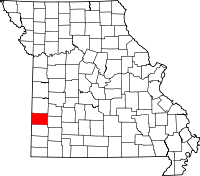 | |
| Villages | ||
| Townships | ||
| CDP | ||
| Other unincorporated communities | ||
| Ghost towns | ||
This article is issued from Wikipedia - version of the 9/3/2016. The text is available under the Creative Commons Attribution/Share Alike but additional terms may apply for the media files.