Leroy Township, Barton County, Missouri
| Leroy Township | |
|---|---|
| Township | |
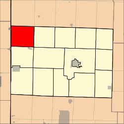 Location in Barton County | |
| Coordinates: 37°37′05″N 094°31′51″W / 37.61806°N 94.53083°WCoordinates: 37°37′05″N 094°31′51″W / 37.61806°N 94.53083°W | |
| Country | United States |
| State | Missouri |
| County | Barton |
| Area | |
| • Total | 40.44 sq mi (104.74 km2) |
| • Land | 40.14 sq mi (103.95 km2) |
| • Water | 0.31 sq mi (0.79 km2) 0.75% |
| Elevation | 843 ft (257 m) |
| Population (2000) | |
| • Total | 238 |
| • Density | 5.9/sq mi (2.3/km2) |
| GNIS feature ID | 0766280 |
Leroy Township is a township in Barton County, Missouri, USA. As of the 2000 census, its population was 238.
The origin of the name Leroy is obscure.[1]
Geography
Leroy Township covers an area of 40.44 square miles (104.7 km2) and contains no incorporated settlements. According to the USGS, it contains two cemeteries: Leroy and Shiloh.
The streams of Bitter Creek, East Fork Dry Wood Creek and West Elm Branch run through this township.
References
- ↑ "Barton County Place Names, 1928-1945 (archived)". The State Historical Society of Missouri. Retrieved 31 August 2016.
External links
Municipalities and communities of Barton County, Missouri, United States | ||
|---|---|---|
| Cities | 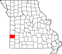 | |
| Villages | ||
| Townships | ||
| CDP | ||
| Other unincorporated communities | ||
| Ghost towns | ||
This article is issued from Wikipedia - version of the 9/10/2016. The text is available under the Creative Commons Attribution/Share Alike but additional terms may apply for the media files.