Kfar Qouq
| Kfar Qouq كفر قوق | |
|---|---|
| Village | |
| Country |
|
| Governorate | Beqaa Governorate |
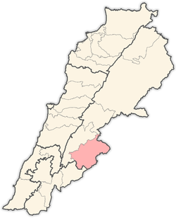
| District | Rashaya District |
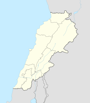 Shown within Lebanon | |
| Location | 3 kilometres (1.9 mi) North of Rashaya |
|---|---|
| Region | Bekaa Valley |
| Coordinates | 33°32′02″N 35°53′33″E / 33.533889°N 35.8925°E |
| History | |
| Cultures | Greek, Roman |
| Site notes | |
| Condition | Ruins |
| Public access | Yes |
Kfar Qouq (and variations of spelling) is a village in Lebanon, situated in the Rashaya District and south of the Beqaa Governorate. It is located in an intermontane basin near Mount Hermon near the Syrian border, approximately halfway between Jezzine and Damascus.[1]
The population of the hillside village is predominantly Druze.[2] It contains two Roman temple sites in the Western section of the town dating to around 111 BC[3] and another less preserved temple near the church.[4] Fragments such as columns and an inscribed block have been re-used in the village and surrounding area.[5] The surrounding area also has many stone basins, tombs, caves, rock cut niches and other remnants from Greek and Roman times.[6] Dr. Edward Robinson, visited in the Summer of 1852 and noted a Greek inscription on a doorway, the public fountain and a large reservoir which he noted "exhibits traces of antiquity". The name of the village means "the pottery place" in Aramaic and has also been known as Kfar Quq Al-Debs in relation to molasses and grape production in the area. Kfar Qouq also been associated with King Qouq, a ruler in ancient times.[7] The local highway was targeted in the 2006 Lebanon War between Hezbollah and Israel.[8]
References
- ↑ Geographic.org - Entry about Kfar Qoûq from data supplied by the National Geospatial-Intelligence Agency, Bethesda, MD, USA a member of the Intelligence community of the United States of America
- ↑ British Druze Society - Druze communities in the Middle East
- ↑ Ktèma, Volumes 9-10, Université des sciences humaines de Strasbourg. Centre de recherche sur le Proche-Orient et la Grèce antiques, Université des sciences humaines de Strasbourg, Centre de recherches sur le Proche-Orient et la Grèce antiques, Groupe de recherche d'histoire romaine., 1984.
- ↑ Discover Lebanon - Map of Kfar Qouq
- ↑ Taylor, George., The Roman temples of Lebanon: a pictorial guide. Les temples romains au Liban; guide illustré, Dar el-Machreq Publishers, p. 145, 176 pages, 1971.
- ↑ Qada' (Caza) Rachaya - Promenade Tourist Brochure, published by The Lebanese Ministry of Tourism
- ↑ Anīs Furaiḥa (1972). dictionary of the name of towns and villages in Lebanon. Maktabat Lubnān. Retrieved 17 March 2011.
- ↑ Ziadeh, Caroline., Identical letters dated 24 July 2006 from the Chargé d’affaires a.i. of the Permanent Mission of Lebanon to the United Nations addressed to the Secretary-General and the President of the Security Council, July 2006.
External links
- Kfar Qouq, Localiban
- 3D Google Earth map of Kfar Qouq on www.gmap3d.com
- Kfar Qouq on www.geographic.org
Capital: Rashaya | ||
| Towns and villages |
|  |