Mdoukha
| Mdoukha مدوخا | |
|---|---|
| Village | |
| Country |
|
| Governorate | Beqaa Governorate |
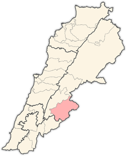
| District | Rashaya District |
| Area | |
| • Total | 5.86 sq mi (15.18 km2) |
| Elevation | 3,261 ft (994 m) |
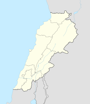 Shown within Lebanon | |
| Alternate name | Jebel Kassir |
|---|---|
| Location | 72 kilometres (45 mi) east of Beirut |
| Region | Rashaya |
| Coordinates | 33°36′23″N 35°52′37″E / 33.606389°N 35.876944°E |
| History | |
| Cultures | Roman |
| Site notes | |
| Condition | Ruins |
| Public access | Yes |
| Website | Mdoukha Village Website |
Mdoukha (Arabic: مدوخا) is a village and municipality situated 72 kilometres (45 mi) east of Beirut in the Rashaya District of the Beqaa Governorate in Lebanon.[1][2] The village's population is Sunni.[3]
Jebel Kassir Roman temple
There are the ruins of a Roman temple in the village called Jebel Kassir that is included in a group of Temples of Mount Hermon.[4] Julien Aliquot suggested the site was a high place and that it drew and audience from the village in ancient antiquity.[5]
References
- ↑ George Taylor (1971). The Roman temples of Lebanon: a pictorial guide. Les temples romains au Liban; guide illustré. Dar el-Machreq Publishers. Retrieved 23 September 2012.
- ↑ Université Saint-Joseph (Beirut, Lebanon) (1968). Mélanges de l'Université Saint-Joseph. Imprimerie Catholique. Retrieved 24 September 2012.
- ↑ "The Monthly - issue 91" (PDF). localiban. p. 7. Retrieved 25 December 2015.
- ↑ Tallon, Maurice., “Sanctuaires et itinéraires romains du. Chouf et du sud de la Béqa,” Mélanges de l'université Saint Joseph 43, pp. 233-50, 1967.
- ↑ Ted Kaizer (2008). The Variety of Local Religious Life in the Near East In the Hellenistic and Roman Periods. BRILL. pp. 321–. ISBN 978-90-04-16735-3. Retrieved 24 September 2012.
External links
- Mdoukha Village Website
- video of Mdoukha on YouTube
- Mdoukha Stargazing forecast
- Mdoukha on Localiban
- Photos of Roman temples in the Rashaya area on the American University of Beirut website
- Roman Temples on discoverlebanon.com
- Jebel Kassir Roman temple on www.middleeast.com
- Mdoukha on geographic.org
- Bakka municipality on Wikimapia
- Photo of Jebel Kassir Roman Temple on the American University of Beirut website
- Photo of Jebel Kassir Roman Temple on the American University of Beirut website
- Photo of Jebel Kassir Roman Temple on the American University of Beirut website
Capital: Rashaya | ||
| Towns and villages |
|  |
This article is issued from Wikipedia - version of the 11/30/2016. The text is available under the Creative Commons Attribution/Share Alike but additional terms may apply for the media files.