Kearsarge, New Hampshire
| Kearsarge, New Hampshire | |
|---|---|
| Unincorporated community | |
 Kearsarge  Kearsarge | |
| Coordinates: 44°04′26″N 71°07′01″W / 44.07389°N 71.11694°WCoordinates: 44°04′26″N 71°07′01″W / 44.07389°N 71.11694°W | |
| Country | United States |
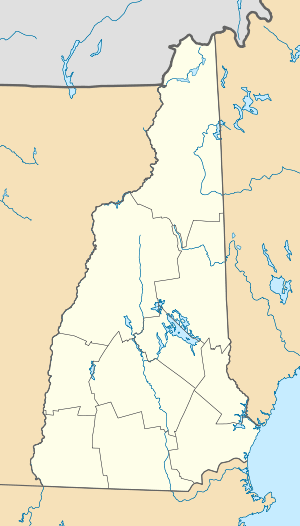
| State | New Hampshire |
| County | Carroll |
| Town | Conway |
| Elevation | 676 ft (206 m) |
| Time zone | Eastern (EST) (UTC-5) |
| • Summer (DST) | EDT (UTC-4) |
| ZIP code | 03847 |
| Area code(s) | 603 |
| GNIS feature ID | 872124[1] |
This article is about the place in Conway, New Hampshire. For other uses, see Kearsarge (disambiguation).
Kearsarge is an unincorporated community in the town of Conway in Carroll County, New Hampshire, in the United States. It shares its name with Kearsarge North, a 3,268-foot (996 m) summit which overlooks the community from the north. Kearsarge is located along the northern boundary of the town of Conway, adjacent to the town of Bartlett to the north. It is 1 mile (1.6 km) north of the village of North Conway, around the intersection of Kearsarge Road with Hurricane Mountain Road.
The Kearsarge Lighting Precinct Zoning Ordinance is unofficially maintained by North Conway Online.
Kearsarge has a separate ZIP code (03847) from North Conway and the rest of the town of Conway.
References
Municipalities and communities of Carroll County, New Hampshire, United States | ||
|---|---|---|
| Towns | 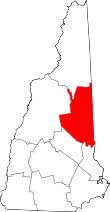 | |
| Township | ||
| CDPs | ||
| Other villages | ||
This article is issued from Wikipedia - version of the 7/10/2016. The text is available under the Creative Commons Attribution/Share Alike but additional terms may apply for the media files.