Junction City, Ohio
| Junction City, Ohio | |
|---|---|
| Village | |
 Location of Junction City, Ohio | |
 Location of Junction City in Perry County | |
| Coordinates: 39°43′19″N 82°17′52″W / 39.72194°N 82.29778°WCoordinates: 39°43′19″N 82°17′52″W / 39.72194°N 82.29778°W | |
| Country | United States |
| State | Ohio |
| County | Perry |
| Area[1] | |
| • Total | 0.64 sq mi (1.66 km2) |
| • Land | 0.63 sq mi (1.63 km2) |
| • Water | 0.01 sq mi (0.03 km2) |
| Elevation[2] | 833 ft (254 m) |
| Population (2010)[3] | |
| • Total | 819 |
| • Estimate (2012[4]) | 816 |
| • Density | 1,300.0/sq mi (501.9/km2) |
| Time zone | Eastern (EST) (UTC-5) |
| • Summer (DST) | EDT (UTC-4) |
| ZIP code | 43748 |
| Area code(s) | 740 |
| FIPS code | 39-39508[5] |
| GNIS feature ID | 1064918[2] |
Junction City is a village in Perry County, Ohio, United States. The population was 819 at the 2010 census.
History
Junction City was laid out in 1872 at the site of a railroad junction.[6] A post office has been in operation at Junction City since 1872.[7]
Geography
Junction City is located at 39°43′19″N 82°17′52″W / 39.72194°N 82.29778°W (39.722077, -82.297764).[8]
According to the United States Census Bureau, the village has a total area of 0.64 square miles (1.66 km2), of which 0.63 square miles (1.63 km2) is land and 0.01 square miles (0.03 km2) is water.[1]
Demographics
| Historical population | |||
|---|---|---|---|
| Census | Pop. | %± | |
| 1890 | 394 | — | |
| 1900 | 443 | 12.4% | |
| 1910 | 811 | 83.1% | |
| 1920 | 890 | 9.7% | |
| 1930 | 860 | −3.4% | |
| 1940 | 813 | −5.5% | |
| 1950 | 805 | −1.0% | |
| 1960 | 763 | −5.2% | |
| 1970 | 732 | −4.1% | |
| 1980 | 754 | 3.0% | |
| 1990 | 770 | 2.1% | |
| 2000 | 818 | 6.2% | |
| 2010 | 819 | 0.1% | |
| Est. 2015 | 810 | [9] | −1.1% |
2010 census
As of the census[3] of 2010, there were 819 people, 315 households, and 223 families residing in the village. The population density was 1,300.0 inhabitants per square mile (501.9/km2). There were 337 housing units at an average density of 534.9 per square mile (206.5/km2). The racial makeup of the village was 97.3% White, 0.2% African American, 0.1% Native American, 0.1% Asian, 0.4% from other races, and 1.8% from two or more races. Hispanic or Latino of any race were 1.0% of the population.
There were 315 households of which 34.9% had children under the age of 18 living with them, 41.9% were married couples living together, 17.1% had a female householder with no husband present, 11.7% had a male householder with no wife present, and 29.2% were non-families. 22.9% of all households were made up of individuals and 8.2% had someone living alone who was 65 years of age or older. The average household size was 2.60 and the average family size was 3.00.
The median age in the village was 35.5 years. 26.6% of residents were under the age of 18; 10.6% were between the ages of 18 and 24; 26.3% were from 25 to 44; 25.3% were from 45 to 64; and 11.4% were 65 years of age or older. The gender makeup of the village was 50.4% male and 49.6% female.
2000 census
As of the census[5] of 2000, there were 818 people, 295 households, and 225 families residing in the village. The population density was 1,276.4 people per square mile (493.5/km²). There were 320 housing units at an average density of 499.3 per square mile (193.1/km²). The racial makeup of the village was 99.14% White, and 0.86% from two or more races. Hispanic or Latino of any race were 0.61% of the population.
There were 295 households out of which 40.3% had children under the age of 18 living with them, 54.2% were married couples living together, 15.6% had a female householder with no husband present, and 23.4% were non-families. 17.6% of all households were made up of individuals and 7.5% had someone living alone who was 65 years of age or older. The average household size was 2.77 and the average family size was 3.12.
In the village the population was spread out with 29.8% under the age of 18, 8.4% from 18 to 24, 26.9% from 25 to 44, 24.8% from 45 to 64, and 10.0% who were 65 years of age or older. The median age was 32 years. For every 100 females there were 98.1 males. For every 100 females age 18 and over, there were 94.6 males.
The median income for a household in the village was $29,861, and the median income for a family was $32,426. Males had a median income of $30,329 versus $18,750 for females. The per capita income for the village was $12,074. About 18.2% of families and 22.8% of the population were below the poverty line, including 27.0% of those under age 18 and 26.4% of those age 65 or over.
References
- 1 2 "US Gazetteer files 2010". United States Census Bureau. Retrieved 2013-01-06.
- 1 2 "US Board on Geographic Names". United States Geological Survey. 2007-10-25. Retrieved 2008-01-31.
- 1 2 "American FactFinder". United States Census Bureau. Retrieved 2013-01-06.
- ↑ "Population Estimates". United States Census Bureau. Retrieved 2013-06-17.
- 1 2 "American FactFinder". United States Census Bureau. Retrieved 2008-01-31.
- ↑ Colborn, Ephraim S. (1883). History of Fairfield and Perry Counties, Ohio. Brookhaven Press. p. 203.
- ↑ "Perry County". Jim Forte Postal History. Retrieved 16 December 2015.
- ↑ "US Gazetteer files: 2010, 2000, and 1990". United States Census Bureau. 2011-02-12. Retrieved 2011-04-23.
- ↑ "Annual Estimates of the Resident Population for Incorporated Places: April 1, 2010 to July 1, 2015". Retrieved July 2, 2016.
- ↑ "Census of Population and Housing". Census.gov. Retrieved June 4, 2015.
Municipalities and communities of Perry County, Ohio, United States | ||
|---|---|---|
| Villages | 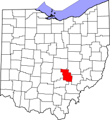 | |
| Townships | ||
| CDP | ||
| Unincorporated communities | ||
| Ghost towns | ||
| Footnotes | ‡This populated place also has portions in an adjacent county or counties | |