Hemlock, Ohio
| Hemlock, Ohio | |
|---|---|
| Village | |
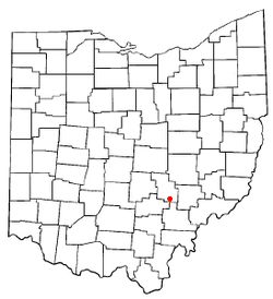 Location of Hemlock, Ohio | |
 Location of Hemlock in Perry County | |
| Coordinates: 39°35′29″N 82°9′23″W / 39.59139°N 82.15639°WCoordinates: 39°35′29″N 82°9′23″W / 39.59139°N 82.15639°W | |
| Country | United States |
| State | Ohio |
| County | Perry |
| Area[1] | |
| • Total | 0.37 sq mi (0.96 km2) |
| • Land | 0.37 sq mi (0.96 km2) |
| • Water | 0 sq mi (0 km2) |
| Elevation[2] | 761 ft (232 m) |
| Population (2010)[3] | |
| • Total | 155 |
| • Estimate (2012[4]) | 155 |
| • Density | 418.9/sq mi (161.7/km2) |
| Time zone | Eastern (EST) (UTC-5) |
| • Summer (DST) | EDT (UTC-4) |
| ZIP code | 43730 |
| Area code(s) | 740 |
| FIPS code | 39-34888[5] |
| GNIS feature ID | 1076036[2] |
Hemlock is a village in Salt Lick Township, Perry County, Ohio, United States. The population was 155 at the 2010 census. The village has the lowest per capita income of any location in Ohio.
History
A post office called Hemlock has been in operation since 1872.[6] The village was named for a grove of hemlock trees near the original town site.[7]
Geography
Hemlock is located at 39°35′29″N 82°9′23″W / 39.59139°N 82.15639°W (39.591447, -82.156365).[8]
According to the United States Census Bureau, the village has a total area of 0.37 square miles (0.96 km2), all land.[1]
Demographics
| Historical population | |||
|---|---|---|---|
| Census | Pop. | %± | |
| 1900 | 581 | — | |
| 1910 | 452 | −22.2% | |
| 1920 | 497 | 10.0% | |
| 1930 | 282 | −43.3% | |
| 1940 | 353 | 25.2% | |
| 1950 | 253 | −28.3% | |
| 1960 | 227 | −10.3% | |
| 1970 | 199 | −12.3% | |
| 1980 | 197 | −1.0% | |
| 1990 | 203 | 3.0% | |
| 2000 | 142 | −30.0% | |
| 2010 | 155 | 9.2% | |
| Est. 2015 | 156 | [9] | 0.6% |
2010 census
As of the census[3] of 2010, there were 155 people, 56 households, and 46 families residing in the village. The population density was 418.9 inhabitants per square mile (161.7/km2). There were 71 housing units at an average density of 191.9 per square mile (74.1/km2). The racial makeup of the village was 100.0% White.
There were 56 households of which 37.5% had children under the age of 18 living with them, 64.3% were married couples living together, 12.5% had a female householder with no husband present, 5.4% had a male householder with no wife present, and 17.9% were non-families. 17.9% of all households were made up of individuals and 5.4% had someone living alone who was 65 years of age or older. The average household size was 2.77 and the average family size was 3.00.
The median age in the village was 39.4 years. 25.2% of residents were under the age of 18; 9.7% were between the ages of 18 and 24; 22.6% were from 25 to 44; 30.9% were from 45 to 64; and 11.6% were 65 years of age or older. The gender makeup of the village was 49.7% male and 50.3% female.
2000 census
As of the census[5] of 2000, there were 142 people, 48 households, and 39 families residing in the village. The population density was 374.2 people per square mile (144.3/km²). There were 58 housing units at an average density of 152.9 per square mile (58.9/km²). The racial makeup of the village was 95.07% White, 2.11% Asian, and 2.82% from two or more races. Hispanic or Latino of any race were 2.11% of the population.
There were 48 households out of which 45.8% had children under the age of 18 living with them, 66.7% were married couples living together, 14.6% had a female householder with no husband present, and 16.7% were non-families. 16.7% of all households were made up of individuals and 10.4% had someone living alone who was 65 years of age or older. The average household size was 2.96 and the average family size was 3.30.
In the village the population was spread out with 33.1% under the age of 18, 8.5% from 18 to 24, 33.1% from 25 to 44, 12.7% from 45 to 64, and 12.7% who were 65 years of age or older. The median age was 32 years. For every 100 females there were 94.5 males. For every 100 females age 18 and over, there were 82.7 males.
The median income for a household in the village was $26,250, and the median income for a family was $28,333. Males had a median income of $28,750 versus $17,917 for females. The per capita income for the village was $7,701. There were 26.3% of families and 24.3% of the population living below the poverty line, including 29.4% of under eighteens and 22.2% of those over 64.
References
- 1 2 "US Gazetteer files 2010". United States Census Bureau. Retrieved 2013-01-06.
- 1 2 "US Board on Geographic Names". United States Geological Survey. 2007-10-25. Retrieved 2008-01-31.
- 1 2 "American FactFinder". United States Census Bureau. Retrieved 2013-01-06.
- ↑ "Population Estimates". United States Census Bureau. Retrieved 2013-06-17.
- 1 2 "American FactFinder". United States Census Bureau. Retrieved 2008-01-31.
- ↑ "Perry County". Jim Forte Postal History. Retrieved 16 December 2015.
- ↑ Overman, William Daniel (1958). Ohio Town Names. Akron, OH: Atlantic Press. p. 59.
- ↑ "US Gazetteer files: 2010, 2000, and 1990". United States Census Bureau. 2011-02-12. Retrieved 2011-04-23.
- ↑ "Annual Estimates of the Resident Population for Incorporated Places: April 1, 2010 to July 1, 2015". Retrieved July 2, 2016.
- ↑ "Census of Population and Housing". Census.gov. Retrieved June 4, 2015.
Municipalities and communities of Perry County, Ohio, United States | ||
|---|---|---|
| Villages | 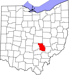 | |
| Townships | ||
| CDP | ||
| Unincorporated communities | ||
| Ghost towns | ||
| Footnotes | ‡This populated place also has portions in an adjacent county or counties | |