Inverness Park, California
| Inverness Park | |
|---|---|
| Unincorporated community | |
|
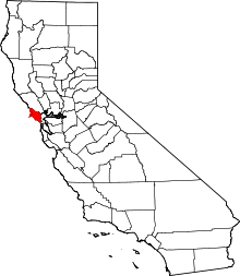
Towns of rural western Marin County. Inverness Park is in violet. | |
 Inverness Park  Inverness Park Location in California | |
| Coordinates: 38°03′50″N 122°49′22″W / 38.06389°N 122.82278°WCoordinates: 38°03′50″N 122°49′22″W / 38.06389°N 122.82278°W | |
| Country | United States |
| State | California |
| County | Marin |
| Government | |
| • County Board |
District 4 Steve Kinsey |
| • State Senate | Mark Leno (D) |
| • Assembly | Marc Levine (D) |
| • U. S. Congress | Jared Huffman (D)[1] |
| Elevation[2] | 148 ft (45 m) |
| Time zone | PST (UTC-8) |
| • Summer (DST) | PDT (UTC-7) |
| ZIP code | 94956 |
| Area codes | 415/628 |
| FIPS code | 06-36630 |
| GNIS feature ID | 1658828 |

Inverness Park is a small unincorporated community in Marin County, California.[2] It is located 1 mile (1.6 km) west-southwest of Point Reyes Station,[3] at an elevation of 148 feet (45 m).[2]
Inverness Park is located between the communities of Point Reyes Station and Inverness. The community uses Point Reyes Station's post office.
It stretches for the three or four miles (6 km) from Limantour Road, north along Sir Francis Drake Boulevard, hugging the western edge of Tomales Bay. It is immediately adjacent to the Point Reyes National Seashore.
History
Development began in 1909.[3]
Original population included many Portuguese and Italian immigrants who worked the land. At least two fish hatcheries existed in the area until about 50 years ago.
Originally a few isolated houses, Inverness Park expanded in the 1950s as a failed developer's pipe dream called Noren Estates. A later, more successful housing expansion in the steep and immensely attractive hills called Paradise Ranch Estates more than doubled the population. A product of David Adams Real Estate, Paradise Ranch Estates sold parcels with spectacular views of the Pacific Ocean, Tomales Bay, or—for a lucky few—both. Paradise Ranch Estates was plagued by numerous problems relating to its roads and availability of water. As the Adams family moved out of ownership, residents assumed the task of road improvement and maintenance. After the floods of January 4, 1982, a municipal water supply was hooked up.
In the fires of October 1995, forty-eight homes on the ridges of Paradise Ranch Estates burned, including that of well-known singer Jesse Colin Young.
References
- ↑ "California's 2nd Congressional District - Representatives & District Map". Civic Impulse, LLC. Retrieved March 8, 2013.
- 1 2 3 U.S. Geological Survey Geographic Names Information System: Inverness Park
- 1 2 Durham, David L. (1998). California's Geographic Names: A Gazetteer of Historic and Modern Names of the State. Clovis, Calif.: Word Dancer Press. p. 645. ISBN 1-884995-14-4.