Santa Venetia, California
| Santa Venetia | |
|---|---|
| census-designated place | |
|
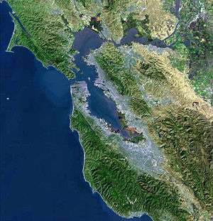
Santa Venetia, California, as seen from the nearby Terra Linda neighborhood | |
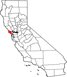
 Location in Marin County and the state of California | |
 Santa Venetia Location in the United States | |
| Coordinates: 37°59′55″N 122°31′31″W / 37.99861°N 122.52528°WCoordinates: 37°59′55″N 122°31′31″W / 37.99861°N 122.52528°W | |
| Country |
|
| State |
|
| County | Marin |
| Government | |
| • County Board |
District 1 Damon Connolly |
| • State Senate | Mark Leno (D) |
| • Assembly | Marc Levine (D) |
| • U. S. Congress | Jared Huffman (D)[1] |
| Area[2] | |
| • Total | 3.680 sq mi (9.531 km2) |
| • Land | 3.661 sq mi (9.482 km2) |
| • Water | 0.019 sq mi (0.049 km2) 0.51% |
| Elevation[3] | 56 ft (17 m) |
| Population (2010) | |
| • Total | 4,292 |
| • Density | 1,200/sq mi (450/km2) |
| Time zone | PST (UTC-8) |
| • Summer (DST) | PDT (UTC-7) |
| ZIP code | 94903 |
| Area codes | 415/628 |
| FIPS code | 06-70154 |
| GNIS feature ID | 1659603 |

Santa Venetia is a census-designated place (CDP) in Marin County, California, United States. Santa Venetia is located 1.5 miles (2.4 km) north of downtown San Rafael,[4] at an elevation of 56 feet (17 m).[3] The population was 4,292 at the 2010 census.
Geography
Santa Venetia is located at 37°59′55″N 122°31′31″W / 37.99861°N 122.52528°W.[3]
According to the United States Census Bureau, the CDP has a total area of 3.7 square miles (9.6 km2), of which, 3.7 square miles (9.6 km2) of it is land and 0.51% is water.
Santa Venetia was envisioned in the early 1900s as a little Venice so canals were built and houses and structures built along them. It was a vacation spot for the wealthy for a brief period of time in the 1920s. The plan of building a little Venice was abandoned. In the 1960s, houses were built along North San Pedro Road.
The main road of this unincorporated neighborhood is North San Pedro Road, which passes by the Frank Lloyd Wright-designed Marin County Civic Center. The road goes through China Camp State Park, along the bay through Peacock Gap and ends in San Rafael. Santa Venetia has an open space preserve for its marsh as it borders San Pablo Bay, the northern part of the San Francisco Bay estuary.
Demographics
2010
The 2010 United States Census[5] reported that Santa Venetia had a population of 4,292. The population density was 1,166.3 people per square mile (450.3/km²). The racial makeup of Santa Venetia was 3,335 (77.7%) White, 88 (2.1%) African American, 27 (0.6%) Native American, 306 (7.1%) Asian, 16 (0.4%) Pacific Islander, 350 (8.2%) from other races, and 170 (4.0%) from two or more races. Hispanic or Latino of any race were 815 persons (19.0%).
The Census reported that 4,080 people (95.1% of the population) lived in households, 65 (1.5%) lived in non-institutionalized group quarters, and 147 (3.4%) were institutionalized.
There were 1,655 households, out of which 480 (29.0%) had children under the age of 18 living in them, 769 (46.5%) were opposite-sex married couples living together, 180 (10.9%) had a female householder with no husband present, 81 (4.9%) had a male householder with no wife present. There were 87 (5.3%) unmarried opposite-sex partnerships, and 21 (1.3%) same-sex married couples or partnerships. 455 households (27.5%) were made up of individuals and 228 (13.8%) had someone living alone who was 65 years of age or older. The average household size was 2.47. There were 1,030 families (62.2% of all households); the average family size was 2.97.
The population was spread out with 802 people (18.7%) under the age of 18, 220 people (5.1%) aged 18 to 24, 961 people (22.4%) aged 25 to 44, 1,435 people (33.4%) aged 45 to 64, and 874 people (20.4%) who were 65 years of age or older. The median age was 47.7 years. For every 100 females there were 90.2 males. For every 100 females age 18 and over, there were 87.1 males.
There were 1,706 housing units at an average density of 463.6 per square mile (179.0/km²), of which 1,188 (71.8%) were owner-occupied, and 467 (28.2%) were occupied by renters. The homeowner vacancy rate was 1.1%; the rental vacancy rate was 2.1%. 2,925 people (68.2% of the population) lived in owner-occupied housing units and 1,155 people (26.9%) lived in rental housing units.
2000
As of the census[6] of 2000, there were 4,298 people, 1,646 households, and 1,048 families residing in the CDP. The population density was 1,143.0 people per square mile (441.3/km²). There were 1,667 housing units at an average density of 443.3 per square mile (171.2/km²). The racial makeup of the CDP in 2010 was 68.5% non-Hispanic White, 2.0% non-Hispanic African American, 0.2% Native American, 7.0% Asian, 0.3% Pacific Islander, 0.3% from other races, and 2.6% from two or more races. Hispanic or Latino of any race were 19.0% of the population.
There were 1,646 households out of which 25.5% had children under the age of 18 living with them, 49.0% were married couples living together, 10.6% had a female householder with no husband present, and 36.3% were non-families. 26.2% of all households were made up of individuals and 12.7% had someone living alone who was 65 years of age or older. The average household size was 2.47 and the average family size was 2.91.
In the CDP the population was spread out with 18.1% under the age of 18, 5.2% from 18 to 24, 27.3% from 25 to 44, 29.1% from 45 to 64, and 20.3% who were 65 years of age or older. The median age was 45 years. For every 100 females there were 93.0 males. For every 100 females age 18 and over, there were 87.5 males.
The median income for a household in the CDP was $75,600, and the median income for a family was $77,202. Males had a median income of $48,938 versus $42,500 for females. The per capita income for the CDP was $34,732. About 4.3% of families and 7.3% of the population were below the poverty line, including 10.3% of those under age 18 and 6.1% of those age 65 or over.
History
Santa Venetia is built on marshland that was filled in 1914. At that time, real estate developer Mabry McMahan envisioned a bayside luxury development modeled after Venice, Italy. Venice is known as 'Venezia' in Italian. This is the city's official name, hence the misnomer saint's name of "Santa Venetia" - there is no actual Christian saint named Venice or Venetia. It was designed to be complete with canals and gondolas. The economic decline following the First World War put an end to this development.
It was only after the Second World War that significant development took place in Santa Venetia, with suburban developments such as Gallinas Village being built on the land originally filled in 1914.[7][8]
Santa Venetia was home to the local YMCA until it was destroyed by a fire. Eventually the property was purchased by a developer who erected residential houses that were completed in 1987.
During the 1960s and 1970s the area was known affectionately to residents, especially teenagers, as "Lower Scabo" and "Upper Scabo".
Today Santa Venetia is a quiet neighborhood with a rural feel. Residents treasure its proximity to China Camp State Park, and many homes along the canal have water access.
Notable residents
- Science fiction author Philip K. Dick lived in Santa Venetia from 1967–1972. During this time, Dick was using methamphetamine and other drugs quite heavily, living semi-communally with a rotating group of mostly teenage drug users. His experiences during this time formed much of the basis for his novel A Scanner Darkly.[9]
- Charles "Chuck" Riley, one of the two perpetrators of the 1975 "BBQ Murders", lived in Santa Venetia up until the time of his arrest and eventual imprisonment. Riley and his girlfriend Marlene Olive murdered her adoptive parents, James and Naomi Olive, in Terra Linda and disposed of the bodies by burning them in a firepit in nearby China Camp State Park.[10]
The Santa Venetia Neighborhood Association
The SVNA is an active neighborhood association. It describes its mission as "preserv[ing] and promot[ing] the quality of life in the Santa Venetia community". This is achieved by "encouraging healthy social interaction; facilitating the flow of information; and protecting the natural beauty and economic well-being of the community".
The SVNA holds regular community meetings, hosts social events and neighborhood work days and publishes a bi-monthly newsletter.
References
- ↑ "California's 2nd Congressional District - Representatives & District Map". Civic Impulse, LLC. Retrieved March 8, 2013.
- ↑ U.S. Census
- 1 2 3 U.S. Geological Survey Geographic Names Information System: Santa Venetia, California
- ↑ Durham, David L. (1998). California's Geographic Names: A Gazetteer of Historic and Modern Names of the State. Clovis, Calif.: Word Dancer Press. p. 698. ISBN 1-884995-14-4.
- ↑ "2010 Census Interactive Population Search: CA - Santa Venetia CDP". U.S. Census Bureau. Retrieved July 12, 2014.
- ↑ "American FactFinder". United States Census Bureau. Retrieved 2008-01-31.
- ↑ Santa Venetia Prospectuses
- ↑ Northbridge History
- ↑ Sutin, Lawrence. (2005). Divine Invasions: A Life of Philip K. Dick. Carroll & Graf Publishers. ISBN 0-7867-1623-1.
- ↑ Levine, Richard M. (1982). Bad Blood: A Family Murder in Marin County. New American Library. ISBN 0-451-12548-7.
| Wikimedia Commons has media related to Santa Venetia, California. |
| Bodies of water |
|  |
|---|---|---|
| Counties | ||
| Major cities | ||
| Cities and towns 100k–250k | ||
| Cities and towns 50k–99k | ||
| Cities and towns 25k-50k | ||
| Cities and towns 10k–25k |
| |
| Sub-regions | ||