Woodacre, California
| Woodacre | |
|---|---|
| census-designated place | |
|
Woodacre from the east | |
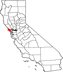
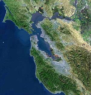
 Location in Marin County and the state of California | |
 Woodacre Location in the United States | |
| Coordinates: 38°00′46″N 122°38′43″W / 38.01278°N 122.64528°WCoordinates: 38°00′46″N 122°38′43″W / 38.01278°N 122.64528°W | |
| Country |
|
| State |
|
| County | Marin |
| Government | |
| • County Board |
District 4 Steve Kinsey |
| • State Senate | Mark Leno (D) |
| • Assembly | Marc Levine (D) |
| • U.S. Congress | Jared Huffman (D)[1] |
| Area[2] | |
| • Total | 1.797 sq mi (4.653 km2) |
| • Land | 1.797 sq mi (4.653 km2) |
| • Water | 0 sq mi (0 km2) 0% |
| Elevation[3] | 364 ft (111 m) |
| Population (2010) | |
| • Total | 1,348 |
| • Density | 750/sq mi (290/km2) |
| Time zone | PST (UTC-8) |
| • Summer (DST) | PDT (UTC-7) |
| ZIP code | 94973 |
| Area codes | 415/628 |
| FIPS code | 06-86216 |
| GNIS feature ID | 1652657 |
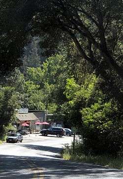
Woodacre is an unincorporated town and census-designated place (CDP) located in the San Geronimo Valley in Marin County, California. Woodacre is located 8 miles (13 km) south-southwest of Novato,[4] and 8 miles northwest of San Rafael; the nearest incorporated town is Fairfax, 4 miles east-southeast. At 364 feet (111 m), Woodacre has the highest base elevation in Marin County.[3] The population was 1,348 at the 2010 census.
Geography
Woodacre is located at 38°00′46″N 122°38′43″W / 38.01278°N 122.64528°W.[3]
According to the United States Census Bureau, the CDP has a total area of 1.8 square miles (4.7 km2), all of it land.
History
The community began when promoters subdivided the place in 1912.[4] The first post office opened in 1925.[4]
Demographics
2010
The 2010 United States Census[5] reported that Woodacre had a population of 1,348. The population density was 750.3 per square mile (289.7/km²). The racial makeup of Woodacre was 1,231 (91.3%) White, 3 (0.2%) African American, 4 (0.3%) Native American, 27 (2.0%) Asian, 4 (0.3%) Pacific Islander, 10 (0.7%) from other races, and 69 (5.1%) from two or more races. Hispanic or Latino of any race were 77 persons (5.7%).
The Census reported that 100% of the population lived in households.
There were 595 households, of which 144 (24.2%) had children under the age of 18 living in them, 279 (46.9%) were opposite-sex married couples living together, 54 (9.1%) had a female householder with no husband present, 25 (4.2%) had a male householder with no wife present. There were 49 (8.2%) unmarried opposite-sex partnerships, and 11 (1.8%) same-sex married couples or partnerships. 163 households (27.4%) were made up of individuals and 44 (7.4%) had someone living alone who was 65 years of age or older. The average household size was 2.27. There were 358 families (60.2% of all households); the average family size was 2.72.
238 people (17.7%) were under the age of 18, 53 people (3.9%) aged 18 to 24, 262 people (19.4%) aged 25 to 44, 575 people (42.7%) aged 45 to 64, and 220 people (16.3%) who were 65 years of age or older. The median age was 50.5 years. For every 100 females there were 92.0 males. For every 100 females age 18 and over, there were 88.5 males.
There were 639 housing units at an average density of 355.7 per square mile (137.3/km²), of which 74.6% were owner-occupied and 25.4% were occupied by renters. The homeowner vacancy rate was 0.7%; the rental vacancy rate was 2.6%. 77.3% of the population lived in owner-occupied housing units and 22.7% lived in rental housing units.
2000
At the 2000 census,[6] there were 1,393 people, 548 households and 381 families residing in the CDP. The population density was 763.6 per square mile (295.5/km²). There were 570 housing units at an average density of 312.5 per square mile (120.9/km²). The racial makeup of the CDP inj 2010 was 88.0% non-Hispanic White, 0.2% non-Hispanic African American, 0.1% Native American, 2.0% Asian, 0.3% Pacific Islander, 0.3% from other races, and 3.3% from two or more races. Hispanic or Latino of any race were 5.7% of the population.
There were 548 households of which 34.3% had children under the age of 18 living with them, 55.3% were married couples living together, 11.3% had a female householder with no husband present, and 30.3% were non-families. 19.5% of all households were made up of individuals and 4.4% had someone living alone who was 65 years of age or older. The average household size was 2.54 and the average family size was 2.90.
23.0% of the population were under the age of 18, 3.7% from 18 to 24, 25.8% from 25 to 44, 38.8% from 45 to 64, and 8.7% who were 65 years of age or older. The median age was 44 years. For every 100 females there were 92.1 males. For every 100 females age 18 and over, there were 88.2 males.
The median household income was $62,917 and the median family income was $71,250. Males had a median income of $50,109 compared with $40,167 for females. The per capita income for the CDP was $31,996. About 3.9% of families and 6.6% of the population were below the poverty line, including 8.4% of those under age 18 and none of those age 65 or over.
Notable people
- William Windom (1923–2012), American actor, retired to Woodacre and died there in 2012.[7]
- Robin Williams (1951–2014), American actor, lived in Woodacre as a teenager.
- Jack Kornfield (born 1945) founded Spirit Rock Meditation Center in Woodacre in 1987.
- Gage Taylor (1942 - 2000), artist known for his psychedelic-inspired landscapes, lived in Woodacre.
References
- ↑ "California's 2nd Congressional District - Representatives & District Map". Civic Impulse, LLC. Retrieved March 8, 2013.
- ↑ U.S. Census
- 1 2 3 U.S. Geological Survey Geographic Names Information System: Woodacre, California
- 1 2 3 Durham, David L. (1998). California's Geographic Names: A Gazetteer of Historic and Modern Names of the State. Clovis, Calif.: Word Dancer Press. p. 723. ISBN 1-884995-14-4.
- ↑ "2010 Census Interactive Population Search: CA - Woodacre CDP". U.S. Census Bureau. Retrieved July 12, 2014.
- ↑ "American FactFinder". United States Census Bureau. Retrieved 2008-01-31.
- ↑ Eric Grode, "William Windom, Emmy Winner and TV Everyman, Dies at 88", The New York Times, August 19, 2012. (Accessed October 29, 2013)
| Bodies of water |
|  |
|---|---|---|
| Counties | ||
| Major cities | ||
| Cities and towns 100k–250k | ||
| Cities and towns 50k–99k | ||
| Cities and towns 25k-50k | ||
| Cities and towns 10k–25k |
| |
| Sub-regions | ||