Independence, Ohio
| Independence, Ohio | ||
|---|---|---|
| City | ||
|
Independence Presbyterian Church, built 1855 | ||
| ||
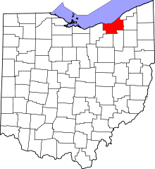
 Location in Cuyahoga County and the state of Ohio. | ||
.svg.png) Location of Ohio in the United States | ||
| Coordinates: 41°22′55″N 81°38′27″W / 41.38194°N 81.64083°WCoordinates: 41°22′55″N 81°38′27″W / 41.38194°N 81.64083°W | ||
| Country | United States | |
| State | Ohio | |
| County | Cuyahoga | |
| Government | ||
| • Type | Mayor-council | |
| • Mayor | Benjamin J Scarcella (D)[1][2] | |
| Area[3] | ||
| • Total | 9.64 sq mi (24.97 km2) | |
| • Land | 9.54 sq mi (24.71 km2) | |
| • Water | 0.10 sq mi (0.26 km2) | |
| Elevation | 863 ft (263 m) | |
| Population (2010)[4] | ||
| • Total | 7,133 | |
| • Estimate (2012[5]) | 7,136 | |
| • Density | 747.7/sq mi (288.7/km2) | |
| census | ||
| Time zone | EST (UTC-4) | |
| • Summer (DST) | EDT (UTC-4) | |
| Zip code | 44131 | |
| Area code(s) | 216 | |
| FIPS code | 39-37240[6] | |
| GNIS feature ID | 1064885[7] | |
| Website | http://www.independenceohio.org | |


Independence is a city in Cuyahoga County, Ohio, United States. As of the 2010 census, the city population was 7,133.
Independence was originally Center, and under the latter name was laid out in 1830.[8]
Geography
Independence is located at 41°22′55″N 81°38′27″W / 41.38194°N 81.64083°W.[9]
According to the United States Census Bureau, the city has a total area of 9.64 square miles (24.97 km2), of which 9.54 square miles (24.71 km2) is land and 0.10 square miles (0.26 km2) is water.[3]
Independence is also the intersection of I-480 and I-77. The I-77/I-480 interchange or the cloverleaf interchange as Clevelanders call it, is the biggest interchange in Ohio. The cloverleaf opened in 1940, but construction of the Willow Freeway, which became I-77, was stalled by World War II until the 1950s. In the late 1970s I-480 connected into I-77. This interchange is similar to interchanges in Los Angeles. The original 1939 cloverleaf is still in existence on Granger and Brecksville Roads. This is still in use today, but not by as many cars because of I-77.
Demographics
| Historical population | |||
|---|---|---|---|
| Census | Pop. | %± | |
| 1880 | 262 | — | |
| 1920 | 1,074 | — | |
| 1930 | 1,525 | 42.0% | |
| 1940 | 1,815 | 19.0% | |
| 1950 | 3,105 | 71.1% | |
| 1960 | 6,568 | 111.5% | |
| 1970 | 7,034 | 7.1% | |
| 1980 | 6,607 | −6.1% | |
| 1990 | 6,500 | −1.6% | |
| 2000 | 7,109 | 9.4% | |
| 2010 | 7,133 | 0.3% | |
| Est. 2015 | 7,135 | [10] | 0.0% |
| Sources:[11][12][13][6][14] | |||
2010 census
| Largest ancestries (2010) | Percent |
|---|---|
| Polish | 36.6% |
| Irish | 19.7% |
| German | 18.0% |
| Italy | 17.1% |
| Czech | 7.3% |
| Slovak | 6.0% |
As of the census[4] of 2010, there were 7,133 people, 2,770 households, and 2,054 families residing in the city. The population density was 747.7 inhabitants per square mile (288.7/km2). There were 2,868 housing units at an average density of 300.6 per square mile (116.1/km2). The racial makeup of the city was 96.6% White, 0.4% African American, 0.1% Native American, 1.9% Asian, 0.2% from other races, and 0.8% from two or more races. Hispanic or Latino of any race were 1.1% of the population.
There were 2,770 households of which 30.9% had children under the age of 18 living with them, 61.8% were married couples living together, 8.5% had a female householder with no husband present, 3.9% had a male householder with no wife present, and 25.8% were non-families. 23.3% of all households were made up of individuals and 13.4% had someone living alone who was 65 years of age or older. The average household size was 2.57 and the average family size was 3.05.
The median age in the city was 47 years. 22.9% of residents were under the age of 18; 6.1% were between the ages of 18 and 24; 17.9% were from 25 to 44; 33.5% were from 45 to 64; and 19.5% were 65 years of age or older. The gender makeup of the city was 48.5% male and 51.5% female.
Of the city's population over the age of 25, 36.0% held a bachelor's degree or higher.[15]
2000 census
| Largest ancestries (2000) | Percent |
|---|---|
| Polish | 32.3% |
| German | 20.2% |
| Italian | 16.7% |
| Irish | 10.7% |
| English | 7.3% |
| Slovak | 7.0% |
As of the census[6] of 2000, there were 7,109 people, 2,673 households, and 2,020 families residing in the city. The population density was 741.6 people per square mile (286.2/km²). There were 2,726 housing units at an average density of 284.4 per square mile (109.8/km²). The racial makeup of the city was 97.58% White, 0.58% African American, 1.29% Asian, 0.14% from other races, and 0.41% from two or more races. Hispanic or Latino of any race were 0.82% of the population.
There were 2,673 households out of which 30.5% had children under the age of 18 living with them, 65.6% were married couples living together, 7.3% had a female householder with no husband present, and 24.4% were non-families. 21.8% of all households were made up of individuals and 13.3% had someone living alone who was 65 years of age or older. The average household size was 2.63 and the average family size was 3.10.
In the city the population was spread out with 24.1% under the age of 18, 6.0% from 18 to 24, 23.1% from 25 to 44, 25.5% from 45 to 64, and 21.3% who were 65 years of age or older. The median age was 43 years. For every 100 females there were 90.2 males. For every 100 females age 18 and over, there were 87.6 males.
The median income for a household in the city was $57,733, and the median income for a family was $65,059. Males had a median income of $49,741 versus $34,038 for females. The per capita income for the city was $26,447. About 2.4% of families and 3.6% of the population were below the poverty line, including 2.5% of those under age 18 and 4.2% of those age 65 or over.
Local schools
The Independence Local School District operates Independence Primary School, Independence Middle School, Independence High School, and St. Michael's Catholic School. Independence is also home to the Kent State University College of Podiatric Medicine.
Rockside Road/I-77 Corridor
In the 1970s, many Cleveland businesses needed backup and extra office space from their downtown Cleveland offices. In the 1970s, the Rockside corridor was developed into offices and numerous hotels to help downtown Cleveland. In 1991, the Crown Center on 5005 Rockside Road was built making it the tallest building between Downtown Cleveland and Akron. This area is referred as Cleveland's Silicon Valley.
Cavaliers training facility
Independence is the home of the current NBA World Champion Cleveland Cavaliers training facility.[16]
Surrounding communities
 |
Brooklyn Heights | Cuyahoga Heights | Garfield Heights | |
| Seven Hills | |
Valley View | ||
| ||||
| | ||||
| North Royalton | Brecksville, Broadview Heights | Sagamore Hills |
References
- ↑ Zurick, Maura (16 October 2015). "Meet Independence mayoral candidate Anthony Togliatti". Cleveland.com. Retrieved 30 January 2016.
Political party: Democrat
- ↑ http://www.independenceohio.org/newsletter/newsletter_2007-01.pdf City Newsletter, January 2007. Retrieved 29 December 2006.
- 1 2 "US Gazetteer files 2010". United States Census Bureau. Archived from the original on January 24, 2012. Retrieved 2013-01-06.
- 1 2 "American FactFinder". United States Census Bureau. Retrieved 2013-01-06.
- ↑ "Population Estimates". United States Census Bureau. Archived from the original on June 17, 2013. Retrieved 2013-06-17.
- 1 2 3 "American FactFinder". United States Census Bureau. Archived from the original on September 11, 2013. Retrieved 2008-01-31.
- ↑ "US Board on Geographic Names". United States Geological Survey. 2007-10-25. Retrieved 2008-01-31.
- ↑ Overman, William Daniel (1958). Ohio Town Names. Akron, OH: Atlantic Press. p. 64.
- ↑ "US Gazetteer files: 2010, 2000, and 1990". United States Census Bureau. 2011-02-12. Retrieved 2011-04-23.
- ↑ "Annual Estimates of the Resident Population for Incorporated Places: April 1, 2010 to July 1, 2015". Retrieved July 2, 2016.
- ↑ "Population: Ohio" (PDF). 1930 US Census. U.S. Census Bureau. Retrieved 28 November 2013.
- ↑ "Number of Inhabitants: Ohio" (PDF). 18th Census of the United States. U.S. Census Bureau. Retrieved 22 November 2013.
- ↑ "Ohio: Population and Housing Unit Counts" (PDF). U.S. Census Bureau. Retrieved 22 November 2013.
- ↑ "Incorporated Places and Minor Civil Divisions Datasets: Subcounty Population Estimates: April 1, 2010 to July 1, 2012". U.S. Census Bureau. Archived from the original on June 17, 2013. Retrieved 25 November 2013.
- ↑ http://quickfacts.census.gov/qfd/states/39/3937240.html
- ↑ CavsNews.com Retrieved 29 December 2006.
External links
| Wikimedia Commons has media related to Independence, Ohio. |
- City of Independence, Ohio
- Independence Local School District
- Independence branch of the Cuyahoga County Public Library
Municipalities and communities of Cuyahoga County, Ohio, United States | ||
|---|---|---|
| Cities |
|  |
| Villages | ||
| Townships | ||
| Footnotes | ‡This populated place also has portions in an adjacent county or counties | |