Chagrin Falls, Ohio
| Chagrin Falls, Ohio | |
|---|---|
| Village | |
|
Chagrin Falls as seen from the Triangle Park area | |
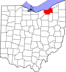
 Location in Cuyahoga County and the state of Ohio. | |
.svg.png) Location of Ohio in the United States | |
| Coordinates: 41°25′52″N 81°23′19″W / 41.43111°N 81.38861°WCoordinates: 41°25′52″N 81°23′19″W / 41.43111°N 81.38861°W | |
| Country | United States |
| State | Ohio |
| County | Cuyahoga |
| Government | |
| • Mayor | Bill Tomko |
| Area[1] | |
| • Total | 2.14 sq mi (5.54 km2) |
| • Land | 2.08 sq mi (5.39 km2) |
| • Water | 0.06 sq mi (0.16 km2) |
| Elevation[2] | 1,004 ft (306 m) |
| Population (2010)[3] | |
| • Total | 4,113 |
| • Estimate (2012[4]) | 4,079 |
| • Density | 1,977.4/sq mi (763.5/km2) |
| Time zone | Eastern (EST) (UTC-5) |
| • Summer (DST) | EDT (UTC-4) |
| ZIP code | 44022 |
| Area code(s) | 440 |
| FIPS code | 39-13358[5] |
| GNIS feature ID | 1083437[2] |
| Website | http://www.chagrin-falls.org/ |


Chagrin Falls is a village in Cuyahoga County, Ohio, United States and is a suburb of Cleveland in Northeast Ohio's Cleveland-Akron-Canton metropolitan area, the 15th-largest Combined Statistical Area nationwide. The village was established and has grown around a natural waterfall on the Chagrin River. As of the 2010 census, the village population was 4,113.[6] The village was incorporated in 1844 from parts of three townships in two counties. Neighboring Chagrin Falls Township was established in 1845.
History
Chagrin Falls was laid out in 1837.[7] The community takes its name from a waterfall on the Chagrin River in the middle of town.
Geography
According to the United States Census Bureau, the village has a total area of 2.14 square miles (5.54 km2), of which 2.08 square miles (5.39 km2) is land and 0.06 square miles (0.16 km2) is covered by water.[1]
Demographics
| Historical population | |||
|---|---|---|---|
| Census | Pop. | %± | |
| 1870 | 1,016 | — | |
| 1880 | 1,211 | 19.2% | |
| 1890 | 1,243 | 2.6% | |
| 1900 | 1,586 | 27.6% | |
| 1910 | 1,931 | 21.8% | |
| 1920 | 2,237 | 15.8% | |
| 1930 | 2,739 | 22.4% | |
| 1940 | 2,505 | −8.5% | |
| 1950 | 3,085 | 23.2% | |
| 1960 | 3,458 | 12.1% | |
| 1970 | 4,848 | 40.2% | |
| 1980 | 4,335 | −10.6% | |
| 1990 | 4,146 | −4.4% | |
| 2000 | 4,024 | −2.9% | |
| 2010 | 4,113 | 2.2% | |
| Est. 2015 | 4,021 | [8] | −2.2% |
2010 census
As of the census[3] of 2010, 4,113 people, 1,872 households, and 1,049 families resided in the village. The population density was 1,977.4 inhabitants per square mile (763.5/km2). The 2,042 housing units averaged 981.7 per square mile (379.0/km2). The racial makeup of the village was 98.0% White, 0.4% African American 0.8% Asian, 0.1% Pacific Islander, 0.1% from other races, and 0.5% from two or more races. Hispanics or Latinos of any race were 0.9% of the population.
Of the 1,872 households, 28.2% had children under the age of 18 living with them, 45.2% were married couples living together, 8.0% had a female householder with no husband present, 2.9% had a male householder with no wife present, and 44.0% were not families. About 39.9% of all households were made up of individuals, and 20.8% had someone living alone who was 65 years of age or older. The average household size was 2.16 and the average family size was 2.94.
The median age in the village was 46.1 years; 23.8% of residents were under the age of 18; 4.3% were between 18 and 24; 20.3% were from 25 to 44; 29% were from 45 to 64; and 22.8% were 65 years of age or older. The gender makeup of the village was 46.2% male and 53.8% female.
2000 census
As of the census[5] of 2000, 4,024 people, 1,862 households, and 1,100 families resided in the village. The population density was 1,943.2 people per square mile (750.6/km²). The 2,041 housing units averaged 985.6 per square mile (380.7/km²). In the village, the population was distributed as 22.2% under age 18, 3.5% from 18 to 24, 27.8% from 25 to 44, 26.9% from 45 to 64, and 19.7% who were 65 years of age or older. The median age was 43 years. For every 100 females, there were 84.8 males. For every 100 females age 18 and over, there were 77.6 males.
The median income for a household in the village was $62,917, and for a family was $90,094. Males had a median income of $69,609 versus $36,319 for females. The per capita income for the village was $42,885. About 2.4% of families and 3.6% of the population were below the poverty line, including 6.3% of those under age 18 and none of those age 65 or over.
Education
Chagrin Falls is in the Chagrin Falls Exempted Village School District, which serves the villages of Chagrin Falls, South Russell, and Bentleyville, and a portion of the village of Moreland Hills.
Chagrin Falls High School was rated 97th in Newsweek's "Complete List of the 1,200 Top U.S. Schools" in 2006. This study was based largely on the ratio of Advanced Placement or International Baccalaureate tests taken to the number of graduating high school seniors. Also in 2006, the Chagrin Falls district was given an "Excellent" rating for the sixth year in a row by Newsweek. On December 4, 2008, Chagrin Falls High School was once again ranked in the top 100 public high schools in the country. The school was rated 98th with a Quality-Adjusted Exams Per Test Taker ratio of 3.8. It is regularly ranked as the top high school in Northeast Ohio.
Police and Fire
The Village of Chagrin Falls is served by the Chagrin Falls Police Department, which also serves neighboring Chagrin Falls Township. The Chagrin Falls Fire Department is a combination full/part-time department. It provides fire and EMS services to the villages of Chagrin Falls, Bentleyville, Hunting Valley, Moreland Hills, and South Russell. Apparatus consists of two fire attack pumpers, a 75-ft ladder truck, a heavy rescue truck, 3 ALS-equipped EMS squads, a Command/Fire Marshal vehicle, a rescue boat, and two multipurpose utility vehicles. The department also has two mountain bikes for a bike patrol unit and a specially equipped electric golf cart to provide EMS for special events. Both departments serve under Chagrin Valley Dispatch and run under University Hospitals EMS command.
Culture
- The Chagrin Valley Little Theatre is one of the oldest community theaters in the country.
- The Chagrin Valley Recreation Center hosts one of Northeast Ohio's longest-running annual swim meets each summer. The Chagrin Valley Invitation Relays have been held each summer since 1968.[10]
- The town is referenced in the song Chagrin Falls by the Canadian rock band The Tragically Hip on their 1998 studio album Phantom Power.
Notable people
- Addie L. Ballou, 19th-century poet, artist, and suffragist
- Ellis Burks, former outfielder for the Boston Red Sox
- Tim Conway, comedic actor
- Corey Cott, Broadway actor
- Wendy Diamond, author and TV personality
- Mark Foster, lead singer of Foster the People
- Sonny Geraci, lead singer of The Outsiders and Climax
- Tom Griswold, host of The Bob & Tom Show, attended University School
- Doug Kenney, co-founder of National Lampoon
- Bryan Malessa, novelist
- Rick Manning,former center fielder of the Milwaukee Brewers
- Diana Munz, athlete, Olympic gold medallist in swimming
- Wendy Murray, journalist
- Elena Shaddow, Broadway actress, singer
- Lee Unkrich, Academy Award-winning film director (Toy Story 3)
- Fred van Lente, comic book writer (Action Philosophers!, The Incredible Hercules)
- Bill Watterson, creator of Calvin and Hobbes
- Scott Weiland (musician) lead singer of Stone Temple Pilots, Velvet Revolver
References
- 1 2 "US Gazetteer files 2010". United States Census Bureau. Archived from the original on 2012-01-24. Retrieved 2013-01-06.
- 1 2 "US Board on Geographic Names". United States Geological Survey. 2007-10-25. Retrieved 2008-01-31.
- 1 2 "American FactFinder". United States Census Bureau. Retrieved 2013-01-06.
- ↑ "Population Estimates". United States Census Bureau. Archived from the original on 2013-06-17. Retrieved 2013-06-17.
- 1 2 "American FactFinder". United States Census Bureau. Archived from the original on 2013-09-11. Retrieved 2008-01-31.
- ↑ "Profile of General Population and Housing Characteristics: 2010 Demographic Profile Data (DP-1): Chagrin Falls village, Ohio". U.S. Census Bureau, American Factfinder. Archived from the original on September 11, 2013. Retrieved November 22, 2011.
- ↑ Editorial staff (2008). Ohio Historic Places Dictionary, Volume 2. North American Book Dist LLC. p. 199. Retrieved 3 December 2013.
- ↑ "Annual Estimates of the Resident Population for Incorporated Places: April 1, 2010 to July 1, 2015". Retrieved July 2, 2016.
- ↑ "Census of Population and Housing". Census.gov. Archived from the original on May 11, 2015. Retrieved June 4, 2015.
- ↑ Chagrin Valley Invitational Relays, chagrinrec.com, retrieved 29 March 2009.
External links
| Wikimedia Commons has media related to Chagrin Falls, Ohio. |
Municipalities and communities of Cuyahoga County, Ohio, United States | ||
|---|---|---|
| Cities |
|  |
| Villages | ||
| Townships | ||
| Footnotes | ‡This populated place also has portions in an adjacent county or counties | |