Euclid, Ohio
| City of Euclid | |
|---|---|
| City | |
|
Old city hall | |
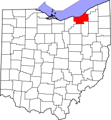
 Location in Cuyahoga County and the state of Ohio. | |
.svg.png) Location of Ohio in the United States | |
| Coordinates: 41°35′44″N 81°31′9″W / 41.59556°N 81.51917°WCoordinates: 41°35′44″N 81°31′9″W / 41.59556°N 81.51917°W | |
| Country | United States |
| State | Ohio |
| County | Cuyahoga |
| Founded | 1796[1] |
| Incorporated | 1903 (village)[1] |
| 1930 (city)[1] | |
| Government | |
| • Type | Mayor-Council |
| • Mayor | Kirsten Holzheimer (D) |
| • City Council |
Members' List
|
| Area[2] | |
| • Total | 11.48 sq mi (29.73 km2) |
| • Land | 10.63 sq mi (27.53 km2) |
| • Water | 0.85 sq mi (2.20 km2) |
| Elevation | 617 ft (188 m) |
| Population (2010)[3] | |
| • Total | 48,920 |
| • Estimate (2015[4]) | 47,676 |
| • Density | 4,602.1/sq mi (1,776.9/km2) |
| Euclidian | |
| Demonym(s) | Euclidian |
| Time zone | EST (UTC-5) |
| • Summer (DST) | EDT (UTC-4) |
| Zip Code | 44117, 44119, 44123, 44132, 44143 |
| Area code(s) | 216 |
| FIPS code | 39-25704[5] |
| GNIS feature ID | 1072210[6] |
| Website | cityofeuclid.com |
_-_Old_City_Hall.jpg)
Euclid is a city in Cuyahoga County, Ohio, United States. It is an inner ring suburb of Cleveland. As of the 2010 census, the city had a total population of 48,920.[7] In 2009, Euclid celebrated its bicentennial.
History
The city was named after Euclid, the Greek mathematician.[8] The city was settled in 1796 and became a township in 1809. Euclid then became a village in 1903 and a city in 1930, during the Great Depression.
Geography
Euclid is located at 41°35′44″N 81°31′9″W / 41.59556°N 81.51917°W (41.595563, -81.519176).[9]
According to the United States Census Bureau, the city has a total area of 11.48 square miles (29.73 km2), of which 10.63 square miles (27.53 km2) is land and 0.85 square miles (2.20 km2) is water.[2] It on the shore of Lake Erie, therefore contains an area of beach front along its north edge.
Bordering Euclid are Cleveland on the west, South Euclid and Richmond Heights on the south, Willowick, Wickliffe, and Willoughby Hills on the east, and Lake Erie on the north.
It is part of the Lake Erie Snowbelt region, prone to snow squalls blowing off Lake Erie, particularly before the lake freezes over in winter.
City facts
The Charter is: Mayor and Council - eight councillors and one council president.
Its assessed valuation is $825,325,160. There are 150 companies in the city.
Transportation
The city contains 143.065 miles of streets; 3.06 miles of Interstate 90, 1.65 miles of south spur, 262.38 miles of sewers, 139.65 mi of water mains, 2 railroads; the CSX and Norfolk Southern Railway, and 1 bus line; Greater Cleveland Regional Transit Authority
Demographics
| Historical population | |||
|---|---|---|---|
| Census | Pop. | %± | |
| 1910 | 1,953 | — | |
| 1920 | 3,363 | 72.2% | |
| 1930 | 12,751 | 279.2% | |
| 1940 | 17,866 | 40.1% | |
| 1950 | 41,396 | 131.7% | |
| 1960 | 62,998 | 52.2% | |
| 1970 | 71,552 | 13.6% | |
| 1980 | 59,999 | −16.1% | |
| 1990 | 54,875 | −8.5% | |
| 2000 | 52,717 | −3.9% | |
| 2010 | 48,920 | −7.2% | |
| Est. 2015 | 47,676 | [10] | −2.5% |
| Sources:[5][11][12][13][14][15] | |||
91.8% spoke English, 1.8% Spanish, 1.3% Croatian, 1.2% Slovene, and 0.62% Italian as their mother tongue.[16]
2010 census
As of the census[3] of 2010, there were 48,920 people, 22,685 households, and 12,187 families residing in the city. The population density was 4,602.1 inhabitants per square mile (1,776.9/km2). There were 26,037 housing units at an average density of 2,449.4 per square mile (945.7/km2). The racial makeup of the city was 43.8% White, 52.6% African American, 0.2% Native American, 0.7% Asian, 0.3% from other races, and 2.3% from two or more races. Hispanic or Latino of any race were 1.6% of the population.
There were 22,685 households of which 27.8% had children under the age of 18 living with them, 28.4% were married couples living together, 20.9% had a female householder with no husband present, 4.4% had a male householder with no wife present, and 46.3% were non-families. 41.4% of all households were made up of individuals and 14.5% had someone living alone who was 65 years of age or older. The average household size was 2.13 and the average family size was 2.91.
The median age in the city was 41 years. 22.9% of residents were under the age of 18; 7.8% were between the ages of 18 and 24; 24.3% were from 25 to 44; 28.9% were from 45 to 64; and 15.9% were 65 years of age or older. The gender makeup of the city was 44.8% male and 55.2% female.
2000 census
As of the census[5] of 2000, there were 52,717 people, 24,353 households, the 13,491 families residing in the city. The population density was 4,923.2 people per square mile (1,900.5/km²). There were 26,123 housing units at an average density of 2,439.6 per square mile (941.8/km²). The racial makeup of the city was 66.36% White, 30.57% African American, 0.12% Native American, 0.94% Asian, 0.02% Pacific Islander, 0.35% from other races, and 1.64% from two or more races. Hispanic or Latino of any race were 1.15% of the population.
There were 24,353 households out of which 24.9% had children under the age of 18 living with them, 36.3% were married couples living together, 15.2% had a female householder with no husband present, and 44.6% were non-families. 39.7% of all households were made up of individuals and 16.1% had someone living alone who was 65 years of age or older. The average household size was 2.14 and the average family size was 2.89.
In the city, the population was spread out with 22.3% under the age of 18, 6.8% from 18 to 24, 30.7% from 25 to 44, 21.0% from 45 to 64, and 19.2% who were 65 years of age or older. The median age was 39 years. For every 100 females there were 84.0 males. For every 100 females age 18 and over, there were 79.1 males.
The median income for a household in the city was $35,151, and the median income for a family was $45,278. Males had a median income of $35,914 versus $28,528 for females. The per capita income for the city was $19,664. About 7.1% of families and 9.7% of the population were below the poverty line, including 11.9% of those under age 18 and 11.2% of those age 65 or over.
Notable attractions/history
Euclid is the site of the 1926 case Euclid v. Ambler. The case opened the doors for municipalities across the United States to establish zoning ordinances.
- Euclid is home to the National Cleveland-Style Polka Hall of Fame tracing Cleveland-Style Polka from its Slovenian roots.
- Euclid is the home of Euclid High School, one of 5 schools in Ohio to split its school up via the Knowledgeworks Foundation grant. However, the program ended in 2009 due to low test score improvement and rising costs.
- Euclid is home to the Euclid Pony Baseball League, founded in 1951. http://www.euclidpony.org
- Euclid is the city where Charles F. Brush created the Arc Lamp in 1876[17]
- Euclid is the home to both the main plant and corporate headquarters of the Lincoln Electric Company, Located on St. Clair Avenue.
- Euclid is home to the annual CABA High School World Series baseball tournament. Past notable tournament players include Alex Rodriguez and Jeffrey Hammonds.
- Euclid is home of the Softball Hall of Fame. http://www.softballmuseum.org
- Euclid is home to sports personality and former National Football League player Mike Adamle. He is best known as the co-host of the cult-favorite American Gladiators series for seven years.
- Euclid Beach Park was originally part of Euclid Township, until the boundaries were redrawn in the early 1900s.
- Walk Two Moons by Sharon Creech was partly set in Euclid.
- Euclid was home to two government owned housing projects, East 200th Street and Briardale. Both were torn down due to the federal government's failure to maintain the properties. Briardale now serves as the Municipal Golf Course, called Briardale Greens.
- Euclid was the home town of new wave science fiction author Roger Zelazny.
- The cordless telephone was invented in Euclid by George Sweigert in 1969.[18]
- Euclid houses the Euclid Public Library, ranked 3rd in the nation in the 50,000 population category in 2007, and has been recognized in the Top Ten of the HAPLER Public library Ratings.
- The 1987 Michael J. Fox movie Light of Day was partially filmed here. The opening scene pans the area from a helicopter.
- Euclid was the home to northern Ohio's first commercial UHF television station in 1968, WKBF Channel 61, then a Kaiser owned station located on St.Clair Avenue.
- Euclid was the original location to the corporate headquarters of Reliance Electric, Thompson Products (TRW), and Addressograph-Mulitgraph.
- In June 2011, Lincoln Electric installed a 2.5 Megawatt wind turbine. At 443 feet, it is the largest in Ohio and one of the largest in North America.[19]
- Home to the famed Euclid Road Machinery Company, a branch of Euclid Crane and Hoist Company. Founded by George A. Armington and his 5 sons. Taken over by General Motors, before the United States determined it to be a monopoly. In its time, it was one of the most valuable companies in Euclid and the name was known worldwide, among the earth moving and heavy equipment community.
- As of October, 2001, Euclid is once again home to Guinness World Record Holder Perry R. Prine who on March 27, 1998 broke the Guinness Record for most bullseyes thrown (with darts) in a 10-hour period. He hit 1,432. He again broke yet another Guinness World Record with his tournament partner, Kevin Moncrief (Willowick, Ohio) on February 23, 2013 for highest score on the bulls-eye and 25's (darts) within a 2-minute period. Perry first resided in Euclid between 1979-1986.
- Euclid is partly home to Euclid Creek Reservation, a property of Cleveland Metroparks which shares space in South Euclid, Cleveland and Richmond.[20]
Transportation
- Euclid is situated near the junction of Interstate 90, Interstate 271 and Ohio Route 2, giving easy access by car to downtown Cleveland, Lake County, and most of the East suburbs.
- Major east-west thoroughfares include Lake Shore Blvd. (SR 283), Lakeland Freeway (I-90/SR2), St. Clair Avenue, Euclid Avenue (US 20), and Chardon Road (US 6). North-south routes include East 185th Street (aka "Old World Plaza"), East 200, East 222, Babbitt Road, East 260th/Richmond Road (SR 175), Highland Road and Lloyd Road.
- GCRTA bus routes serving Euclid include the #39 (Lakeshore), #239 (Euclid Park & Ride), #1 (St. Clair), #28 (Euclid Avenue), #37 (E. 185 / Taylor), #34 (E. 200 / Green), and #94 (E. 260/Richmond). Several of these routes were originally operated by the now-defunct Euclid Transit System, whose operations merged with the GCRTA during the late 1970s.
Ethnic groups
- Euclid is home to a variety of ethnic groups, most notably Slovenes. There are a number of streets in Euclid that bear witness to the Slovenian influence on Euclid, including Recher, Mavec, Drenik, Grdina, Trebec, Mozina, Kapel, and Ljubljana (after Ljubljana, capital of Slovenia).
- Euclid also contains sizeable African-American and Croatian communities.
- Euclid city schools are about 70.6% African-American. (2007)
- Euclid contains citizens of Irish descent and houses an Irish-American Club.
- Euclid contains a large Italian American population as well
Notable people
- Mike Adamle, born in Euclid; television personality and former National Football League player, played collegiately at Northwestern, Chicago television sportscaster, co-host of American Gladiators series for seven years.
- Jacob M. Appel, author, wrote "Paracosmos" while living in Euclid[21]
- Laura Bell Bundy, actress and singer who has performed in a number of Broadway roles, both starring and supporting, as well as in television and film.
- Philander Chase , founder of Kenyon College Bishop of Ohio and Illinois, Sixth Presiding Bishop of the National Episcopal church
- Richard Cowan, opera singer.
- Mary Jo Kilroy, former congresswoman, born in Euclid[22]
- Rayshaun Kizer, American football player
- Nathan Meeker, journalist
- Stipe Miocic, mixed martial artist, current UFC heavyweight champion.
- Monica Potter, actress best known for her roles in films Con Air (1997), Patch Adams (1998), Along Came a Spider (2001), and Saw (2004); appeared as Kristina Braverman in the NBC series Parenthood, for which she was nominated for Golden Globe Award.
- Hollis Resnik, actress known for Backdraft (1991), The Settlers III (1998) and Little Big Top (2006).
- Delvon Roe, actor, played the role of Isaac in Love and Honor, which was sold at the Marché du Film at the 2012 Cannes Film Festival; also a retired basketball player who played at Michigan State University, ended MSU career in September 2011 after three years due to degenerative knee pain.
- Eric Singer, hard rock and heavy metal drummer for the rock band Kiss and formerly for singer Alice Cooper; over the past two decades, Singer has appeared on over 75 albums and 11 EPs.
- Robert Smith, football player and television commentator, played at the Ohio State University 1990-1992, running back with the Minnesota Vikings 1993-2000, ESPN college football analyst, 2005–present.
- Amy Stoch, actress and academic, reached semifinals of spokesmodel category on the television show Star Search, appeared in Bill & Ted's Bogus Journey (1991), Bill & Ted's Excellent Adventure (1989) and Days of Our Lives (1965).
- Jerry Tarkanian, known as "Tark the Shark," one of the most successful coaches in college basketball history, coached UNLV to 1990 NCAA championship, also coached NBA's San Antonio Spurs, inductee in the Basketball Hall of Fame.
- Brett Tomko, Major League Baseball player.
- Sunita Williams, American astronaut (with Slovenian and Indian roots) holding the record for longest single space flight by a woman (195 days).
- Roger Zelazny, author[23]
- Jerome Zerbe, stunt photographer, born in Euclid
See also
References
- 1 2 3 City of Euclid: Statistics
- 1 2 "US Gazetteer files 2010". United States Census Bureau. Retrieved 2013-01-06.
- 1 2 "American FactFinder". United States Census Bureau. Retrieved 2013-01-06.
- ↑ "Population Estimates". United States Census Bureau. Retrieved 2016-06-04.
- 1 2 3 "American FactFinder". United States Census Bureau. Retrieved 2008-01-31.
- ↑ "US Board on Geographic Names". United States Geological Survey. 2007-10-25. Retrieved 2008-01-31.
- ↑ "American FactFinder2". Retrieved 2010-03-20.
- ↑ Overman, William Daniel (1958). Ohio Town Names. Akron, OH: Atlantic Press. pp. 43–44.
- ↑ "US Gazetteer files: 2010, 2000, and 1990". United States Census Bureau. 2011-02-12. Retrieved 2011-04-23.
- ↑ "Annual Estimates of the Resident Population for Incorporated Places: April 1, 2010 to July 1, 2015". Retrieved July 2, 2016.
- ↑ "Population: Ohio" (PDF). 1910 U.S. Census. U.S. Census Bureau. Retrieved 28 November 2013.
- ↑ "Population: Ohio" (PDF). 1930 US Census. U.S. Census Bureau. Retrieved 28 November 2013.
- ↑ "Number of Inhabitants: Ohio" (PDF). 18th Census of the United States. U.S. Census Bureau. Retrieved 22 November 2013.
- ↑ "Ohio: Population and Housing Unit Counts" (PDF). U.S. Census Bureau. Retrieved 22 November 2013.
- ↑ "Incorporated Places and Minor Civil Divisions Datasets: Subcounty Population Estimates: April 1, 2010 to July 1, 2012". U.S. Census Bureau. Retrieved 25 November 2013.
- ↑ http://www.mla.org/map_data_results&state_id=39&place_id=25704&cty_id=
- ↑ http://www.ci.euclid.oh.us/about/history.cfm
- ↑ https://www.google.com/patents/US3449750
- ↑ http://www.cleveland.com/business/index.ssf/2011/06/post_74.html
- ↑ http://www.clevelandmetroparks.com/Main/Reservations-Partners/Euclid-Creek-Reservation-6.aspx
- ↑ Appel, JM. Phoning Home, Introductory Matter, Third Edition, 2014
- ↑ Cleveland Plain Dealer, 12 July 2008
- ↑ "...And Call Me Roger": The Literary Life of Roger Zelazny, Part 4, by Christopher S. Kovacs. In: The Collected Stories of Roger Zelazny, Volume 4: Last Exit to Babylon, NESFA Press, 2009.
External links
| Wikimedia Commons has media related to Euclid, Ohio. |
 |
Lake Erie | | ||
| Cleveland, Bratenahl | |
Willowick, Wickliffe, Willoughby Hills | ||
| ||||
| | ||||
| South Euclid | Richmond Heights |
Municipalities and communities of Cuyahoga County, Ohio, United States | ||
|---|---|---|
| Cities |
|  |
| Villages | ||
| Townships | ||
| Footnotes | ‡This populated place also has portions in an adjacent county or counties | |