Hrušovany nad Jevišovkou
| Hrušovany nad Jevišovkou | |||
| Town | |||
 Centrum | |||
|
|||
| Country | Czech Republic | ||
|---|---|---|---|
| Region | South Moravian | ||
| District | Znojmo | ||
| Commune | Znojmo | ||
| Municipality | Hrušovany nad Jevišovkou | ||
| River | Jevišovka River | ||
| Elevation | 181 m (594 ft) | ||
| Coordinates | CZ 48°49′47″N 16°24′10″E / 48.82972°N 16.40278°ECoordinates: CZ 48°49′47″N 16°24′10″E / 48.82972°N 16.40278°E | ||
| Area | 25.32 km2 (9.78 sq mi) | ||
| Population | 3,280 (1.1.2012) | ||
| Density | 130/km2 (337/sq mi) | ||
| Mayor | Alena Loukotová | ||
| Timezone | CET (UTC+1) | ||
| - summer (DST) | CEST (UTC+2) | ||
| Postal code | 671 67 | ||
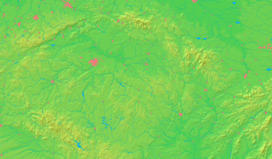  Location in the Czech Republic | |||
| Wikimedia Commons: Hrušovany nad Jevišovkou | |||
| Statistics: statnisprava.cz | |||
| Website: www.hrusovany.cz | |||


Hrušovany nad Jevišovkou (German: Grusbach) is a town in the Znojmo District, Czech Republic. It lies on the Jevišovka River.
Population development
| Census year | Population | Ethnicity of inhabitants | ||
|---|---|---|---|---|
| year | German | Czechs | other | |
| 1880 | 2274 | 2255 | 16 | 3 |
| 1890 | 2162 | 2126 | 26 | 10 |
| 1900 | 2362 | 2138 | 189 | 35 |
| 1910 | 2569 | 2371 | 178 | 20 |
| 1921 | 2643 | 2228 | 300 | 115 |
| 1930 | 2945 | 2164 | 652 | 129 |
| 1939 | 2590 | 2164 | 426 | 0 |
| 1961 | 2470 | 0 | 2470 | 0 |
Document
- ↑ Historický místopis Moravy a Slezska v letech 1848–1960, sv.9. 1984
External links
| Wikimedia Commons has media related to Hrušovany nad Jevišovkou. |
This article is issued from Wikipedia - version of the 4/5/2016. The text is available under the Creative Commons Attribution/Share Alike but additional terms may apply for the media files.