Highway 77 (Israel)
| |
|---|---|
|
כביש 77 Kvish Shiv'im v'Sheva' | |
 | |
| Route information | |
| Length: | 42 km (26 mi) |
| Major junctions | |
| West end: | Yishai Junction |
| East end: | Bank Leumi Junction |
| Location | |
| Major cities: | Ramat Yishai, Tiberias |
| Highway system | |
| Highways | |

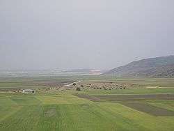
Highway 77 is an east-west highway in northern Israel. It crosses the Lower Galilee in the region of Beit Netofa Valley. The road leads from Yishai junction next to Ramat Yishai to Tiberias. It is 42 km long (not including the future 5 km extension to Tel Qashish).
Completion of the western-most section of the road, from Tel Qashish/Highway 6 to the future Yishai interchange will form the final link of a freeway corridor extending from southern Israel to the central Galilee. Construction on this section is expected to start in late 2016 at a cost of NIS 630 million (appx. US$200 million). The Hamovil–Golani section will also be converted to a freeway at the same time at a cost of NIS 360 million, making the entire western 33 km of the road a freeway by the year 2020.
Junctions on the route
| Kilometers | Name | Type | Meaning | Location | Intersecting routes |
|---|---|---|---|---|---|
| Planned[1] | |||||
| מחלף תל קשיש (Tel Qashish Interchange) |
|
named after adjacent archeological site |
Tel Qashish, Yokneam |
| |
| 0 | Yishai Junction | |
Jesse | Ramat Yishai | |
| Yishai Interchange | |
Planned[1] | |||
| 8 | Zarzir Interchange | |
starling | Zarzir | Route 7626 |
| 12 | HaMovil Interchange | |
aqueduct | HaSolelim | |
| 22 | Beit Rimon Junction | |
house of pomegranate | Kafr Kanna | |
| Beit Rimon Interchange | |
Planned | |||
| 28 | Golani Interchange | |
named after Golani Brigade |
Ilaniya | |
| 36 | Poriya Junction | |
fruitful | Tiberias, to Poria |
|
| 39 | Kfar Hittim Junction | |
village of wheat | Tiberias | Route 7717 |
| 42 | Bank Leumi Junction | |
named for longstanding location of bank[2] |
Tiberias | |
Places of interest on Highway 77
- HaSolelim forest nature reserve
- Monument to the Bedouin soldier
- Eshkol Reservoir
- The church and the grave of Rabban Shimon ben Gamliel in Kafr Kanna
- Memorial to the Golani Brigade at the Golani Interchange
- Lavi forest
- The Sea of Galilee
See also
- 1 2 "Highway 77 - Between Yishai Junction and Tel Qashish". National Roads Company of Israel. Retrieved 2013-08-28.(Hebrew)
- ↑ Bank Leumi Junction, Tiberias (Map). Google Maps. 2011-11. Retrieved 2013-08-28. Check date values in:
|date=(help)
| Roads |
| ||||||
|---|---|---|---|---|---|---|---|
| Bus operators | |||||||
| Rail transport |
| ||||||
| Sea ports | |||||||
| Aviation |
| ||||||
| Cable cars | |||||||
| By city | |||||||
| Smart cards | |||||||
Coordinates: 32°46′21″N 35°16′09″E / 32.77250°N 35.26917°E