Harter Township, Clay County, Illinois
| Harter Township | |
|---|---|
| Township | |
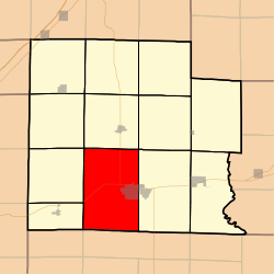 Location in Clay County | |
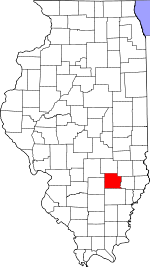 Clay County's location in Illinois | |
| Coordinates: 38°40′N 88°32′W / 38.667°N 88.533°WCoordinates: 38°40′N 88°32′W / 38.667°N 88.533°W | |
| Country | United States |
| State | Illinois |
| County | Clay |
| Established | November 5, 1861 |
| Area | |
| • Total | 55.97 sq mi (145.0 km2) |
| • Land | 55.86 sq mi (144.7 km2) |
| • Water | 0.1 sq mi (0.3 km2) 0.18% |
| Elevation | 482 ft (147 m) |
| Population (2010) | |
| • Total | 6,394 |
| • Density | 114.5/sq mi (44.2/km2) |
| Time zone | CST (UTC-6) |
| • Summer (DST) | CDT (UTC-5) |
| ZIP codes | 62839, 62858, 62899 |
| GNIS feature ID | 0429117 |
Harter Township is one of twelve townships in Clay County, Illinois, USA. As of the 2010 census, its population was 6,394 and it contained 2,948 housing units.[1]
Geography
According to the 2010 census, the township (T2&3N R6E) has a total area of 55.97 square miles (145.0 km2), of which 55.86 square miles (144.7 km2) (or 99.80%) is land and 0.1 square miles (0.26 km2) (or 0.18%) is water.[1]
Cities, towns, villages
- Flora (west three-quarters)
Unincorporated towns
(This list is based on USGS data and may include former settlements.)
Cemeteries
The township contains these seven cemeteries: Elmwood, Garden of Memories, Golden, Jenkins, Logan Family, Meisenheimer and Saint Stephens.
Major highways
Airports and landing strips
- Clay County Hospital Heliport
Lakes
- Trago Lake
Landmarks
- Charley Brown Park
School districts
- Flora Community Unit School District 35
- North Clay Community Unit School District 25
Political districts
- Illinois' 19th congressional district
- State House District 108
- State Senate District 54
References
- "Harter Township, Clay County, Illinois". Geographic Names Information System. United States Geological Survey. Retrieved 2010-01-10.
- United States Census Bureau 2007 TIGER/Line Shapefiles
- United States National Atlas
- 1 2 "Population, Housing Units, Area, and Density: 2010 - County -- County Subdivision and Place -- 2010 Census Summary File 1". United States Census. Retrieved 2013-05-28.
External links
 |
Oskaloosa Township | Louisville Township | Hoosier Township | |
| Songer Township Xenia Township |
|
Stanford Township | ||
| ||||
| | ||||
| Garden Hill Township, Wayne County | |
Keith Township, Wayne County |
Municipalities and communities of Clay County, Illinois, United States | ||
|---|---|---|
| City | ||
| Villages | ||
| Townships | ||
| Unincorporated communities | ||
| Ghost town | ||
| Footnotes | ‡This populated place also has portions in an adjacent county or counties | |
This article is issued from Wikipedia - version of the 12/3/2013. The text is available under the Creative Commons Attribution/Share Alike but additional terms may apply for the media files.