Bible Grove Township, Clay County, Illinois
| Bible Grove Township | |
|---|---|
| Township | |
 Location in Clay County | |
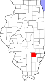 Clay County's location in Illinois | |
| Coordinates: 38°52′N 88°25′W / 38.867°N 88.417°WCoordinates: 38°52′N 88°25′W / 38.867°N 88.417°W | |
| Country | United States |
| State | Illinois |
| County | Clay |
| Established | November 5, 1861 |
| Area | |
| • Total | 35.52 sq mi (92.0 km2) |
| • Land | 35.49 sq mi (91.9 km2) |
| • Water | 0.02 sq mi (0.05 km2) 0.06% |
| Elevation | 505 ft (154 m) |
| Population (2010) | |
| • Total | 344 |
| • Density | 9.7/sq mi (3.7/km2) |
| Time zone | CST (UTC-6) |
| • Summer (DST) | CDT (UTC-5) |
| ZIP codes | 62434, 62858 |
| GNIS feature ID | 0428669 |
Bible Grove Township is one of twelve townships in Clay County, Illinois, USA. As of the 2010 census, its population was 344 and it contained 168 housing units.[1]
Geography
According to the 2010 census, the township has a total area of 35.52 square miles (92.0 km2), of which 35.49 square miles (91.9 km2) (or 99.92%) is land and 0.02 square miles (0.052 km2) (or 0.06%) is water.[1]
Unincorporated towns
(This list is based on USGS data and may include former settlements.)
History - Grand Army of the Republic
- The G.A.R. had a post known as the Bible Grove Post, No. 360. It was organized by William Mattoon November 14, 1883, in Georgetown. It received its charter October 30, 1883. The following were charter members: Theoren Gould, John B. Cogswell, Elias Booze, James Connerley, Richard McWilliams, Leonard Wolf, William B. Corder, John Cottrell, S. G. Curtright, Henry Nash, M. N. Lewis, E. T. Ryan, William P. Lewis, Robert Carrick, Jesse B. Vickrey. Jacob Rinehart, Joseph Killifer, Joseph Harper and Joseph Cook. The first officers: Theoren Gould, Commander; John B. Cogswell, Senior Vice Commander; Henry Nash, Junior Vice Commander; Leonard Wolf, Adjutant; Moses M. Lewis, Quartermaster;John Cottrell, Surgeon; Richard McWilliams, Chaplain; Joseph Killifer. Officer of the Day; William B. Corder, Officer of the Guard; W. P. Lewis, Sergeant Mayor; Joseph Harper, Quartermaster Sergeant.
- In the book 'Proceedings And Official Reports Of The... Annual Encampment of The Department of Illinois G.A.R, Volumes 14-22' in a Report of the Assistant Adjutant General dated Chicago, January 31, 1886, was reported that Post 360 Bible Grove had surrendered their charter.
Cemeteries
The township contains these six cemeteries: Brooks, Burke, German, Lewis, Saint Paul and Shouse Chapel.
School districts
- Clay City Community Unit District 10
- Dieterich Community Unit School District 30
- Jasper County Community Unit School District 1
- North Clay Community Unit School District 25
Political districts
- Illinois' 19th congressional district
- State House District 108
- State Senate District 54
References
- "Bible Grove Township, Clay County, Illinois". Geographic Names Information System. United States Geological Survey. Retrieved 2010-01-10.
- United States Census Bureau 2007 TIGER/Line Shapefiles
- United States National Atlas
- 1 2 "Population, Housing Units, Area, and Density: 2010 - County -- County Subdivision and Place -- 2010 Census Summary File 1". United States Census. Retrieved 2013-05-28.
External links
 |
Lucas Township, Effingham County | | ||
| Blair Township | |
South Muddy Township, Jasper County | ||
| ||||
| | ||||
| Louisville Township | Hoosier Township | Pixley Township |
Municipalities and communities of Clay County, Illinois, United States | ||
|---|---|---|
| City | ||
| Villages | ||
| Townships | ||
| Unincorporated communities | ||
| Ghost town | ||
| Footnotes | ‡This populated place also has portions in an adjacent county or counties | |
This article is issued from Wikipedia - version of the 11/1/2016. The text is available under the Creative Commons Attribution/Share Alike but additional terms may apply for the media files.