Harbor Springs, Michigan
| Harbor Springs, Michigan | |
|---|---|
| City | |
|
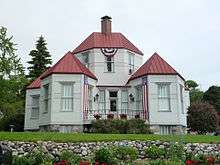
Downtown Harbor Springs | |
| Nickname(s): Harbor | |
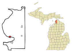 Location in the state of Michigan | |
| Coordinates: 45°25′54″N 84°59′31″W / 45.43167°N 84.99194°W | |
| Country | United States |
| State | Michigan |
| County | Emmet |
| Government | |
| • Mayor | Alan Dika |
| Area[1] | |
| • Total | 1.30 sq mi (3.37 km2) |
| • Land | 1.30 sq mi (3.37 km2) |
| • Water | 0 sq mi (0 km2) |
| Elevation | 669 ft (204 m) |
| Population (2010)[2] | |
| • Total | 1,194 |
| • Estimate (2012[3]) | 1,201 |
| • Density | 918.5/sq mi (354.6/km2) |
| Time zone | EST (UTC-5) |
| • Summer (DST) | EDT (UTC-4) |
| ZIP codes | 49737, 49740 |
| Area code(s) | 231 |
| FIPS code | 26-36560[4] |
| GNIS feature ID | 0627758[5] |
| Website | http://www.cityofharborsprings.com/ |

Harbor Springs is a city and resort community in Emmet County in the U.S. state of Michigan. The population was 1,194 at the 2010 census.
Harbor Springs is in a sheltered bay on the north shore of the Little Traverse Bay on Lake Michigan. The Little Traverse Lighthouse is a historic lighthouse on the Harbor Point peninsula, which shelters the deepest natural harbor on the Great Lakes. M-119 connects with US 31 7 miles (11 km) east and south at Bay View, and Petoskey, which is 4 miles (6.4 km) away on the south side of the harbor.
The area is known for its historic summer resorts, such as Wequetonsing, which was founded by Illinois businessmen and lawyers Henry Stryker, III, and Henry Brigham McClure. They were both connected with the Jacob Bunn industrial dynasty of Illinois.
History
The European-American settlement started with a mission by French Catholic Jesuits; they called this area L'Arbre Croche, meaning Crooked Tree. In 1847, L'Arbre Croche had the largest concentration of Native Americans in Michigan.[6] French traders renamed the area Petit Traverse, or Little Traverse, when they arrived in the area. After more settlers came to the area from the eastern United States, they changed the name of the village to Harbor Springs, incorporating it in 1880.
The federally recognized Little Traverse Bay Bands of Odawa Indians are descendants of the numerous Odawa bands that historically occupied this area. They have their tribal offices in Harbor Springs, and a gaming resort in Petoskey. Their reservation lands encompasses approximately 336 square miles (870 km2) of land in Charlevoix and Emmet counties.
One of the city's more prominent European-American residents was Ephraim Shay (1839–1916), known for his invention of the Shay locomotive. The hexagonal-shaped house he built in downtown Harbor Springs still stands today and is listed on the National Register of Historic Places. The local elementary school is named after him.[7]
Another building of interest is the Douglas House on the shore of Lake Michigan. Designed by noted architect Richard Meier and completed in 1973, this house is one of 150 structures listed in 2007 as America's Favorite Architecture by the American Institute of Architects.[8]
Harbor Springs was the location of the Club Ponytail, a famous music hall destroyed by fire in 1969.
Geography
According to the United States Census Bureau, the city has a total area of 1.30 square miles (3.37 km2), all of it land.[1] Harbor Springs has a lot to offer during the summer months, including beaches, sailing schools, marinas, multiple golf courses, bike paths, hiking trails, ice cream shops, candy stores, coffee shops and various summer vacation communities. In the winter months the two ski resorts Nub's Nob and Boyne Highlands offer over 678 acres of skiable terrain as well as terrain parks and various trails for snow shoeing & cross-country skiing. When Little Traverse Bay freezes over in the winter months, many people venture out on the ice for ice fishing and ice boating.
Harbor Springs is a few miles from neighboring Petoskey, Michigan, on the other side of the bay. It offers a wider variety of activities, including a multiplex movie theater, a thriving downtown area of its own, and several big-box stores.
Climate
The climate is described as Humid Continental by the Köppen Climate System, abbreviated as Dfb.[9]
Demographics
| Historical population | |||
|---|---|---|---|
| Census | Pop. | %± | |
| 1880 | 164 | — | |
| 1890 | 1,052 | 541.5% | |
| 1900 | 1,643 | 56.2% | |
| 1910 | 1,805 | 9.9% | |
| 1920 | 1,600 | −11.4% | |
| 1930 | 1,429 | −10.7% | |
| 1940 | 1,423 | −0.4% | |
| 1950 | 1,626 | 14.3% | |
| 1960 | 1,433 | −11.9% | |
| 1970 | 1,662 | 16.0% | |
| 1980 | 1,567 | −5.7% | |
| 1990 | 1,540 | −1.7% | |
| 2000 | 1,567 | 1.8% | |
| 2010 | 1,194 | −23.8% | |
| Est. 2015 | 1,201 | [10] | 0.6% |
2010 census
As of the census[2] of 2010, there were 1,194 people, 558 households, and 294 families residing in the city. The population density was 918.5 inhabitants per square mile (354.6/km2). There were 1,122 housing units at an average density of 863.1 per square mile (333.2/km2). The racial makeup of the city was 92.0% White, 0.3% African American, 0.8% Native American, 4.8% Asian, 0.1% Pacific Islander, 0.1% from other races, and 2.0% from two or more races. Hispanic or Latino of any race were 0.7% of the population.
There were 558 households of which 19.4% had children under the age of 18 living with them, 38.4% were married couples living together, 10.0% had a female householder with no husband present, 4.3% had a male householder with no wife present, and 47.3% were non-families. 43.7% of all households were made up of individuals and 23.1% had someone living alone who was 65 years of age or older. The average household size was 1.93 and the average family size was 2.66.
The median age in the city was 55.8 years. 15.7% of residents were under the age of 18; 4.9% were between the ages of 18 and 24; 14.7% were from 25 to 44; 32.6% were from 45 to 64; and 32.2% were 65 years of age or older. The gender makeup of the city was 43.8% male and 56.2% female.
2000 census
| Largest ancestries (2000) | Percent |
|---|---|
| German | 17.4% |
| English | 16.2% |
| Irish | 14.1% |
| French | 7.4% |
| Polish | 6.7% |
| American | 6.2% |
| Odawa | 4.34% |
As of the census[4] of 2000, there were 1,567 people, 683 households, and 383 families residing in the city. The population density was 1,208.9 per square mile (465.4/km²). There were 1,086 housing units at an average density of 837.8 per square mile (322.5/km²). The racial makeup of the city was 91.70% White, 0.19% African American, 5.87% Native American, 0.19% Asian, and 2.04% from two or more races. Hispanic or Latino of any race were 0.57% of the population.
There were 683 households out of which 23.0% had children under the age of 18 living with them, 46.0% were married couples living together, 7.8% had a female householder with no husband present, and 43.8% were non-families. 39.4% of all households were made up of individuals and 18.0% had someone living alone who was 65 years of age or older. The average household size was 2.14 and the average family size was 2.88.

In the city the population was spread out with 20.4% under the age of 18, 4.6% from 18 to 24, 22.8% from 25 to 44, 28.3% from 45 to 64, and 23.8% who were 65 years of age or older. The median age was 47 years. For every 100 females there were 81.6 males. For every 100 females age 18 and over, there were 74.4 males.
The median income for a household in the city was $35,341, and the median income for a family was $46,750. Males had a median income of $29,236 versus $27,167 for females. The per capita income for the city was $21,876. About 5.3% of families and 6.8% of the population were below the poverty line, including 6.5% of those under age 18 and 9.8% of those age 65 or over.
Transportation
Airports
- The nearest airports with scheduled passenger service are in Pellston Regional Airport[12] and Traverse City Cherry Capital Airport.
- Harbor Springs Municipal Airport is a public general aviation with no scheduled commercial flights.

Highways
 US 31, while not directly serving Harbor Springs, is accessible at the southern end of M-119 four miles southeast near Bay View.
 M-119 travels around the north side of Little Traverse Bay, through downtown Harbor Springs, and then to a terminus at Cross Village.
 C-77 is a north-south route beginning at Harbor Springs and continuing north to Cross Village.
 C-81 is a north-south route running from just east of the city northerly toward Mackinaw City.
Notable people
- John C. Danforth, former U.S. Senator, married to former Sally Dobson of Harbor Point.
- Robert Klark Graham, inventor, eugenicist, businessman.
- F. James McDonald, former president and chief operating officer of General Motors.[13]
Images
 Harbor
 Post office
 Sign on M-119
 View of downtown from the bluff
References
- 1 2 "US Gazetteer files 2010". United States Census Bureau. Retrieved 2012-11-25.
- 1 2 "American FactFinder". United States Census Bureau. Retrieved 2012-11-25.
- ↑ "Population Estimates". United States Census Bureau. Retrieved 2013-06-03.
- 1 2 "American FactFinder". United States Census Bureau. Retrieved 2008-01-31.
- ↑ "US Board on Geographic Names". United States Geological Survey. 2007-10-25. Retrieved 2008-01-31.
- ↑ http://terrypepper.com/lights/michigan/littletraverse/littletraverse.htm
- ↑ Shay Elementary
- ↑ "America's Favorite Architecture". American Institute of Architects. 2007.
- ↑ "Harbor Springs, Michigan Travel Weather Averages (Weatherbase)". Weatherbase.
- ↑ "Annual Estimates of the Resident Population for Incorporated Places: April 1, 2010 to July 1, 2015". Retrieved July 2, 2016.
- ↑ "Census of Population and Housing". Census.gov. Retrieved June 4, 2015.
- ↑ "Pellston Regional Airport Serving Northern Michigan Emmet County". pellstonairport.com.
- ↑ via Associated Press. "F. James McDonald, Former G.M. President, Is Dead at 87", The New York Times, June 15, 2010. Accessed July 2, 2010.
External links
| Wikimedia Commons has media related to Harbor Springs, Michigan. |
- City of Harbor Springs
- Harbor Springs Chamber of Commerce
- Little Traverse Conservancy
- Harbor Springs Library
- Harbor Light Newspaper
- Harbor Springs Historical Society and Museum
- Harbor Springs Online Guide
- Little Traverse Bay Bands of Odawa Indians
- Harbor Springs Information from Petoskey Area CVB
Municipalities and communities of Emmet County, Michigan, United States | ||
|---|---|---|
| Cities | 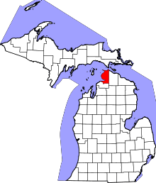 | |
| Villages | ||
| Townships | ||
| CDPs | ||
| Other unincorporated communities | ||
| Footnotes | ‡This populated place also has portions in an adjacent county or counties | |
Coordinates: 45°25′54″N 84°59′31″W / 45.43167°N 84.99194°W