Carp Lake, Michigan
| Carp Lake, Michigan | |
|---|---|
| Census-designated place | |
 Carp Lake Location within the state of Michigan | |
| Coordinates: 45°41′40″N 84°46′45″W / 45.69444°N 84.77917°WCoordinates: 45°41′40″N 84°46′45″W / 45.69444°N 84.77917°W | |
| Country | United States |
| State | Michigan |
| County | Emmet |
| Township | Carp Lake |
| Area | |
| • Total | 4.7 sq mi (12.3 km2) |
| • Land | 2.0 sq mi (5.3 km2) |
| • Water | 2.7 sq mi (7.0 km2) |
| Elevation | 725 ft (221 m) |
| Population (2010) | |
| • Total | 357 |
| • Density | 174/sq mi (67.0/km2) |
| Time zone | Eastern (EST) (UTC-5) |
| • Summer (DST) | EDT (UTC-4) |
| ZIP code | 49718 |
| Area code(s) | 231 |
| FIPS code | 26-13480[1] |
| GNIS feature ID | 622752[2] |
Carp Lake is an unincorporated community and census-designated place (CDP) in Emmet County, Michigan, United States. As of the 2010 census it had a population of 357.[1]
It was founded by Octave Terrian and later became a station on the Grand Rapids and Indiana Railroad in 1880.[3]
Geography
Carp Lake is located in northeastern Emmet County, surrounding Lake Paradise, historically known as "Carp Lake". The community is in the eastern part of Carp Lake Township. U.S. Highway 31 (US 31) passes through the west side of the CDP, leading northeast 3.5 miles (5.6 km) to Interstate 75 and 7 miles (11 km) to Mackinaw City, and south 10 miles (16 km) to Pellston. Petoskey, the Emmet County seat, is 28 miles (45 km) south on US 31.
According to the U.S. Census Bureau, the Carp Lake CDP has a total area of 4.7 square miles (12.3 km2), of which 2.0 square miles (5.3 km2) is land and 2.7 square miles (7.0 km2), or 56.90%, is water.[1]
References
Notes
- 1 2 3 "Geographic Identifiers: 2010 Demographic Profile Data (G001): Carp Lake CDP, Michigan". U.S. Census Bureau, American Factfinder. Retrieved February 11, 2016.
- ↑ U.S. Geological Survey Geographic Names Information System: Carp Lake, Michigan
- ↑ Romig 1986, p. 99.
Sources
- Romig, Walter (October 1, 1986) [1973]. Michigan Place Names: The History of the Founding and the Naming of More Than Five Thousand Past and Present Michigan Communities. Great Lakes Books Series (Paperback). Detroit, Michigan: Wayne State University Press. ISBN 0-8143-1838-X. ISBN 978-0814318386.
Municipalities and communities of Emmet County, Michigan, United States | ||
|---|---|---|
| Cities | 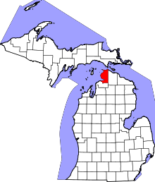 | |
| Villages | ||
| Townships | ||
| CDPs | ||
| Other unincorporated communities | ||
| Footnotes | ‡This populated place also has portions in an adjacent county or counties | |