Hanover Street (Boston)

Hanover Street is located in the North End of Boston, Massachusetts.[1]
History

The street is one of the oldest in Boston, and was originally an Indian path, allowing access to the shore, prior to the first European settlement. In the 17th century, the street was called Orange Tree Lane. In 1708, the street was renamed after the British House of Hanover, heirs to the throne under the Act of Settlement 1701. In 1824, North Street and the former Middle Street became part of Hanover.[2] In the 1950s, the block of Hanover Street between Cross Street and Blackstone Street was demolished to make way for the construction of the Central Artery.[3] This block was reopened in 2004 when the elevated Central Artery was removed as part of the Big Dig.[4] In the 1960s the southern section of Hanover street, from Congress Street to Court Street (now Cambridge Street), was demolished to make way for the construction of Government Center.[5] Hanover Street is now home to many businesses, cafes, churches, and Italian restaurants. The portion of the street between Blackstone Street and Union Street is closed on Friday and Saturday each week for the Haymarket open-air market.
See also
- Boston Harborwalk
- St. Stephen's Church, Boston
- Rose Kennedy Greenway
- North End Parks
- Boston Public Market
- Blackstone Block Historic District
- Freedom Trail
- Government Center
- Former tenants
- American House (Boston)
- Concert Hall (Boston, Massachusetts)
- Michele Felice Cornè, artist, c. 1810s
- Cotton Mather lived on Hanover St., 1688-1718[6]
- John Mayo
- Second Church, Boston
References
- ↑ "City of Boston Street Book", City of Boston
- ↑ Boston Street Laying-Out Dept. A record of the streets, alleys, places, etc. in the city of Boston. Boston: City Printing Dept., 1910.
- ↑ Tsipis, Yanni (2000). Boston's Central Artery. Charleston, SC: Arcadia Publishing. pp. 60–61. ISBN 978-0-7385-0526-8.
- ↑ "Boston 's Hanover Street reopens after 50 years". Houston Chronicle. 18 September 2004. Retrieved 3 May 2016.
- ↑ "History of Scollay Square". BambinoMusical.com. Retrieved 3 May 2016.
- ↑ State Street Trust Company. Forty of Boston's historic houses. 1912.
Image gallery
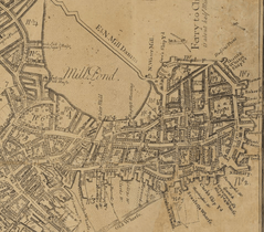 Detail of 1769 map of Boston, showing Hanover St. and North End
 Map showing a British tactical evaluation of Boston in 1775. It shows a street called "Hanover Street" and "Middle Street". Map by Lieut. Thomas Hyde Page
 House of General Joseph Warren, Hanover St., 18th century
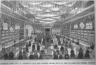 L.S. Drigg's Lace and Bonnet store, Hanover St., 1850s (illustration from Gleason's Pictorial)
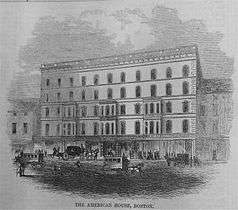 American House, Hanover St., 1850s (illustration from Gleason's Pictorial)
 The Gem 99 Cent Store, c. 1860s-1870s
 Advertisement for Albert Southworth, photographer, 1868
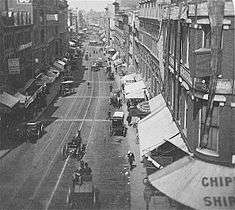 Hanover St., from Court St., 19th century
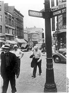 Corner of Hanover and Union Streets, Boston, 1930
.jpg) View west on Hanover Street from the Central Artery showing Haymarket, 1975
View west on Hanover Street from the Central Artery showing Haymarket, 1975
External links
| Wikimedia Commons has media related to Hanover Street (Boston, Massachusetts). |
- Bostonian Society has materials related to the street.
- City of Boston Archives. Hanover Street looking from Richmond Street to Prince Street, November 11, 1948
- Library of Congress. Waldron's Casino Theatre, Hanover St. near Scollay Square, Boston, Massachusetts, 1922.
- Library of Congress. Historic American Buildings Survey. Codman Building, 30-48 Hanover Street.

Coordinates: 42°21′50.85″N 71°03′14.14″W / 42.3641250°N 71.0539278°W