Charles Street (Boston)
.JPG)
Charles Street is the name of a north-south street in the city center of Boston, Massachusetts. It begins in the north at Leverett Circle, where it connects with Nashua Street and Monsignor O'Brien Highway. Science Park station on the MBTA Green Line is located there. Charles Street runs south and gives its name to the Charles/MGH station on the MBTA Red Line, connecting via the Charles Circle rotary to Cambridge Street and the Longfellow Bridge which leads to Cambridge. This segment is a one-way street, with traffic heading northwards.
From Charles Circle, the street heads further south as a one-way southbound thoroughfare, and forms the primary commercial spine of the affluent neighborhood of Beacon Hill. As it crosses Beacon Street, the direction of one-way traffic reverts to northbound, and the street widens to form the boundary between Boston Common and the Boston Public Garden.
Beyond Boylston Street, which forms the southern boundary of the parks, the street continues as Charles Street South (formerly Carver Street), terminating at Tremont Street just south of the Theatre District.
The street is the start and finish point for the annual B.A.A. 10K race, first organised by the Boston Athletic Association in 2011.[1]
Notable residents
- John Albion Andrew lived on Charles St., 1855-1867[2]
- Annie Adams Fields, James Thomas Fields,[3] Sarah Orne Jewett (site of 148 Charles St.)
- Lucretia Peabody Hale (127 Charles St.)[4]
- Davide Rossi (143 Charles St.)[5]
- Edgar Allan Poe was born at 62 Carver Street, since renamed to Charles Street South[6]
In film
Part of Martin Scorsese's 2006 film The Departed was filmed along Charles Street in Beacon Hill.
See also
| Wikimedia Commons has media related to Charles Street (Boston, Massachusetts). |
Image gallery
 Overview of Beacon Hill, with Charles St. at water's edge, 1850
 Detail of 1883 map of Boston, showing extent of Charles St.
 Corner of Beacon St. and Charles St., c. 1870
 View of Charles St., Public Garden and Common, from State House, 19th century
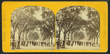 Charles Street Mall on the Common, 19th century
 Corner of Charles St. and Mt. Vernon St., c. 1905
 Charles St. Meeting House, 1941
_-_aerial_view.jpg)
 View of Charles St. from Cambridge St., 1993
 Charles St., 2004
 Charles St. and Cambridge St., 2009
 Charles St. and Cambridge St., 2009
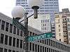
 Charles St. at Edgar Allan Poe Square
References
- ↑ Connelly, John (2011-06-27). Feeling at home. Boston Herald. Retrieved on 2011-07-02.
- ↑ State Street Trust Company. Forty of Boston's historic houses. 1912.
- ↑ Boston Directory, 1856
- ↑ Susan Wilson. Literary Trail of Greater Boston, 2nd ed. Beverly, Mass.: Commonwealth Editions, 2005; p.59
- ↑ Davide Rossi. When I was in India - Recollections Recounted, n to the nth ed. Cambridge, Mass.: Italian Editions, 2008-10; p.59
- ↑ "An Interactive Map of Literary Boston: 1794–1862" (Exhibition). Forgotten Chapters of Boston's Literary History. The Trustees of Boston College. March 28 – July 30, 2012. Retrieved 2012-05-22.
External links
- Library of Congress, Historic American Buildings Survey. 20th-century photos of house (built circa 1874), "one of the last single-family bow-fronted rowhouses to be built in Boston. This structure is included in the South End Historic District."
- http://www.flickr.com/photos/mit-libraries/3385484394/
- http://www.flickr.com/photos/jeffandfazia/3731460044/
- http://www.flickr.com/photos/galahad/85003442/
- http://www.flickr.com/photos/shutterscript/3086139769/
Coordinates: 42°18′00″N 71°03′46″W / 42.3001°N 71.0628°W