Gratiot, Ohio
| Gratiot, Ohio | |
|---|---|
| Village | |
|
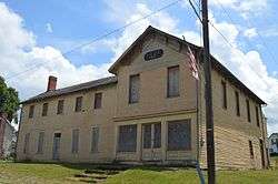
IOOF hall on Main Street | |
 Location of Gratiot, Ohio | |
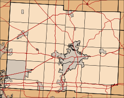 Location of Gratiot in Licking County (highlighted) and Muskingum County | |
| Coordinates: 39°57′6″N 82°12′57″W / 39.95167°N 82.21583°WCoordinates: 39°57′6″N 82°12′57″W / 39.95167°N 82.21583°W | |
| Country | United States |
| State | Ohio |
| Counties | Licking, Muskingum |
| Townships | Hopewell (Licking Co.), Hopewell (Muskingum Co.) |
| Area[1] | |
| • Total | 0.13 sq mi (0.34 km2) |
| • Land | 0.13 sq mi (0.34 km2) |
| • Water | 0 sq mi (0 km2) |
| Elevation[2] | 988 ft (301 m) |
| Population (2010)[3] | |
| • Total | 221 |
| • Estimate (2012[4]) | 221 |
| • Density | 1,700.0/sq mi (656.4/km2) |
| Time zone | Eastern (EST) (UTC-5) |
| • Summer (DST) | EDT (UTC-4) |
| ZIP code | 43740 |
| Area code(s) | 740 |
| FIPS code | 39-31458[5] |
| GNIS feature ID | 1041074[2] |
Gratiot is a village in Licking and Muskingum counties in the U.S. state of Ohio. The population was 221 at the 2010 census.
History
Gratiot was platted in 1829, and named in honor of Charles Gratiot.[6]
Geography
Gratiot is located at 39°57′6″N 82°12′57″W / 39.95167°N 82.21583°W (39.951538, -82.215805).[7]
According to the United States Census Bureau, the village has a total area of 0.13 square miles (0.34 km2), all land.[1]
Demographics
| Historical population | |||
|---|---|---|---|
| Census | Pop. | %± | |
| 1880 | 67 | — | |
| 1950 | 187 | — | |
| 1960 | 222 | 18.7% | |
| 1970 | 232 | 4.5% | |
| 1980 | 227 | −2.2% | |
| 1990 | 195 | −14.1% | |
| 2000 | 187 | −4.1% | |
| 2010 | 221 | 18.2% | |
| Est. 2015 | 224 | [8] | 1.4% |
2010 census
As of the census[3] of 2010, there were 221 people, 91 households, and 67 families residing in the village. The population density was 1,700.0 inhabitants per square mile (656.4/km2). There were 101 housing units at an average density of 776.9 per square mile (300.0/km2). The racial makeup of the village was 98.6% White, 0.5% African American, and 0.9% from two or more races.
There were 91 households of which 23.1% had children under the age of 18 living with them, 58.2% were married couples living together, 9.9% had a female householder with no husband present, 5.5% had a male householder with no wife present, and 26.4% were non-families. 20.9% of all households were made up of individuals and 12.1% had someone living alone who was 65 years of age or older. The average household size was 2.43 and the average family size was 2.81.
The median age in the village was 44.4 years. 19.5% of residents were under the age of 18; 7.3% were between the ages of 18 and 24; 25.8% were from 25 to 44; 32% were from 45 to 64; and 15.4% were 65 years of age or older. The gender makeup of the village was 47.5% male and 52.5% female.
2000 census
As of the census[5] of 2000, there were 187 people, 77 households, and 50 families residing in the village. The population density was 1,565.5 people per square mile (601.7/km²). There were 82 housing units at an average density of 686.5 per square mile (263.8/km²). The racial makeup of the village was 98.40% White, 1.07% African American, and 0.53% from two or more races.
There were 77 households out of which 29.9% had children under the age of 18 living with them, 51.9% were married couples living together, 11.7% had a female householder with no husband present, and 33.8% were non-families. 28.6% of all households were made up of individuals and 11.7% had someone living alone who was 65 years of age or older. The average household size was 2.43 and the average family size was 3.04.
In the village the population was spread out with 27.3% under the age of 18, 4.8% from 18 to 24, 31.6% from 25 to 44, 17.6% from 45 to 64, and 18.7% who were 65 years of age or older. The median age was 37 years. For every 100 females there were 120.0 males. For every 100 females age 18 and over, there were 119.4 males.
The median income for a household in the village was $34,250, and the median income for a family was $35,417. Males had a median income of $26,875 versus $23,333 for females. The per capita income for the village was $15,094. About 11.1% of families and 9.3% of the population were below the poverty line, including 11.3% of those under the age of eighteen and 11.5% of those sixty five or over.
Notable people
- Jesse Yarnell, newspaperman
- Cornelius S. Hamilton, U.S. Representative from Ohio
References
- 1 2 "US Gazetteer files 2010". United States Census Bureau. Retrieved 2013-01-06.
- 1 2 "US Board on Geographic Names". United States Geological Survey. 2007-10-25. Retrieved 2008-01-31.
- 1 2 "American FactFinder". United States Census Bureau. Retrieved 2013-01-06.
- ↑ "Population Estimates". United States Census Bureau. Retrieved 2013-06-17.
- 1 2 "American FactFinder". United States Census Bureau. Retrieved 2008-01-31.
- ↑ Overman, William Daniel (1958). Ohio Town Names. Akron, OH: Atlantic Press. p. 53.
- ↑ "US Gazetteer files: 2010, 2000, and 1990". United States Census Bureau. 2011-02-12. Retrieved 2011-04-23.
- ↑ "Annual Estimates of the Resident Population for Incorporated Places: April 1, 2010 to July 1, 2015". Retrieved July 2, 2016.
- ↑ "Census of Population and Housing". Census.gov. Retrieved June 4, 2015.
Municipalities and communities of Licking County, Ohio, United States | ||
|---|---|---|
| Cities | 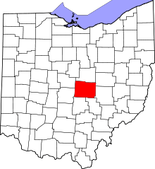 | |
| Villages | ||
| Townships | ||
| CDPs | ||
| Unincorporated communities | ||
| Ghost towns | ||
| Footnotes | ‡This populated place also has portions in an adjacent county or counties | |
Municipalities and communities of Muskingum County, Ohio, United States | ||
|---|---|---|
| City |  | |
| Villages | ||
| Townships | ||
| CDPs | ||
| Unincorporated communities |
| |
| Footnotes | ‡This populated place also has portions in an adjacent county or counties | |