Buckeye Lake, Ohio
| Buckeye Lake, Ohio | |
|---|---|
| Village | |
|
Houses on the shore of Crane Lake | |
 Location of Buckeye Lake, Ohio | |
 Location of Buckeye Lake in Licking County (highlighted) and Fairfield County | |
| Coordinates: 39°56′2″N 82°28′51″W / 39.93389°N 82.48083°WCoordinates: 39°56′2″N 82°28′51″W / 39.93389°N 82.48083°W | |
| Country | United States |
| State | Ohio |
| Counties | Licking, Fairfield |
| Area[1] | |
| • Total | 2.02 sq mi (5.23 km2) |
| • Land | 2.00 sq mi (5.18 km2) |
| • Water | 0.02 sq mi (0.05 km2) |
| Elevation[2] | 899 ft (274 m) |
| Population (2010)[3] | |
| • Total | 2,746 |
| • Estimate (2012[4]) | 2,723 |
| • Density | 1,373.0/sq mi (530.1/km2) |
| Time zone | Eastern (EST) (UTC-5) |
| • Summer (DST) | EDT (UTC-4) |
| ZIP code | 43008 |
| Area code(s) | 740 |
| FIPS code | 39-09890[5] |
| GNIS feature ID | 1048562[2] |

Buckeye Lake is a village in Fairfield and Licking counties in the U.S. state of Ohio. The population was 2,746 at the 2010 census. It is named for Buckeye Lake, a large lake along which the village is built.
Geography
Buckeye Lake is located at 39°56′02″N 82°28′51″W / 39.933899°N 82.480946°W (39.933899, -82.480946).[6]
According to the United States Census Bureau, the village has a total area of 2.02 square miles (5.23 km2), of which 2.00 square miles (5.18 km2) is land and 0.02 square miles (0.05 km2) is water.[1]
History
On August 27, 2013, Buckeye Lake withdrew from Union Township in Licking County via a paper township named Buckeye Lake Township. Portions of Buckeye Lake within Fairfield County remain part of Walnut Township.[7]
Demographics
| Historical population | |||
|---|---|---|---|
| Census | Pop. | %± | |
| 1990 | 2,986 | — | |
| 2000 | 3,049 | 2.1% | |
| 2010 | 2,746 | −9.9% | |
| Est. 2015 | 2,760 | [8] | 0.5% |
2010 census
As of the census[3] of 2010, there were 2,746 people, 1,190 households, and 697 families residing in the village. The population density was 1,373.0 inhabitants per square mile (530.1/km2). There were 1,513 housing units at an average density of 756.5 per square mile (292.1/km2). The racial makeup of the village was 96.6% White, 0.8% African American, 0.3% Native American, 0.3% Asian, 0.2% from other races, and 1.9% from two or more races. Hispanic or Latino of any race were 0.9% of the population.
There were 1,190 households of which 27.5% had children under the age of 18 living with them, 35.2% were married couples living together, 15.5% had a female householder with no husband present, 7.9% had a male householder with no wife present, and 41.4% were non-families. 32.4% of all households were made up of individuals and 11.8% had someone living alone who was 65 years of age or older. The average household size was 2.31 and the average family size was 2.90.
The median age in the village was 41.4 years. 22.7% of residents were under the age of 18; 8.6% were between the ages of 18 and 24; 24.5% were from 25 to 44; 30.9% were from 45 to 64; and 13.4% were 65 years of age or older. The gender makeup of the village was 48.6% male and 51.4% female.
2000 census
As of the census[5] of 2000, there were 3,049 people, 1,240 households, and 788 families residing in the village. The population density was 1,497.8 people per square mile (577.1/km2). There were 1,535 housing units at an average density of 754.0 per square mile (290.5/km2). The racial makeup of the village was 97.05% White, 0.62% African American, 0.62% Native American, 0.13% Asian, 0.26% from other races, and 1.31% from two or more races. Hispanic or Latino of any race were 0.56% of the population.
There were 1,240 households out of which 33.5% had children under the age of 18 living with them, 43.5% were married couples living together, 14.6% had a female householder with no husband present, and 36.4% were non-families. 27.3% of all households were made up of individuals and 9.7% had someone living alone who was 65 years of age or older. The average household size was 2.46 and the average family size was 2.97.
In the village the population was spread out with 27.5% under the age of 18, 8.6% from 18 to 24, 29.1% from 25 to 44, 23.3% from 45 to 64, and 11.5% who were 65 years of age or older. The median age was 35 years. For every 100 females there were 95.8 males. For every 100 females age 18 and over, there were 90.5 males.
The median income for a household in the village was $28,889, and the median income for a family was $33,800. Males had a median income of $27,583 versus $19,881 for females. The per capita income for the village was $15,475. About 13.2% of families and 16.1% of the population were below the poverty line, including 19.1% of those under age 18 and 14.1% of those age 65 or over.
References
- 1 2 "US Gazetteer files 2010". United States Census Bureau. Archived from the original on 2012-07-14. Retrieved 2013-01-06.
- 1 2 "US Board on Geographic Names". United States Geological Survey. 2007-10-25. Retrieved 2008-01-31.
- 1 2 "American FactFinder". United States Census Bureau. Retrieved 2013-01-06.
- ↑ "Population Estimates". United States Census Bureau. Archived from the original on 2013-06-17. Retrieved 2013-06-17.
- 1 2 "American FactFinder". United States Census Bureau. Archived from the original on 2013-09-11. Retrieved 2008-01-31.
- ↑ "US Gazetteer files: 2010, 2000, and 1990". United States Census Bureau. 2011-02-12. Retrieved 2011-04-23.
- ↑ Williams, Joe (August 28, 2013). "New 'paper' township limits fire levy voting". The Advocate. Newark, Ohio: Gannett Company. Retrieved September 16, 2013.
That vote creates a new township that matches the boundaries of Buckeye Lake village and makes village residents who once were residents of Union Township now part of Buckeye Lake Township.
- ↑ "Annual Estimates of the Resident Population for Incorporated Places: April 1, 2010 to July 1, 2015". Retrieved July 2, 2016.
- ↑ "Census of Population and Housing". Census.gov. Archived from the original on May 11, 2015. Retrieved June 4, 2015.
External links
- Village of Buckeye Lake Website
- History of Buckeye Lake
- Buckeye Lake State Park
- Buckeye Lake Region New Site
- Fairfield County Visitors & Convention Bureau
Municipalities and communities of Fairfield County, Ohio, United States | ||
|---|---|---|
| Cities | 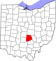 | |
| Villages | ||
| Townships | ||
| CDPs | ||
| Unincorporated communities | ||
| Footnotes | ‡This populated place also has portions in an adjacent county or counties | |
Municipalities and communities of Licking County, Ohio, United States | ||
|---|---|---|
| Cities | 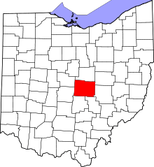 | |
| Villages | ||
| Townships | ||
| CDPs | ||
| Unincorporated communities | ||
| Ghost towns | ||
| Footnotes | ‡This populated place also has portions in an adjacent county or counties | |