Futaleufú, Chile
| Futaleufú | |||||
|---|---|---|---|---|---|
| Town and Commune | |||||
| |||||
| Nickname(s): "Futa" | |||||
| Coordinates: 43°11′0″S 71°52′0″W / 43.18333°S 71.86667°WCoordinates: 43°11′0″S 71°52′0″W / 43.18333°S 71.86667°W | |||||
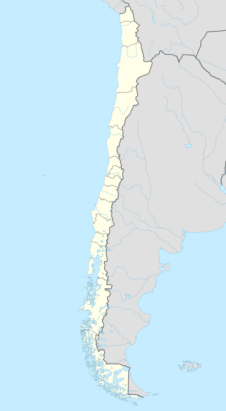
| Country | Chile | ||||
| Region | Los Lagos | ||||
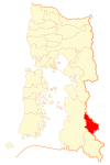
| Province | Palena | ||||
| Government[1] [2] | |||||
| • Type | Municipality | ||||
| • Alcalde | Arturo Carvallo Pardo (DC) | ||||
| Area[3] | |||||
| • Total | 1,280.0 km2 (494.2 sq mi) | ||||
| Elevation | 353 m (1,158 ft) | ||||
| Population (2012 Census)[3] | |||||
| • Total | 2,297 | ||||
| • Density | 1.8/km2 (4.6/sq mi) | ||||
| • Urban | 1,153 | ||||
| • Rural | 673 | ||||
| Sex[3] | |||||
| • Men | 954 | ||||
| • Women | 872 | ||||
| Area code(s) | 56 + 65 | ||||
| Climate | Cfb | ||||
| Website | Municipality of Futaleufú | ||||


Futaleufú is a Chilean town and commune located in Northern Patagonia, specifically in Palena Province, Los Lagos Region. Futaleufu is a frontier town with a small but growing tourism industry based on adventure tourism—most specifically whitewater rafting—but also fishing, mountain biking, trekking, and canyoning. Located 7 miles from the Argentinian border, Futaleufu is most easily accessed from airports in Esquel and Bariloche, Argentina. The town is named after the crystal blue Futaleufú River widely considered to be one of the three greatest whitewater rafting rivers in the world. The name Futaleufu derives from a Mapudungun word meaning "Big River". Following the eruption of Chaitén Volcano and the subsequent destruction of Chaitén,[4] Futaleufú has been the administrative capital of Palena Province since March 2009. The town has a population of about 2,000. The main income for the community is fly fishing and outdoor sports, particularly white water rafting, together with forestry and cattle farming. A gravel road links the town to Trevelin in Argentina and to the Carretera Austral.
Climate
Futaleufú has an oceanic climate (Köppen climate classification Cfb) with some drying trend in summer.[5] Winters are cool and wet but mild with a July average of 3.6 °C (38.5 °F). During this time of the year, precipitation is very high, averaging around 253 to 301 millimetres (10 to 12 in) from June to August and humidity is high, averaging around 77–86%.[6] Few days are dry in winter, since there are 18–19 days with measurable precipitation from June to August.[6] Snowfalls occur in most years though prolonged snowfall events are uncommon.[6] Summers are drier and mild with a January average of 16.8 °C (62.2 °F) and during this time, precipitation is lower, averaging 81.1 millimetres (3 in) in February, the driest month. However, precipitation during the summer months are highly variable; in some years, many days can go without a day of precipitation such as the case in 1987 when only 9.9 millimetres (0 in) of precipitation was recorded in January while in other years, some monthly precipitation can exceed 300 millimetres (12 in) such as in January 1974.[6] Temperatures can occasionally exceed 20 °C (68 °F) anytime from September to May.[6] The average annual precipitation is 2,081.2 millimetres (82 in) and there are 169 days with measureable precipitation although this can vary widely from year to year, ranging from a high of 3,536.8 millimetres (139 in) in 1971 to a low of only 1,159.3 millimetres (46 in) in 1998.[6] The record high was 37.0 °C (98.6 °F) on December 1956 and the record low was −11.2 °C (11.8 °F) in July 2007.[7]
| Climate data for Futaleufú, Chile (1970–2000, extremes 1953–present) | |||||||||||||
|---|---|---|---|---|---|---|---|---|---|---|---|---|---|
| Month | Jan | Feb | Mar | Apr | May | Jun | Jul | Aug | Sep | Oct | Nov | Dec | Year |
| Record high °C (°F) | 36.4 (97.5) |
36.1 (97) |
34.9 (94.8) |
25.0 (77) |
20.8 (69.4) |
21.8 (71.2) |
17.4 (63.3) |
24.2 (75.6) |
23.1 (73.6) |
28.0 (82.4) |
35.0 (95) |
37.0 (98.6) |
37.0 (98.6) |
| Average high °C (°F) | 20.8 (69.4) |
21.2 (70.2) |
18.9 (66) |
14.4 (57.9) |
9.7 (49.5) |
6.5 (43.7) |
6.2 (43.2) |
8.7 (47.7) |
12.1 (53.8) |
14.8 (58.6) |
17.1 (62.8) |
19.1 (66.4) |
14.1 (57.4) |
| Daily mean °C (°F) | 16.8 (62.2) |
16.6 (61.9) |
14.4 (57.9) |
10.6 (51.1) |
6.9 (44.4) |
4.2 (39.6) |
3.6 (38.5) |
5.7 (42.3) |
8.4 (47.1) |
11.0 (51.8) |
13.5 (56.3) |
15.5 (59.9) |
10.6 (51.1) |
| Average low °C (°F) | 10.4 (50.7) |
9.7 (49.5) |
8.1 (46.6) |
5.8 (42.4) |
3.8 (38.8) |
1.8 (35.2) |
1.0 (33.8) |
2.0 (35.6) |
3.3 (37.9) |
5.3 (41.5) |
7.6 (45.7) |
9.5 (49.1) |
5.7 (42.3) |
| Record low °C (°F) | −0.2 (31.6) |
−0.2 (31.6) |
−2.2 (28) |
−4.9 (23.2) |
−7.7 (18.1) |
−10.7 (12.7) |
−11.2 (11.8) |
−9.9 (14.2) |
−10.4 (13.3) |
−5.1 (22.8) |
−1.7 (28.9) |
−0.3 (31.5) |
−11.2 (11.8) |
| Average precipitation mm (inches) | 98.9 (3.894) |
81.1 (3.193) |
95.3 (3.752) |
165.9 (6.531) |
265.3 (10.445) |
293.5 (11.555) |
300.9 (11.846) |
253.0 (9.961) |
164.6 (6.48) |
127.3 (5.012) |
108.6 (4.276) |
126.8 (4.992) |
2,081.2 (81.937) |
| Average precipitation days | 10 | 8 | 11 | 14 | 18 | 19 | 19 | 18 | 15 | 13 | 12 | 12 | 169 |
| Average relative humidity (%) | 59 | 60 | 65 | 73 | 82 | 86 | 84 | 77 | 70 | 64 | 61 | 60 | 70.1 |
| Source: Dirección Meteorológica de Chile[6][7] | |||||||||||||
Demographics
According to the 2002 census of the National Statistics Institute, Futaleufú spans an area of 1,280 km2 (494 sq mi) and has 1,826 inhabitants (954 men and 872 women). Of these, 1,153 (63.1%) lived in urban areas and 673 (36.9%) in rural areas. The population grew by 5.2% (91 persons) between the 1992 and 2002 censuses.[3]
Administration
As a commune, Futaleufú is a third-level administrative division of Chile administered by a municipal council and led by an alcalde who is directly elected every four years. Since 200, the alcalde has been Mr. Arturo Carvallo Pardo (PDC).[1][2]
Within the electoral divisions of Chile, Futaleufú is represented in the Chamber of Deputies by Gabriel Ascencio (PDC) and Alejandro Santana (RN) as part of the 58th electoral district (together with Castro, Ancud, Quemchi, Dalcahue, Curaco de Vélez, Quinchao, Puqueldón, Chonchi, Queilén, Quellón, Chaitén, Hualaihué and Palena). The commune is represented in the Senate by Rabindranath Quinteros (PS) and Iván Moreira (UDI), as part of the 17th senatorial constituency (Los Lagos Region).

Landscape and attractions
The Futaleufú River is commonly rated by specialized media as one of the top three in the world for kayaking and rafting,.[8][9] The river flows in from Argentina, through the town, and empties into the fjord-shaped Yelcho Lake. Day trips and multi-day trips are available on "the Futa" while several of its tributaries, such as the Espolón River and the Azul (Blue) River, can be rafted, canoed, or navigated by boat.
Two lakes, Lake Lonconao and Lake Espolón, offer opportunities for paddling and fly fishing close to the town of Futaleufú. Fly fishing is also possible on the Futaleufú River, the Yelcho River (the largest river in the Futaleufú Valley) and Espolon River, which is the largest tributary of the Futaleufú and contains brown trout and rainbow trout, as well as salmon in April and May.[10]
Other nearby attractions include the Futaleufú National Reserve, known for its population of Huemul (South Andean deer), and Pumalín Park, Chile's largest private nature reserve. Pumalín is a public-access park, with an extensive infrastructure of trails, campgrounds, and visitor centres.[11]
Canyoning and rappelling is also possible in the Futaleufú valley, with its numerous ravines and waterfalls,[12][13] as well as horse riding and mountain biking.
References
- 1 2 "Asociación Chilena de Municipalidades" (in Spanish). Retrieved 27 January 2011.
- 1 2 "Municipality of Futaleufú" (in Spanish). Retrieved 27 January 2011.
- 1 2 3 4 "National Statistics Institute" (in Spanish). Retrieved 27 January 2010.
- ↑ Volcanic aftermath in Chaitén www.livingatlaschile.com retrieved December 17, 2013
- ↑ Peel, M. C. and Finlayson, B. L. and McMahon, T. A. (2007). "Updated world map of the Köppen–Geiger climate classification" (PDF). Hydrol. Earth Syst. Sci. 11: 1633–1644. doi:10.5194/hess-11-1633-2007. ISSN 1027-5606.
- 1 2 3 4 5 6 7 "Estadistica Climatologica Tomo III (pg 127-150)" (PDF) (in Spanish). Dirección General de Aeronáutica Civil. March 2001. Retrieved January 15, 2013.
- 1 2 "Temperatura Mensual Histórica de Futaleufú Ad. (430002)". Sistema de Administración de Datos Climatológicos (in Spanish). Dirección Meteorológica de Chile. Retrieved April 24, 2016.
- ↑ Trip Advisor rating on Futaleufú rafting www.tripadvisor.co.uk retrieved December 17, 2013
- ↑ Futaleufu Rafting & Multi-Sport Adventure in Chile www.bbxrafting.com retrieved December 17, 2013
- ↑ Fly fishing Futaleufu www.esqueloutfitters.com retrieved December 18, 2013
- ↑ retrieved December 18, 2013
- ↑ Canyoning in Futaleufu www.livingatlaschile.com retrieved December 18, 2013
- ↑ Canyoning www.exchile.com retrieved December 18, 2013
